Michigan Map 3d Pictures, Images and Stock Photos
Browse 300+ michigan map 3d stock photos and images available, or start a new search to explore more stock photos and images.
Most popular
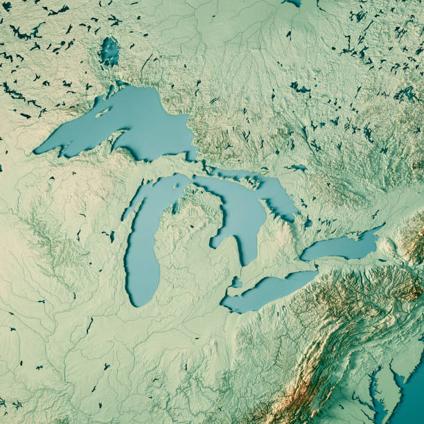
3D Render of a Topographic Map of the Great Lakes, USA and Canada. All source data is in the public domain. Color texture and Rivers: Made with Natural Earth. http://www.naturalearthdata.com/downloads/10m-raster-data/10m-cross-blend-hypso/ http://www.naturalearthdata.com/downloads/10m-physical-vectors/ Relief texture: SRTM data courtesy of USGS. URL of source image: https://e4ftl01.cr.usgs.gov//MODV6_Dal_D/SRTM/SRTMGL1.003/2000.02.11/ Water texture: HIU World Water Body Limits: http://geonode.state.gov/layers/?limit=100&offset=0&title__icontains=World%20Water%20Body%20Limits%20Detailed%202017Mar30
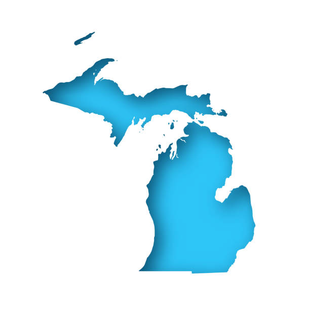
Map of Michigan cut out on a blank white paper with a blue background. Modern and trendy paper cutout effect. Vector Illustration (EPS file, well layered and grouped). Easy to edit, manipulate, resize or colorize. Vector and Jpeg file of different sizes.

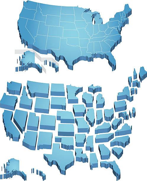
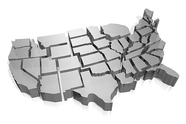
3D extruded map of the US. Individual states.
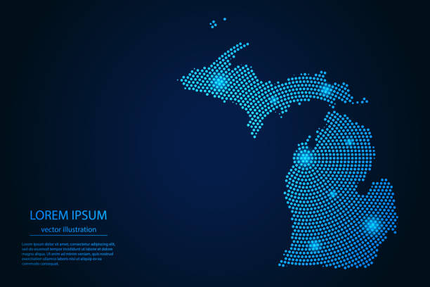
Abstract image Michigan map from point blue and glowing stars on a dark background. vector illustration.
3D Render of a Topographic Map of North East USA and parts of Ontario and Quebec, and Nova Scotia to the right. All source data is in the public domain. Color texture: Made with Natural Earth. http://www.naturalearthdata.com/downloads/10m-raster-data/10m-cross-blend-hypso/ Relief texture: GMTED2010 data courtesy of USGS. URL of source image: https://topotools.cr.usgs.gov/gmted_viewer/viewer.htm Water texture: World Water Body Limits: Humanitarian Information Unit HIU, U.S. Department of State http://geonode.state.gov/layers/geonode%3AWorld_water_body_limits_polygons Boundaries: Humanitarian Information Unit HIU, U.S. Department of State (database: LSIB) http://geonode.state.gov/layers/geonode%3ALSIB_10

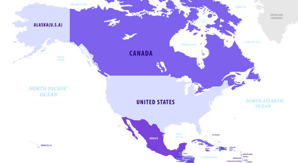
3D gray USA map - on white background (Alabama, Arizona, Arkansas, California, Colorado, Connecticut, Delaware, Florida, Georgia, Idaho, Illinois, Indiana, Iowa, Kansas, Kentucky, Louisiana, Maine, Maryland, Massachusetts, Michigan, Minnesota, Mississippi, Missouri, Montana, Nebraska, Nevada, New Hampshire, New Jersey, New Mexico, New York, North Carolina, North Dakota, Ohio, Oklahoma, Oregon, Pennsylvania, Rhode Island, South Carolina, South Dakota, Tennessee, Texas, Utah, Vermont, Virginia, Washington, West Virginia, Wisconsin, Wyoming).
![Michigan Topographic Relief Map - 3D Render 3D render of a topographic map of Michigan. All source data is in the public domain. SRTM data courtesy of the U.S. Geological Survey (https://search.earthdata.nasa.gov/search/granules?p=C1000000240-LPDAAC_ECS&pg[0][v]=f&pg[0][gsk]=-start_date&q=srtm%201%20arc&tl=1640787673!3!!&m=11.7421875!-80.859375!2!1!0!0%2C2). Map rendered using QGIS and Blender software. michigan map 3d stock pictures, royalty-free photos & images](https://media.istockphoto.com/id/1366591921/photo/michigan-topographic-relief-map-3d-render.jpg?s=612x612&w=0&k=20&c=VTvHKCzsZimMy3hKF5NbYfHBYqvtgrEeCsR6QCtQdnE=)
3D render of a topographic map of Michigan. All source data is in the public domain. SRTM data courtesy of the U.S. Geological Survey (https://search.earthdata.nasa.gov/search/granules?p=C1000000240-LPDAAC_ECS&pg[0][v]=f&pg[0][gsk]=-start_date&q=srtm%201%20arc&tl=1640787673!3!!&m=11.7421875!-80.859375!2!1!0!0%2C2). Map rendered using QGIS and Blender software.

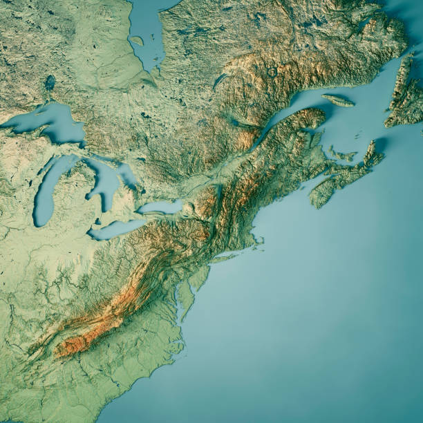
3D Render of a Topographic Map of North East Region of the United States of America. All source data is in the public domain. Color texture: Made with Natural Earth. http://www.naturalearthdata.com/downloads/10m-raster-data/10m-cross-blend-hypso/ Relief texture: GMTED2010 data courtesy of USGS. URL of source image: https://topotools.cr.usgs.gov/gmted_viewer/viewer.htm Water texture: World Water Body Limits: Humanitarian Information Unit HIU, U.S. Department of State http://geonode.state.gov/layers/geonode%3AWorld_water_body_limits_polygons Boundaries: Humanitarian Information Unit HIU, U.S. Department of State (database: LSIB) http://geonode.state.gov/layers/geonode%3ALSIB_10

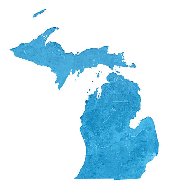
Map of Michigan - USA

3D map of Michigan isolated on a blank and gray background, with a dropshadow. Vector Illustration (EPS10, well layered and grouped). Easy to edit, manipulate, resize or colorize.

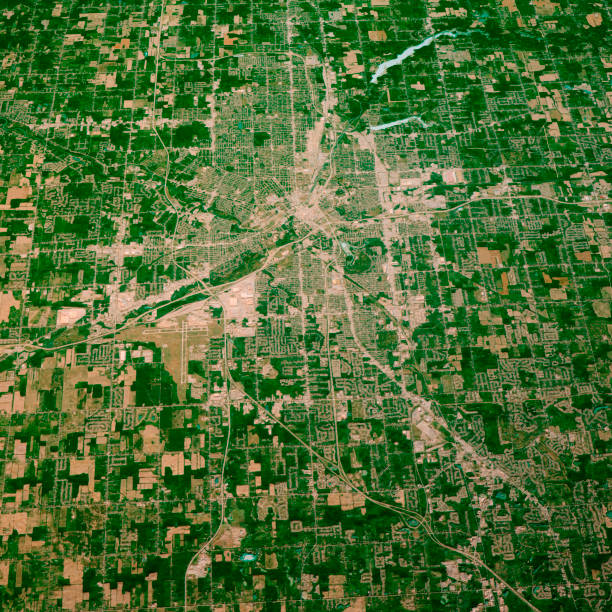
3D Render of a Topographic Map of Detroit, Michigan, USA. All source data is in the public domain. Contains modified Copernicus Sentinel data (May 2019) courtesy of ESA. URL of source image: https://scihub.copernicus.eu/dhus/#/home. Relief texture SRTM data courtesy of NASA. URL of source image: https://search.earthdata.nasa.gov/search/granules/collection-details?p=C1000000240-LPDAAC_ECS&q=srtm%201%20arc&ok=srtm%201%20arc


Map of Michigan with a realistic paper cut effect isolated on white background. Vector Illustration (EPS10, well layered and grouped). Easy to edit, manipulate, resize or colorize. Please do not hesitate to contact me if you have any questions, or need to customise the illustration. http://www.istockphoto.com/bgblue/

"3D rendering and image composing: Topographic Map of Michigan. Including state borders, rivers and accurate longitude/latitude lines. High resolution available! High quality relief structure!Relief texture and satellite images courtesy of NASA. Further data source courtesy of CIA World Data Bank II database.Note: This image is perfectly congruent to the image"
3D render and image composing: Topographic Map of Michigan, USA. Isolated on White. High quality relief structure!

All the Great Lakes sketch scribble map isolated on white background. Hand drawn vector map of the Great Lakes. Realistic 3D ballpoint pen or roller pen illustration.


https://visibleearth.nasa.gov/collection/1484/blue-marble


Michigan State Map in blue with its capital city- Lansing marked by the yellow star;

3D Render of a Topographic Map of the State of Michigan, USA. All source data is in the public domain. Color texture: Made with Natural Earth. http://www.naturalearthdata.com/downloads/10m-raster-data/10m-cross-blend-hypso/ Relief texture and Rivers: SRTM data courtesy of USGS. URL of source image: https://e4ftl01.cr.usgs.gov//MODV6_Dal_D/SRTM/SRTMGL1.003/2000.02.11/ Water texture: SRTM Water Body SWDB: https://dds.cr.usgs.gov/srtm/version2_1/SWBD/

Michigan state USA map glowing silhouette outline made of stars lines triangles, low polygonal shapes. Communication, internet technologies concept. Wireframe futuristic design. Vector illustration

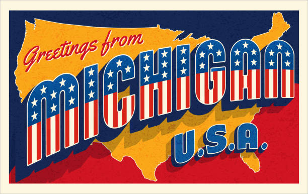
Greetings from Michigan USA. Retro postcard with patriotic stars and stripes lettering and United States map in the background. Vector illustration.

3D Render of a Topographic Map of the Great Lakes, USA and Canada. All source data is in the public domain. Color texture and Rivers: Made with Natural Earth. http://www.naturalearthdata.com/downloads/10m-raster-data/10m-cross-blend-hypso/ http://www.naturalearthdata.com/downloads/10m-physical-vectors/ Relief texture: SRTM data courtesy of USGS. URL of source image: https://e4ftl01.cr.usgs.gov//MODV6_Dal_D/SRTM/SRTMGL1.003/2000.02.11/ Water texture: HIU World Water Body Limits: http://geonode.state.gov/layers/?limit=100&offset=0&title__icontains=World%20Water%20Body%20Limits%20Detailed%202017Mar30

3D Render of a Topographic Map of Flint, Michigan, USA. All source data is in the public domain. Contains modified Copernicus Sentinel data (Aug 2019) courtesy of ESA. URL of source image: https://scihub.copernicus.eu/dhus/#/home. Relief texture SRTM data courtesy of NASA. URL of source image: https://search.earthdata.nasa.gov/search/granules/collection-details?p=C1000000240-LPDAAC_ECS&q=srtm%201%20arc&ok=srtm%201%20arc

A red flag-shaped pushpin pinpointing the city of Chicago, also known as Chi-Town, on a map.

White map of Michigan isolated on a trendy color, a bright red background and with a dropshadow. Vector Illustration (EPS file, well layered and grouped). Easy to edit, manipulate, resize or colorize. Vector and Jpeg file of different sizes.

3D Render of an US State map of Michigan with the Administrative Divisions, Counties. All source data is in the public domain. USGS The National Map: https://viewer.nationalmap.gov/basic/


3D render of the US state of Michigan painted with its flag.

Michigan map on blue USA map image with hi-res rendered artwork that could be used for any graphic design.

USA map - three-dimensional vector illustration
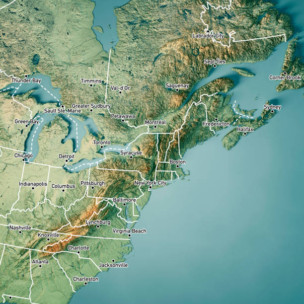
3D Render of a Topographic Map of North East USA and parts of Ontario and Quebec, and Nova Scotia to the right. Version with Country Boundaries and Cities. All source data is in the public domain. Color texture: Made with Natural Earth. http://www.naturalearthdata.com/downloads/10m-raster-data/10m-cross-blend-hypso/ Relief texture: GMTED2010 data courtesy of USGS. URL of source image: https://topotools.cr.usgs.gov/gmted_viewer/viewer.htm Water texture: World Water Body Limits: Humanitarian Information Unit HIU, U.S. Department of State http://geonode.state.gov/layers/geonode%3AWorld_water_body_limits_polygons Boundaries: Humanitarian Information Unit HIU, U.S. Department of State (database: LSIB) http://geonode.state.gov/layers/geonode%3ALSIB_10

3D Render of a Topographic Map of the State of Michigan, USA. All source data is in the public domain. Relief texture and Rivers: SRTM data courtesy of USGS. URL of source image: https://e4ftl01.cr.usgs.gov//MODV6_Dal_D/SRTM/SRTMGL1.003/2000.02.11/ Water texture: SRTM Water Body SWDB: https://dds.cr.usgs.gov/srtm/version2_1/SWBD/

White map of Michigan isolated on a trendy color, a blue green background and with a dropshadow. Vector Illustration (EPS10, well layered and grouped). Easy to edit, manipulate, resize or colorize.

3D Render of a Topographic Map of the State of Michigan, USA. All source data is in the public domain. Boundaries Level 1: USGS, National Map, National Boundary Data. https://viewer.nationalmap.gov/basic/#productSearch Relief texture and Rivers: SRTM data courtesy of USGS. URL of source image: https://e4ftl01.cr.usgs.gov//MODV6_Dal_D/SRTM/SRTMGL1.003/2000.02.11/ Water texture: SRTM Water Body SWDB: https://dds.cr.usgs.gov/srtm/version2_1/SWBD/

3D Render of a Topographic Map of the Great Lakes, USA and Canada. All source data is in the public domain. Color texture and Rivers: Made with Natural Earth. http://www.naturalearthdata.com/downloads/10m-raster-data/10m-cross-blend-hypso/ http://www.naturalearthdata.com/downloads/10m-physical-vectors/ Relief texture: SRTM data courtesy of USGS. URL of source image: https://e4ftl01.cr.usgs.gov//MODV6_Dal_D/SRTM/SRTMGL1.003/2000.02.11/ Water texture: HIU World Water Body Limits: http://geonode.state.gov/layers/?limit=100&offset=0&title__icontains=World%20Water%20Body%20Limits%20Detailed%202017Mar30

3D USA State vector map
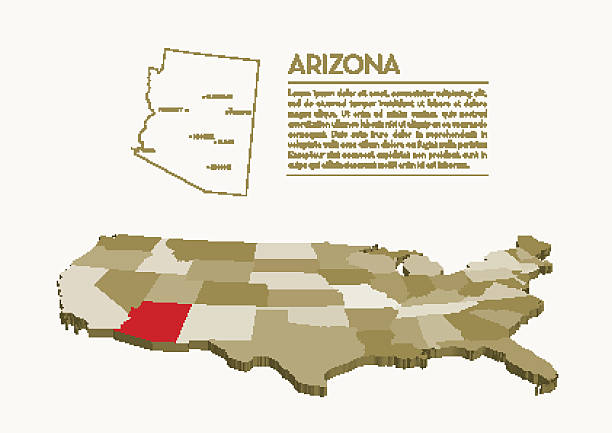
3D USA State vector map - ARIZONA

Michigan watercolor map vector illustration of blue color with border line on light background using paint brush

Image relative to USA travel. New York cities and places names cloud. 3D rendering

3D Render of a Topographic Map of Flint, Michigan, USA. All source data is in the public domain. Contains modified Copernicus Sentinel data (Aug 2019) courtesy of ESA. URL of source image: https://scihub.copernicus.eu/dhus/#/home. Relief texture SRTM data courtesy of NASA. URL of source image: https://search.earthdata.nasa.gov/search/granules/collection-details?p=C1000000240-LPDAAC_ECS&q=srtm%201%20arc&ok=srtm%201%20arc
USA map and flag - highly detailed vector illustration

Map of Michigan with a realistic paper cut effect isolated on white background. Vector Illustration (EPS10, well layered and grouped). Easy to edit, manipulate, resize or colorize. Please do not hesitate to contact me if you have any questions, or need to customise the illustration. http://www.istockphoto.com/portfolio/bgblue/

3D Render of a Topographic Map of Warren, Michigan, USA. All source data is in the public domain. Contains modified Copernicus Sentinel data (May 2019) courtesy of ESA. URL of source image: https://scihub.copernicus.eu/dhus/#/home. Relief texture SRTM data courtesy of NASA. URL of source image: https://search.earthdata.nasa.gov/search/granules/collection-details?p=C1000000240-LPDAAC_ECS&q=srtm%201%20arc&ok=srtm%201%20arc


3D render of a golf ball and red flag on a golf course putting green shaped like the USA state of Michigan.


3D map of Michigan isolated on a blank blueprint, with a dropshadow (color used: blue and white). Vector Illustration (EPS10, well layered and grouped). Easy to edit, manipulate, resize or colorize.

3D Illustration of a waving flag of Michigan

3d isometric Map of Michigan is a state of United States with national flag

Vector. Map of US state
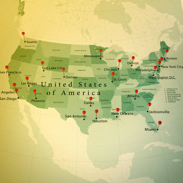
3D Render of a Map of the USA with Straight Pins at the Position of important Cities. Vintage Color Style. Very high resolution available! All source data is in the public domain. http://www.naturalearthdata.com/about/terms-of-use/ Made with Natural Earth: Internal Administrative Boundaries, Populated Places http://www.naturalearthdata.com/downloads/10m-cultural-vectors/


3D Render of a Topographic Map of Lansing, Michigan, USA. All source data is in the public domain. Contains modified Copernicus Sentinel data (Apr 2019) courtesy of ESA. URL of source image: https://scihub.copernicus.eu/dhus/#/home. Relief texture SRTM data courtesy of NASA. URL of source image: https://search.earthdata.nasa.gov/search/granules/collection-details?p=C1000000240-LPDAAC_ECS&q=srtm%201%20arc&ok=srtm%201%20arc
Next