Middle East North Africa Pictures, Images and Stock Photos
Browse 11,300+ middle east north africa stock photos and images available, or search for vector map middle east north africa or middle east north africa map to find more great stock photos and pictures.
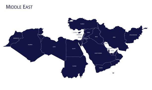
Map of Middle East. Vector
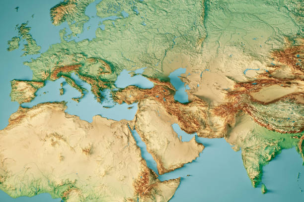
3D Render of a Topographic Map of Europe, India and Middle East. All source data is in the public domain. Color and Water texture: Made with Natural Earth. http://www.naturalearthdata.com/downloads/10m-raster-data/10m-cross-blend-hypso/ http://www.naturalearthdata.com/downloads/110m-physical-vectors/ Relief texture: GMTED 2010 data courtesy of USGS. URL of source image: https://topotools.cr.usgs.gov/gmted_viewer/viewer.htm
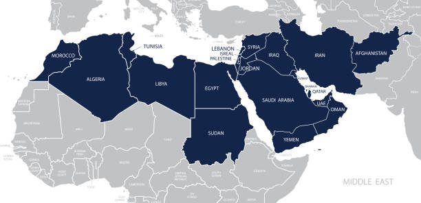
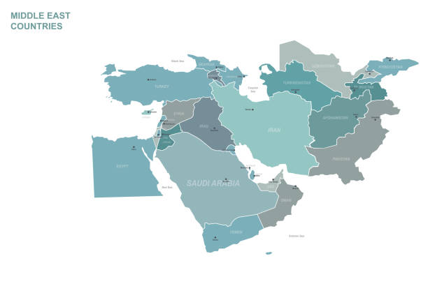
Map of Middle East. Member states are as follows;
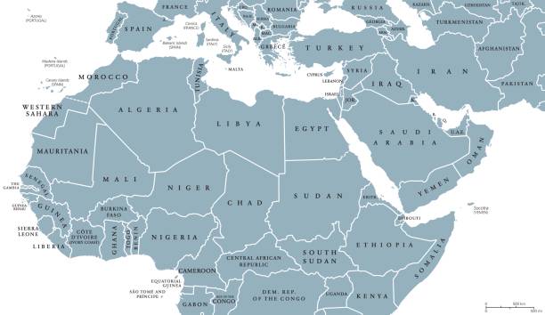
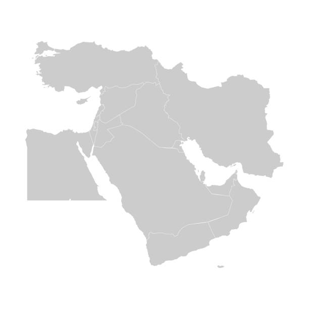
North Africa and Middle East political map with countries and borders. English labeling. Maghreb, Mediterranean, West and Central Asian countries. Gray illustration on white background. Vector.
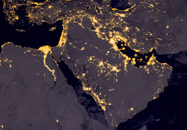
Middle east, west asia, east europe lights during night as it looks like from space. Elements of this image are furnished by NASA
Map of Middle East. Vector
Vector illustration with simplified map of Asian countries. Middle East. States borders of Turkey, Georgia, Armenia, United Arab Emirates, Saudi Arabia, Qatar, Oman, Iran, Israel. Grey silhouette
Mini Globe showing the Middle East.
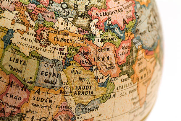
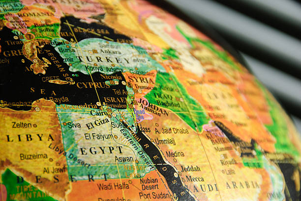
A close-up/macro photograph of Middle East from a desktop globe. Adobe RGB color profile.
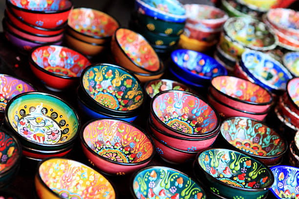
"this kind of hand made art craft is famous in middle eastern cultures as well as in the Mexican one, usually sold in gift shops as souvenirs..More Similar and Arabia Related.."
Map of Middle East on a Earth globe, looking west to Europe. Turkey, Syria, Lebanon, Israel, Jordan, Egypt, Saudi Arabia, Yemen, Oman, Qatar, United Arab Emirates, Kuwait, Iraq, Iran and Afghanistan are the main focus. Countries are highlighted in yellow, while seas are deep blue and land are brown gray. Europe and North Africa are also included in the frame, together with Mediterranean Sea and Persian Gulf. Physical and geographical features are visible. Geopolitics and diplomacy connected to history and geography. Map is blank, without country names. For illustration puroposes only, country grouping and current borders status may differ.
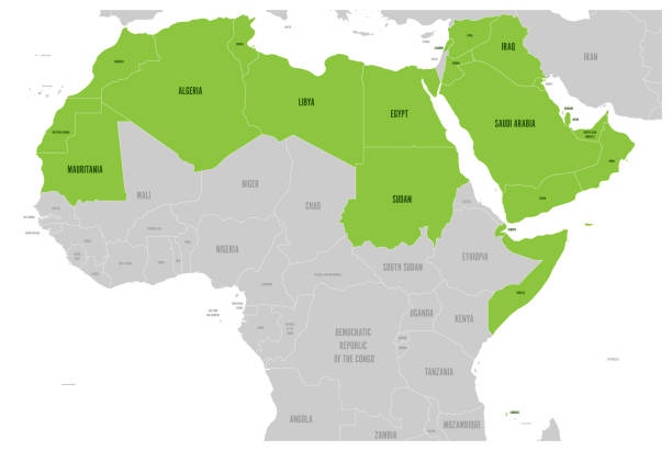
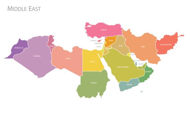
Arab World states political map with higlighted 22 arabic-speaking countries of the Arab League. Northern Africa and Middle East region. Vector illustration.
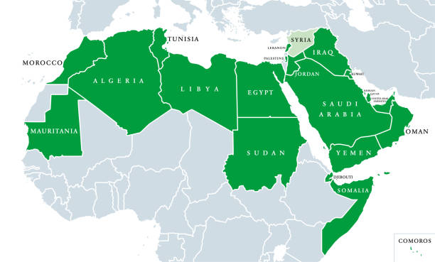
Arab League political map. League of Arab States, location in North Africa and Arabia. Regional organization of 22 member states. Syria is suspended since 2011. English labeling. Illustration. Vector.
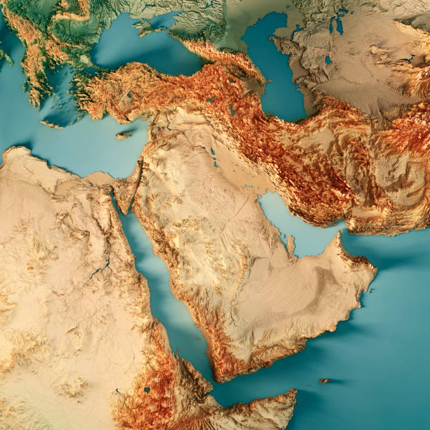
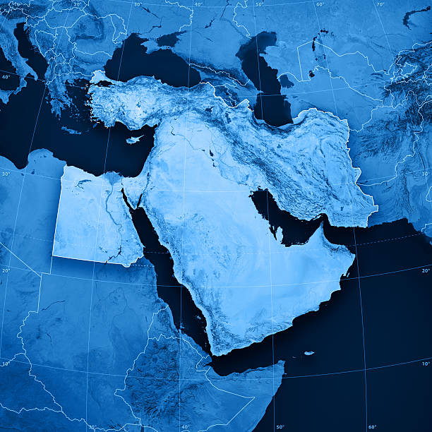
3D Render of a Topographic Map of Middle East. All source data is in the public domain. Color texture: Made with Natural Earth. http://www.naturalearthdata.com/downloads/10m-raster-data/10m-cross-blend-hypso/ Relief texture: GMTED2010 data courtesy of USGS. URL of source image: https://topotools.cr.usgs.gov/gmted_viewer/viewer.htm Water texture: World Water Body Limits: Humanitarian Information Unit HIU, U.S. Department of State http://geonode.state.gov/layers/geonode%3AWorld_water_body_limits_polygons Boundaries: Humanitarian Information Unit HIU, U.S. Department of State (database: LSIB) http://geonode.state.gov/layers/geonode%3ALSIB_10
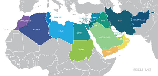
Map of Middle East. Member states are as follows;

Young Egyptian woman sitting in a bar. About 25 years old, Middle Eastern female.

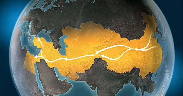
Map of Silk Road, a network of overland routes that connected China to Middle East and Europe through Central Asia. The road network was used in the past centuries by merchants trading goods and silk between distant countries and cross-continental regions. Marco Polo, an italian explorer, is believed to have travelled the route in the 13th century. Geopolitics, commerce and diplomacy connected to history and geography. Map is blank, without country names. Map is for illustration puroposes only, country grouping and current borders status may differ.
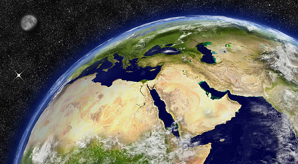
Middle East region on planet Earth from space with Moon and stars in the background. Elements of this image furnished by NASA.

Crowded village in a developing country view. The sunset scene from Sohag city in south Egypt showing Naidah village which overlooks the Nile river

3D Render of a Topographic Map of Europe, India and Middle East. All source data is in the public domain. Color and Water texture: Made with Natural Earth. http://www.naturalearthdata.com/downloads/10m-raster-data/10m-cross-blend-hypso/ http://www.naturalearthdata.com/downloads/110m-physical-vectors/ Relief texture: GMTED 2010 data courtesy of USGS. URL of source image: https://topotools.cr.usgs.gov/gmted_viewer/viewer.htm
A portion of a colorful globe with a black water background showing the Middle East with particular focus on Egypt, Turkey, and Syria.
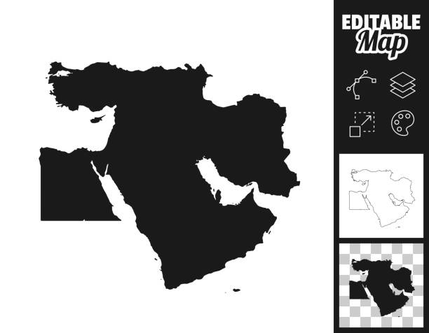
Map of Middle East for your own design. Three maps with editable stroke included in the bundle: - One black map on a white background. - One line map with only a thin black outline in a line art style (you can adjust the stroke weight as you want). - One map on a blank transparent background (for change background or texture). The layers are named to facilitate your customization. Vector Illustration (EPS file, well layered and grouped). Easy to edit, manipulate, resize or colorize. Vector and Jpeg file of different sizes.
Map of Middle East with countries and borders. Vector illustration.

Middle Eastern man outdoors close up.
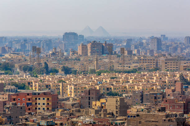
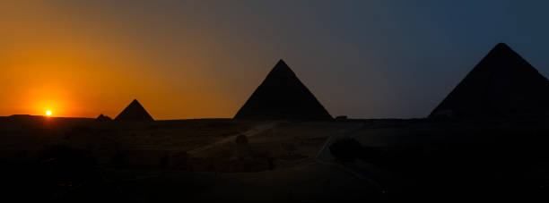
Pyramid, Pyramid Shape, Smog, Famous Place, Urban Skyline
vector of the World Map map

Coral reefs, concept of biodiversity of marine ecosystems untouched by human activities, concept of vacation, diving, resting and sport on exotic beaches of the Red Sea, Middle East
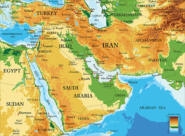
Highly detailed physical map of Middle East in vector format,with all countries, major cities and all the relief forms .

"3D render and image composing: Topographic Map of the Middle East region. Including borders, rivers and accurate longitude/latitude lines. High resolution available! High quality relief structure!Relief texture and satellite images courtesy of NASA. Further data source courtesy of CIA World Data Bank II database.Related images:"

World map highlighted middle east countries with green map vector illustration.

Arab League Countries maps set. Vector eps10
vector of the World map

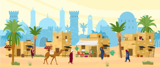
Arabic desert landscape with traditional mud brick houses and people. Ancient temple at the background. Bedouin with camel, woman with jug on head. Flat vector illustration.
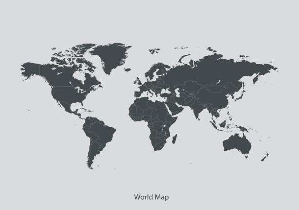
vector of the World map
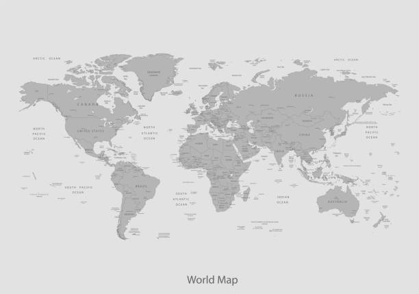
vector of the World Map map

3D Render of a Topographic Map of Europe, India and Middle East. All source data is in the public domain. Color and Water texture: Made with Natural Earth. http://www.naturalearthdata.com/downloads/10m-raster-data/10m-cross-blend-hypso/ http://www.naturalearthdata.com/downloads/110m-physical-vectors/ Relief texture: GMTED 2010 data courtesy of USGS. URL of source image: https://topotools.cr.usgs.gov/gmted_viewer/viewer.htm

Africa, single countries, gray political map. Largest continent, including Madagascar. With English country names and international borders. Isolated illustration on white background. Vector.
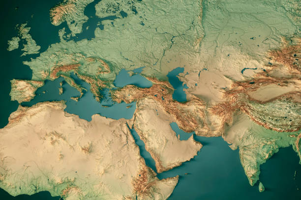
3D Render of a Topographic Map of Europe, India and Middle East. All source data is in the public domain. Color and Water texture: Made with Natural Earth. http://www.naturalearthdata.com/downloads/10m-raster-data/10m-cross-blend-hypso/ http://www.naturalearthdata.com/downloads/110m-physical-vectors/ Relief texture: GMTED 2010 data courtesy of USGS. URL of source image: https://topotools.cr.usgs.gov/gmted_viewer/viewer.htm

Vector border for Holy Month Ramadan with copyspace for wishing text, round price tag with illustration of hanging lamps and crescent, masjid with dome and minarets for eid ramadan on white background

Middle East region on planet Earth from space with stars in the background. Elements of this image furnished by NASA.
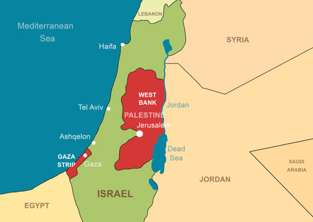
Israel and Palestine in Middle East on contour map. Palestinian territories of Gaza and West Bank. Jerusalem and Jordan River on outline map. Theme of Israel, war, conflict.


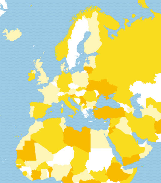
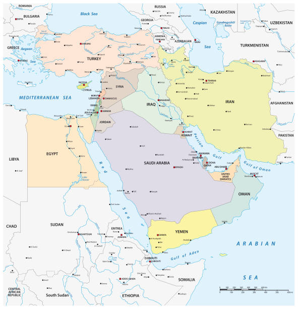
North Africa and Middle East political map with most important capitals and international borders. Maghreb, Mediterranean, West and Central Asian countries. Illustration with English labeling. Vector
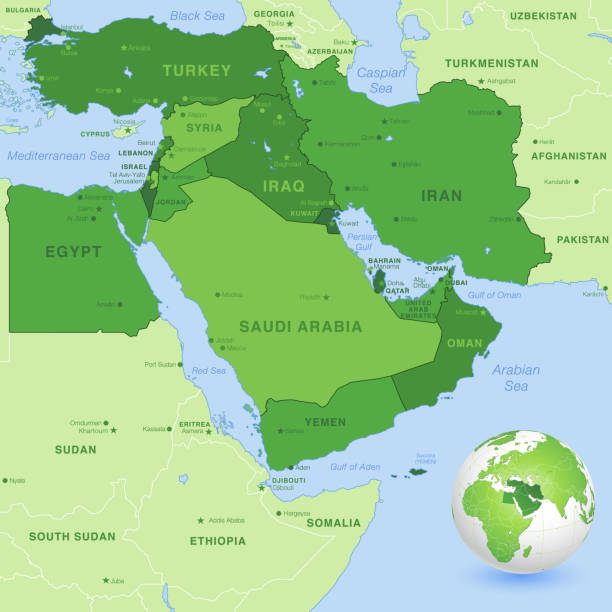
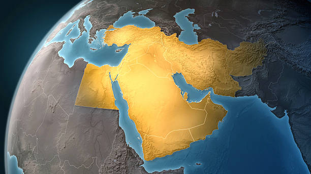
High detail map of the Middle East Zone, with a 3D Globe centered on Middle East.

Arab man using a mobile app. About 25 years old, Middle Eastern male.
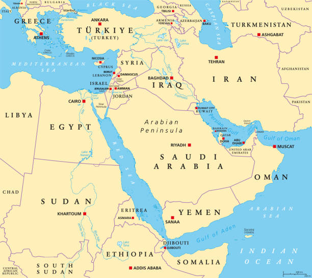
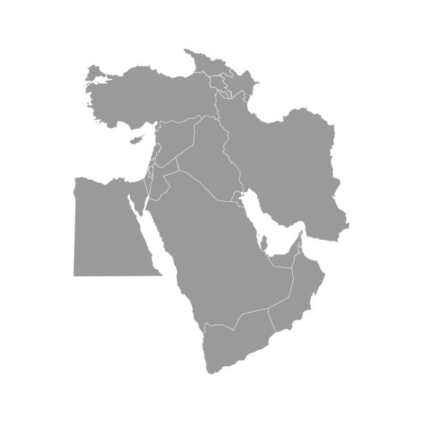
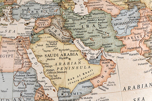
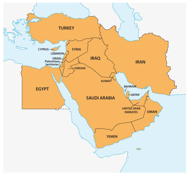
The Middle East, political map with capitals and international borders. Geopolitical region encompassing the Arabian Peninsula, the Levant, Turkey, Egypt, Iran and Iraq. Formerly called Near East.

3D render and image composing: Topographic Map of the Middle East region. Isolated on White. High resolution available! High quality relief structure!
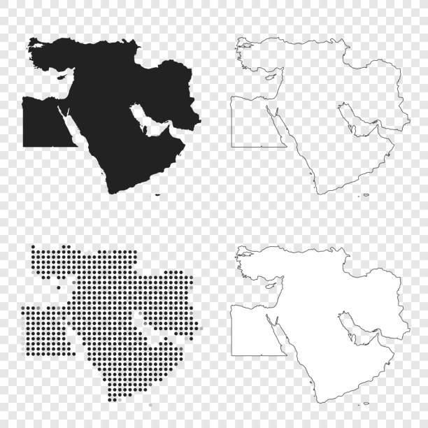
Map of Middle East for your own design. With space for your text and your background. Four maps included in the bundle: - One black map. - One blank map with only a thin black outline (in a line art style). - One mosaic map. - One white map with a thin black outline. The 4 maps are isolated on a blank background (for easy change background or texture).The layers are named to facilitate your customization. Vector Illustration (EPS10, well layered and grouped). Easy to edit, manipulate, resize or colorize.
Next