
Mogadishu Pictures, Images and Stock Photos
Browse 1,200+ mogadishu stock photos and images available, or search for mogadishu somalia or mogadishu city to find more great stock photos and pictures.
Most popular
A view of Ali Jimale Mosque building facade in Mogadishu
Mogadishu, Somaila-April 29, 3013: Fishermen at the port of Mogadishun in Somalia.

Bombed buildings in Mogadishu Somalia

Bombed or destroyed buildings in Mogadishu Somalia

The smoke after bombing in Somalia Bossaso
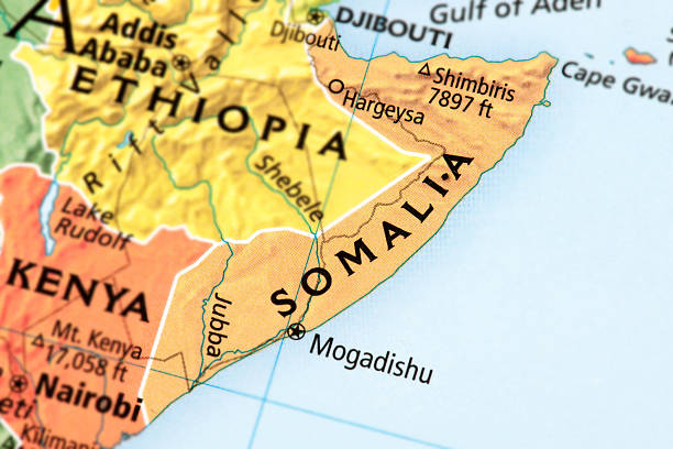
Map of Somalia. A detail from the World Map.
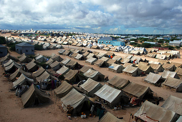
Mogadishu,Somalia-April, 30, 2013 :A general view of the tent camp where thousands of Somali immigrants on April 30, 2013, in Mogadishu,Somalia.

Map of Federal Republic of Somalia through magnifying glass
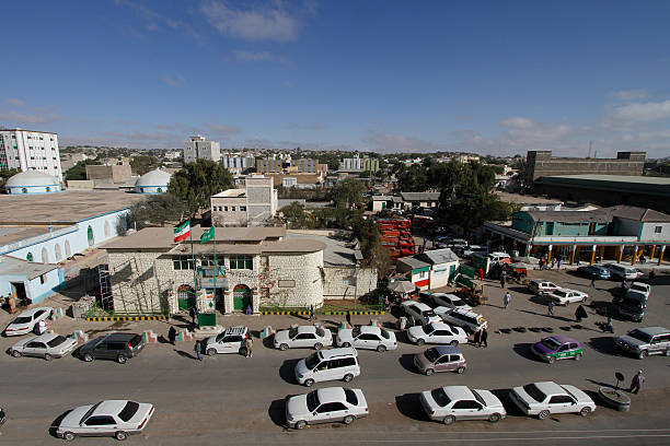
Hargeisa,Somaliland - May 06, 2015: Cars passing through the main road in Hargeisa, capital city of Somaliland. Somaliland is a self-declared state internationally recognized as an autonomous region of Somalia.


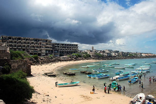
An aerial view of the Somalian coastline near Mogadishu – an area frequented by modern-day pirates.

Silhouette Skyline panorama of city of Mogadishu, Somalia - vector illustration

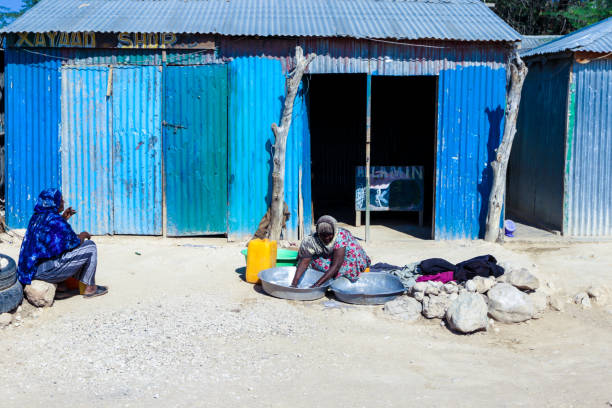
Shelter in Mogadishu Somalia
Mogadishu, Somalia-April 29, 3013: Fishermen at the port of Mogadishu in Somalia.

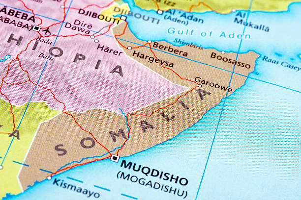
Map of Somalia. A detail from the World Map.

Mogadishu rebuilding bomb damaged house

Hargeisa, Somaliland - November 10, 2019: City scape View of the Poor Area of the Capital Streets

Camel in the desert, walking in the morning sun

Political map of Somalia with capital Mogadishu, with national borders, most important cities and rivers. Illustration with English labeling and scaling.

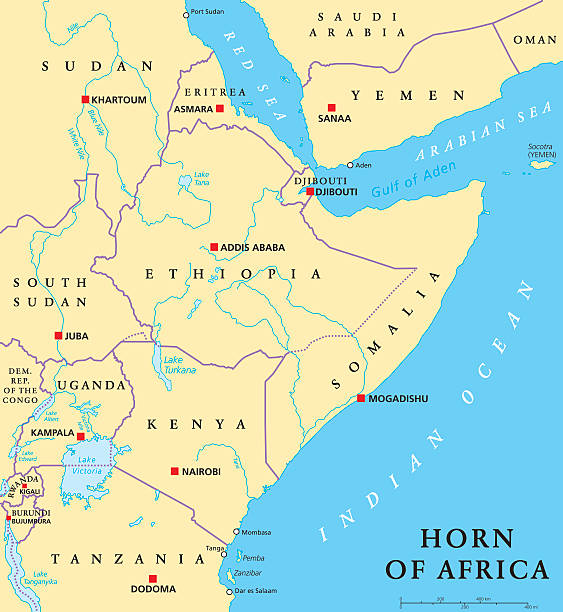
Horn of Africa peninsula political map with capitals, national borders, important cities, rivers and lakes. In ancient times called Land of the Berbers. English labeling and scaling. Illustration.
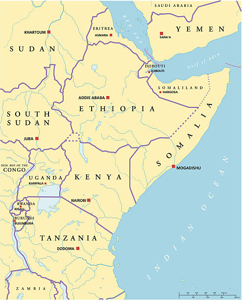
Political map of East Africa with capitals, national borders, rivers and lakes. Vector illustration with English labeling and scaling.

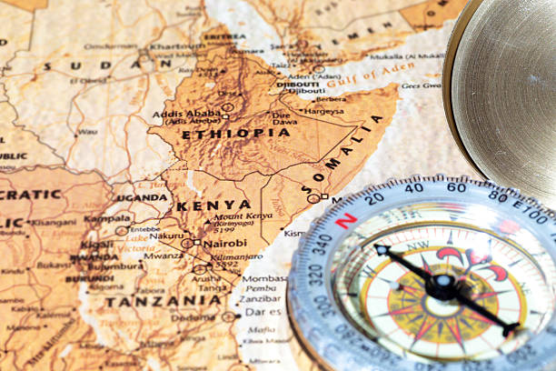
Compass on a map pointing at Kenya, Ethiopia and Somalia, planning a travel destination

Map of Somalia with pin of country capital. Somalia Map with neighboring countries in green color.

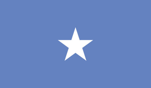
High resolution digital render of Somalia flag.

Somalia country detailed editable map with regions cities and towns, roads and railways, geographic sites. Vector EPS-10 file

Highly Detailed Flag Of Somalia - Somalia Flag High Detail - National flag Somalia - Large size flag jpeg image - Somalia, Mogadishu

Somalia detailed map with regions and cities of the country. Vector illustration

Bombed or destroyed buildings in Mogadishu Somalia

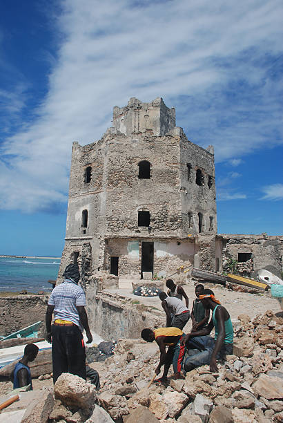
The tower of port Mogadishu Somalia

"Illustration of life in Mogadishu. Published in Systematischer Bilder-Atlas zum Conversations-Lexikon, Ikonographische Encyklopaedie der Wissenschaften und Kuenste (Brockhaus Verlaghaus, Germany). A 1875 edition."

Shelter with a perfect view in Somalia Mogadishu

A soldier from the African Union Mission in Somalia (AMISOM), wears a green armband over his camouflage uniform reading AU (African Union).

Pacific Centered World map with magnified Somalia. Flag and map of Somalia on Asia in Center World Map.
Icon flag of Somalia . Round glossy flag. Vector illustration. EPS 10

"Mogadishu is the capital of Somalia, where a lot of modern days pirates originates."
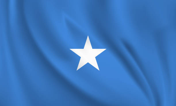
Waving flag of Somalia blowing in the wind. Full page flying flag. Vector realistic illustration EPS10

horn of africa vector map


An aerial view of the Somalian coastline near Mogadishu – an area frequented by modern-day pirates.

Map of Somalia.

Illustration of a Somalian dancers from Mogadishu


vector illustration of Somalia map


https://maps.lib.utexas.edu/maps/africa/africa_pol_2012.pdf https://maps.lib.utexas.edu/maps/africa/somalia_physio-2002.jpg


Coronavirus pandemic reported on the map of Somalia. Spread of COVID-19 represented with red circles on a black background, like a radar screen. Conceptual image: coronavirus detected, quarantined area, spread of the disease, coronavirus outbreak on the territory, virus alert, danger zone, confined space, closing of borders, area under control, stop coronavirus, defeat the virus. Vector Illustration (EPS10, well layered and grouped). Easy to edit, manipulate, resize or colorize.
Somalia flag - glossy circle badge. Vector icon.

Crossed flags of Somalia and Ethiopia. Official colors. Correct proportion. Vector illustration

Somalia, flag, country, culture, background, vector

3d rendering of a Somalia national flag waving


Maps of Somalia isolated on white background. Easily customizable for your design.

3D map of Somalia isolated on a blank blueprint, with a dropshadow (color used: blue and white). Vector Illustration (EPS10, well layered and grouped). Easy to edit, manipulate, resize or colorize.
Next