
Ocean City Maryland Map Pictures, Images and Stock Photos
Browse 6 ocean city maryland map stock photos and images available, or start a new search to explore more stock photos and images.
Most popular
A set of vintage-style icons and typography representing the state of Maryland, including Baltimore and Ocean City. Each items is on a separate layer. Includes a layered Photoshop document. Ideal for both print and web elements.

A vintage-style map of Maryland with freeways, highways and major cities. Shoreline, lakes and rivers are very detailed. Includes an EPS and JPG of the map without roads and cities. Texture, compass, cities, etc. are on separate layers for easy removal or changes.
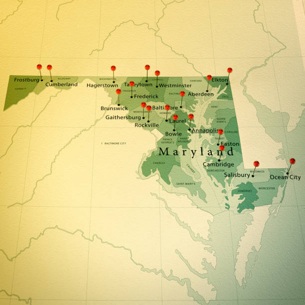
3D Render of a Map of Maryland with Straight Pins at the Position of important Cities. Vintage Color Style. Very high resolution available! All source data is in the public domain. http://www.naturalearthdata.com/about/terms-of-use/ Made with Natural Earth: Internal Administrative Boundaries, Populated Places http://www.naturalearthdata.com/downloads/10m-cultural-vectors/

Greetings from Ocean City vintage rusty metal sign on a white background, vector illustration

MD Worcester County Vector Map Green. All source data is in the public domain. U.S. Census Bureau Census Tiger. Used Layers: areawater, linearwater, cousub, pointlm.