
Us Weather Map Pictures, Images and Stock Photos
Browse 60+ us weather map stock photos and images available, or search for weather radar or weather forecast to find more great stock photos and pictures.
Severe weather map forecast over part of United States.
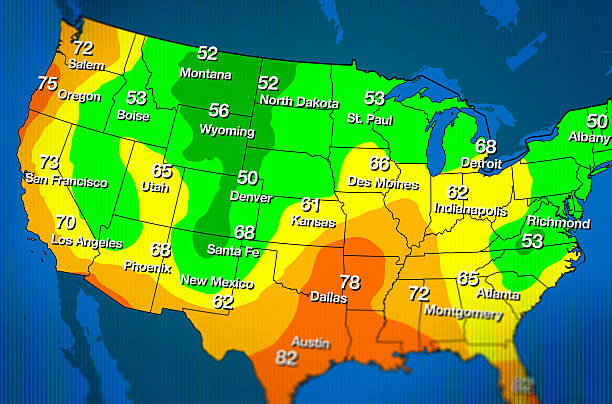
Fictitious weather forecast map with various temperatures.
Weather forecast USA. Meteorological weather map of the United State of America. Realistic synoptic map USA with aditable generic map showing isobars and weather fronts. Topography and physical map.EPS 10

Highly detailed weather map of the USA with weather icons. All elements separately grouped and can be easily changed.
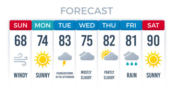
Weather forecast layout design for a week weekly days.

Fictitious cold weather map with temperatures.
Imaginary weather vector map of the United States of America

Weather symbols and isoline weather map. EPS 10 file. Transparency effects used on highlight elements.

Weather forecast of USA. Meteorological weather map of the United State of America. Realistic synoptic map with aditable generic map showing isobars and weather fronts. Topography and physical map

A imaginary weather map of the United States of America

Weather forecast. Meteorological weather map of the United State of America. Realistic synoptic map USA with aditable generic map showing isobars and weather fronts. Topography and physical map.EPS 10
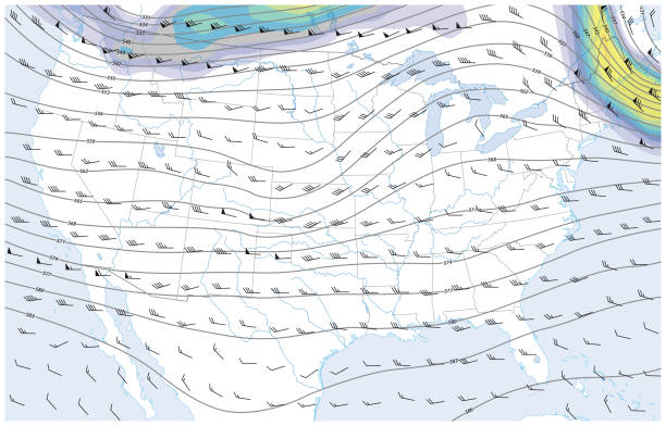

High detailed map оf United States with weather icons
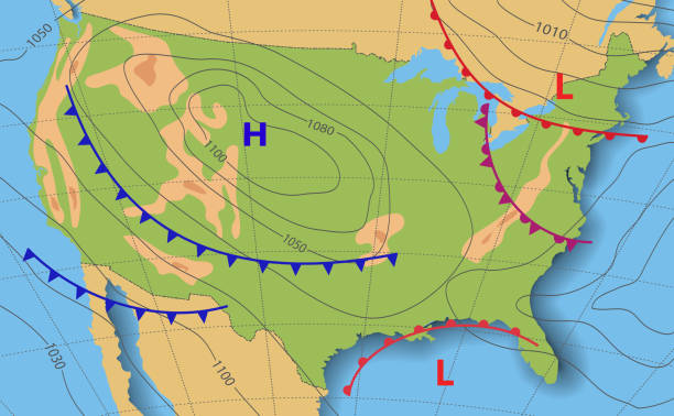
Weather forecast USA. Meteorological weather map of the United State of America. Realistic synoptic map with aditable generic map showing isobars and weather fronts. Topography and physical map.EPS 10

Forecast weather map of America. Topography map. Geography landforms and elevation. Template of synoptic map with movement fronts cyclone and anticyclone wind in graphic chart, isobar, temperature

Mexico. Weather map of the Mexico. Meteorological forecast. Realistic and Editable synoptic map of the country showing isobars and weather fronts. Vector illustration. EPS 10
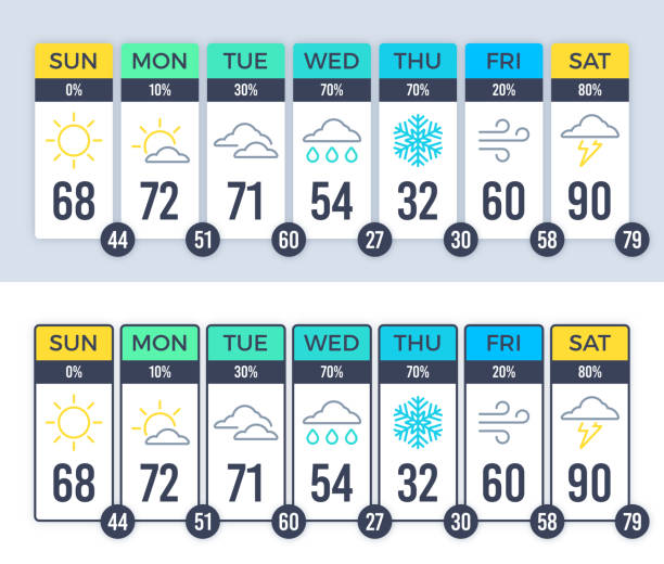
Weather forecast layout design for a week weekly days.


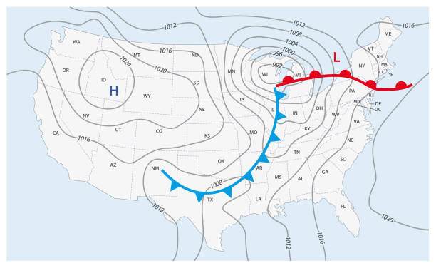
Weather forecast map of USA. Cold and warm fronts movement to America. Template of climate map for synoptic prediction with pressure, isobars, temperature, meteorology cyclone, direction wind fronts

Canada. Canada bordered by USA and Alaska. Weather map of the country. Meteorological forecast. Editable vector illustration of a generic map showing isobars and weather fronts. EPS 10.


The Rand-McNally Grammar School Geography 1895 - Chicago & New York

Weather forecast. Meteorological weather map of the United State of America. Realistic synoptic map USA with aditable generic map showing isobars and weather fronts. Topography and physical map.EPS 10
Chicago

Weather map of the United States of America. Meteorological forecast . Editable vector illustration of a generic weather map showing with tornado, isobars and weather fronts

Science or meteorology: Curved flow lines suggesting some larger flow, for example wind or water

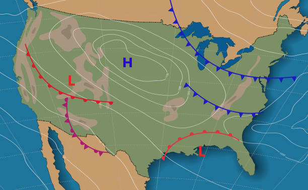
Weather high and low pressure fronts.

Weather radar extreme weather concept.
Set of 15 gray weather line icons of sun, clouds, rain, snow, wind, storm lightning, umbrella, and tools for meteorologists to measure and forecast weather

Mexico. Weather map of the Mexico. Meteorological forecast on a dark background. Realistic and Editable synoptic map of the country showing isobars and weather fronts. Vector illustration. EPS 10

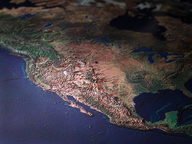
High detailed map оf North America with weather icons

Weather pattern high low pressure isobar isoline meteorology map.


Because of global warming there is a cracked ground and a globe sits upon it


Weather map inspired by weather map, flow pattern made of arrows

Canada. Realistic synoptic map of the Canada showing isobars and weather fronts. Meteorological forecast. Map country with national flag. Vector illustration. EPS 10.
Smart phones with apps icons, weather and GPS navigation widgets isolated on transparent background
Smart phones with apps icons, weather and GPS navigation widgets isolated on transparent background


Physical and topography map of Mexico. Realistic weather map of the country showing isobars and weather fronts. Meteorological forecast. Vector illustration. EPS 10

Weather map of the Canada. Realistic synoptic map of the country showing isobars and weather fronts. Canada bordered by USA and Alaska. Meteorological forecast. Vector illustration EPS 10

Weather forecast map of India. Movement of warm cyclone to country. Template of climate map for synoptic prediction with pressure, isobars, temperature, meteorology cyclone, direction wind fronts

A map showing the course of the Great Storm in late March 1890 in the United States of America, during which the city of Louisville, Kentucky, was partially destroyed: it was known as the Louisville Cyclone. From “Harper’s Weekly - A Journal of Civilization” Volume XXXIV No. 1737 of Saturday 5th April 1890. Published by Harper & Brothers and costing 10 cents including supplement.

Weather forecast USA. Meteorological weather map of the United State of America. Realistic synoptic map USA with aditable generic map showing isobars and weather fronts. Topography and physical map.EPS 10

dry earth, cracked land

Canada. Weather map of the country. Meteorological forecast. Detailed physical map of Canada colored according to elevation, with rivers, lakes, mountains. Vector map with national flag. EPS 10

On a sand dune there is a world globe


High detailed State of Hawaii map with navigation icons.

Weather map inspired flow pattern made of arrows


World weather map concept illustration.


On a sand dune there is a world globe
An icon of a weather forecaster reporting on the weather. The icon includes editable strokes or outlines using the EPS vector file.
Next