Veneto Map Pictures, Images and Stock Photos
Browse 2,400+ veneto map stock photos and images available, or start a new search to explore more stock photos and images.
Most popular

Vector of highly detailed map of Italy with administrative divisions - global colors for easy edit

Black silhouette map of the Veneto region in Italy on white background

High Quality map of Veneto is a state of Italy, with borders of the districts

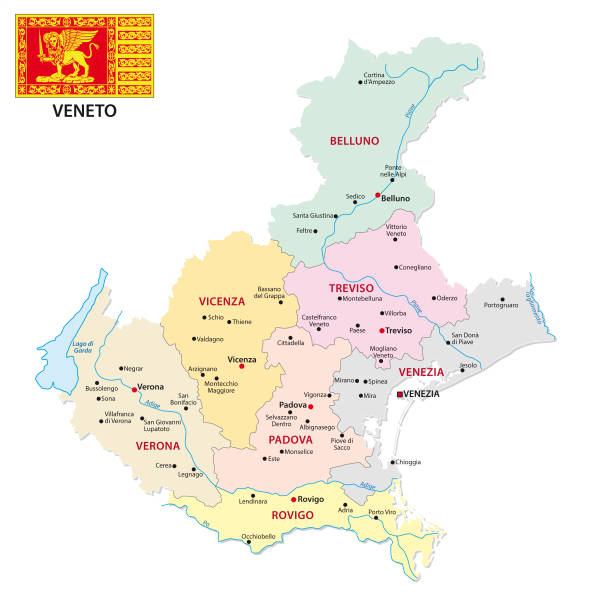
The Veneto region map divided in provinces with labels, Italy

The Veneto grayscale map divided in administrative areas with labels, Italy
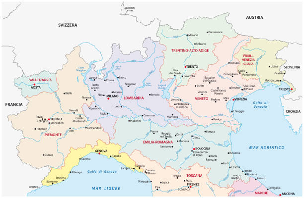
North italy administrative and political vector map
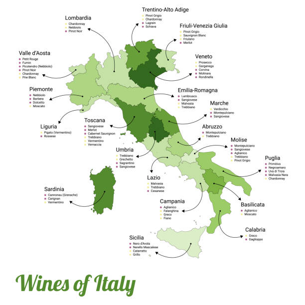
Vector illustration of the map of all the different kinds of wines in every region in Italy.
Map of Veneto for your own design. Four maps with editable stroke included in the bundle: - One black map on a white background. - One blank map on a black background. - One white map with shadow on a blank background (for easy change background or texture). - One line map with only a thin black outline (in a line art style). The layers are named to facilitate your customization. Vector Illustration (EPS10, well layered and grouped). Easy to edit, manipulate, resize or colorize. Vector and Jpeg file of different sizes.

Map of Veneto for your own design. With space for your text and your background. Four maps included in the bundle: - One black map. - One blank map with only a thin black outline (in a line art style). - One mosaic map. - One white map with a thin black outline. The 4 maps are isolated on a blank background (for easy change background or texture).The layers are named to facilitate your customization. Vector Illustration (EPS10, well layered and grouped). Easy to edit, manipulate, resize or colorize.

Andres Allgemeiner Handatlas - Bielefeld und Leipzig 1896

Map of Veneto in a trendy vintage style. Beautiful retro illustration with old textured yellow paper and a black long shadow (colors used: yellow, white and black). Vector Illustration (EPS10, well layered and grouped). Easy to edit, manipulate, resize or colorize. Vector and Jpeg file of different sizes.

Map of Italy vector illustration, design. Icons with Italian Colosseum, pasta, gandola, cathedral. Sicilia and Sardinia islands. Explore Italy concept image

Topographic map of the European Alps. Lithograph, published in 1897.


Map of Veneto in a trendy vintage style. Beautiful retro illustration with old textured paper (colors used: blue, green, beige and red). Vector Illustration (EPS10, well layered and grouped). Easy to edit, manipulate, resize or colorize. Vector and Jpeg file of different sizes.
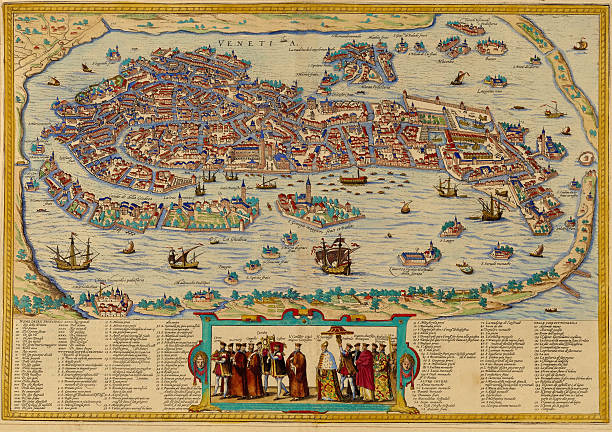
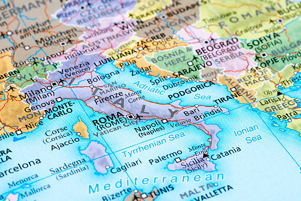
A medieval map of Venice, Italy, from a XVII century original. Nice cartouches and vignetes and a nice example of decorative mapping. See more Italian images and maps:

Illustration of Carnival Mardi gras on multicolors feathers,colors of the Mardi Gras.

Meyers hand-Atlas Leipzig und Wien Verlag des Bibliographischen Instituts 1900
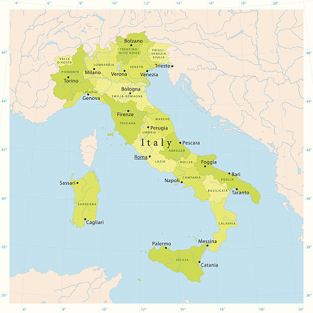
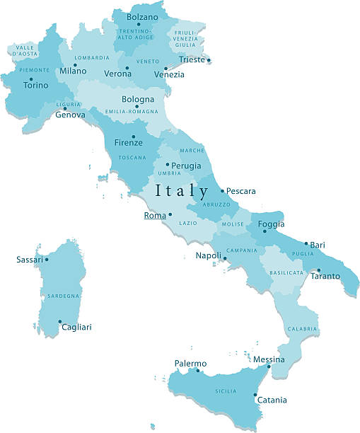
Italy regions map isolated on white background. Cartography map of Italian regional administrative borders. Vector stock

Venezia on a road map

Veneto (Autonomous region of Italy) map vector illustration, scribble sketch Veneto map

White map of Veneto isolated on a trendy color, a blue green background and with a dropshadow. Vector Illustration (EPS10, well layered and grouped). Easy to edit, manipulate, resize or colorize.

Map of Venezia, Italy. Detail from the World Atlas.

White map of Veneto isolated on a blue background with a long shadow effect and in a flat design style. Vector Illustration (EPS10, well layered and grouped). Easy to edit, manipulate, resize or colorize.


Vector illustration of the map of all the different kinds of wines in every region in Italy. Cut out design element on a transparent background on the vector file.


Vintage map of Italy in 1861
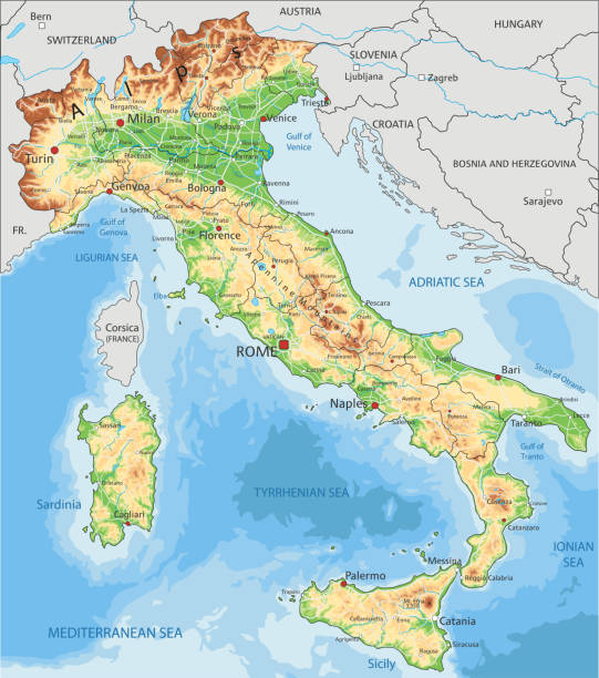
High detailed Italy physical map with labeling. Organized vector illustration on seprated layers.

Vintage map of Italy fron 1837
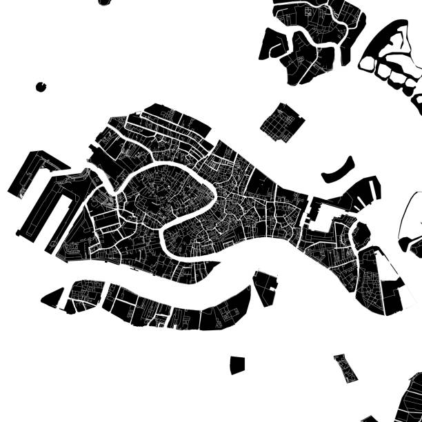
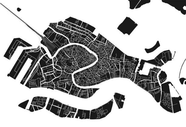
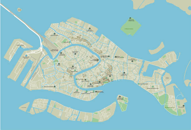
Topographic / Road map of Venice, Italy. Original map data is open data via © OpenStreetMap contributors. All maps are layered and easy to edit.

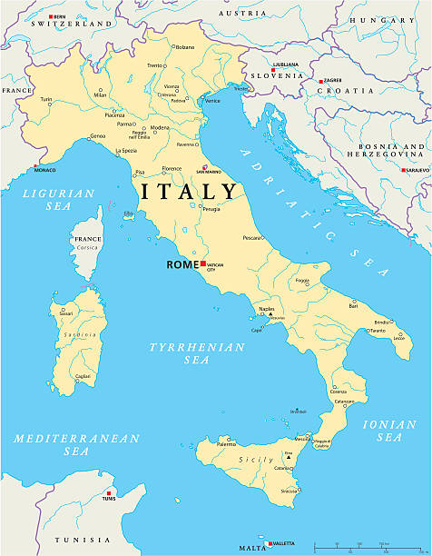
Political map of Italy with capital Rome, the Vatican and San Marino, with national borders, most important cities, rivers and lakes. Vector illustration with English labeling and scaling.

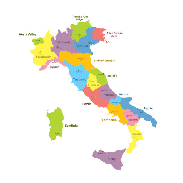
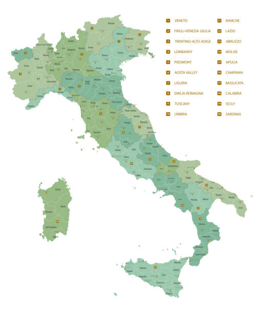
Italian political map with administrative province names - Campania, Emilia-Romagna, Friuli-Venezia Giulia, Lazio and more. Map of Italy with region borders infographic isolated on white background

Abstract dot pattern vector map of the region of Veneto, Italy. Carefully built with little circles. The country dots and background dots are each grouped as a compound path, so you can easily change colors and even use gradients with just a few clicks. File was created on July 24, 2015. The colors in the .eps-file are ready for print (CMYK). Included files are EPS (v10) and Hi-Res JPG (3000 x 3000 px).
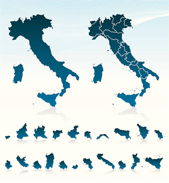
Highly detailed vector map of Italy. File was created on September 5, 2011. The colors in the .eps-file are ready for print (CMYK). Included files: EPS (v8) and Hi-Res JPG.

Verona Italy City Map in Retro Style. Outline Map. Vector Illustration.

map of Veneto province of Italy and location on Italian map

Map of Veneto sketched and isolated on a white background. The map is purple with a black outline. Pink and blue are overlapped to create a modern visual effect, looking like anaglyph image. The combination of pink and blue in this illustration creates a predominantly purple map. Vector Illustration (EPS file, well layered and grouped). Easy to edit, manipulate, resize or colorize. Vector and Jpeg file of different sizes.


3D Render of a Topographic Map of the state of Veneto in Northern Italy.

3d map of cities and roads in Europe. Countries and their neighbors.

Stylized map of Italy with main attractions and landmarks. Vector illustration

Italy Map - Vintage Detailed Vector Illustration

Detailed vector map of Italy with administrative divisions. File was created on October 22, 2012. The colors in the .eps-file are ready for print (CMYK). Included files: EPS (v8) and Hi-Res JPG (4711 × 5600 px).
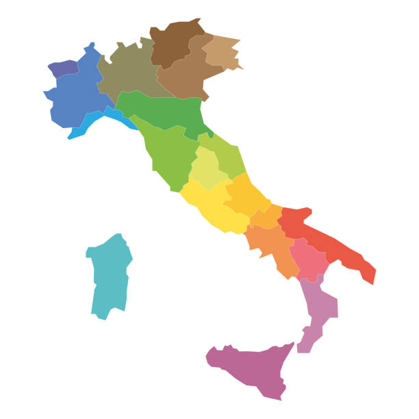
Regions of Italy. Map of regional country administrative divisions. Colorful vector illustration.


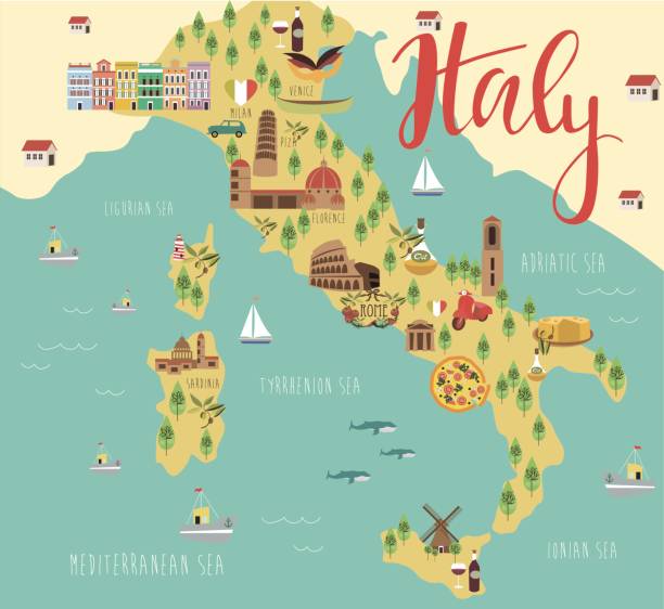
Illustration map with animals, nature and landmarks. Vector illustration
Detailed vector map of Italy with regions.
Map of Italy vector illustration, design. Icons with Italian Colosseum, pizza, wine, cathedral. Mediterranean Sicilia and Sardinia islands. Explore Italy concept image
Next