Xinjiang Region Pictures, Images and Stock Photos
Browse 210+ xinjiang region stock photos and images available, or start a new search to explore more stock photos and images.
Most popular
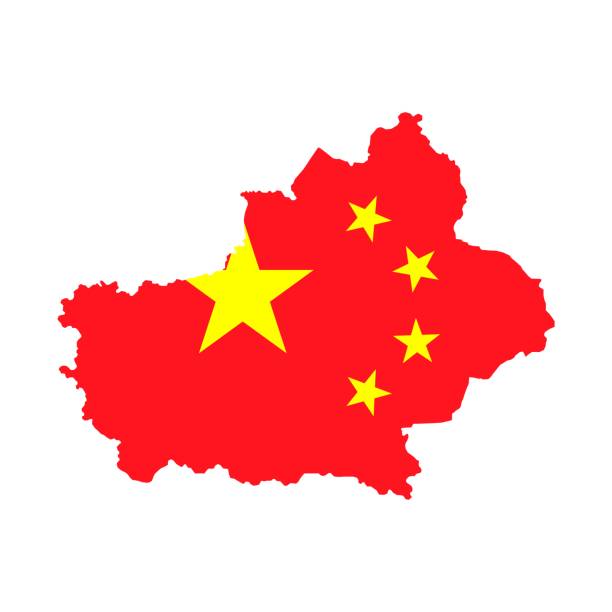
Map of People's Republic of China where Xinjiang Uyghur Autonomous Region province is pulled out


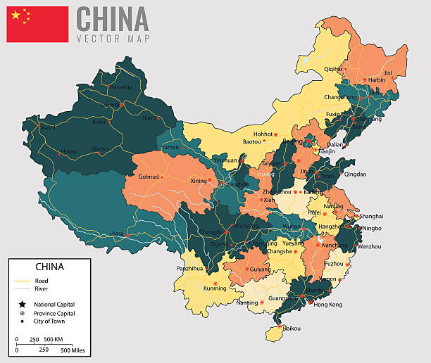
China map with provinces. All territories are selectable. Vector illustration

YARKENT, CHINA - Oct 2011: An older uyghur man and woman walk along a street in Yarkant near Kashgar in the Xinjiang Uygur Autonomous Region of western China
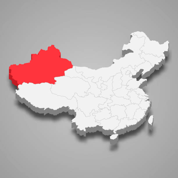
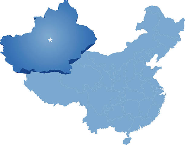
Xinjiang province location within China 3d map

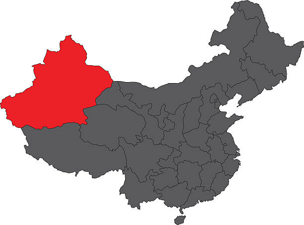
Color map of the regions and divisions of China

Multi-lingual directional sign on streets in Kashgar or Kashi, Xinjiang Autonomous Region, China.

International Grand Bazaar in Urumqi, China. International Grand Bazaar is the largest bazaar in the world by scale. It was opened to public in 2003

3D Render of a Topographic Map of the Northwest China region. All source data is in the public domain. Color texture: Made with Natural Earth. http://www.naturalearthdata.com/downloads/10m-raster-data/10m-cross-blend-hypso/ Relief texture: GMTED2010 data courtesy of USGS. URL of source image: https://topotools.cr.usgs.gov/gmted_viewer/viewer.htm Water texture: SRTM Water Body SWDB: https://dds.cr.usgs.gov/srtm/version2_1/SWBD/ Boundaries Level 0: Humanitarian Information Unit HIU, U.S. Department of State (database: LSIB) http://geonode.state.gov/layers/geonode%3ALSIB7a_Gen Boundaries Level 1: Made with Natural Earth. https://www.naturalearthdata.com/downloads/10m-cultural-vectors/

Multi-lingual directional sign on streets in Kashgar or Kashi, Xinjiang Autonomous Region, China.

3D Render of a Topographic Map of the Northwest China region. Version with administrative Boundaries. All source data is in the public domain. Color texture: Made with Natural Earth. http://www.naturalearthdata.com/downloads/10m-raster-data/10m-cross-blend-hypso/ Relief texture: GMTED2010 data courtesy of USGS. URL of source image: https://topotools.cr.usgs.gov/gmted_viewer/viewer.htm Water texture: SRTM Water Body SWDB: https://dds.cr.usgs.gov/srtm/version2_1/SWBD/ Boundaries Level 0: Humanitarian Information Unit HIU, U.S. Department of State (database: LSIB) http://geonode.state.gov/layers/geonode%3ALSIB7a_Gen Boundaries Level 1: Made with Natural Earth. https://www.naturalearthdata.com/downloads/10m-cultural-vectors/

Urumchi, Xinjiang, China - September 13, 2018 : Corpses of Xinjiang Mummies on display in Urumchi, Xinjiang Autonomous Region, China.

Details of minaret at the Mausoleum of Apak Khoja and Tomb of the Fragrant Concubine in Kashgar, or Kashi, Xinjiang, China.

china regions vector map


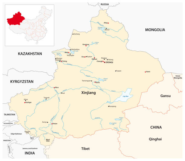
High Quality map of Xinjiang Uyghur is a province of China, with borders of the divisions

Uigher Eidgah mosque minaret with Chinese flag in Old City Kashgar, or Kashi, Xinjiang, China.

Colorful political map of China. Administrative divisions - provinces. Simple flat vector map with labels.


Parks, religions, buildings,

Urumchi, Jinjiang, China - September 14, 2018 : Class of young Pioneers pose for class photo in People's Park in Urumchi, Xinjiang Autonomous Region, China.

Illustration of a Political Map of China

Panorama of skyline in modern Urumchi, Xinjiang Autonomous Region, China from People's Park.

Pigeons feeding on streets of Old city in Kashgar, or Kashi, Xinjiang, China.

Kashgar, Xinjiang, China - September 16, 2018 : Buyers and sellers haggling over sheep at the Sunday Livestock Bazaar and Market in Kashgar, or Kashi, China.

Kashgar, Xinjiang, China - September 15, 2018 : Portrait of Uyghur man during Sunday Livestock Bazaar in Kashgar, or Kashi, Xinjiang, China.


Kashgar, Xinjiang, China - September 15, 2018 : Tourists on rainy streets Old City of Kashgar, or Kashi, Xinjiang, China.

Kashgar, Xinjiang, China - September 15, 2018 : Entrance gate to Tomb of the Fragrant Concubine, Kashgar, China.

Pigeons feeding on streets of Old city in Kashgar, or Kashi, Xinjiang, China.

Pigeons feeding on streets of Old city in Kashgar, or Kashi, Xinjiang, China.

Kashgar, Xinjiang, China - September 16, 2018 : Motorbike pulling trailer of sheep at the Sunday Livestock Bazaar and Market in Kashgar, or Kashi, China.

Kashgar, Xinjiang, China - September 15, 2018 : Buyers and sellers at sheep pens during Sunday Livestock Market and Bazaar in Kashgar, or Kashi, Xinjiang, China.

Kashgar, Xinjiang, China - September 16, 2018 : Panorama of buyers and sellers haggling over sheep at the Sunday Livestock Bazaar and Market in Kashgar, or Kashi, China.

Kuche, China - March 4, 2006: Old man and kid from the Chinese Uyghur minority in front of a Mosque in the small city of Kuche on the silk road, Xinjiang Autonomous Region, China.


Urumchi, Xinjiang, China - Septemter 14, 2018 : Visitors on path at People's Park in Urumchi, Xinjiang Autonomous Region, China.

Minarets and facade at the Mausoleum of Apak Khoja and Tomb of the Fragrant Concubine in Kashgar, or Kashi, Xinjiang, China.

Minarets and domes on mosque at Grand Bazaar in Urumchi, Xinjiang Autonomous Region, China.


High Quality map of Xinjiang is a province of China

Kashgar, Xinjiang, China - September 15, 2018 : Actors in traditional uniforms with olden banners on wall of new Old City Kashgar, or Kashi, Xinjiang, China.

KASHGAR, CHINA - Oct 2011: A smiling uyghur man leads a donkey through the crowds at the weekly Sunday animal market in Kashgar in the Xinjiang Uygur Autonomous Region of western China


Tombs in graveyard at the Mausoleum of Apak Khoja and Tomb of the Fragrant Concubine in Kashgar, or Kashi, Xinjiang, China.

Minarets and facade at the Mausoleum of Apak Khoja and Tomb of the Fragrant Concubine in Kashgar, or Kashi, Xinjiang, China.

Minarets and facade at the Mausoleum of Apak Khoja and Tomb of the Fragrant Concubine in Kashgar, or Kashi, Xinjiang, China.

Shuttered madrasa at the Mausoleum of Apak Khoja and Tomb of the Fragrant Concubine in Kashgar, or Kashi, Xinjiang, China.


KASHGAR, CHINA - Oct 2011: An old uyghur man with a white beard walks past livestock at the weekly market in Yopurga, near Kashgar in the Xinjiang Uygur Autonomous Region in western China

Kashgar, Xinjiang, China - September 15, 2018 : Butcher at Sunday Bazaar in Kashgar, or Kashi, Xinjiang, China.

KASHGAR, CHINA - Oct 2011: Uyghur people travel along birch tree lined roads to the weekly market at Yopurga near Kashgar in Xinjiang Uygur Autonomous Region of China


KASHGAR, CHINA - Oct 2011: View of the 24 metre tall statue of Chairman Mao in the city of Kashgar in the Xinjiang Uygur Autonomous Region of western China

China Flag at Khunjerab pass, Pak China Border 6/28/2018

"People's Republic Of China" Written on the Beautiful Khujerab Pass Boder,
Next