Georgia Highway Map stock vectors
Browse 820+ georgia highway map stock illustrations and vector graphics available royalty-free, or start a new search to explore more great stock images and vector art.
Most popular
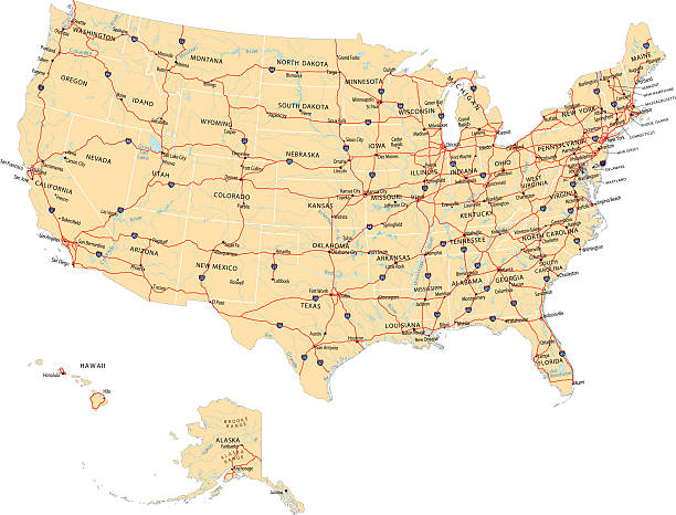
Highly detailed map of United States with roads, states, state capitals, important cities, rivers and major lakes.

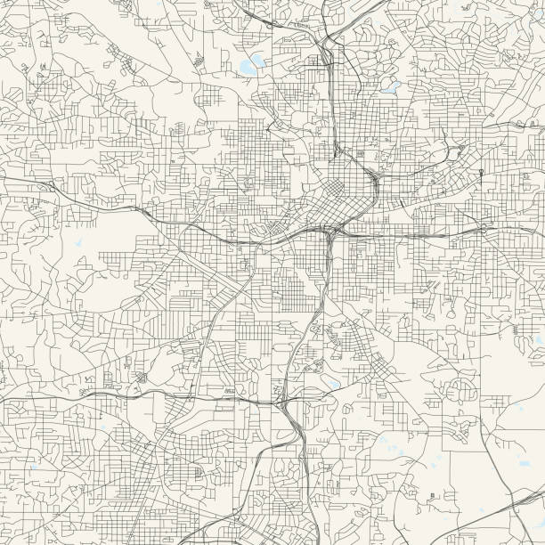
Topographic / Road map of Atlanta GA. Original map data is public domain sourced from www.census.gov/
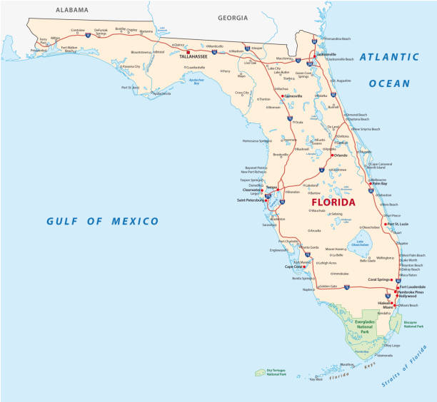
florida road vector map with national parks
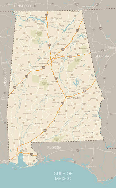
A detailed map of Alabama state with cities, roads, major rivers, and lakes plus National Forests. Includes neighboring states and surrounding water.
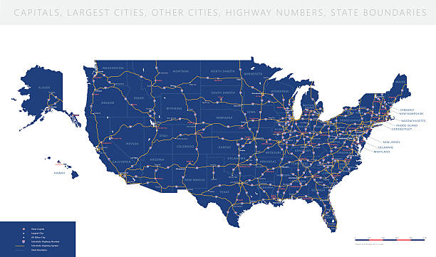
High detailed USA interstate road map vector
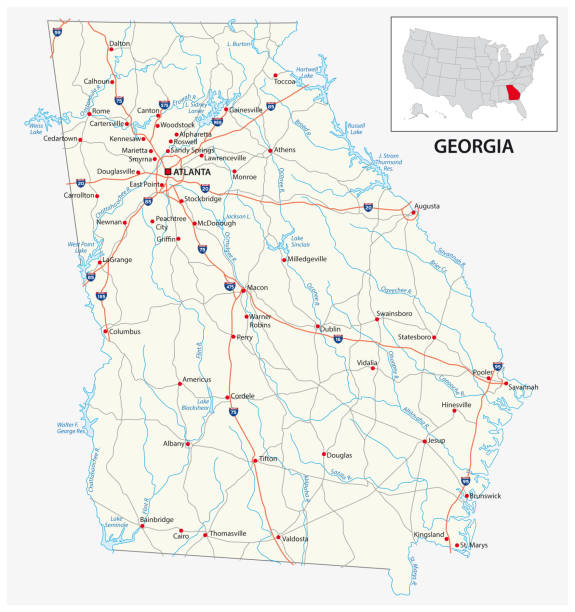

Vector illustration of map of Georgia with major roads, rivers and lakes.
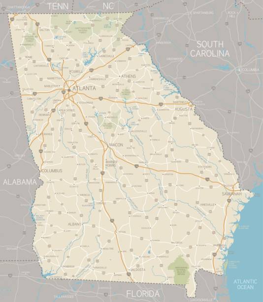
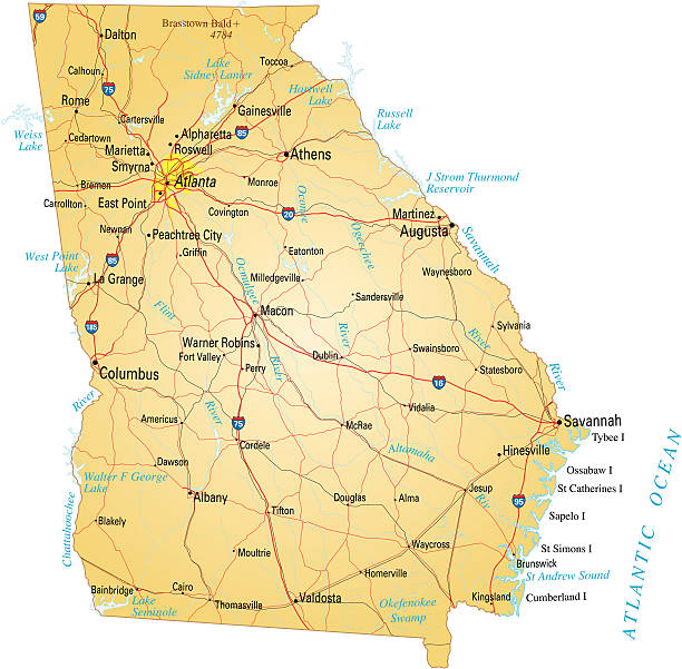
A detailed map of Georgia state with cities, roads, major rivers, and lakes. Includes neighboring states and surrounding water.
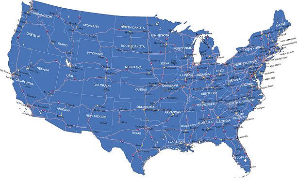
Detailed map of United States of America.
High detailed USA interstate road map vector
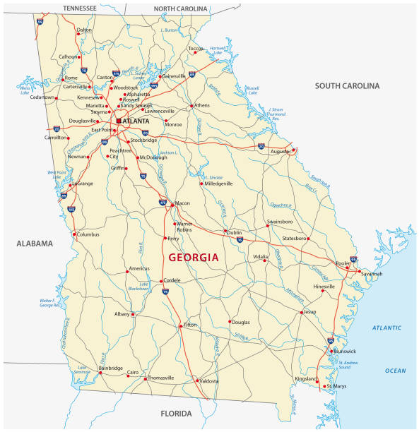
georgia road vector map
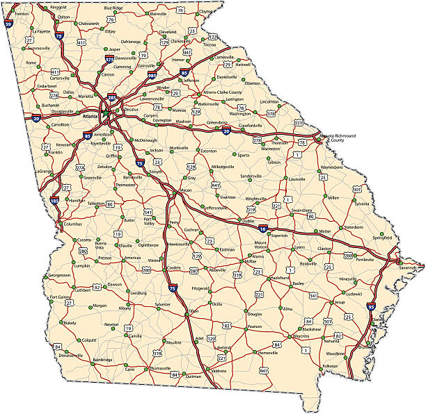
Highway map of the state of Georgia with Interstates and US Routes. It also has lines for state and county routes (but not labeled/named) and many cities on it as well. All cities are the County Seats and the Capitol.

Road map of Georgia, US American federal state. Editable highly detailed transportation map with highways and interstate roads, rivers and cities realistic vector illustration


A vintage-style map of Georgia with freeways, highways and major cities. Shoreline, lakes and rivers are very detailed. Includes an EPS and JPG of the map without roads and cities. Texture, compass, cities, etc. are on separate layers for easy removal or changes.

Florida state detailed editable map with with cities and towns, geographic sites, roads, railways, interstates and U.S. highways. Vector EPS-10 file, trending color scheme


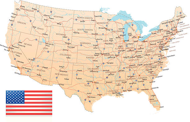
Highly detailed map of United States with roads, states, big cities, rivers and some other objects

Atlanta Georgia USA City Map in Retro Style. Outline Map. Vector Illustration.

vector road map of the US American State of California.


Alabama road vector map
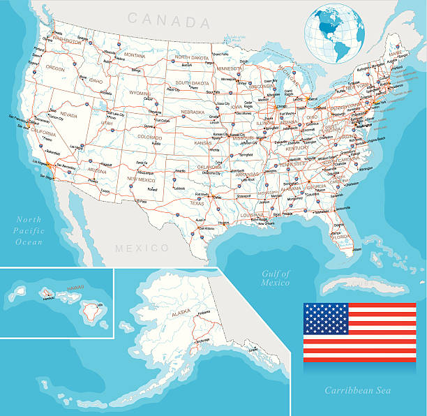
Highly detailed map of United States with roads, states, big cities, rivers and some other objects

georgia road vector map with flag

Florida administrative and political vector map with flag
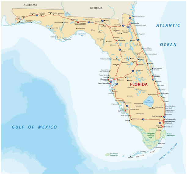
Florida vector road map with national parks

Topographic / Road map of Atlanta GA - Poster Style. Original map data is public domain sourced from www.census.gov/

illustration of Georgia state road & highway map for your design and products.

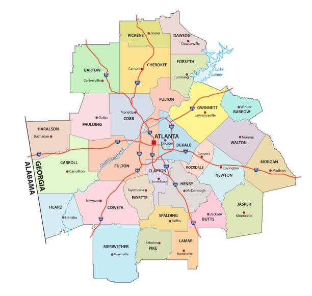
Large and detailed map of DeKalb county in Georgia, USA.

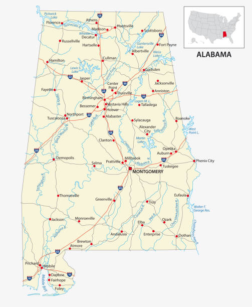
road map of the US American State of Alabama.

Topographic / Road map of Atlanta GA - Poster Style. Original map data is public domain sourced from www.census.gov/


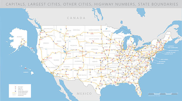
Outline Political US Map with titles of the states. All USA regions are separated and named in a layer panel.

Highway traffic road. Isometric 3d transport cars vector illustrations.

Atlanta Georgia USA City Map in Retro Style in Golden Color. Outline Map. Vector Illustration.

Topographic / Road map of Atlanta GA - Poster Style. Original map data is public domain sourced from www.census.gov/

Colored Political US Map with titles of the states. All USA regions are separated and named in a layer panel

Poster Style Topographic / Road map of Tbilisi, Georgia. Map data is open data via openstreetmap contributors. All maps are layered and easy to edit. Roads are editable stroke.

north carolina road vector map

Road map of North Carolina, US American federal state. Editable highly detailed transportation map of North Carolina with highways and interstate roads, rivers, lakes and cities vector illustration

Topographic / Road map of Atlanta GA. Original map data is public domain sourced from www.census.gov/

Florida vector road map with national parks
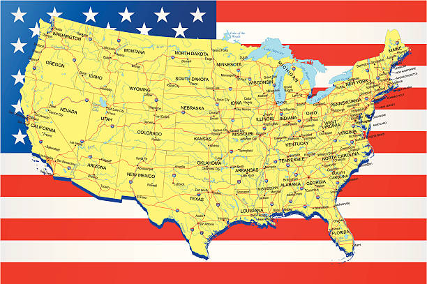
Highly detailed map of United States with roads, states, big cities, rivers and some other objects on american flag background

south carolina road vector map

Large and detailed map of Henry county in Georgia, USA.

Outline United States Of America map. US background template. Map of America with separated countries and interstate borders. All states and regions are named in the layer panel.

Large and detailed map of Fulton county in Georgia, USA.

Atlanta Georgia USA City Map in Retro Style Black and White Color. Outline Map. Vector Illustration.

Florida administrative and political vector map

Topographic / Road map of Atlanta GA. Original map data is public domain sourced from www.census.gov/

US American State of Georgia. USA state of Georgia county map outline on white background. Vector illustration.

Large and detailed map of Houston county in Georgia, USA.

Map of an old playing card of Laurens county in Georgia, USA.

Large and detailed map of Bibb county in Georgia, USA.

Georgia state detailed editable map with with cities and towns, geographic sites, roads, railways, interstates and U.S. highways. Vector EPS-10 file, trending color scheme
Next