Kosovo Serbia Map stock vectors
Browse 1,200+ kosovo serbia map stock illustrations and vector graphics available royalty-free, or start a new search to explore more great stock images and vector art.
Most popular
Central Balkan Region Map. Vector illustration.
Highly detailed vector map of Central Europe with states, capitals and big cities
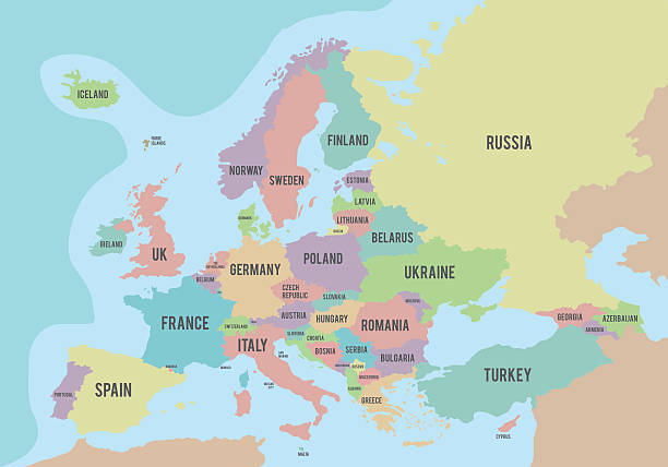
Political map of Europe with different colors for each country and names in English. Vector illustration.
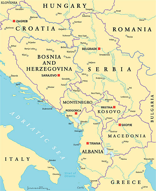
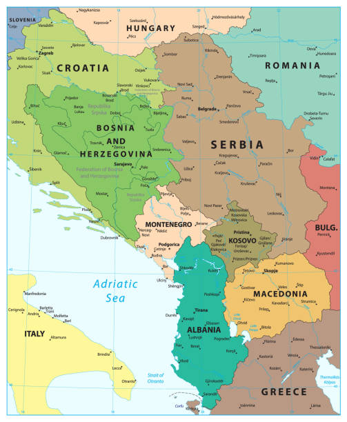
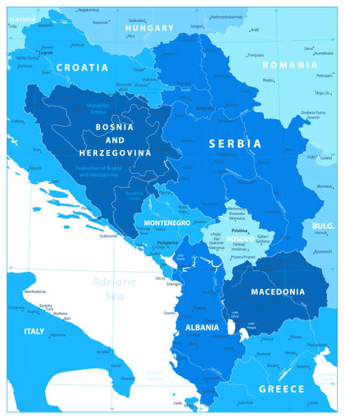
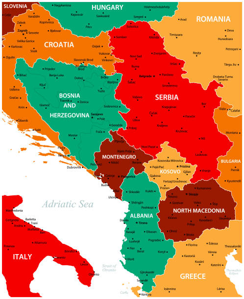
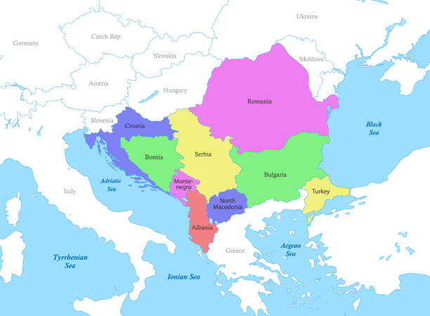
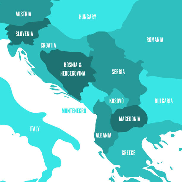
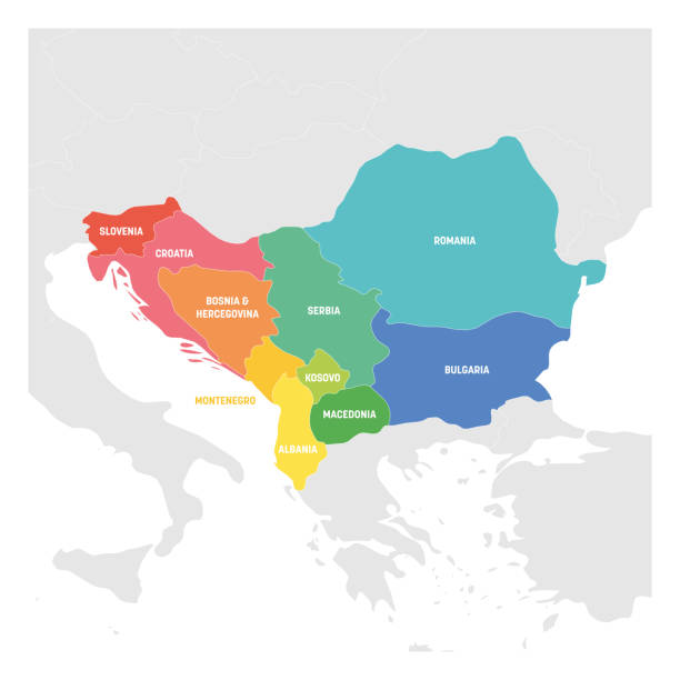
Central Balkan Political Map formed by Bosnia and Herzegovina, Serbia, Montenegro, Kosovo, Albania and Macedonia. With capitals, national borders, important cities, rivers and lakes. English labeling and scaling.
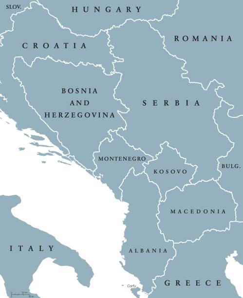
Central Balkan political map with borders. Southeastern countries on the Balkan Peninsula in Europe from Croatia to Greece. Gray illustration on white background. English labeling. Vector.
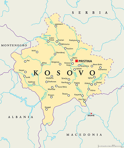
Kosovo political map with capital Pristina, national borders, important cities, rivers and lakes. English labeling and scaling. Illustration.
Central Balkan Region Map in Colors Of Blue. Vector illustration.

Serbia Map - Vintage High Detailed Vector Illustration

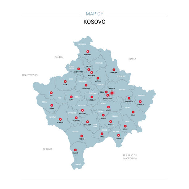
"Detailed vector map of Kosovo with administrative divisions. File was created on November 12, 2012. The colors in the .eps-file are ready for print (CMYK). Included files: EPS (v8) and Hi-Res JPG (5161aa aaa 5600 px)."

vector illustration of Map of Serbia with Kosovo with national flag within the gray map of South Europe
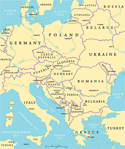
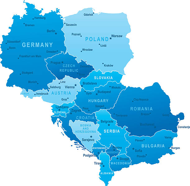
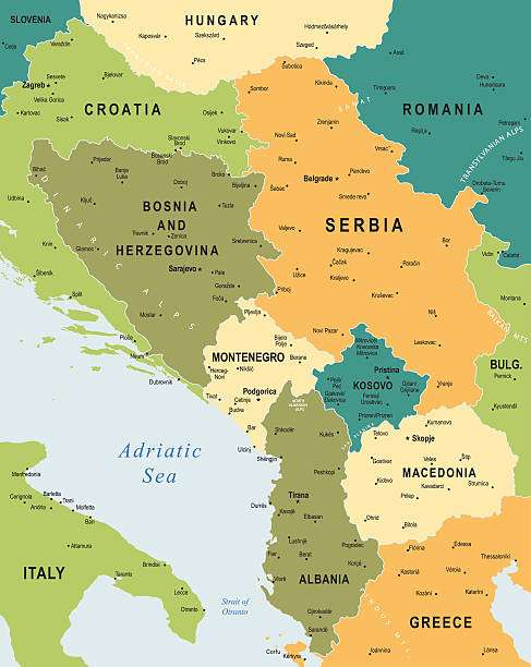
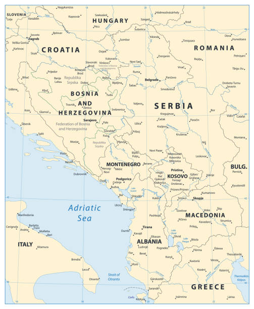
Central Europe Political Map with capitals, national borders, rivers and lakes. English labeling and scaling. Illustration.


All round World Flags with country names (part2)
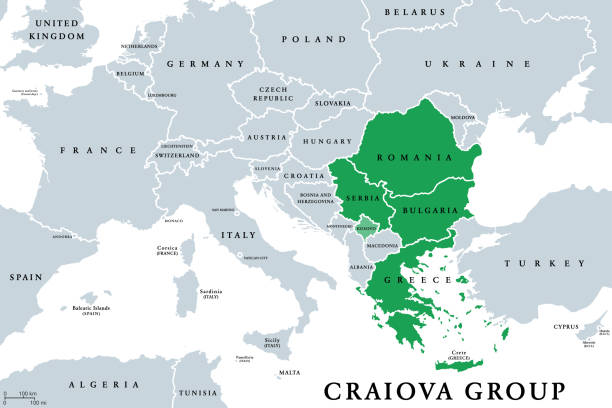
Craiova Group (Quadrilateral) member states political map. Craiova Four or C4, a cooperation project of the four European states Romania, Bulgaria, Greece and Serbia. English. Illustration. Vector.
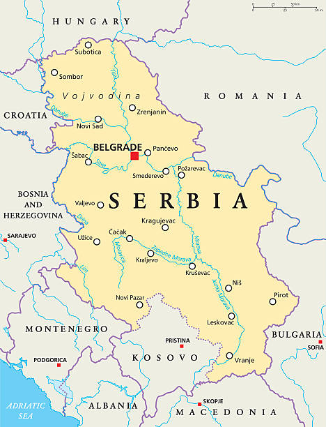
Serbia political map with capital Belgrade, national borders, important cities, rivers and lakes. English labeling and scaling. Illustration.
Highly detailed vector map of Central Europe with states, capitals and big cities.
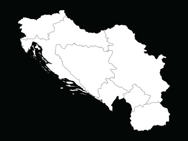
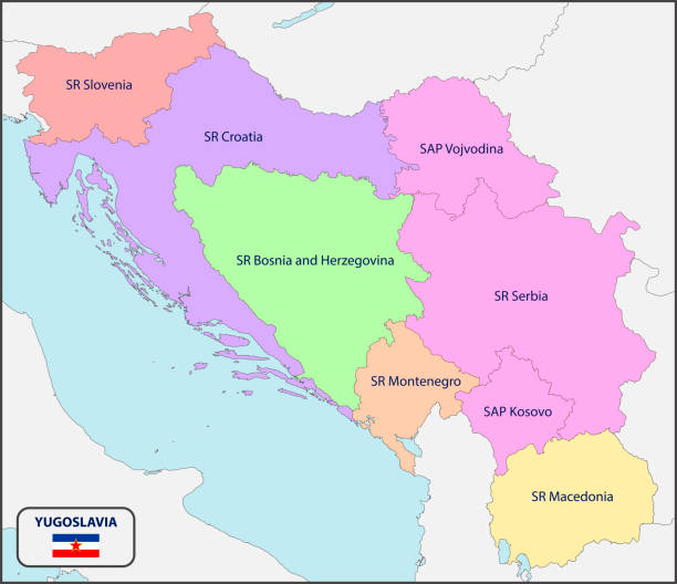
vector illustration of White map of Former Yugoslavia countries on black background
Kosovo vector map. Editable template with regions, cities, red pins and blue surface on white background.


vector illustration of Map of Former Yugoslavia countries with national flag

Highly detailed physical map of Kosovo, in vector format,with all the relief forms,regions and big cities.

Central Balkan Map - Vintage Detailed Vector Illustration

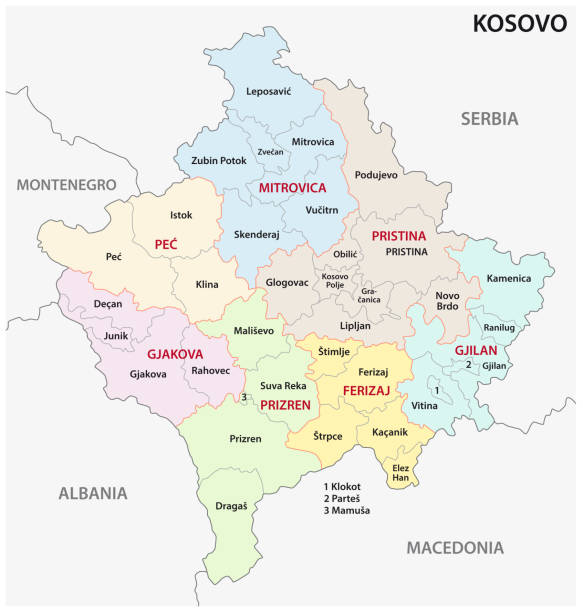
kosovo administrative and political vector map
Color political map of Southeast Europe with borders of the countries.
High detailed map of Central Balkan Region with national borders

Europe map concept showing countries of europe labeled and separated into groups. EPS 10 file. Transparency effects used on highlight elements.
Central Balkan Map. Vector illustration.
Political map of Balkans - States of Balkan Peninsula. Four shades of turquoise blue vector illustration,
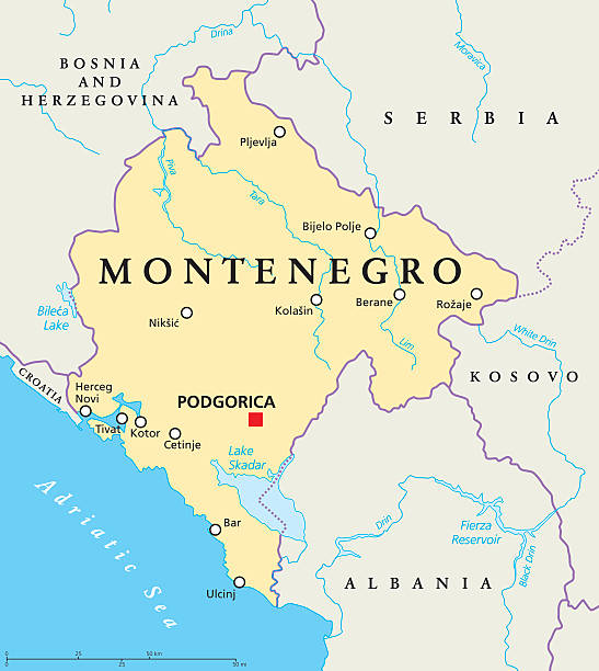
Montenegro political map with capital Podgorica, national borders, important cities, rivers and lakes. English labeling and scaling. Illustration.

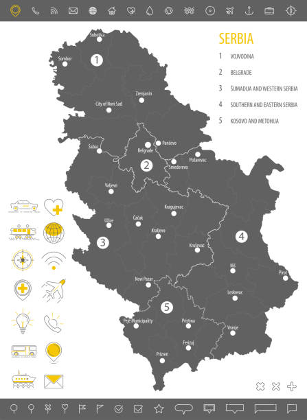
Serbia political map with capital Belgrade and neighbor countries. Republic in Southeastern Europe located on the Balkan Peninsula. Gray illustration with English labeling on white background. Vector.
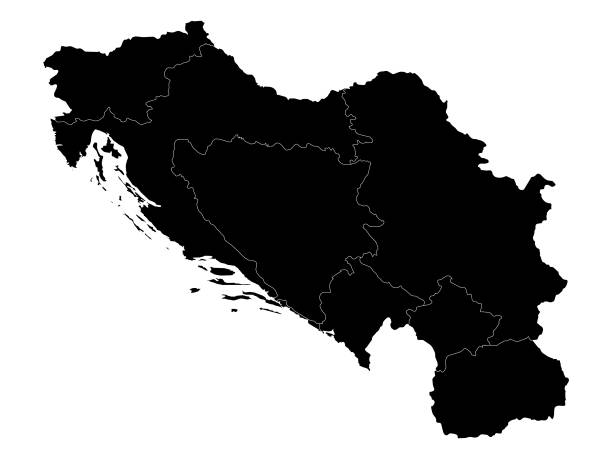
vector illustration of Black map of Former Yugoslavia on white background
Serbia flag - flat collection. Flags of different shaped twelve flat icons. Vector illustration set

Macedonia region, political map. Region of the Balkan Peninsula in Southeast Europe. Part of Greece, North Macedonia, Bulgaria, Albania, Kosovo and Serbia. English labeling. Illustration. Vector.
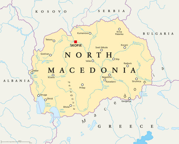
North Macedonia political map with capital Skopje, borders, important cities, rivers and lakes. Former Yugoslav Republic of Macedonia, renamed in February 2019. English labeling. Illustration. Vector.
http://dikobraz.org/map_2.jpg
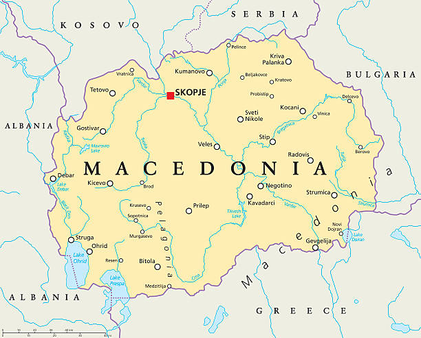
Macedonia political map with capital Skopje, national borders, important cities, rivers and lakes. English labeling and scaling. Illustration.

A set of pixel perfect vector icons for country maps from A to Z (Part 3).


Serbia map and flag - High Detailed Vector Illustration

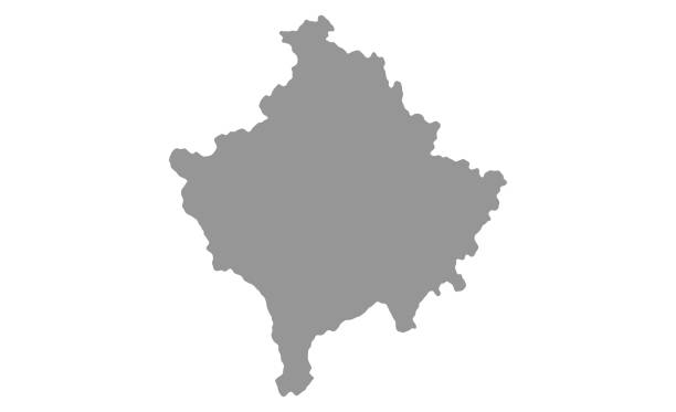
Vector isolated illustration of simplified administrative map of Kosovo. Borders and names of the districts. Grey silhouettes. White outline.

High detailed map of Central Balkan Region with national borders and navigation icons

Geographical region of Macedonia, political map. Region of the the Balkan Peninsula in Southeast Europe, part of Greece, North Macedonia, Bulgaria, Albania, Kosovo and Serbia. Illustration. Vector.
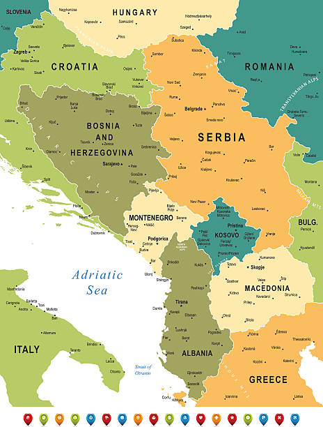
High detailed map of Central Balkan Region with national borders and navigation icons

Southeast Europe Region. Map of countries of Balkan Peninsula. Vector illustration.

Political map of Europe with different colors for each country and names in Spanish. Vector illustration.

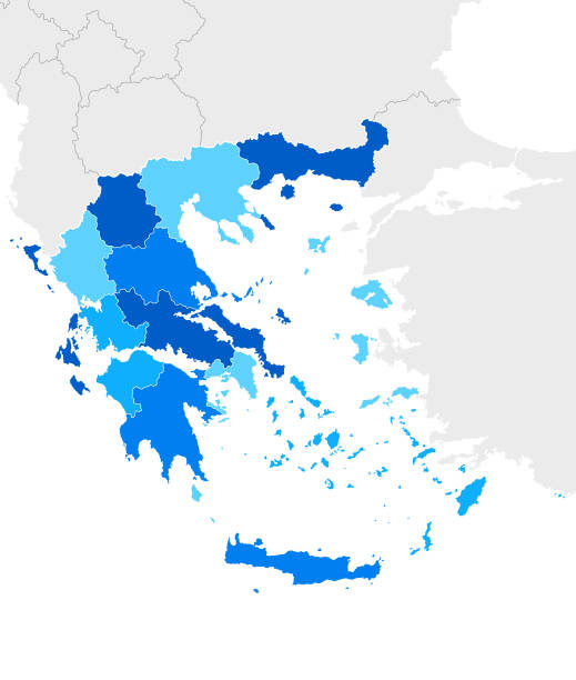
Southeast Europe Region. Colorful map of countries of Balkan Peninsula. Vector illustration.

Political map of Balkans - States of Balkan Peninsula. Four shades of orange vector illustration.

vector illustration of Black map of Balkan peninsula

Print map of europe for t-shirt, poster or geographic themes. Hand-drawn colorful map with states and capital names. Vector modern Illustration.Detailed illustration map shape can be use for presentation,chart,template and report.white background.
Next