
State Of Indiana Map stock vectors
Browse 3,400+ state of indiana map stock illustrations and vector graphics available royalty-free, or start a new search to explore more great stock images and vector art.
Most popular
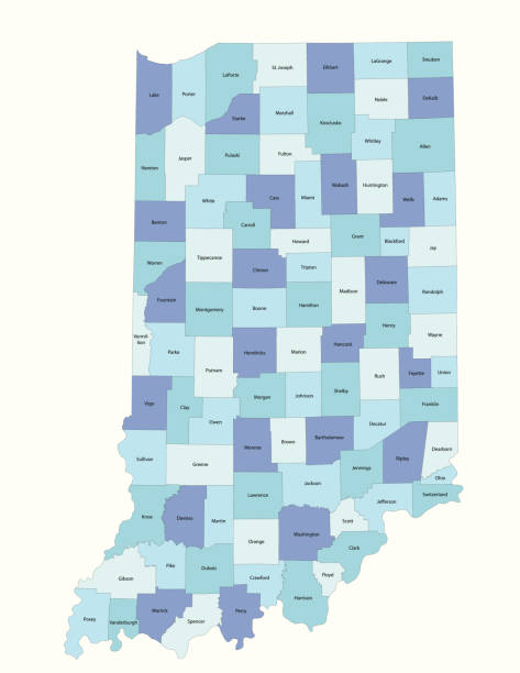
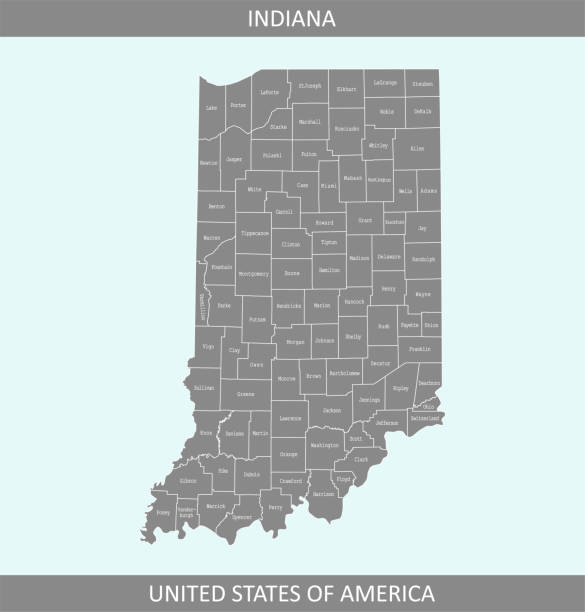
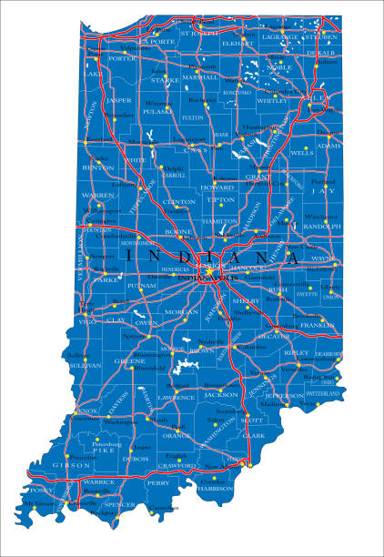
Detailed state-county map of Indiana. This file is part of a series of state/county maps. Each file is constructed using multiple layers including county borders, county names, and a highly detailed state silhouette. Each file is fully customizable with the ability to change the color of individual counties to suit your needs.

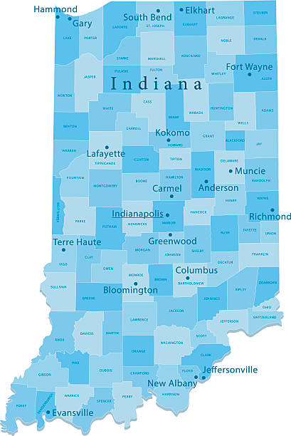
A Map of Indiana and its counties with labels

indiana road vector map with flag

Indiana State dark silhouette map isolated on white background
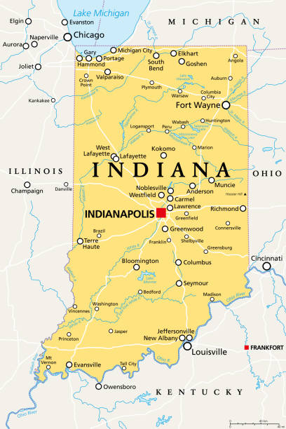
Indiana, IN, political map, with the capital Indianapolis, and most important cities, rivers and lakes. State in the Midwestern region of the United States of America, nicknamed The Hoosier State.

map of the U.S. state of Indiana

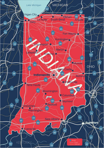
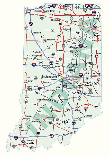
A detailed map of Indiana state with cities, roads, major rivers, and lakes plus National Forests. Includes neighboring states and surrounding water.
The maps are accurately prepared by a GIS and remote sensing expert.

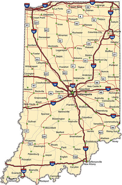
Highway map of the state of Indiana with Interstates and US Routes. It also has lines for state and county routes (but not labeled) and many cities on it as well. All cities are the County Seats and the Capitol (and some others).
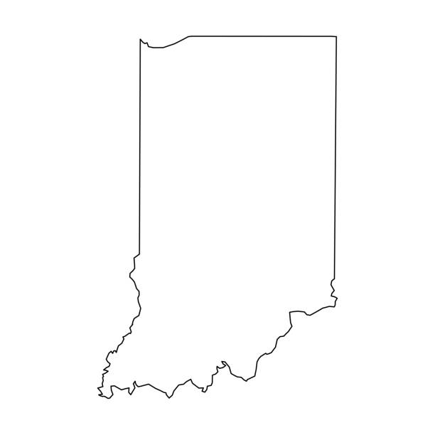
Indiana, state of USA - solid black outline map of country area. Simple flat vector illustration.

Indiana, USA - 3d map isolated on white background with sea, lakes, rivers and roads. Vector map with shadow. Vector template for website, design, cover, infographics.

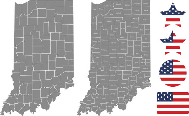
"Highly-detailed Indiana county map. Each county shape is in a separate labeled layer. All layers have been alphabetized for easy manipulation, recoloring or other use. (see image below -- note: labels only available in AICS2 and AI10 files)"

vector illustration of Indiana map

High Quality map state of United States. Indiana

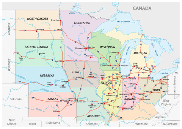
Illustrated pictorial map of Midwest United States. Includes Wisconsin, Michigan, Missouri, Illinois, Indiana, Kentucky and Ohio. Vector Illustration.
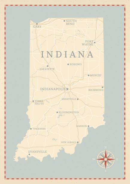
A vintage-style map of Indiana with freeways, highways and major cities. Shoreline, lakes and rivers are very detailed. Includes an EPS and JPG of the map without roads and cities. Texture, compass, cities, etc. are on separate layers for easy removal or changes.


Map of Indiana in a trendy vintage style. Beautiful retro illustration with old textured paper and light rays in the background (colors used: blue, green, beige and black for the outline). Vector Illustration (EPS10, well layered and grouped). Easy to edit, manipulate, resize or colorize.

Indianapolis IN City Vector Road Map Blue Text. All source data is in the public domain. U.S. Census Bureau Census Tiger. Used Layers: areawater, linearwater, roads.

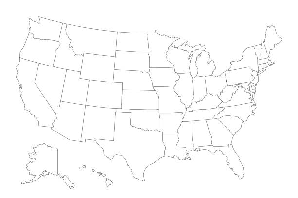
Line USA state, American map illustration, America vector isolated on white background, outline style

Map of Indiana state with counties

illustration of Indiana state map with road map for your design and products.

Map of Indiana isolated on white background. Includes 9 buttons with a flat design style for your design, in different colors (red, orange, yellow, green, blue, purple, gray, black, white, line art), each icon is separated on its own layer. Vector Illustration (EPS10, well layered and grouped). Easy to edit, manipulate, resize or colorize. Please do not hesitate to contact me if you have any questions, or need to customise the illustration. http://www.istockphoto.com/portfolio/bgblue


The map is accurately prepared by a map expert.

vector of the Indiana map


"Vector illustration of map of Indiana with major roads, rivers and lakes."

lake michigan vector map

Illustrated map of the state of Indiana in United States with cities and landmarks. Editable vector illustration
Detailed vector map of Indiana with administrative divisions. File was created on February 15, 2013. The colors in the .eps-file are ready for print (CMYK). Included files: EPS (v8) and Hi-Res JPG (3953 × 5600 px).

Stylized red sketch map of Indiana illustration vector

Indiana Map Vector Illustration Design Template. Vector eps 10.


Indiana state detailed editable map with with cities and towns, geographic sites, roads, railways, interstates and U.S. highways. Vector EPS-10 file, trending color scheme


Indiana county map outline vector illustration and its location highlighted on USA map

A set of vintage-style icons and typography representing the state of Indiana, including Indianapolis. Each items is on a separate layer. Includes a layered Photoshop document. Ideal for both print and web elements.

illustration of highly detailed U.S.A map with all state for your design , products and print.
Detailed map of Indiana state,in vector format,with county borders,roads and major cities.

Vector illustration of the Indiana County Map (Gray, Black, White)
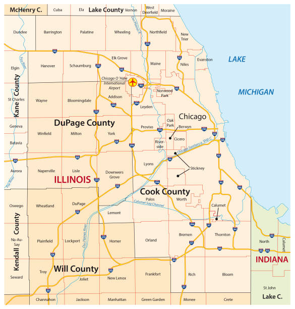
greater chicago, Illinois vector map


Gray Map on White Background of Counties of USA Federal State of Indiana
Indiana state road map with Interstates, U.S. Highways and state roads. All elements on separate layers for easy editing. Map created January 2, 2010.


Topographic / Road map of Indianapolis, IN. Original map data is open data via © OpenStreetMap contributors

Stylized blue sketch map of Indiana on white background

Next