Illustrations
Colonies Map stock illustrations
Browse 430+ colonies map stock illustrations and vector graphics available royalty-free, or search for american colonies map or british colonies map to find more great stock images and vector art.


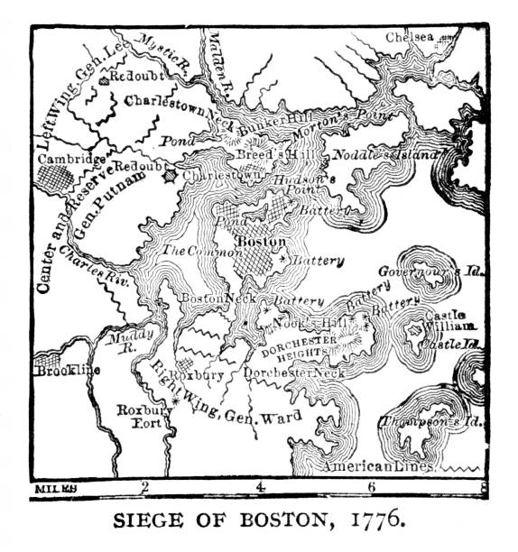
Map of Bunker Hill battle during siege of Boston, Massachusetts during American Revolutionary War, June 17, 1775. Illustration published 1895. Original edition is from my own archives. Copyright has expired and is in Public Domain.
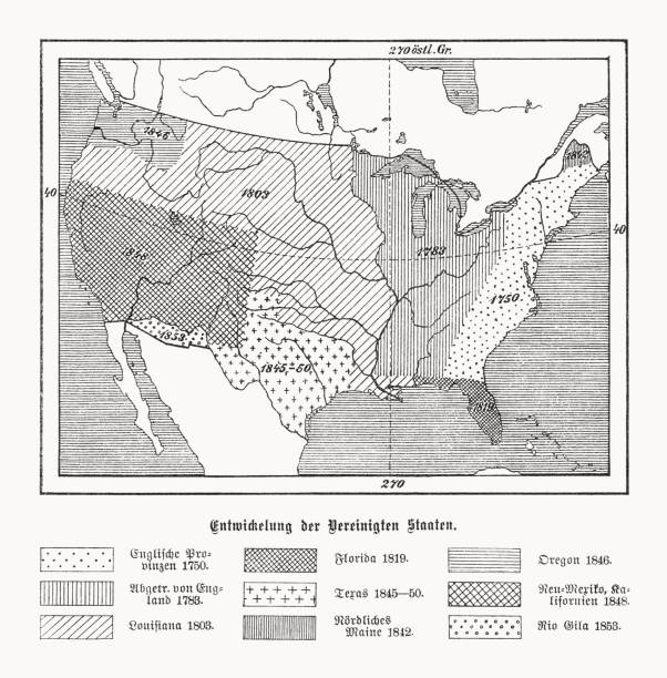
Map of the historical development of the United States of America during the 18th and 19th centuries (explanations in German). Left: English provinces 1750; Dismissed by England 1783; Louisiana 1803. Center: Florida 1819; Texas 1845 - 1850; Northern Maine 1842. Right: Oregon 1846; New Mexico/California 1848; Rio Gila 1853. Wood engraving, published in 1899.


Saturn planet with rings of gas poster. Galaxy discovery and exploration. Realistic planetary system in deep space vector illustration. Astronomy and astrophysics science flyer with solar system.

Low polygonal design, futuristic space or data and technology concept, 3d vector illustration with virtual reality effect, abstract tech background.


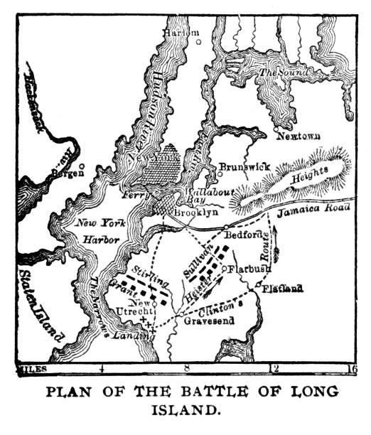
Battle plan of Long Island,, New York USA, 1776 map. Illustration published 1895. Copyright expired; artwork is in Public Domain.

Simplified world map with Global North and Global South divide. Modern flat vector infographic, clip art illustration.
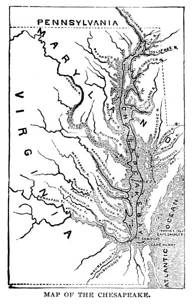
Virginia and Maryland map (USA) during the 16th-17th Centuries. Illustration published 1895. Copyright expired; artwork is in Public Domain.
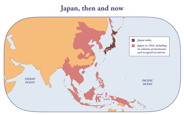
Japan today and at its greatest extend in 1942
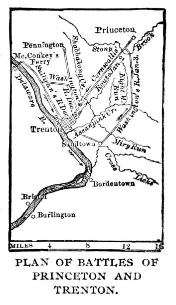
Revolutionary War Battle Plans in Princeton and Trenton, New Jersey, USA, 1776 map. Illustration published 1895. Copyright expired; artwork is in Public Domain.

Travel around the world with different mode of transport.
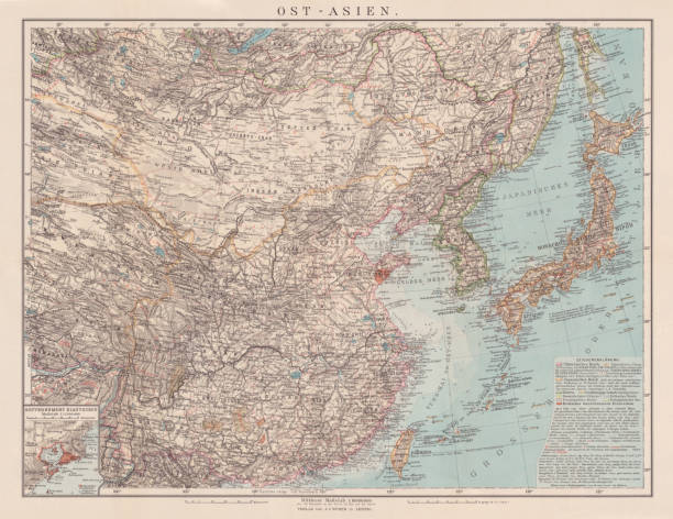
Historical map of East Asia with China, Japan and Korea. Explanations in German. Chromolithograph, published in 1900.


identifying its capital city, Conakry. African set. Spiral fingerprint series
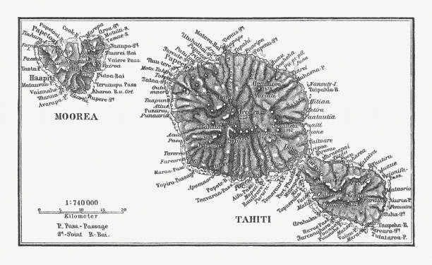
Historical map af Moorea and Tahiti. Wood engraving, published in 1897.

Hawaiian Island map, USA. Illustration engraving published 1898. Original edition is in my own archives. Copyright has expired and is in Public Domain.


Two army boots facing each other in front of a globe, symbolizing rising geopolitical tensions and global conflict. Concepts of military standoff, diplomacy, and global power struggles
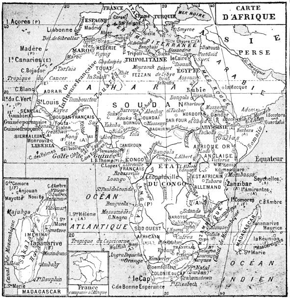
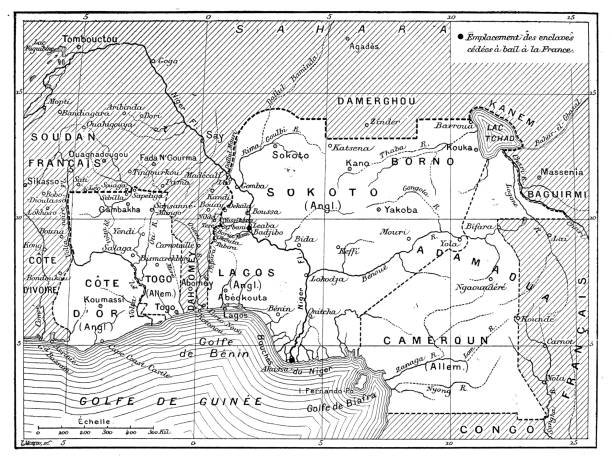
Map of Africa in the 19th century. Old vintage illustration, 1897

World Countries vector maps series. Spiral, fingerprint series
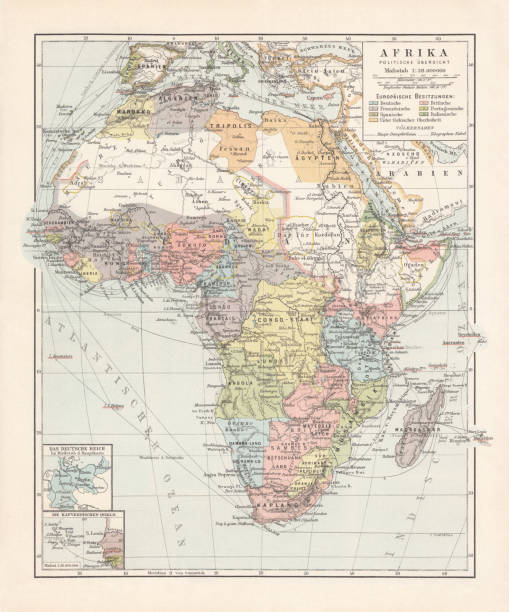
Political map of Africa at the end of the 19th century. Lithograph, published in 1899.
Comprehensive Geography by James Monteith - American Book Company 1882, 1889.

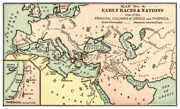
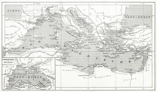
Map from La Premiere Annee de Geographie by P. Foncin - Paris 1887


Historical map with the date line (outdated designations in German). Wood engraving, published in 1893.

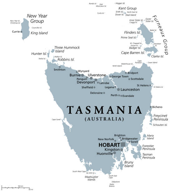
Tasmania, island state of Australia, gray political map. Located south of the Australian mainland, surrounded by thousand islands, with the capital and largest city Hobart. Illustration. Vector.
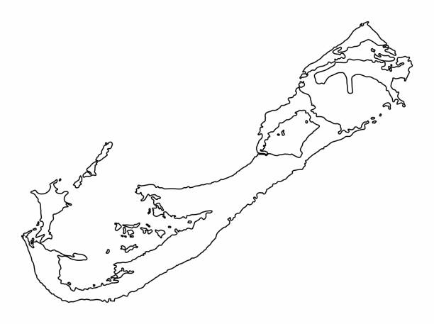
Bermuda outline map isolated on white background

identifying its capital city, Maputo. African set. Spiral fingerprint series
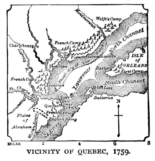
Quebec, Canada map, 1759. Illustration published 1895. Copyright expired; artwork is in Public Domain.

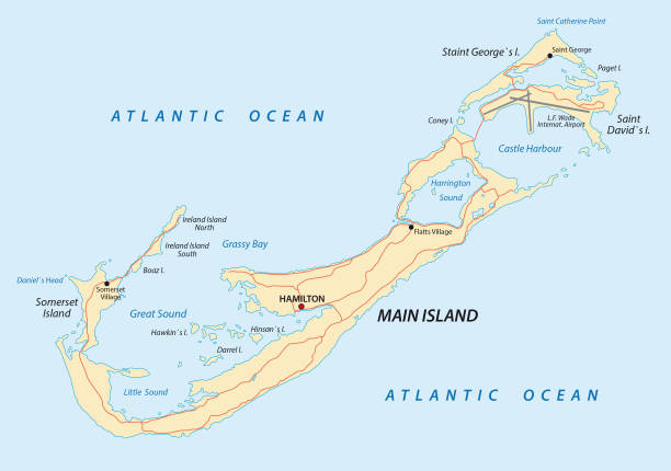
Bermuda road vector map


Hiistorical political map of Europe at the end of the 19th century. Explanations in French. Chromolithograph, published in 1898.

identifying its capital city, Gaborone. African set. Spiral fingerprint series


Vector illustration of Mars planet landscape and space exploration machine, space technology in flat style

Australia map vector illustration, scribble sketch Australia

Gray silhouette of Australia. Southern continent. Vector

identifying its capital city, Kampala African set. Spiral fingerprint series

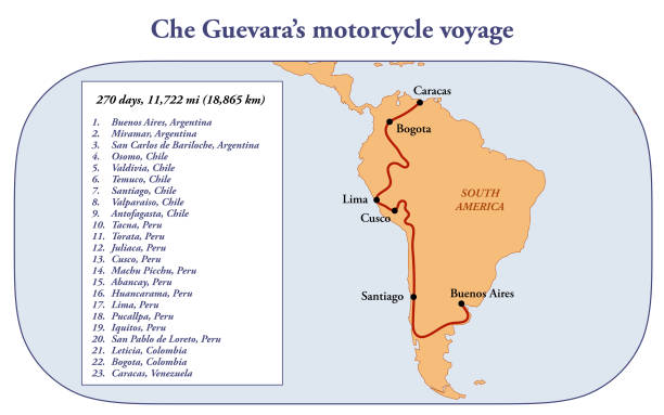
Route map of Che Guevara's motorcycle voyage in South America

Previous
of 8Next