
Israel Gaza stock illustrations
Browse 1,000+ israel gaza stock illustrations and vector graphics available royalty-free, or search for israel gaza map or separation wall israel gaza to find more great stock images and vector art.
Most popular
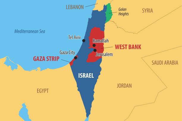
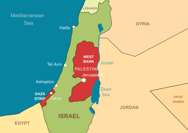
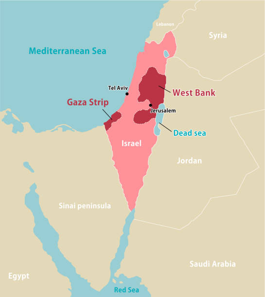
Vector map of Israel and Palestine, showing the areas of the West Bank and the Gaza strip
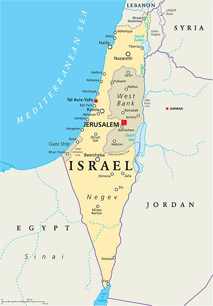
Israel political map with capital Jerusalem, national borders, important cities, rivers and lakes. English labeling and scaling. Illustration.

Israeli and palestinian grunge Flag. this flag represents the relationship between Palestine and Israel

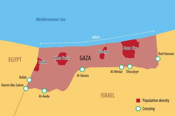
Vector map of the Gaza Strip with the main cities and border crossings

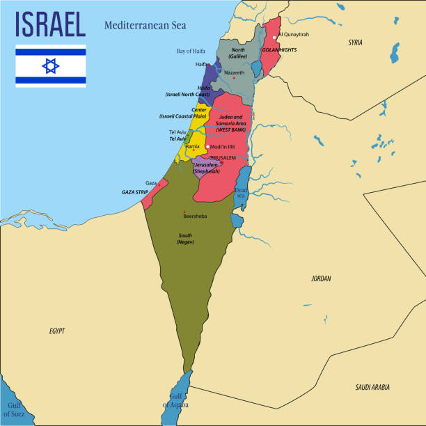
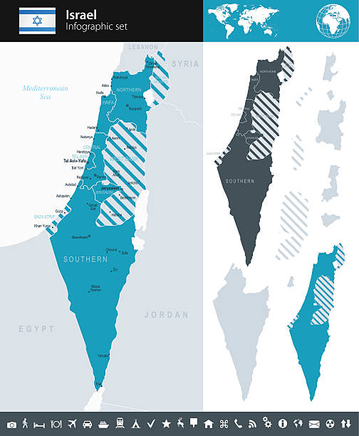
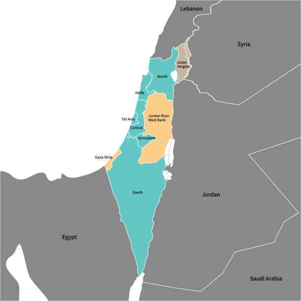
Israel political map of administrative divisions - districts, Gaza Strip and Judea and Samaria Area. Solid blue blank vector map with white borders.
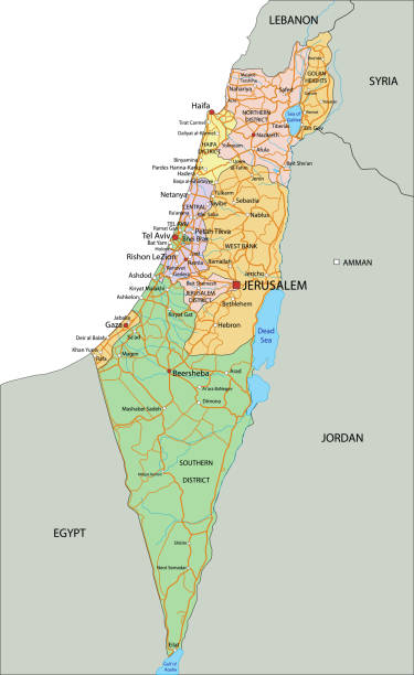
Vector highly detailed political map of Israel with regions and their capitals. All elements are separated in editable layers clearly labeled.EPS 10
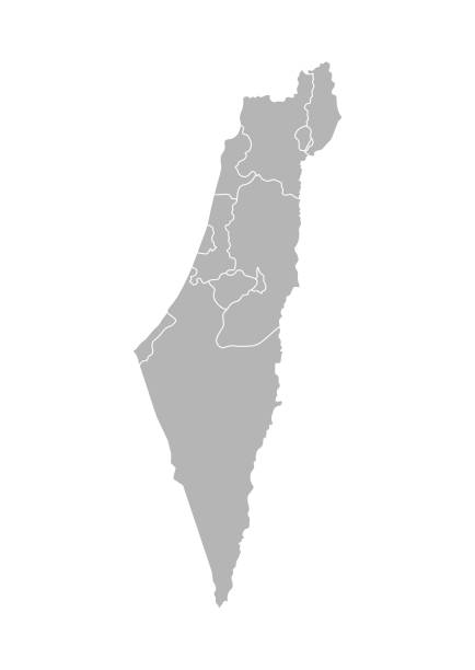
Vector isolated illustration of simplified administrative map of Israel. Borders of the districts (regions). Grey silhouettes. White outline.
Israel and Palestine in Middle East on contour map. Palestinian territories of Gaza and West Bank. Jerusalem and Jordan River on outline map. Theme of Israel, war, conflict.
Israel vector map with flag
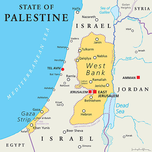
State of Palestine with designated capital East Jerusalem, claiming West Bank and Gaza Strip. Political map with borders and important places. Most areas are occupied by Israel. English labeling.

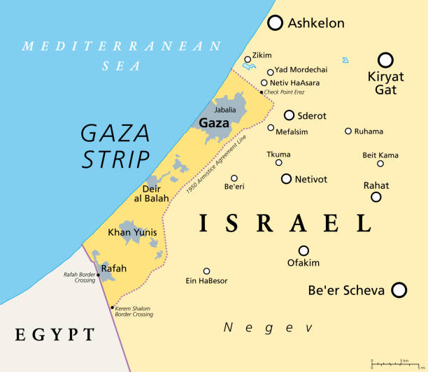
Part of the Southern District of Israel, political map, with the Gaza Strip, bottom half of West Bank, Dead Sea, and with borders and most important cities in this region. Illustration. Vector.
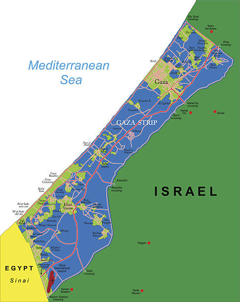
The Gaza Strip and surroundings, political map. Gaza is a self-governing Palestinian territory and narrow piece of land located on the coast of the Mediterranean Sea, bordered by Israel and Egypt.
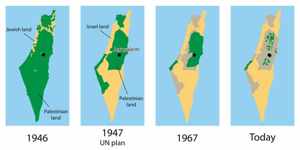
Vector map of the Palestine and Israel territories over the years

Israel political map of administrative divisions - districts, Gaza Strip and Judea and Samaria Area. Thin black outline map with division name labels.

Israel map vector illustration, scribble sketch State of Israel, West Bank and Gaza Strip

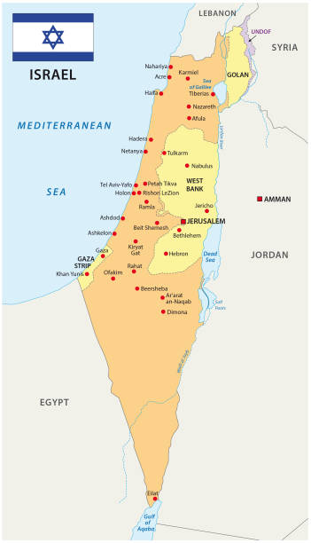
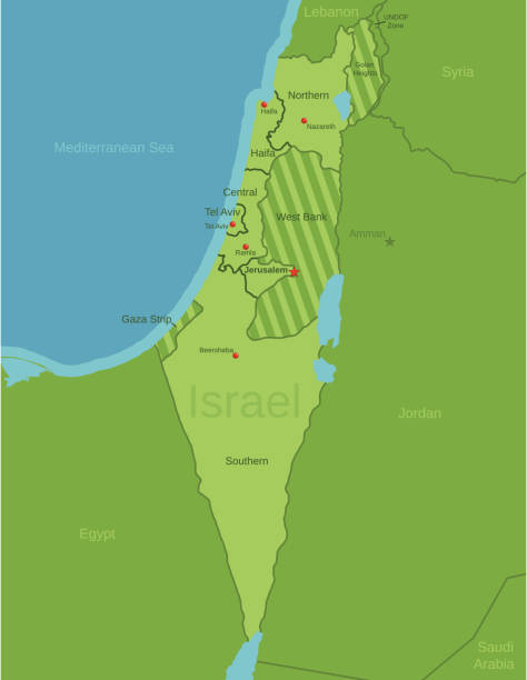
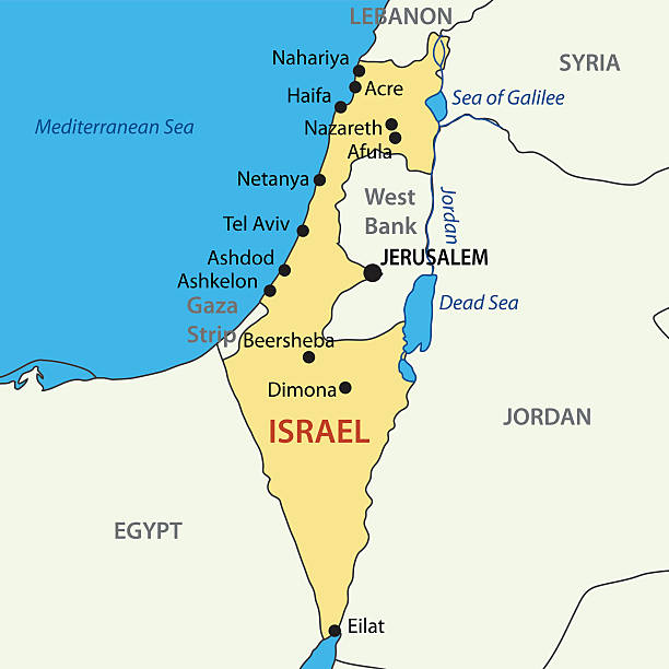
Israel political map with capital Jerusalem and neighbors. State of Israel, a country in Middle East with Palestinian territories West Bank and Gaza Strip. Illustration with English labeling. Vector.


Detailed vector map of State of Israel with border states, administrative districts and main cities.
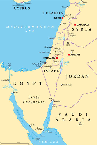
Israel and the Sinai Peninsula, political map. The Southern Levant, an arid geographical and historical region, encompassing Israel, Palestine, Jordan, Lebanon, southern Syria and the Sinai Peninsula.


Israel political map of administrative divisions - districts, Gaza Strip and Judea and Samaria Area. 3D colorful vector map with name labels.
Vector maps of Israel with variable specification and icons
This file is a map highlighting Israel as well as it's districts and capital cities. This map also shows surrounding countries and capital cities if present. This map has text labels for the countries, districts, capital cities and major bodies of water. ZOOM IN on this highly detailed map, it is a great addition to the collection. This file will work well for your print or web based project. This file is layered and grouped (labeled in ai v10 file), making it a very easy file to work with. This download contains an editable ai v10 and eps file, as well as a large JPG file.
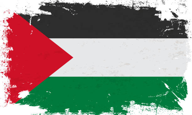
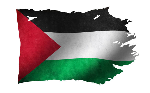
Palestine flag with brush paint textured isolated on white background. Vector illustration EPS10
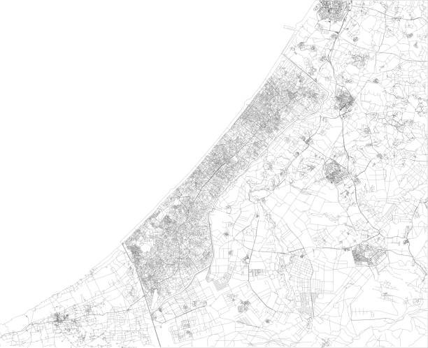
Satellite view of the Gaza Strip is a self-governing Palestinian territory on the eastern coast of the Mediterranean Sea. Map, streets of the area

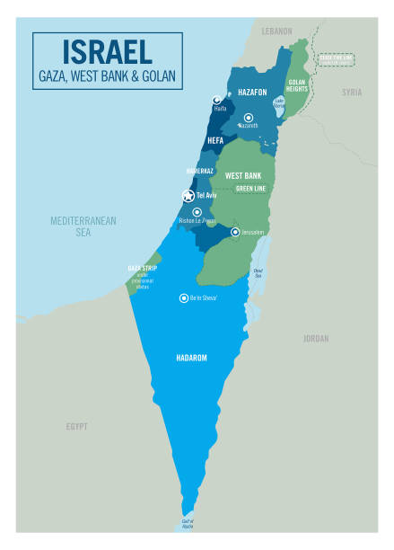
Map of Israel including Gaza Strip and West Bank.
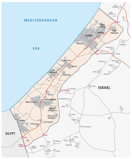
Detailed map of Gaza Strip.

set of 4 political maps of Israel with regions isolated on white background - vector design element

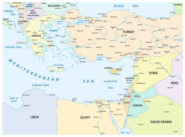
Eastern Mediterranean Political Map with capitals national borders, important cities, rivers and lakes. English labeling and scaling. Illustration.

Eastern Mediterranean countries political map with national borders. Nations to the east of Mediterranean Sea, also called Levant. English labeling and scaling. Gray illustration on white background.

Historical view of Gaza City, State of Palestine. Wood engraving, published in 1891.
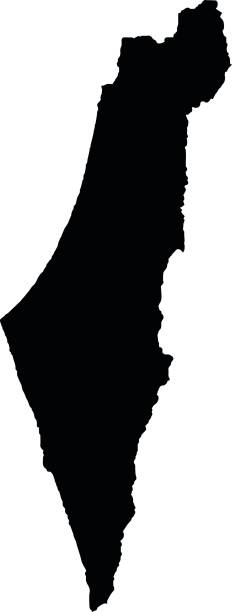
State of Israel - vector map.
gaza strip vector map


Map of Gaza Strip with roads and cities. Vector illustration
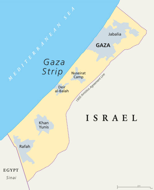
Gaza Strip political map. Self governing Palestinian territory on the coast of Mediterranean Sea that borders to Israel and Egypt. Claimed by State of Palestine. English labeling. Illustration. Vector

Palestine map flag. Vector design isolated on white background. Vector illustration eps10

Map of Gaza Strip for your own design. Three maps with editable stroke included in the bundle: - One black map on a white background. - One line map with only a thin black outline in a line art style (you can adjust the stroke weight as you want). - One map on a blank transparent background (for change background or texture). The layers are named to facilitate your customization. Vector Illustration (EPS file, well layered and grouped). Easy to edit, manipulate, resize or colorize. Vector and Jpeg file of different sizes.
Israel - Highly detailed, editable political map with labeling. Organized vector illustration on seprated layers.
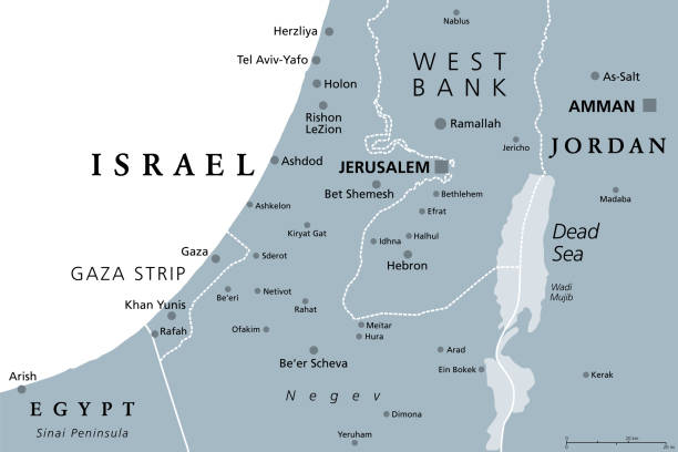
Part of the Southern District of Israel, gray political map, with the Gaza Strip, bottom half of West Bank, Dead Sea, and with borders and most important cities in this region. Illustration. Vector.


israel and palestine peace movement illustration

all Flags of regions of Egypt. Glossy button flag design

Israel map in the colors of the national flag with David star. Vector illustration blue and white Israeli map isolated on black background

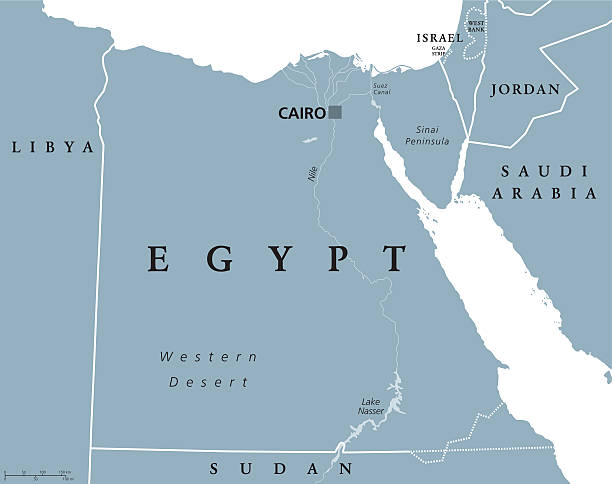
Egypt political map with capital Cairo, with Nile, Sinai Peninsula and Suez Canal. Arab Republic of Egypt with international borders and neighbor countries. Gray colored illustration. English labeling.

National flag of Palestine that can be used for celebrating national days. Vector illustration

"Highly detailed vector map of Israel. File was created on August 17, 2012. The colors in the .eps-file are ready for print (CMYK). Included files: EPS (v8) and Hi-Res JPG (2800 x 2800 px)."

Vintage painting shows a panoramic view of Gaza in the State of Palestine, 1839.
Vector map palestine country on white background

Israel - Retro Vector Map

Map of Gaza Strip cut out on a blank white paper with a blue background. Modern and trendy paper cutout effect. Vector Illustration (EPS file, well layered and grouped). Easy to edit, manipulate, resize or colorize. Vector and Jpeg file of different sizes.

Highly detailed editable political Israel map. Organized vector illustration on seprated layers.