Topographic / Road map of Johannesburg, South Africa. Original map data is open data via © OpenStreetMap contributors. All maps are layered and easy to edit. Roads are editable stroke.
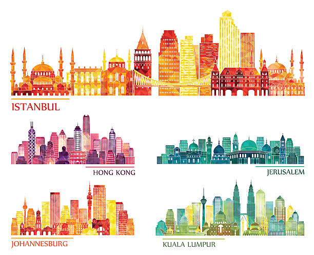
Browse 510+ johannesburg map stock illustrations and vector graphics available royalty-free, or start a new search to explore more great stock images and vector art.
Topographic / Road map of Johannesburg, South Africa. Original map data is open data via © OpenStreetMap contributors. All maps are layered and easy to edit. Roads are editable stroke.

City of Johannesburg Metropolitan Municipality road, administrative and political vector map
Map of Africa - Infographic Vector illustration
Map of South Africa for your own design. With space for your text and your background. Four maps included in the bundle: - One black map. - One blank map with only a thin black outline (in a line art style). - One mosaic map. - One white map with a thin black outline. The 4 maps are isolated on a blank background (for easy change background or texture).The layers are named to facilitate your customization. Vector Illustration (EPS10, well layered and grouped). Easy to edit, manipulate, resize or colorize.

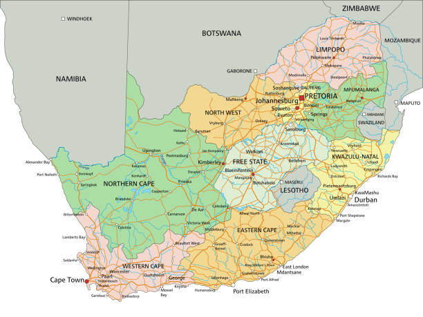
south africa road, administrative and political vector map.
South Africa - Highly detailed editable political map with labeling. Organized vector illustration on seprated layers.

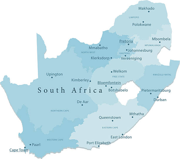
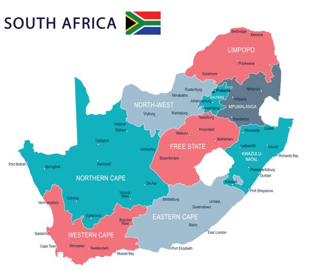
South Africa, gray political map with nine provinces, with largest cities, and borders. Republic and southernmost country in Africa, with the three capitals Pretoria, Cape Town and Bloemfontein.

Illustrated map of South Africa with nature and landmarks. Editable vector illustration
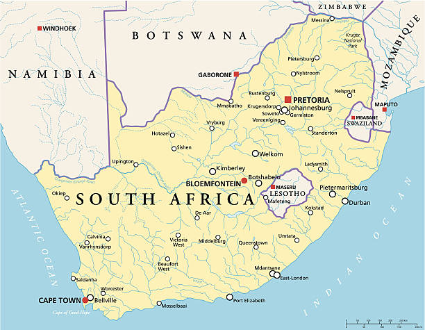
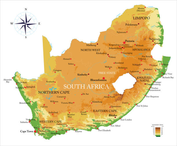
Political map of South Africa with the capitals Pretoria, Bloemfontein and Cape Town, with national borders, most important cities, rivers and lakes. Vector illustration with English labeling and scaling.

Poster Style Topographic / Road map of Johannesburg, South Africa. Original map data is open data via © OpenStreetMap contributors. All maps are layered and easy to edit. Roads are editable stroke.
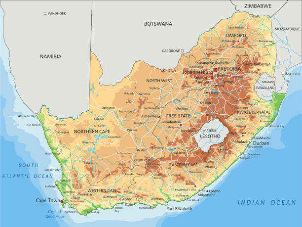
High detailed South Africa physical map with labeling. Organized vector illustration on seprated layers.

Map of South Africa - Vector illustration

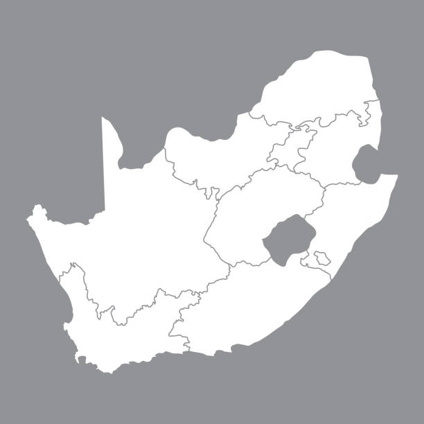
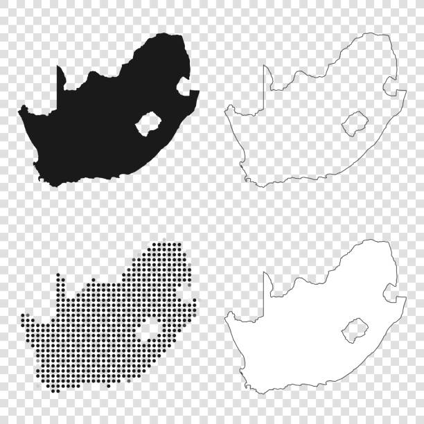
Map of South Africa isolated on a blank background with a black outline and shadow. Vector Illustration (EPS file, well layered and grouped). Easy to edit, manipulate, resize or colorize. Vector and Jpeg file of different sizes.

High detailed South Africa road map with labeling. Organized vector illustration on seprated layers.
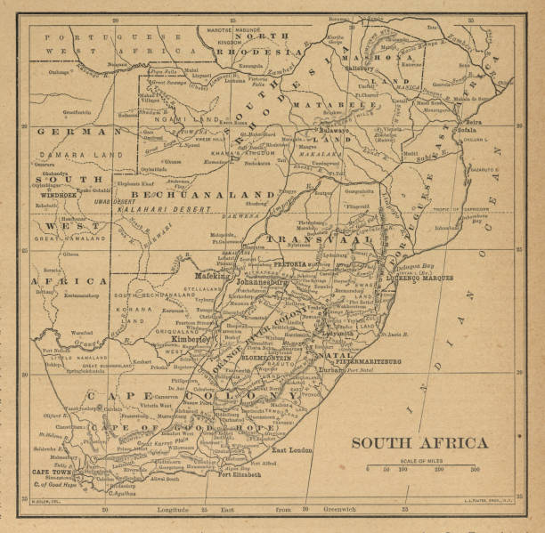
Very Rare, Beautifully Illustrated Antique Victorian Engraved Colored Map of South Africa Antique Victorian Engraved Colored Map, 1899. Source: Original edition from my own archives. Copyright has expired on this artwork. Digitally restored.

Poster Style Topographic / Road map of Johannesburg, South Africa. Original map data is open data via © OpenStreetMap contributors. All maps are layered and easy to edit. Roads are editable stroke.

Topographic / Road map of Johannesburg, South Africa. Original map data is open data via © OpenStreetMap contributors. All maps are layered and easy to edit. Roads are editable stroke.

South Africa map glowing silhouette outline made of stars lines dots triangles, low polygonal shapes. Communication, internet technologies concept. Wireframe futuristic design. Vector illustration.

Map of South Africa created with a mesh of thin bright blue lines and glowing dots, isolated on a dark blue background. Conceptual illustration of networks (communication, social, internet, ...). Vector Illustration (EPS10, well layered and grouped). Easy to edit, manipulate, resize or colorize.

Doodle freehand drawing South Africa political map with major cities. Vector illustration.

Maps of South Africa isolated on white background. Easily customizable for your design.
Highly detailed physical map of the South Africa, in vector format,with all the relief forms,regions and big cities.
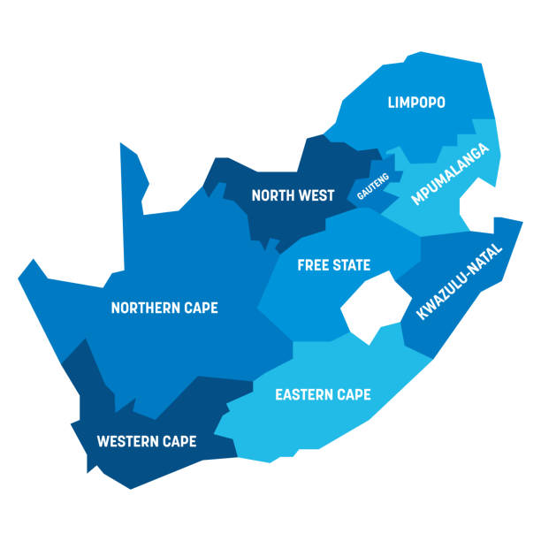
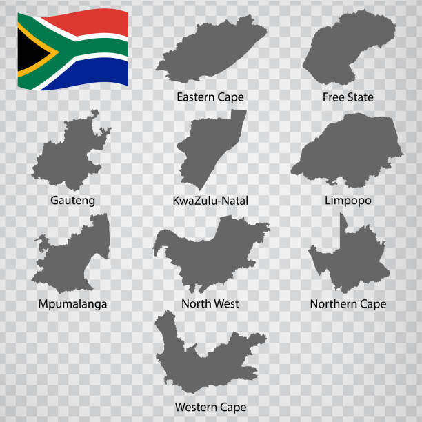
Blue political map of South Africe, RSA. Administrative divisions - provinces. Simple flat vector map with labels.

South Africa map and flag - highly detailed vector illustration

3D map of South Africa isolated on a blank and gray background, with a dropshadow. Vector Illustration (EPS10, well layered and grouped). Easy to edit, manipulate, resize or colorize.

Silhouette and colored (green) Africa map

south africa national park vector map

South Africa map, black and white detailed outline regions of the country. Vector illustration
South Africa flag - flat collection. Flags of different shaped twelve flat icons. Vector illustration set

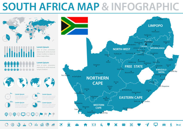
South Africa Map - Detailed Info Graphic Vector Illustration

South Africa - Highly detailed editable political map with labeling. Organized vector illustration on seprated layers.
South Africa map and flag - highly detailed vector illustration
Highly detailed vector map of South African Republic with states, capitals and big cities.

Africa map background with states. Africa map isolated on white background with flag. Vector illustration map europe

Map of South Africa - Vector illustration

south africa road vector map
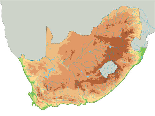
High detailed South Africa physical map. Organized vector illustration on seprated layers.

Coronavirus pandemic reported on the map of South Africa. Spread of COVID-19 represented with red circles on a black background, like a radar screen. Conceptual image: coronavirus detected, quarantined area, spread of the disease, coronavirus outbreak on the territory, virus alert, danger zone, confined space, closing of borders, area under control, stop coronavirus, defeat the virus. Vector Illustration (EPS10, well layered and grouped). Easy to edit, manipulate, resize or colorize.

South Africa map created with a mesh of thin black lines and a light shadow, isolated on a blank background. Conceptual illustration of networks (communication, social, internet, ...). Vector Illustration (EPS10, well layered and grouped). Easy to edit, manipulate, resize or colorize.
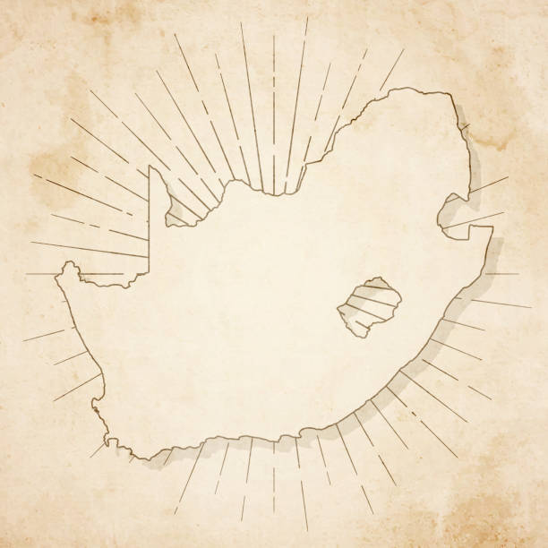
Map of South Africa in a trendy vintage style. Beautiful retro illustration of an antique map with light rays in the background and on old textured paper. Included: Realistic texture of an old parchment (colors used: sepia, beige, brown). Vector illustration (EPS10, well superimposed and grouped). Easy to edit, manipulate, resize or colorize.
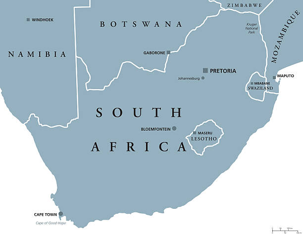
South Africa political map with the capitals Pretoria, Bloemfontein and Cape Town. With national borders and neighbor countries. Gray illustration with English labeling on white background. Vector.

Map of South Africa - Vector illustration

South Africa map and flag - highly detailed vector illustration
© 2025 iStockphoto LP. The iStock design is a trademark of iStockphoto LP. Browse millions of high-quality stock photos, illustrations, and videos.
Do Not Sell or Share