
Tulsa Oklahoma City stock illustrations
Browse 90+ tulsa oklahoma city stock illustrations and vector graphics available royalty-free, or start a new search to explore more great stock images and vector art.
Most popular


City of Tulsa, Oklahoma postal rubber stamp, vector object over white background

Vector Illustration of a City Street Map of Tulsa, Oklahoma, USA. Scale 1:60,000. All source data is in the public domain. U.S. Geological Survey, US Topo Used Layers: USGS The National Map: National Hydrography Dataset (NHD) USGS The National Map: National Transportation Dataset (NTD)

Tulsa OK City Vector Road Map Blue Text. All source data is in the public domain. U.S. Census Bureau Census Tiger. Used Layers: areawater, linearwater, roads.

Tulsa Oklahoma city skyline vector silhouette illustration

City skyline set. USA. Vector silhouette background illustration.

Tulsa, Oklahoma architecture line skyline illustration. Linear vector cityscape with famous landmarks, city sights, design icons. Editable strokes

Oklahoma, OK, political map with capital Oklahoma City, important cities, rivers and lakes. US State in the South Central region, nicknamed Native America, Land of the Red Man, or Sooner State. Vector

Topographic / Road map of Tulsa, Oklahoma. USA United States of America. Original map data is open data via © OpenStreetMap contributors. All maps are layered and easy to edit. Roads are editable stroke.


Tulsa, Oklahoma city skyline silhouette vector illustration


Tulsa Oklahoma city skyline vector silhouette illustration
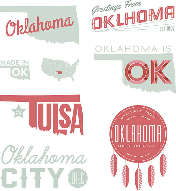
A set of vintage-style icons and typography representing the state of Oklahoma, including Tulsa and Oklahoma City. Each items is on a separate layer. Includes a layered Photoshop document. Ideal for both print and web elements.
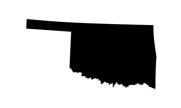
silhouette map of Oklahoma City in the United States on white background

Topographic / Road map of Tulsa, Oklahoma. USA United States of America. Original map data is open data via © OpenStreetMap contributors. All maps are layered and easy to edit. Roads are editable stroke.

Stamp or label with name of Tulsa, Oklahoma, USA, vector illustration

Tulsa Oklahoma city skyline vector silhouette illustration
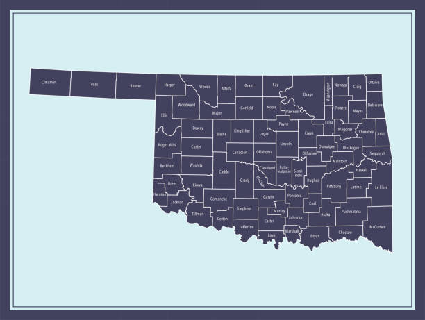
Downloadable county map of Oklahoma state of United States of America. The map is accurately prepared by a map expert.

United States, Tulsa city skyline isolated vector illustration. United States, Tulsa travel cityscape with landmarks

Oklahoma state detailed editable map with cities and towns, geographic sites, roads, railways, interstates and U.S. highways. Vector EPS-10 file, trending color scheme


USA, Oklahoma, Tulsa winter city skyline. Merry Christmas and Happy New Year decorated banner. Winter greeting card with snow and Santa Claus. Flat, line vector, linear christmas illustration


Tulsa Oklahoma city skyline vector silhouette illustration

Tulsa Oklahoma city skyline vector silhouette illustration


Tulsa handwritten city name.Modern Calligraphy Hand Lettering for Printing,background ,logo, for posters, invitations, cards, etc. Typography vector.

Vector illustration of a golden city skyline complete with light rays, skyscrapers and smokestacks

Topographic / Road map of Tulsa, Oklahoma. USA United States of America. Original map data is open data via © OpenStreetMap contributors. All maps are layered and easy to edit. Roads are editable stroke.


Oklahoma, OK, gray political map, with capital Oklahoma City and the most important cities. US State in the South Central region, nicknamed Native America, Land of the Red Man, or Sooner State. Vector

Tulsa City (United States cities, United States of America, usa city) map vector illustration, scribble sketch City of Tulsa map


Great set of stylized line drawings of American cities. Here's Phoenix, San Jose, Denver, San Antonio, and Tulsa. Perfect for any design. EPS and JPEG files included. Be sure to view my other illustrations, thanks!

Tulsa Oklahoma city skyline vector silhouette illustration
United States, Tulsa city isolated skyline vector illustration, travel landmark

A highly detailed vector map of Tulsa, Oklahoma with a multicoloured hand painted watercolour texture. Map is isolated on a white background. "Tulsa" stylized text is added overtop with a heart to indicate the location of the capital city.


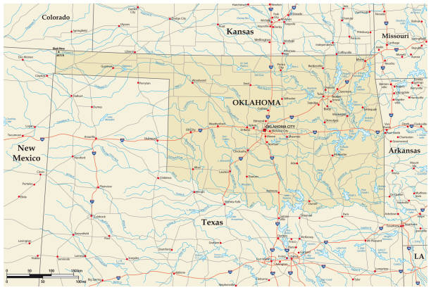
"Vector illustration of map of Oklahoma with major roads, rivers and lakes."

Poster style topographic / Road map of Tulsa, Oklahoma. USA United States of America. Original map data is open data via © OpenStreetMap contributors. All maps are layered and easy to edit. Roads are editable stroke.


Stamp or label with text Tulsa, Oklahoma written inside, vector illustration

Vector Illustration of a Road Map of Oklahoma State, USA. All source data is in the public domain. U.S. Geological Survey, US Topo Used Layers: USGS The National Map: National Hydrography Dataset (NHD) USGS The National Map: National Transportation Dataset (NTD)

The map is accurately prepared by a map expert.

Topographic / Road map of Tulsa, Oklahoma. USA United States of America. Original map data is open data via © OpenStreetMap contributors. All maps are layered and easy to edit. Roads are editable stroke.

Poster style topographic / Road map of Tulsa, Oklahoma. USA United States of America. Original map data is open data via © OpenStreetMap contributors. All maps are layered and easy to edit. Roads are editable stroke.

Tulsa Oklahoma city skyline vector silhouette illustration


Poster style topographic / Road map of Tulsa, Oklahoma. USA United States of America. Original map data is open data via © OpenStreetMap contributors. All maps are layered and easy to edit. Roads are editable stroke.


Next