Vector of USA Map Made of Stickman Figure with Patriotic Colors
Browse 1,400+ us voting map stock illustrations and vector graphics available royalty-free, or start a new search to explore more great stock images and vector art.
Vector of USA Map Made of Stickman Figure with Patriotic Colors
USA map made of many people, large crowd shape. Group of people stay in us country map formation. Immigration, election, multicultural diversity population concept. Vector isometric illustration.
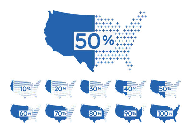
United States percentage polling voting infographic map design.
US election results map. American Presidential Election results
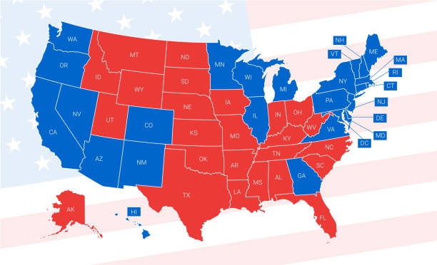
![[Vector] US election results map. American Presidential Election Usa map voting. Presidential election map each state american electoral votes showing republicans or democrats political. us voting map stock illustrations](https://media.istockphoto.com/id/2014720427/vector/vector-us-election-results-map-american-presidential-election.jpg?s=612x612&w=0&k=20&c=mYwvWTj93BxSymFnoCaOOnCKZuweGNcKFVKSZU2To7Q=)
Usa map voting. Presidential election map each state american electoral votes showing republicans or democrats political.
Vector illustration of a red and blue election United States map.

The electoral votes allocated to each US state for the 2024 elections based on the 2020 census

Usa map voting. Presidential election map each state american electoral votes showing united republicans or democrats political vector infographic

2024 Presidential Election Interactive Map https://maps.lib.utexas.edu/maps/united_states/us_general_reference_map-2003.pdf

Patriots of United States on the USA map.
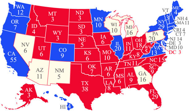
United States of America 2020 presidential election map with electoral college votes by state and swing states. 270 electoral college votes are required to win the presidency. The map is accurately prepared by a map expert. The reference for the number of electoral college votes by state can be found at https://www.archives.gov/electoral-college/allocation

Political campaign and voting attributes, patriotic symbols, american flags and maps collection. Vector hand drawn objects isolated on white background.

Presidential Election day in United States of America 2024. Political election campaign banner with realistic national American flag on blue background. Your vote is your voice. Vector illustration

USA Voting Map. Poster map of United States of America for Election, Voting, US President elections. Infographic design, USA map with states, Democratic, Republican USA states. Vector Illustration
Map of the United States with infographic elements.Map of the United States with Election infographic elements. Elections and political icons in flat design style.

3D map of the United States in the colors of the American flag or a hand drops a paper ballot into a slot like a ballot box

2024 Presidential Election Interactive Map https://maps.lib.utexas.edu/maps/united_states/us_general_reference_map-2003.pdf

Brexit. Poster map of the European Union with country names. Print map of EU for web and polygraphy, on business, economic, political, Brexit and geography themes. Vector Illustration
Vector illustration of a political USA map with the states colored in either red or blue with a white outline. Each state is an individual object and can be colored separately.

2024 US United States presidential election electoral college vote map results
![[Vector] US election results map. American Presidential Election Usa map voting. Presidential election map each state american electoral votes showing republicans or democrats political. us voting map stock illustrations](https://media.istockphoto.com/id/2016980171/vector/vector-us-election-results-map-american-presidential-election.jpg?s=612x612&w=0&k=20&c=rAY8cn9O1yJE0ZwPwjE9YCotYbCjx0FH_mX7RXbZWeQ=)
Usa map voting. Presidential election map each state american electoral votes showing republicans or democrats political.

US election map. American Presidential Election results infographics template. All the states are separated and named in the layer panel.
Vector illustration of a red and blue ballot box with a white map of California on it.

Map of Europe with European Union members and Great Britain or United Kingdom in brexit. Vector illustration
Vector illustration of a red and blue ballot box with a white map of France on it.

Presidential Election day in the United States of America 2024. Election event banner with realistic national American flag on blue background. Your vote is your voice. Vector illustration
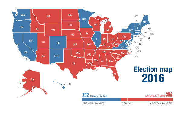
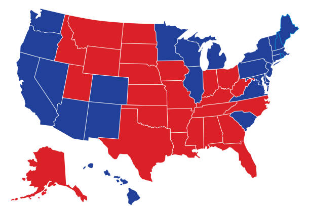
Election map, between democrats and republicans, per state for 2016 presidential elections

Tv Speaker Woman Communication to Nation Politic Infographic Election from Congress Building with Vote Audience Percentage from Election Box to Parliament. Vector Isometric People.
Detailed vector map of the United States. Each State is it's own shape and can be colored to your preference. Excellent for political elections data.

Presidential Election USA Map. Every state has its own layer, red and blue, for easier editing and changing between republicans and democrats.
Vector illustration of a red and blue ballot box with a white map of Texas on it.

Usa map voting. Presidential election map each state american electoral votes showing republicans or democrats political on folded paper.
Vector illustration of a Georgia map ballot box on a red circle background.

Vote Texas state map outline. Patriotic design element to encourage voting in presidential election 2016. Vote Texas vector illustration.

presidential election 2020 in United States concept- vector illustration

State of Georgia poster design encouraging people of Georgia to vote in the US senate runoff election in January 2021
Vector illustration of a red and blue ballot box with a white map of New Hampshire on it.
Icon Set, Politics things on white background, made in adobe Illustrator (vector)
Vector illustration of a Michigan map ballot box on a red circle background.

USA presidential election 2016 vote sticker. Georgia state map outline with US flag. Vote sticker vector illustration.

Usa map. Infographic us map with grey states and pins, topographic info outline road, travel poster vote vector election president

United States of America 2020 presidential election map with electoral college votes by state and swing states. 270 electoral college votes are required to win the presidency. The map is accurately prepared by a map expert. The reference for the number of electoral college votes by state can be found at https://www.archives.gov/electoral-college/allocation

USA presidential election 2016 vote sticker. Indiana state map outline with US flag. Vote sticker vector illustration.
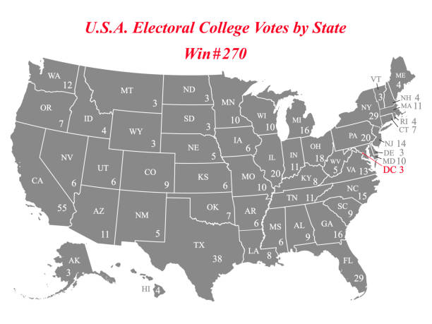
Highly detailed vector map of United States of America with abbreviated names of states and electoral college vote number by state. 270 electoral college votes are required for a presidential candidate to win the election. The map is accurately prepared by a map expert, and the reference for this map can be found at https://www.archives.gov/electoral-college/allocation

Vector illustration of the map of the United States of America made with circles and bubbles. Cut out design element for social media platforms, democracy, elections, topography and cartography, global and international relationships, the media and design projects in general.

Vote Pennsylvania state map outline. Patriotic design element to encourage voting in presidential election 2016. Vote Pennsylvania vector illustration.
Elections and political icons in flat design style.
Vector illustration of a red and blue ballot box with a white map of Pennsylvania on it.

Vote Ohio state map outline. Patriotic design element to encourage voting in presidential election 2016. Vote Ohio vector illustration.

Illustration of American Elections.
© 2025 iStockphoto LP. The iStock design is a trademark of iStockphoto LP. Browse millions of high-quality stock photos, illustrations, and videos.
Do Not Sell or Share