Icons Chinese major cities flat style. Shanghai and china, Beijing and Guangzhou, Hong Kong and Dalian, Tianjin and Harbin, Chongqing and Hangzhou illustration. White black
Illustrations
Zhejiang Illustrations stock illustrations
Browse 390+ zhejiang illustrations stock illustrations and vector graphics available royalty-free, or start a new search to explore more great stock images and vector art.
Most popular

Ancient pavilion silhouette in hangzhou, China. Jixian pavilion on the west lake in hangzhou. Chinese traditional landscape.
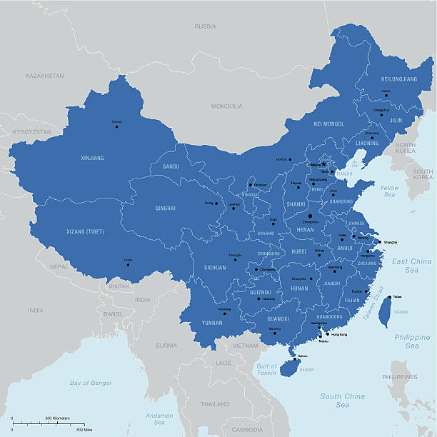
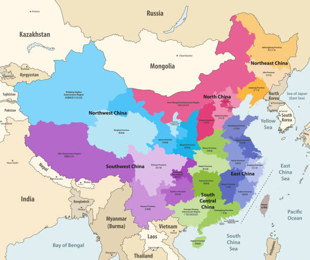
Highly detailed vector map of China with regions, capital and big cities.
Map of China. Chinese administrative districts and divisions.

Investment funds. Thin line icon set. Outline symbol collection. Editable vector stroke. 256x256 Pixel Perfect scalable to 128px, 64px...
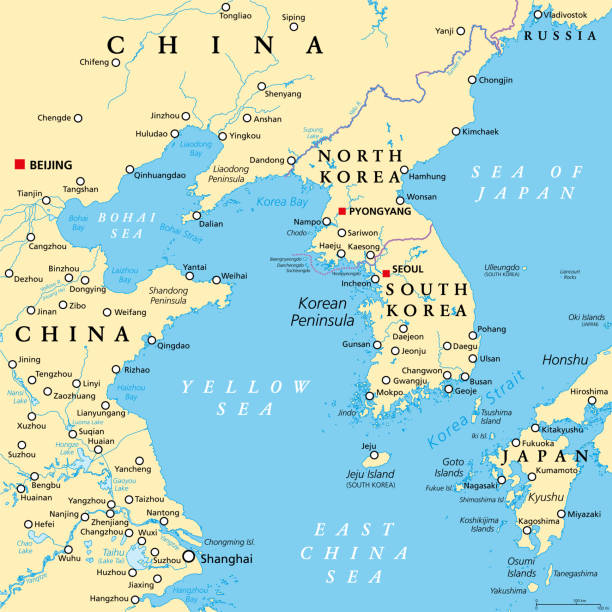
Korean Peninsula region, political map. Peninsular region Korea in East Asia, divided between the 2 countries North and South Korea, bordered by China and Russia, separated from Japan by Korea Strait.
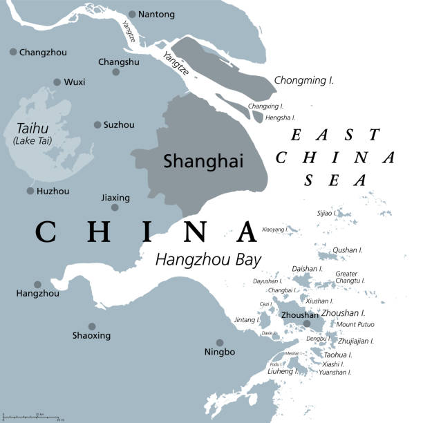
Shanghai and the Yangtze River Delta, gray political map, with major cities. Megalopolis of China, located where Yangtze River drains into East China Sea, with Hangzhou Bay and Zhoushan Archipelago.

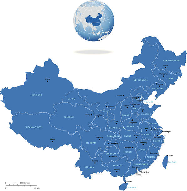
Highly detailed vector map of China with regions, capital and big cities
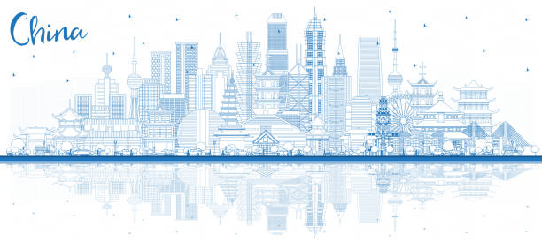
Outline China City Skyline with Blue Buildings and Reflections. Famous Landmarks in China. Vector Illustration. Travel and Tourism Concept with Modern Architecture. China Cityscape with Landmarks.

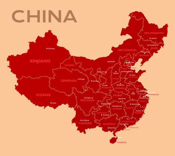
China political map divide by state colorful outline simplicity style. Vector illustration.
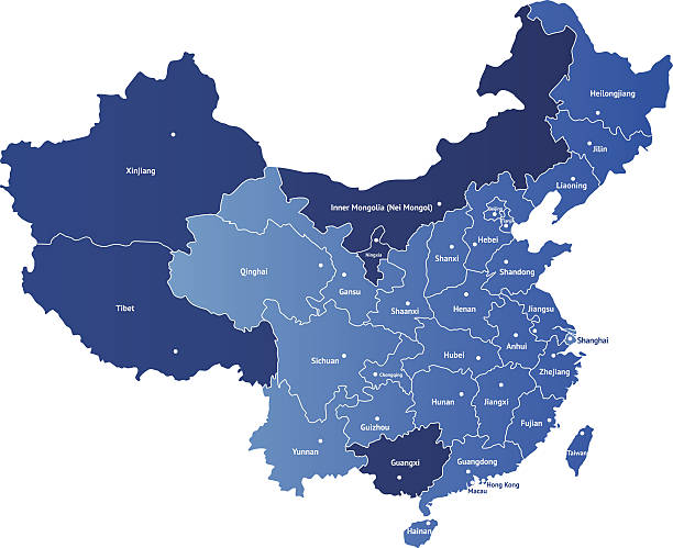
Detailed vector map of China with the names of the provinces. Each of provinces you can separate and use as individal map.
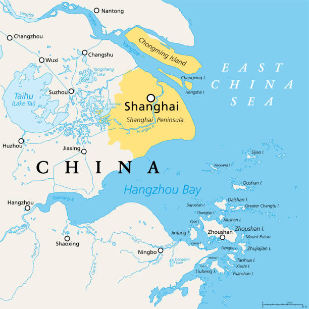
Shanghai and the Yangtze River Delta, political map with major cities. Megalopolis of China, located where the Yangtze River drains into the East China Sea, with Hangzhou Bay and Zhoushan Archipelago.

This vector map is accurately prepared by a GIS and remote sensing expert with highly detailed information.

Vector silhouette of a Chinese pavilion in Hangzhou

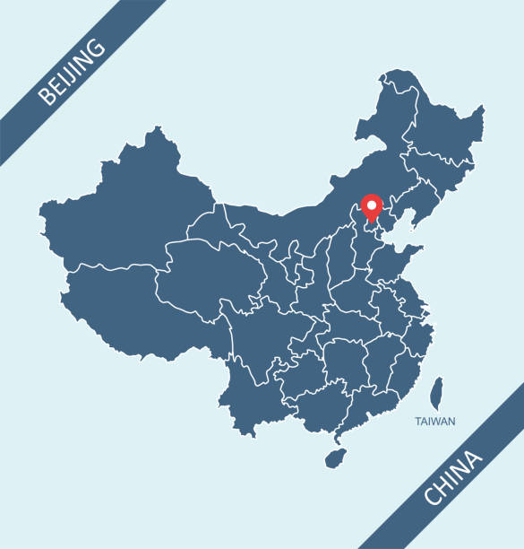
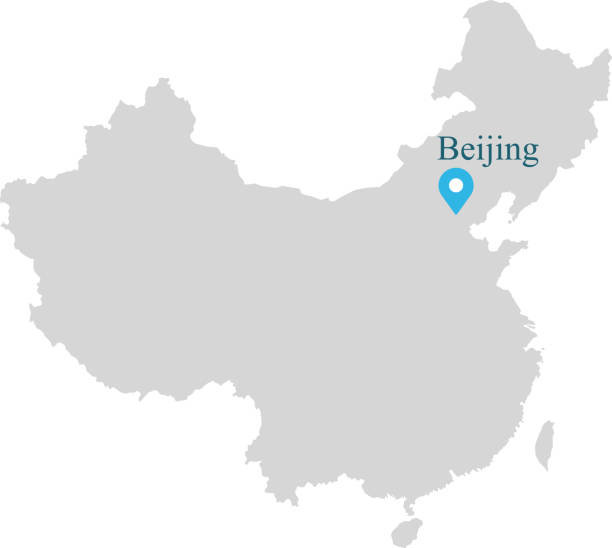
Highly detailed downloadable and printable map of China with its capital location, Beijing, for web banner, mobile, smartphone, iPhone, iPad applications and educational use. The map is accurately prepared by a map expert.


Outline Ningbo China City Skyline with Blue Buildings and Reflections. Vector Illustration. Business Travel and Tourism Concept with Historic Architecture. Ningbo Cityscape with Landmarks.

Outline Hangzhou Skyline with Blue Buildings and Reflections. Vector Illustration. Business Travel and Tourism Concept with Modern Architecture. Image for Presentation Banner Placard and Web Site.

Hangzhou China Skyline with Color Buildings, Blue Sky and Reflections. Vector Illustration. Business Travel and Tourism Concept with Modern Architecture. Hangzhou Cityscape with Landmarks.

Map of China with capital

Map of China, separated with municipality, province, autonomous region and special administration region.

Hangzhou China City Skyline with Gray Buildings Isolated on White. Vector Illustration. Business Travel and Tourism Concept with Modern Architecture. Hangzhou Cityscape with Landmarks.

This vector map of China country has been accurately made by a graphic designer who has a postgraduate degree in GIS and remote sensing. You can use this map to show your study site of a project.

Vector illustration of G-20 countries flags. The Group of Twenty, the World's Leading 20 Economies. Banner for Summit G20, financial ann economic international forum. Infographic design image

Detailed map of Shanghai.
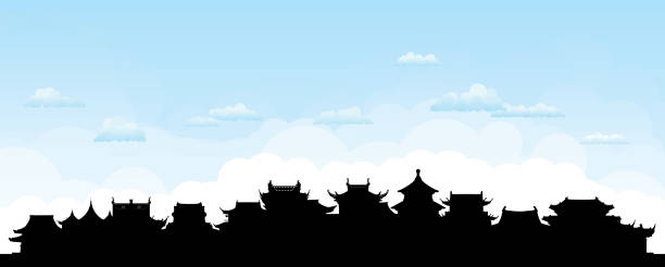
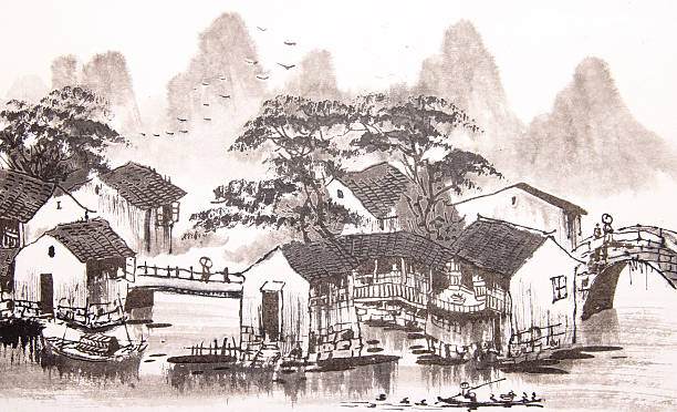
Ancient Chinese city. All buildings are complete and moveable.

China City Skyline with Gray Buildings and Blue Sky. Famous Landmarks in China. Vector Illustration. Business Travel and Tourism Concept with Modern Architecture. China Cityscape with Landmarks.


Hangzhou China City Skyline in Paper Cut Style with White Buildings, Moon and Neon Garland. Vector Illustration. Travel and Tourism Concept. Hangzhou Cityscape with Landmarks.


Detailed 3D vector map of China. The map was divided into separate layers. Included Zip with AI file with the names of the provinces.


Hangzhou City skyline black and white silhouette. Vector illustration. Simple flat concept for tourism presentation, banner, placard or web site. Cityscape with landmarks.

China map and flag - highly detailed vector illustration


Shipping Cargo Container China Flag For Logistics And Transportation With Clouds

Abstract Watercolor Skyline of Hangzhou, the capital of China’s Zhejiang province

China political map divide by state colorful outline simplicity style. Vector illustration.

Map of Zhejiang sketched and isolated on a white background. The map is purple with a black outline. Pink and blue are overlapped to create a modern visual effect, looking like anaglyph image. The combination of pink and blue in this illustration creates a predominantly purple map. Vector Illustration (EPS file, well layered and grouped). Easy to edit, manipulate, resize or colorize. Vector and Jpeg file of different sizes.


China country map outline vector illustration with scales of miles and kilometers, borders of states or provinces and their names, and capital location and name, Beijing

China PR main port cities distribution and position.

China political map divide by state colorful outline simplicity style. Vector illustration.

Outline Welcome to China Skyline with Blue Buildings. Famous Landmarks in China. Vector Illustration. Business Travel and Tourism Concept with Modern Architecture. China Cityscape with Landmarks.

Ancient China. All buildings are complete and moveable.


Map of China. Chinese administrative districts and divisions.


Greetings from Hangzhou vintage rusty metal plate on a white background, vector illustration
This abstract dotted China map is accurately prepared using the overlaid vector map of the China with highly detailed information. The map is prepared by a GIS and remote sensing specialist.
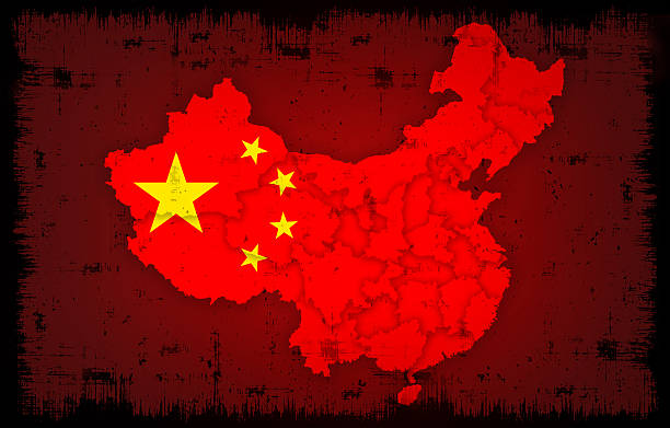
raster illustration of china flag and map with grunge background…

Poster style topographic / Road map of Hangzhou, China . Map data is open data via openstreetmap contributors. All maps are layered and easy to edit. Roads are editable stroke.

Next