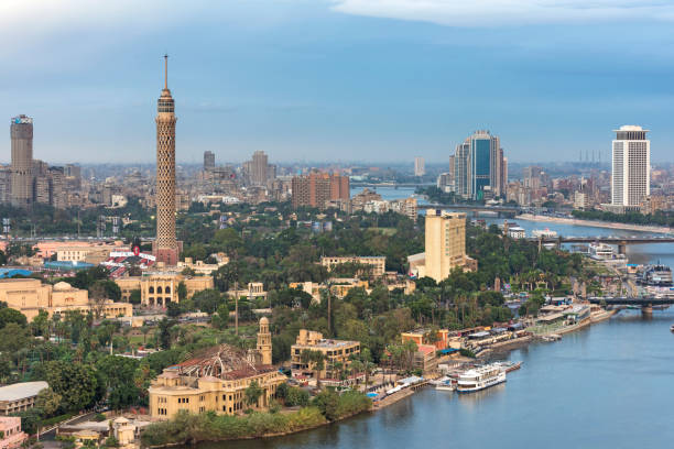
Panorama of Cairo cityscape taken during the sunset from the famous Cairo tower, Cairo, Egypt
Browse 2,000+ cairo-aerial stock photos and images available, or start a new search to explore more stock photos and images.
Panorama of Cairo cityscape taken during the sunset from the famous Cairo tower, Cairo, Egypt

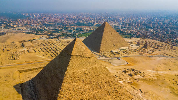
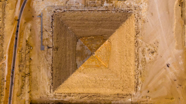
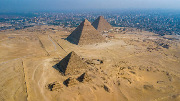
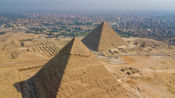
The Giza pyramid complex, also called the Giza Necropolis viewed from airplane window. Khufu, Khafre, Menkaure and Sphinx are visible.
Skyline over the Nile in Cairo before sunset, aerial view, Egypt.

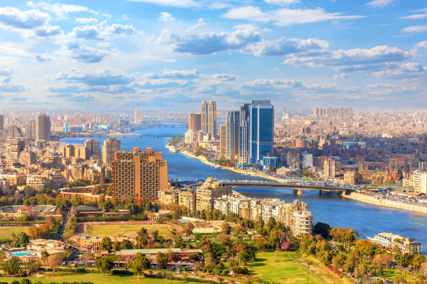
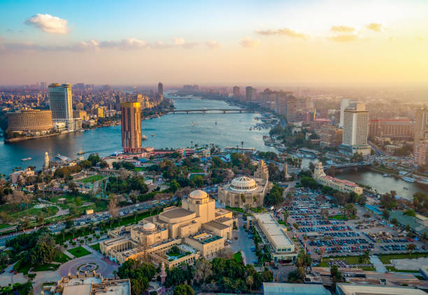
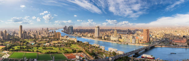
Beautiful view of Cairo downtown and the Nile from above, Egypt.
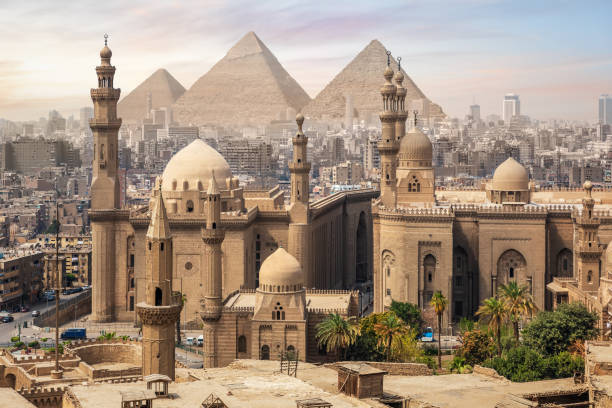
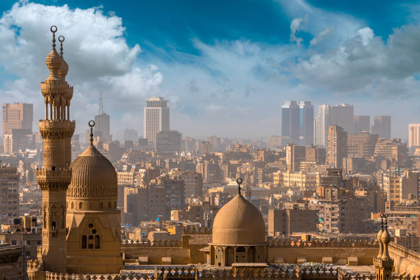
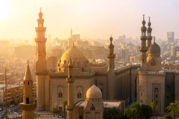
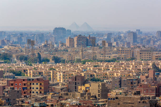
The Mosque of Sultan Hassan and the Great Pyramids of Giza, Cairo skyline, Egypt.

Panoramic scenery of Gezira island and the Pyramids of Cairo, Egypt.
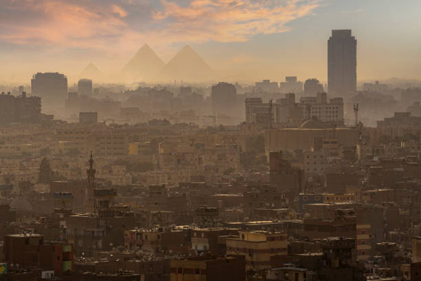
Pyramid, Pyramid Shape, Smog, Famous Place, Urban Skyline

A cityscape of the downtown area of Cairo, capital city of Egypt.

Aerial view of Cairo showcasing numerous residential buildings in Egypt
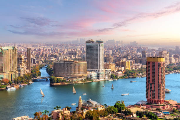
Cairo aerial View and Nile River in Egypt

Sunset in Cairo city, view from above
A cityscape of the downtown area of Cairo, capital city of Egypt - aerial view.
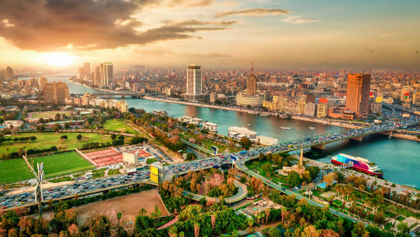
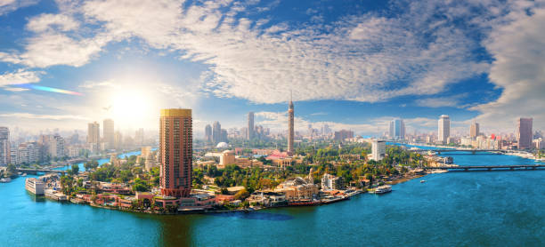
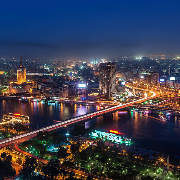
Exclusive aerial sunset panorama of central Cairo, the Nile and the bridges, Egypt.
The view of Gezira Island with Cairo Tower in the middle of the island, on the right side river Nile,

Panorama of the Nile River, view of the Cairo city

A cityscape of the downtown area of Cairo, capital city of Egypt - aerial view.
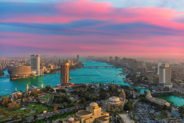
Sunset area of Cairo, view of the Nile and prestigious buildings of Egypt.

3D Render of a Topographic Map of Cairo, Egypt. All source data is in the public domain.Color and Water texture: Contains modified Copernicus Sentinel data (2021) courtesy of ESA.URL of source image: https://dataspace.copernicus.eu/explore-data/data-collections/sentinel-data/sentinel-2Relief texture: SRTM data courtesy of NASA JPL (2020). URL of source image:https://lpdaac.usgs.gov/products/srtmgl1v003/

Panorama of Cairo cityscape taken during the sunset from the famous Cairo tower, Cairo, Egypt

Wing view of a plane departing airport and flying over Cairo city, Egypt

View of the City of Cairo, Egypt, where you can see in the background the 3 pyramids of Cheops, Khafre and Micerinos. Made from the Alabaster Mosque, in the Citadel of Saladin.

Gezira island on the Nile, exclusive aerial view of Cairo, Egypt.
A cityscape of the downtown area of Cairo, capital city of Egypt - aerial view. This panoramic landscape is an very high resolution multi-frame composite and is suitable for large scale printing.

Hot air balloons over Nile river and Valley of Kings in Luxor at sunrise in Egypt

Aerial view of the living quarters of Giza at the background of Pyramids of Egypt
Cairo aerial panorama, the Nile and the downtown buildings, Egypt.

A nighttime scene of the Giza Pyramids

Elevated view of the river Nile in Egypt from a hot air balloon.

Cairo, Egypt -- March 15, 2003: Panoramic view of the Egyptian Museum to the west north side of town at noon. Palm trees are in the garden. At the background, neon lights are installed on the roofs of the buildings.

Mosque-Madrassa of Sultan Hassan and the Pyramids in the mist, Cairo, Egypt.

Sunset Views of 6th October Bridge in Cairo

Cairo, Egypt -- March 15, 2003: Panoramic view of the Egyptian Museum to the west north side of town at sunset t. Palm trees are in the garden. At the background, neon lights are installed on the roofs of the buildings.

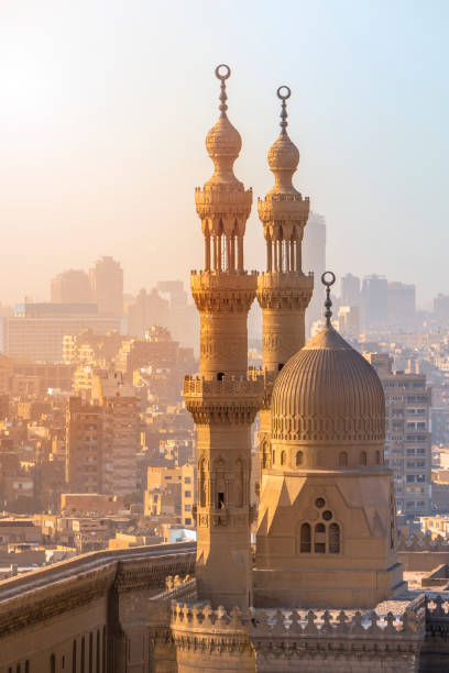
Scenic view of the mosque-madrassa of sultan hassan and the al-rifai mosque in cairo, egypt, with cityscape in background

White wing of a passenger plane against the background of Cairo, capital of Egypt.
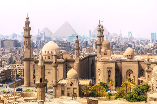
The Mosque-Madrassa of Sultan Hassan and the Pyramids in the background, Cairo, Egypt.

The iconic Pyramids with their technologies and astrological links are testament to an ancient civilisation that in many ways was further advanced than we are today. The River Nile has always and continues to be a lifeline for Egypt. Trade, communication, agriculture, water and now tourism provide the essential ingredients of life - from the Upper Nile and its cataracts, along its fertile banks to the Lower Nile and Delta. In many ways life has not changed for centuries, with transport often relying on the camel on land and felucca on the river

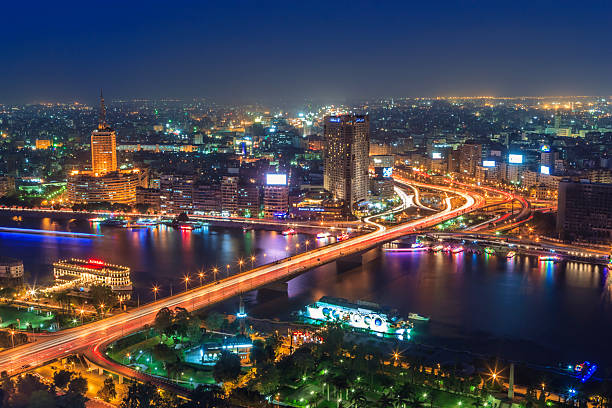
Incredible sunset over the Nile and night center of Cairo, Egypt.

Cairo, Egypt A young man urban exploring on a rooftop in downtown Cairo at sunset next to a large abandoned tank.
A cityscape of the downtown area of Cairo, capital city of Egypt - aerial view.

3D Render of a Topographic Map of Cairo, Egypt.All source data is in the public domain.Contains modified Copernicus Sentinel data (Jul 2019) courtesy of ESA. URL of source image: https://scihub.copernicus.eu/dhus/#/home.Relief texture SRTM data courtesy of NASA. URL of source image: https://search.earthdata.nasa.gov/search/granules/collection-details?p=C1000000240-LPDAAC_ECS&q=srtm%201%20arc&ok=srtm%201%20arc

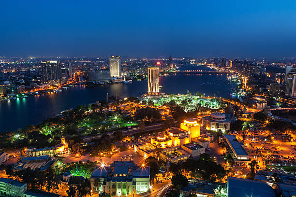
Cairo downtown, view of the Nile and the skyscrappers at night, Egypt.

Panorama of Cairo cityscape taken during the sunset from the famous Cairo tower, Cairo, Egypt