Images
Gansu Province Pictures, Images and Stock Photos
Browse 12,400+ gansu province stock photos and images available, or search for sichuan province or yunnan province to find more great stock photos and pictures.
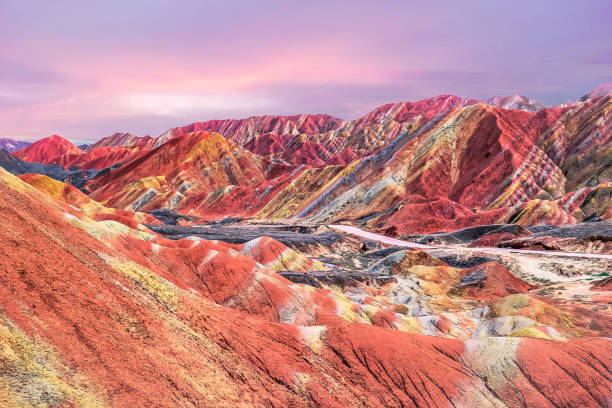
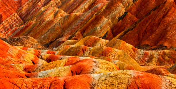
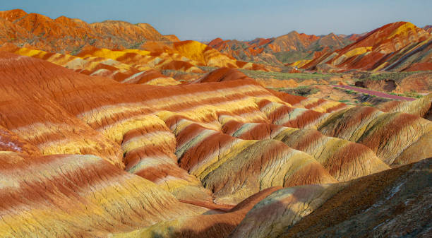
Aerial view on the colorful rainbow mountains of Zhangye danxia landform geological park in Gansu province, China, May 2017
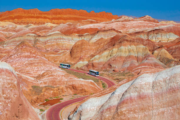
buses in the Danxia Landform of Zhangye, Gansu, China. Copy space for text, blue sky

Jiayuguan is a pass standing at the western end of the Ming Dynasty Great Wall.
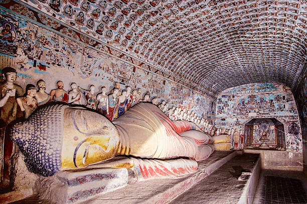
reclining buddha gold statue at mogao caves in the desert near dunhuang,china.A UNESCO world heritage site.
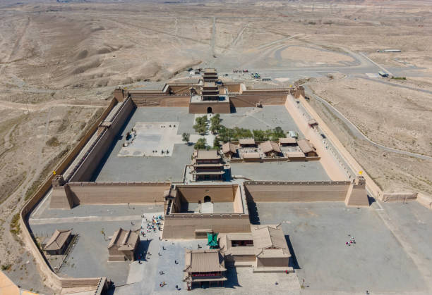
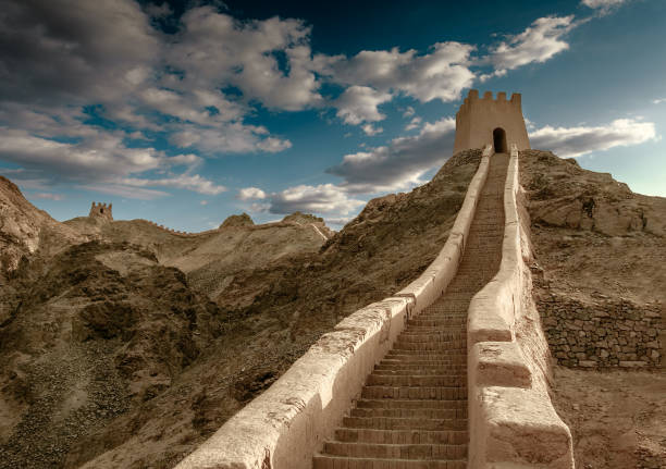
the first frontier fortress at the west end of the Ming dynasty Great Wall, near the city of Jiayuguan in Gansu province.
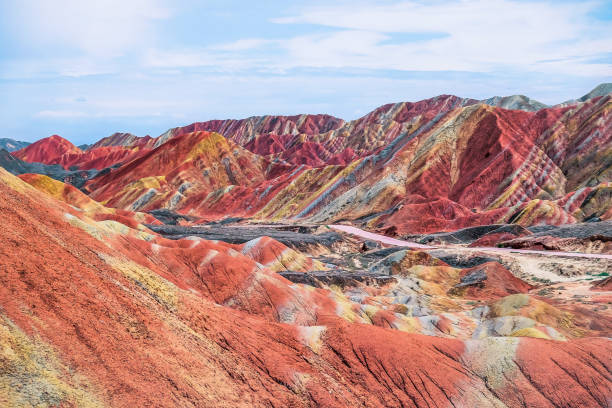
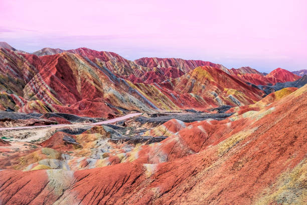
Amazing scenery of Rainbow mountain and blue sky background in sunset. Zhangye Danxia National Geopark, Gansu, China. Colorful landscape, rainbow hills, unusual colored rocks, sandstone erosion

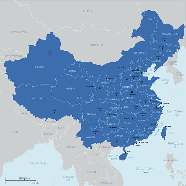
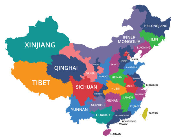
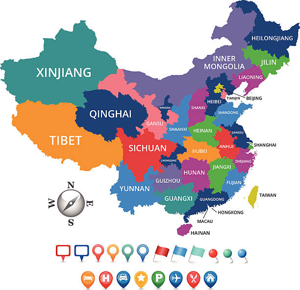
Highly detailed vector map of China with regions, capital and big cities.

9 story high wooden porch of cave 96-Mogao Caves S.section comprising 492 caves and cell temples-some open for tourist visit housing Buddhist art from centuries 4th to 14th. Dunhuang-Gansu prov.-China
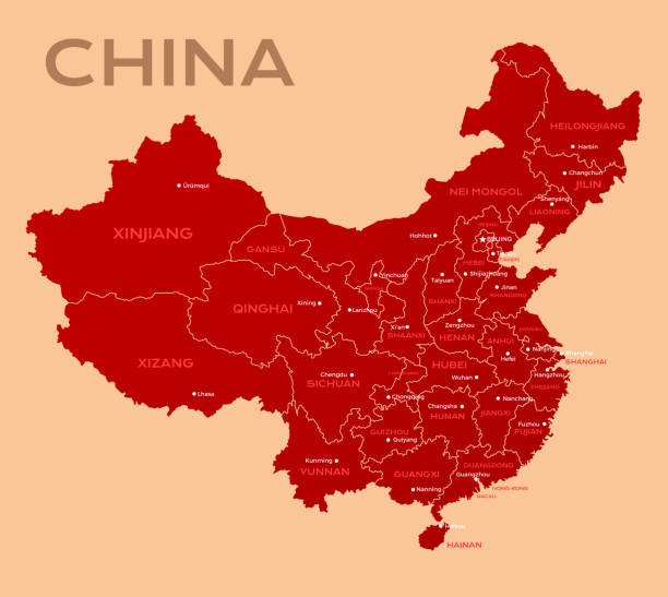
Map of China. Chinese administrative districts and divisions.

A beautiful sunset light over the Fort Jiayuguan under a moody sky in Gansu Province, Western China.

lanzhou beef noodles, lanzhou stretched noodles, a local snack in gansu province, China


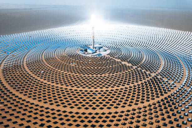
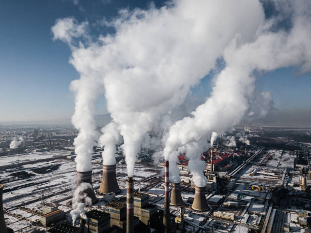
Photovoltaic power generation, solar Thermal Power Station. Shot in Dunhuang, China.

Haedong Yonggungsa Temple and Haeundae Sea in Busan, Buddhist temple in Busan, South Korea.

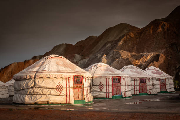
Mongolian tents at the Rainbow mountains of Zhangye Danxia Geopark in the Gansu province, China.


Chinese mural patterns backgrounds, Mogao caves. Before the Tang Dynasty.

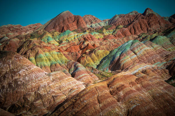
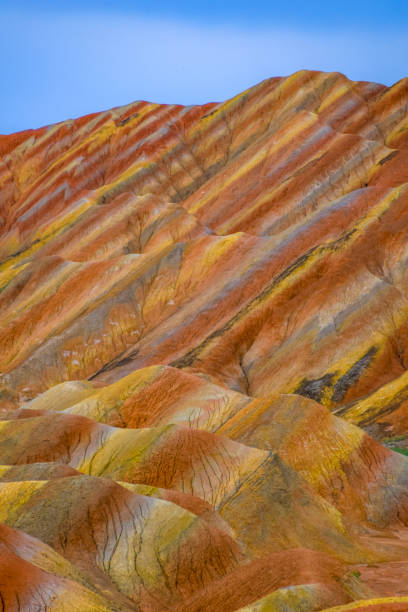
Multicolored geological layers of Zhangye Danxia landform, Gansu, China. Wallpaper, background, brown, red, yellow, green and white colors, rainbow mountains of China
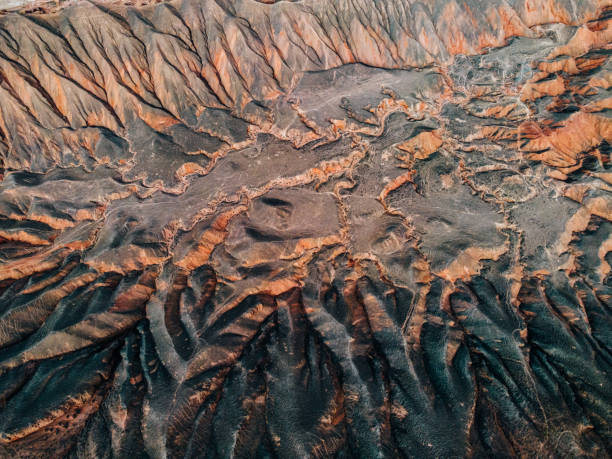
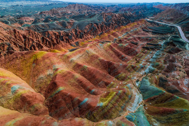
Aerial View of Mountains and Danxia Landform

"Crescent Spring and Mingyue Pavilion in the morning, Dunhuang of ChinaPlease see other similar pictures from my portfolio:"
The road through the typical Danxia land form in Zhangye Danxia Geological Park, Zhangye, Gansu, China. Blue sky with copy space for text, colorful, panorama


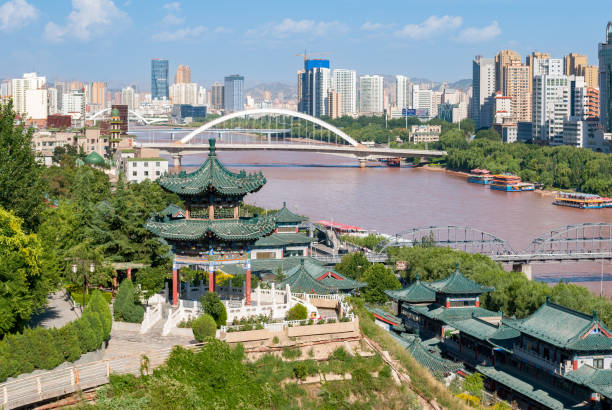
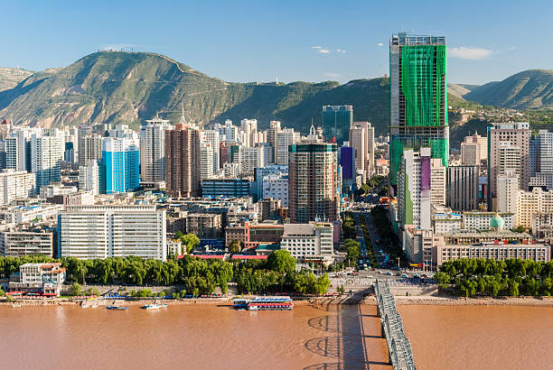
A panoramic view of the river crossing the capital of Gansu Province.
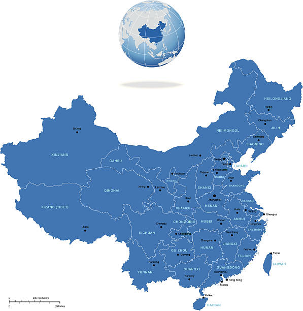
Highly detailed vector map of China with regions, capital and big cities


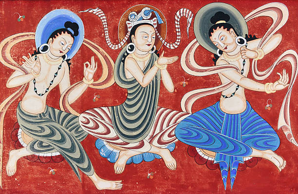
Chinese dunhuang mural backgrounds, Mogao caves. Qin Dynasty (366 AD) to Yuan Dynasty.


Mural buddhism patterns abstract backgrounds, Mogao caves. The Northern Wei Dynasty (AD 386 onwards), China.

This vector map is accurately prepared by a GIS and remote sensing expert with highly detailed information.

Sand dunes of Dunhuang, Gansu, China. Sunset hour, horizontal image with copy space for text, wallpaper, background
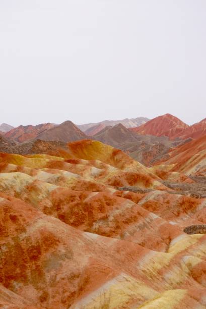
Zhangye Qicai Danxia Scenic Spot in Gansu, China

Tourists ride camels at Mingsha Shan (Singing Sand Dunes) in Dunhuang, China

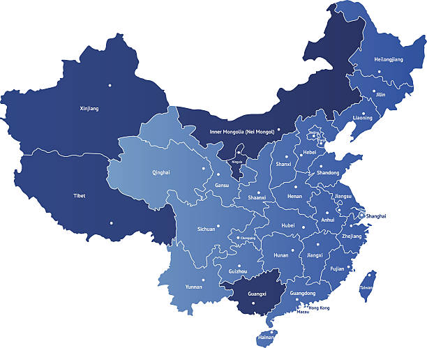
Detailed vector map of China with the names of the provinces. Each of provinces you can separate and use as individal map.


3D Render of a Topographic Map of the Northwest China region. All source data is in the public domain. Color texture: Made with Natural Earth. http://www.naturalearthdata.com/downloads/10m-raster-data/10m-cross-blend-hypso/ Relief texture: GMTED2010 data courtesy of USGS. URL of source image: https://topotools.cr.usgs.gov/gmted_viewer/viewer.htm Water texture: SRTM Water Body SWDB: https://dds.cr.usgs.gov/srtm/version2_1/SWBD/ Boundaries Level 0: Humanitarian Information Unit HIU, U.S. Department of State (database: LSIB) http://geonode.state.gov/layers/geonode%3ALSIB7a_Gen Boundaries Level 1: Made with Natural Earth. https://www.naturalearthdata.com/downloads/10m-cultural-vectors/
Great for any print or web projects :biggrin:

Group of tourists are riding camel at the sand mountain Mingsha Shan desert or the singing sand dunes with the caravan as part of the Silk Road in Dunhuang, Gansu, China.

Yueya Spring is a crescent-shaped lake in an oasis, 6 km south of the city of Dunhuang in Gansu Province, China.

Spectacular colorful rusty sandstone and siltstone landforms of Zhangye Danxia-Red Cloud Nnal.Geological Park so called Rainbow Mountains-E.foothills of the Qilian Range. Zhangye-Gansu province-China.

9 story high wooden porch of cave 96-Mogao Caves S.section comprising 492 caves and cell temples-some open for tourist visit housing Buddhist art from centuries 4th to 14th. Dunhuang-Gansu prov.-China
Next