Images
Mesquite Flat Dunes Pictures, Images and Stock Photos
Browse 3,100+ mesquite flat dunes stock photos and images available, or start a new search to explore more stock photos and images.
Most popular

Death Valley is a desert valley located in Eastern California. It is the lowest, driest, and hottest area in North America.Death Valley's Badwater Basin is the point of the lowest elevation in North America, at 279 feet (85 m) below sea level.This point is 84.6 miles (136.2 km) east-southeast of Mount Whitney, the highest point in the contiguous United States with an elevation of 14,505 feet (4,421 m).Death Valley's Furnace Creek holds the record for the highest reliably recorded air temperature in the world, 134 °F (56.7 °C) on July 10, 1913.Located near the border of California and Nevada, in the Great Basin, east of the Sierra Nevada mountains, Death Valley constitutes much of Death Valley National Park and is the principal feature of the Mojave and Colorado Deserts Biosphere Reserve.

Photographing the various scenic overlooks, historical landmarks, and geographical wonders that Death Valley National Park has to offer.

Lone mesquite tree on the flats. Naturally pruned by livestock.
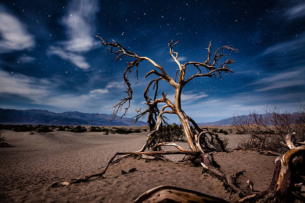
The gnarled and twisted branches of a dead mesquite tree in the sand of the Mesquite Flat Dunes in Death Valley National Park, lit by moonlight at night with stars emerging from a semi-cloudy sky.
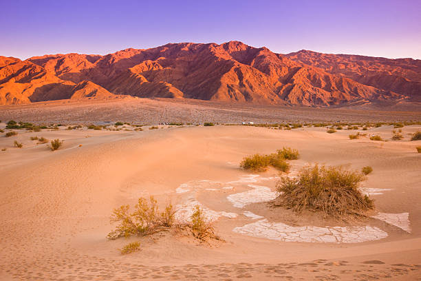
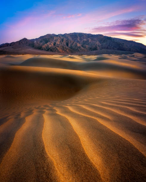
Many people identify the typical desert as a vast area covered by sand dunes. That may be true in some parts of the world but in the Mojave, less than one percent of the desert is covered with sand dunes. In order for sand dunes to exist there has to be a source of sand. Also there needs to be winds to move the sands and a place for the sand to collect. The eroded canyons and washes of Death Valley National Park in California provide plenty of sand. The wind seems to blow frequently here, especially in the springtime, and there are a few areas where the sand is trapped by geographic features such as mountains. Mesquite Flats near Stovepipe Wells is one such place. This sunset picture of the sand dunes and the Grapevine Mountains was taken after a winter storm had passed.

The Empty Quarter, or Rub al Khali - The world's largest sand deser in Dubai.

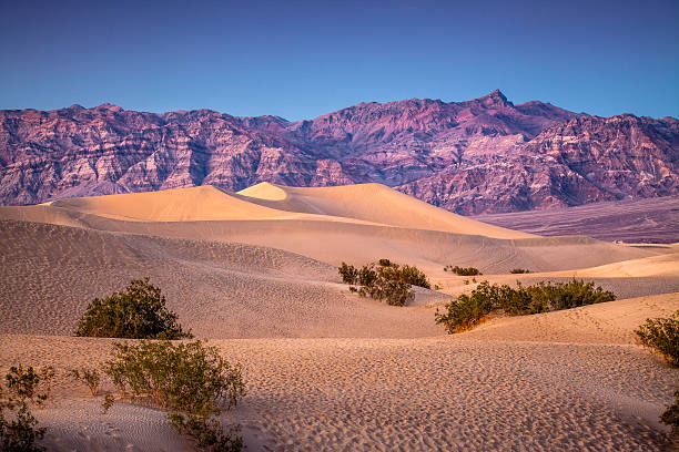
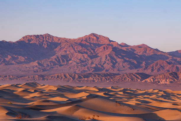
Grapevine Mountains Standing Tall Over The Mesquite Dunes in Death Valley National Park

The Mesquite Sand Dunes in Death Valley National Park in California USA
Windswept landscape of Mesquite Flat Dunes, Death Valley National Park, at sunset with a clear sky.

Mesquite Flat Sand Dunes in Death Valley N.P. California, USA ,Nikon D3x

Early morning light on the twisted trunk of a fallen tree at Mesquite Flat Sand dunes in Death Valley

The famous Mesquite Flat Sand Dunes in the Mojave Desert's Death Valley National Park California.
Colorful sunset over Mesquite dunes of Death Valley California


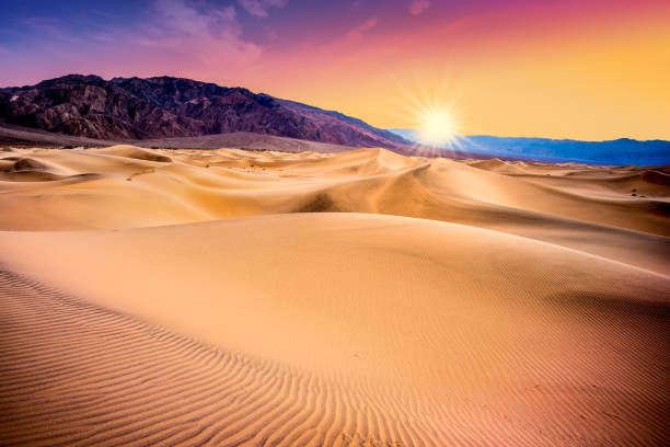
Death Valley, California sand dunes with colorful sunset

Death Valley National Park, which is situated on the eastern side of the Sierra Nevada Mountain range in the southern Inyo County in California, is among the most arid National Parks in US.
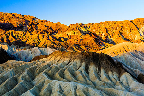
Zabriskie Point is a part of Amargosa Range located in east of Death Valley in Death Valley National Park in the United States noted for its erosional landscape.
Mesquite Flat Sand Dunes in California's Death Valley
Mesquite Flat Sand Dunes, Death valley National park, California, USA

Sand Dunes in Death Valley - Scenic landscape views at sunset. Death Valley, California, USA.

Alabama Hills at the base of Mount Whitney.

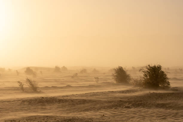
Dense Sand Storm Whips Through Stove Pipe Wells in Death Valley Wilderness

Sand Dunes at Mesquite Flats in winter. Death Valley, California, USA.

Death Valley National Park, which is situated on the eastern side of the Sierra Nevada Mountain range in the southern Inyo County in California, is among the most arid National Parks in US.


Beautiful Mesquite Flat Dunes at Death Valley National Park in California USA. Seen a hot day in the dry desert.

Mesquite Flat Sand Dunes in Death Valley National Park.

Sunset near the flat sand dunes in Death Valley National Park, California.

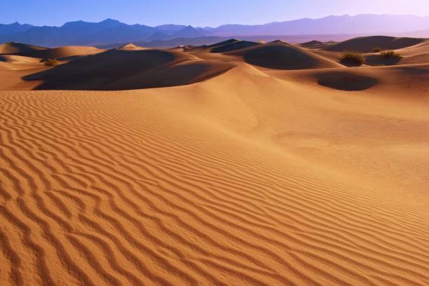
Sand dune textures at the Mesquite Dunes, Death Valley National Park, California, USA

Sand dune textures at sunrise at the Mesquite Dunes, Death Valley National Park, California, USA

Sand dune textures at sunrise at the Mesquite Dunes, Death Valley National Park, California, USA


Mesquite Flat Sand Dunes Death Valley


Mesquite Flat Sand Dunes in Death Valley National Park, California.

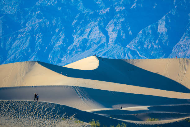
Just after sunrise two hikers are on Mesquite Flat Sand Dunes near Stovepipe Wells in Death Valley National Park.


beautiful Mesquite flats in the death valley desert in sunset light, USA


Mesquite Flat Sand Dunes Death Valley

Mesquite Flat sand dunes in Death Valley California


Mesquite Flat sand dunes in Death Valley California

Mesquite Flat Sand Dunes in Death Valley CA provide shelter for many types of wildlife.

Mesquite Flat Sand Dunes in Death Valley N.P. California, USA ,Nikon D3x

Mojave desert landscapes near the Death Valley National Park/ National Parks of the USA. California - Nevada boarder in the USA. Death Valley is the largest national park in the lower 48 states, and the hottest, driest and lowest of all the national parks in the United States. Mojave Desert. Extremely hot weather in summer

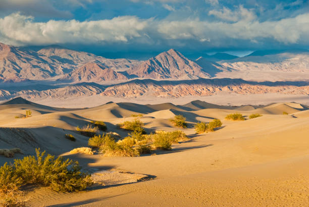
Scenic view of Amargosa Mountains from Mesquite Flat Sand Dunes in Death Valley National Park.


A beautiful shot of Mesquite Flat Sand Dunes at Death Valley National Park in California, USA

The dramatic side-light of sunset creates shadows and light in the sand dunes at Mesquite Flat Sand Dunes, Death Valley National Park

Sand dunes landscape seen at Death Valley National Park, California, USA, at sunrise


The sand dunes of Death Valley National Park

Photographing the various scenic overlooks, historical landmarks, and geographical wonders that Death Valley National Park has to offer.
Next