
Mississippi River Aerial Pictures, Images and Stock Photos
Browse 1,300+ mississippi river aerial stock photos and images available, or search for mississippi river map or nile river to find more great stock photos and pictures.
Curving road along the Mississippi River near Brainerd, Minnesota in the fall.

Aerial view of downtown Minneapolis over the Mississippi River.

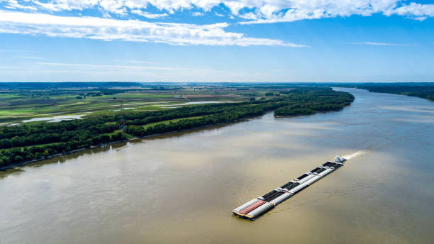
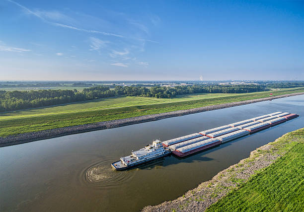
Barge on the Mississippi River captured from drone

Aerial View of Minneapolis and St.Anthony Falls at Dusk - May 2019

Memphis Tennessee TN Downtown Drone Skyline Aerial.

A line of oil tankers transporting fuel to the refineries located along the Mississippi River just north of New Orleans, Louisiana.

Aerial view of reflections of sunset over islands in the Mississippj River between Iowa and Wisconsin.
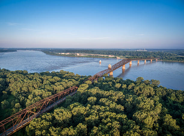
The old Chain of Rocks Bridge over Mississippi River near St Louis - aerial view from Illinois shore
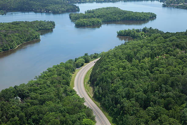
Aerial view of a curving road alongside the Mississippi River in Brainerd, Minnesota

Aerial view to Mississippi river and Quincy city, Illinois and Missouri states, North America, USA.
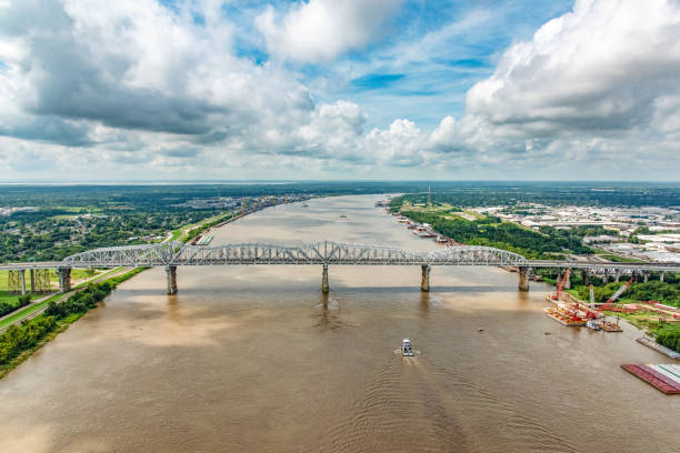
A bridge supporting both vehicles and a railway crossing the Mississippi River which is flanked on both sides by various industry located just north of New Orleans, Louisiana, shot from an altitude of about 600 feet over the river.

Fly over Minneapolis with views to the Minneapolis St. Paul airport, the Mississippi river and Lake of the Isles, Lake Calhoun and Cedar Lake.

Mississippi River aerial view

A aerial view of the Mississippi River with a view of the landscape
barges on Chain of Rocks Canal of MIssissippi River above St Louis - aerial view

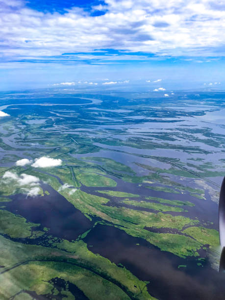
swamp and wetlands in New Orleans aerial view


3D Render of a Topographic Map of Davenport, Iowa, USA. All source data is in the public domain. Contains modified Copernicus Sentinel data (Apr 2019) courtesy of ESA. URL of source image: https://scihub.copernicus.eu/dhus/#/home. Relief texture SRTM data courtesy of NASA. URL of source image: https://search.earthdata.nasa.gov/search/granules/collection-details?p=C1000000240-LPDAAC_ECS&q=srtm%201%20arc&ok=srtm%201%20arc
overlooking mississippi river from smith avenue bridge in saint paul minnesota

aerial view of farmland near Mississippi and Missouri Rivers confluence at Columbia Bottom Conservation Area
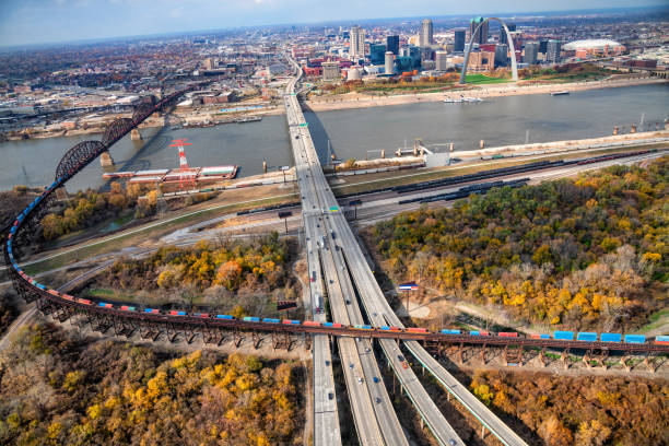
A large interstate freeway and a freight train crossing paths on the Illinois side of the Mississippi River with the skyline of St. Louis, Missouri in the background.

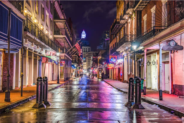
Jackson Square in the midst of New Orleans' famed French Quarter.

3D Render of a Topographic Map of the State of Mississippi, USA. All source data is in the public domain. Relief texture and Rivers: SRTM data courtesy of USGS. URL of source image: https://e4ftl01.cr.usgs.gov//MODV6_Dal_D/SRTM/SRTMGL1.003/2000.02.11/ Water texture: SRTM Water Body SWDB: https://dds.cr.usgs.gov/srtm/version2_1/SWBD/


Minneapolis skyline aerial / elevated view with the Mississippi River, Third Avenue Bridge, and a park with golden colored trees during Autumn.

A barge passing through Pere Marquette State Park on the Mississippi River

A tugboat pushing a barge into a canal along the Mississippi River near downtown St. Louis, Missouri.

The downtown and surrounding areas of New Orleans, Louisiana shot from an altitude of about 1000 feet during a helicopter photo flight.

Cache River in Illinois above confluence with the Mississippi River, aerial view of fall scenery

Aerial view of city of Winona from atop bluffs above highway 61 and Lake Winona in Minnesota

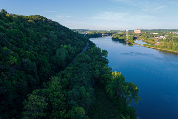
Spectacular View of the Confluence of the Wisconsin and Mississippi Rivers

A tugboat pushing a large barge under a bridge in the center of the Mississippi River just north of downtown St. Louis.

overlooking missisippi river and wooded banks during autumn season from lake street bridge in minneapolis

3D Render of a Topographic Map of Davenport, Iowa, USA. All source data is in the public domain. Contains modified Copernicus Sentinel data (Apr 2019) courtesy of ESA. URL of source image: https://scihub.copernicus.eu/dhus/#/home. Relief texture SRTM data courtesy of NASA. URL of source image: https://search.earthdata.nasa.gov/search/granules/collection-details?p=C1000000240-LPDAAC_ECS&q=srtm%201%20arc&ok=srtm%201%20arc

A storage facility for oil prior to being transported for refining and distribution for energy consumption throughout the United States.

Aerial drone image of the Mississippi River

The skyline of the city of St. Louis, Missouri on the banks of the Mississippi River.
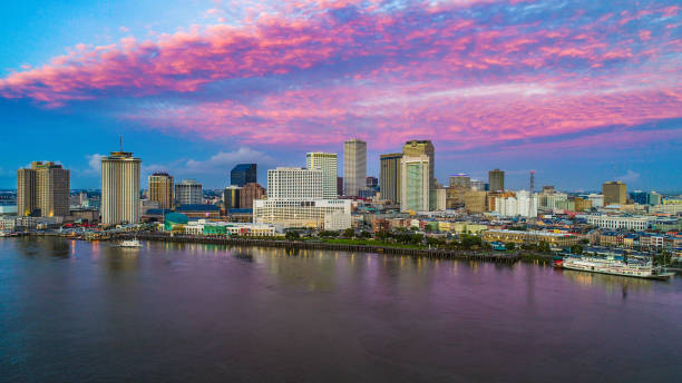
New Orleans, Louisiana, USA Skyline at Sunrise
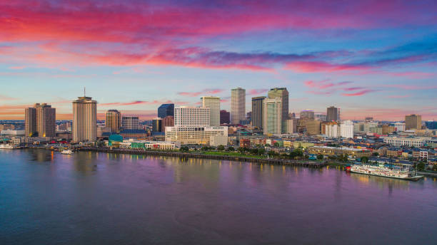
New Orleans, Louisiana, USA Downtown Drone Skyline Aerial.

The late afternoon sun shines in this aerial view over the Minneapolis skyline.

The Hale Boggs Memorial Bridge spanning the Mississippi River just north of New Orleans, Louisiana named for a former congressman out of New Orleans who disappeared in Alaska in 1972 when his small private plane never arrived at its destination.

Sunrise on the Mississippi

New Orleans is a Louisiana city on the Mississippi River, near the Gulf of Mexico. Nicknamed the "Big Easy," it's known for its round-the-clock nightlife, vibrant live-music scene and spicy, singular cuisine reflecting its history as a melting pot of French, African and American cultures.

barges on Chain of Rocks Canal of Mississippi River above St Louis - aerial view

aerial view of a gravel road and fields near Mississippi and Missouri Rivers confluence at Columbia Bottom Conservation Area

Industry and shipping line the banks of the Mississippi River in this aerial view shot at an altitude of about 1000 feet just south of the city of St. Louis, Missouri.


The Hale Boggs Memorial Bridge spanning the Mississippi River just north of New Orleans, Louisiana named for a former congressman out of New Orleans who disappeared in Alaska in 1972 when his small private plane never arrived at its destination.

Aerial shot of New Orleans, Louisiana from over the French Quarter on a summer morning.

Aerial photo of Alton, Illinois down the Mississippi River
A tug boat moving toward a bridge spanning the mighty Mississippi River in southern Louisiana near New Orleans.

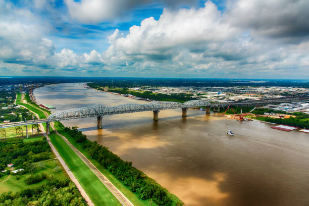
Aerial shot of the Hernando de Soto Bridge heading out of Memphis, Tennessee and carrying Interstate 40 across the Mississippi into Arkansas.

Poster Style Topographic / Road map of St. Louis, Missouri, USA United States of America. Original map data is open data via © OpenStreetMap contributors. All maps are layered and easy to edit. Roads are editable stroke.

The city skyline of New Orleans, Louisiana, along the banks of the Mississippi River shot from an altitude of about 800 feet

Aerial view of downtown Minneapolis at sunrise

The downtown area of New Orleans, Louisiana shot from an altitude of about 700 feet during a helicopter photo flight.
Next