
bayou of mississippi river delta region in jean lafitte national park near new orleans louisiana
bayou of mississippi river delta region in jean lafitte national park near new orleans louisiana

Fall Colors on the Confluence of the MIssissippi and Wisconsin Rivers

Mississippi River Basin in the USA detailed editable vector map, trending color scheme

Evening image of the New Orleans skyline from the Delta of the Mississipi River

Evening image of the New Orleans skyline from the Delta of the Mississipi River
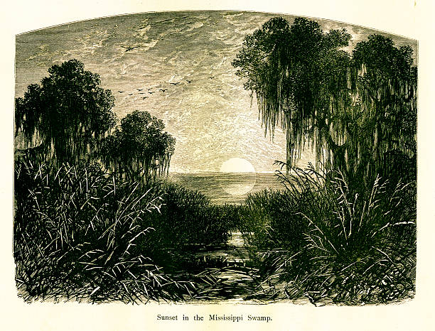
Sunset in Mississippi Swamp, USA. Published in Picturesque America or the Land We Live In (D. Appleton & Co., New York, 1872).
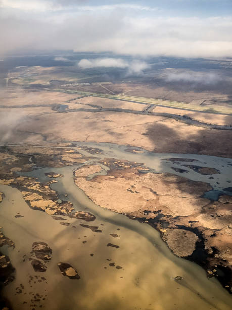
Flying into New Orleans over swamps and the Mississippi River during a storm.

A nameless bluesman plays in a deep south roadhouse.

barge and motor boat on mississippi river delta region in southern louisiana

mississippi river through the woodlands of jean lafitte national park near new orleans louisiana

Flying into New Orleans over swamps and the Mississippi River during a storm.
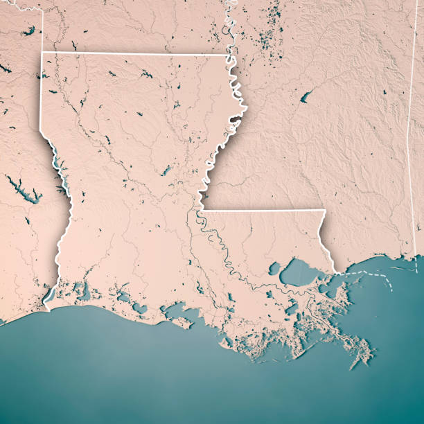
3D Render of a Topographic Map of the State of Louisiana, USA. All source data is in the public domain. Boundaries Level 1: USGS, National Map, National Boundary Data. https://viewer.nationalmap.gov/basic/#productSearch Relief texture and Rivers: SRTM data courtesy of USGS. URL of source image: https://e4ftl01.cr.usgs.gov//MODV6_Dal_D/SRTM/SRTMGL1.003/2000.02.11/ Water texture: SRTM Water Body SWDB: https://dds.cr.usgs.gov/srtm/version2_1/SWBD/
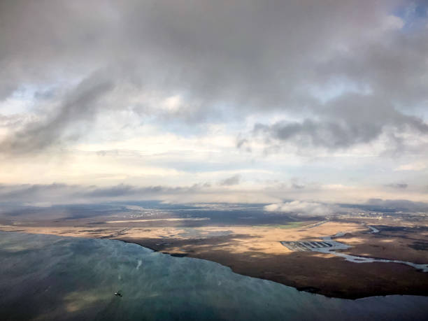
Flying into New Orleans over swamps and the Mississippi River during a storm.
Evening image of the New Orleans skyline from the Delta of the Mississipi River
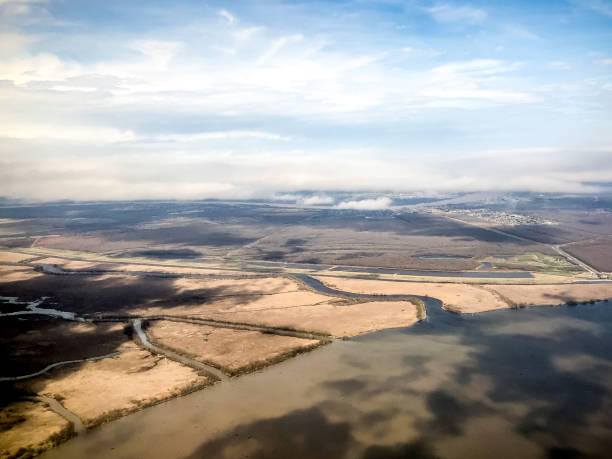
Flying into New Orleans over swamps and the Mississippi River during a storm.
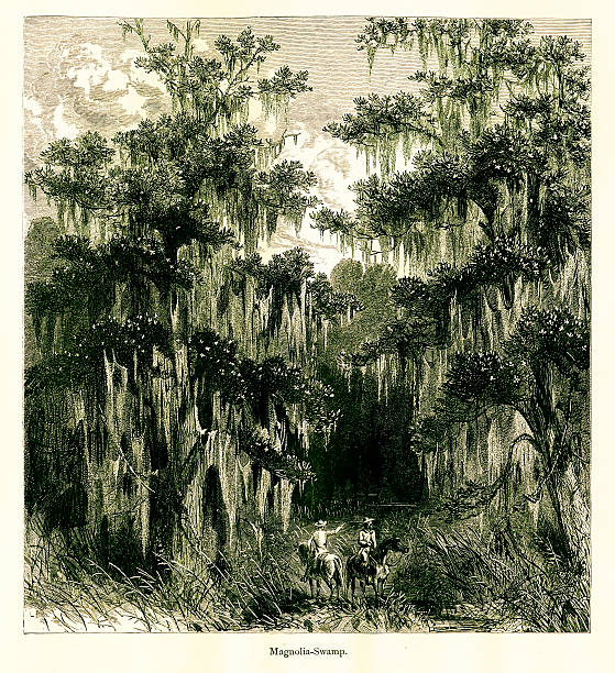
Magnolia Swamp, Mississippi River, North America. Published in Picturesque America or the Land We Live In (D. Appleton & Co., New York, 1872)

Winter Confluence of the Wisconsin and Mississippi River at Pikes Peak State Park in Iowa

Flying into New Orleans over swamps and the Mississippi River during a storm.

A Dolphin in Gulf of Mexico, Louisiana.

Sunset over the Mississippi River at Memphis, Tennessee.

3D Render of a Topographic Map of the State of Louisiana, USA. All source data is in the public domain. Color texture: Made with Natural Earth. http://www.naturalearthdata.com/downloads/10m-raster-data/10m-cross-blend-hypso/ Boundaries Level 1: USGS, National Map, National Boundary Data. https://viewer.nationalmap.gov/basic/#productSearch Relief texture and Rivers: SRTM data courtesy of USGS. URL of source image: https://e4ftl01.cr.usgs.gov//MODV6_Dal_D/SRTM/SRTMGL1.003/2000.02.11/ Water texture: SRTM Water Body SWDB: https://dds.cr.usgs.gov/srtm/version2_1/SWBD/

Sunset over New Orleans, Louisiana from a cruise ship.

Very Rare, Beautifully Illustrated Antique Engraving of Southwest Pass Mississippi River Bayou, Louisiana, United States, American Victorian Engraving, 1872. Source: Original edition from my own archives. Copyright has expired on this artwork. Digitally restored.

Men fix the levee, caused by a crevasse of the lower Mississippi River, Louisiana, USA. Pen and pencil illustration engravings, published 1872. This edition edited by William Cullen Bryant is in my private collection. Copyright is in public domain.

3D Render of a Topographic Map of the State of Louisiana, USA. All source data is in the public domain. Relief texture and Rivers: SRTM data courtesy of USGS. URL of source image: https://e4ftl01.cr.usgs.gov//MODV6_Dal_D/SRTM/SRTMGL1.003/2000.02.11/ Water texture: SRTM Water Body SWDB: https://dds.cr.usgs.gov/srtm/version2_1/SWBD/

Jukebox playlist from Mississippi Blues Bar

19th-century illustration of a market garden on the coast of the Mississippi River. Engraving published in Picturesque America (D. Appleton & Co., New York, 1872).

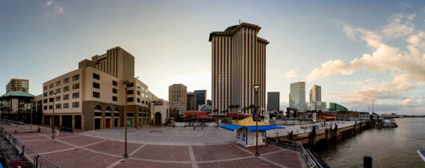
Sunrise shot of the corporate building skyline of New Orleans, LA, USA

Flying into New Orleans over swamps and the Mississippi River during a storm.

Flying into New Orleans over swamps and the Mississippi River during a storm.

Cypress Swamp, Mississippi River, North America. Published in Picturesque America or the Land We Live In (D. Appleton & Co., New York, 1872).

Drone view of Bridge Over Mississippi River at Memphis, Tennessee

View of the Mississippi River, a green line of trees on the horizon, on the right a moored boat to a wooden pier, Louisiana.

Antique engraving of the Mississippi River at New Orleans, United States of America. Illustration published in Picturesque America (D. Appleton & Co., New York, 1872). MORE VINTAGE AMERICAN ILLUSTRATIONS HERE:

Drone view of Bridge Over Mississippi River at Memphis, Tennessee

Flying into New Orleans over swamps and the Mississippi River during a storm.

Flying into New Orleans over swamps and the Mississippi River during a storm.

Diagram of the Mississippi River Delta in North America, USA. Illustration published in Physical Geology by Mytton Maury (University Publishing Company, New York and New Orleans) in 1894. Digitally restored.

Flying into New Orleans over swamps and the Mississippi River during a storm.

Vintage engraving of a Map of the Delta of the Mississippi river, 19th Century

Lake Bigeaux under blue skies and white clouds in Louisiana with dead trees in swamp area

Very Rare, Beautifully Illustrated Antique Engraving of New Orleans on the Mississippi River, Louisiana, United States, American Victorian Engraving, 1872. Source: Original edition from my own archives. Copyright has expired on this artwork. Digitally restored.
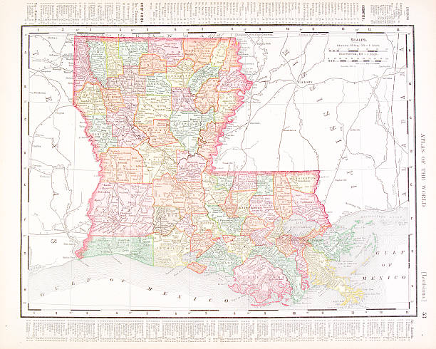
Vintage map of the state of Louisiana, USA - See lightbox for more

3D Render of a Topographic Map of the State of Louisiana, USA. All source data is in the public domain. Color texture: Made with Natural Earth. http://www.naturalearthdata.com/downloads/10m-raster-data/10m-cross-blend-hypso/ Relief texture and Rivers: SRTM data courtesy of USGS. URL of source image: https://e4ftl01.cr.usgs.gov//MODV6_Dal_D/SRTM/SRTMGL1.003/2000.02.11/ Water texture: SRTM Water Body SWDB: https://dds.cr.usgs.gov/srtm/version2_1/SWBD/

View of New Orleans city skyline from the Miississippi river delta on a paddle boat at dusk with the American flag flying.

Sunset over the bayou at the mouth of the Mississippi River, Louisiana, USA. Pen and pencil illustration engravings, published 1872. This edition edited by William Cullen Bryant is in my private collection. Copyright is in public domain.

Night shot of the corporate building skyline of New Orleans, LA, USA

A plantation house by the lower Mississippi River, Louisiana, USA. Pen and pencil illustration engravings, published 1872. This edition edited by William Cullen Bryant is in my private collection. Copyright is in public domain.

Lousiana state detailed editable map with cities and towns, geographic sites, roads, railways, interstates and U.S. highways. Vector EPS-10 file, trending color scheme
© 2024 iStockphoto LP. The iStock design is a trademark of iStockphoto LP. Browse millions of high-quality stock photos, illustrations, and videos.
Do Not Sell or Share