Illustrated map of the state of New Mexico in United States with cities and landmarks. Editable vector illustration
Browse 2,600+ old west map stock photos and images available, or search for western map to find more great stock photos and pictures.
Illustrated map of the state of New Mexico in United States with cities and landmarks. Editable vector illustration

Political map of World. Blank map for school quiz. Simplified black thick outline on white background.

Poster Style Topographic / Road map of San Antonio, TX, USA. Original map data is public domain sourced from www.census.gov/
Set of wild west outline vector icons.

Topographic / Road map of Phoenix, AZ. Original map data is public domain sourced from www.census.gov/

Set of four planet Earth globes with green land silhouette map on blue water background. Simple flat vector illustration.

Delaware state detailed editable map with with cities and towns, geographic sites, roads, railways, interstates and U.S. highways. Vector EPS-10 file, trending color scheme

Illustrated map of the state of Florida in United States with cities and landmarks. Editable vector illustration

Topographic / Road map of San Antonio, TX, USA. Original map data is public domain sourced from www.census.gov/

Plexus particle world map vector illustration concept

Map Source: https://www.cia.gov/library/publications/the-world-factbook/graphics/ref_maps/jpg/time_zones.jpg

Illustrated map of the state of Oklahoma in United States with cities and landmarks. Editable vector illustration
Set of wild west flat vector icons.

Political map of World with dots instead of small states. Blank map for school quiz. Simplified black thin outline on white background.
compass icon main directions vector illustration white background

Blank political map of World. Simplified vector map in four shades of grey.

Political map of South Asia and Middle East countries. Simple flat vector map in four shades of turquoise blue.

Seamless cartoon desert landscape, vector layered game background for parallax effect

Illustrated map of the state of Nebraska in United States with cities and landmarks. Editable vector illustration
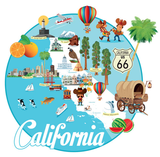
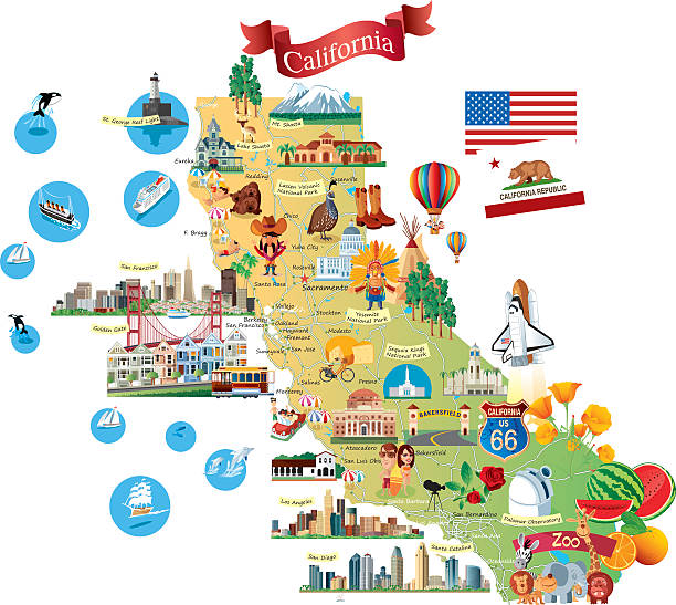
Vector CALIFORNIA CARTOON MAP http://legacy.lib.utexas.edu/maps/us_2001/california_ref_2001.jpg

Map of Cyprus, sign silhouette. World Map Globe. Vector Illustration isolated on white background. Europe continent.

Topographic / Road map of Las Vegas NV, USA. Original map data is public domain sourced from www.census.gov/
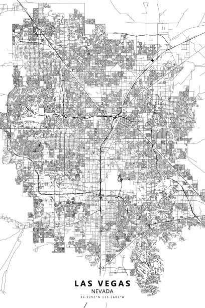
Poster Style Topographic / Road map of Las Vegas NV, USA. Original map data is public domain sourced from www.census.gov/

Simplified colorful map of World. Vector illustration.

Wild West concept. Various objects. Cowboy theme, western. Boots, cactus, hat, handwritten word Western. Shepherd life.Hand drawn. Design element.Vector art

Icons and illustrations for nearly any adventure - all grouped and layered for easy editing and isolation.
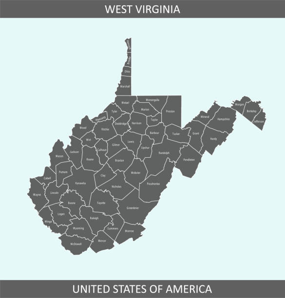
County map of West Virginia state of United States of America. The map is accurately prepared by a map expert.
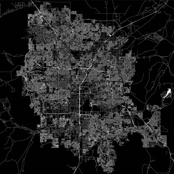
Topographic / Road map of Las Vegas NV, USA. Original map data is public domain sourced from www.census.gov/

Topographic / Road map of Dallas, TX, USA.

Topographic / Road map of Dallas, TX, USA.

map of San Francisco, 1873, composed with 2 vintage stained papers.

Hand drawn fairytale historic treasure map. Seamless background, vector.

Cowboy boots freehand vector illustration. Hand drawn shoes, cowboy theme wild West concept, western,shepherd life. Design element for print t-shirt, paper, logo, card, poster, template, backdrop. Fashion and life style

Political map of World. Simplified vector map in four shades of gray.

Vector USA cartoon Map

Political map of Balkans - States of Balkan Peninsula. Simple flat black outline with black country name labels.