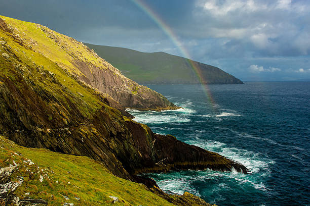
Aldinga and Sellicks Beach south of Adelaide on the Fleurieu Peninsula.
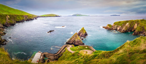
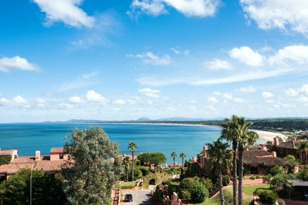
Browse 266,400+ peninsular stock photos and images available, or start a new search to explore more stock photos and images.
Aldinga and Sellicks Beach south of Adelaide on the Fleurieu Peninsula.

Cyprus Blue Lagoon near the Village of Latchi - Latsi at the coast of Akamas National Forest Park. Stunning Aeerial Drone View of the Blue Lagoon towards small Tourist Motorboats anchored in the turquoise and blue lagoon of Latchi - Latsi, Akamas National Forest Park, North-Western Coast of Greek Part of Cyprus, Paphos District, Cyprus Island, Mediterranean Island.
Beautiful view on Dunquin Harbour and small rocky islands with turquoise water and green fields in the background. Dingle peninsula, Co Kerry, Ireland
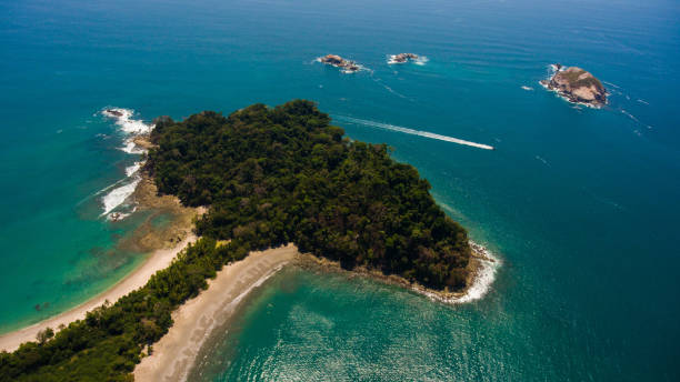
A drone shot of the National park Manuel Antonio, Costa Rica

Panorama of famous secluded beach of Rincon, Las Galeras, Dominican Republic

Beautiful sunset twilight view to Camps Bay, Scenic view during colorful sunset with beautiful cloudscape. Camps Bay the famous suburb of the city of Cape Town with white sandy beaches underneath the Table Mountain. Camps Bay, Cape Town, South Africa, Africa
Breathtaking view from Whales Peninsula (Punta Ballena), close to Punta del Este resort town, Maldonado, Uruguay

3d rendering of bright colorful Iberian Peninsula map isolated in white wall with Spain and Portugal flags.

Flock of arctic sterns flying over land and sea, Vatnsnes peninsula, Iceland, Europe

An aerial view of gorgeous Orange County in Southern California on a summer afternoon.

Hong Kong - February 16, 2024 : Chinese New Year red lanterns decorated at the Peninsula Hong Kong in Tsim Sha Tsui, Hong Kong.

Earth maps courtesy of NASA: http://visibleearth.nasa.gov/

Southwest Asia, political map with multi colored silhouettes of single countries. Also called Western, West or Southwestern Asia, a subregion, overlapping with Middle East, including Caucasus region.
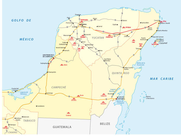
Road vector map of Yucatan with the main maya ruins

Chinamans Hat beach viewed from the lookout on a day at Yorke Peninsula, South Australia

Eğirdir Lake with Eğirdir Town and the mountains in the background in the Isparta.

One of the biggest tourist attractions, that dominates the landscape, is the Bodrum Castle in Turkey
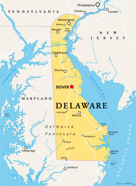
Delaware, DE, political map. State in the Mid-Atlantic region of the United States of America. Capital Dover. The First State, The Small Wonder, Blue Hen State, The Diamond State. Illustration. Vector.

Landscape with Sirmione town, Garda Lake, Italy

Baily Lighthouse is a lighthouse on the southeastern part of Howth Head in County Dublin, Ireland

Cancun, Cozumel and Riviera Maya, Mexico, political map. Cancun, city on the coast of Yucatan Peninsula, north of Riviera Maya, a Caribbean coast resort, with Cozumel in the east of Playa del Carmen.

Tourist group enjoy visiting Karpaz Golden Beach in Karpas, North Cyprus on sunny day

Golden Beach is the best beach of Cyprus, Karpas Peninsula, North.
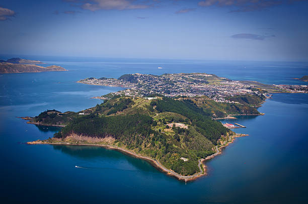
Aerial view looking south over Miramar Peninsular, Wellington, New Zealand

Aerial view of the Ponta de Sao Lourenco peninsula, Madeira Islands, Portugal

Moonta Bay pier viewed against sunset , Yorke Peninsula, South Australia
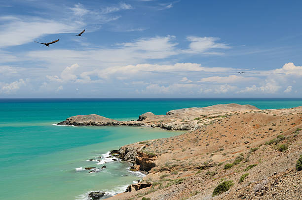
Colombia, wild coastal desert of Penisula la Guajira near the Cabo de la Vela resort. The picture present beautiful Caribbean coast with turquoise water and orange sand
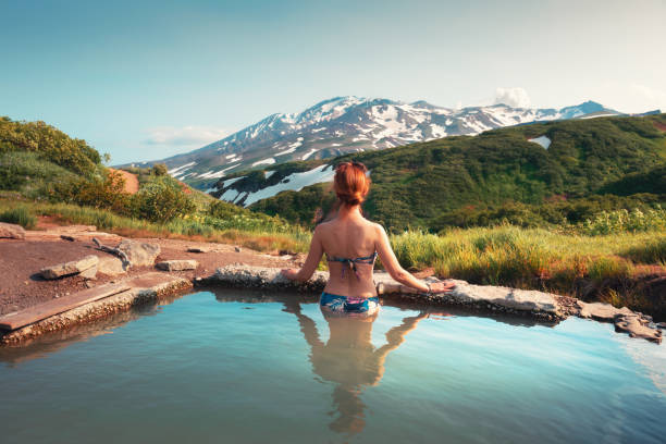
Beautiful woman in a natural thermal pool with a mountain view. Hot thermal springs in Kamchatka peninsula, Russia. Summer travel concept

Santander city aerial panoramic view. Santander is the capital of the Cantabria region in Spain
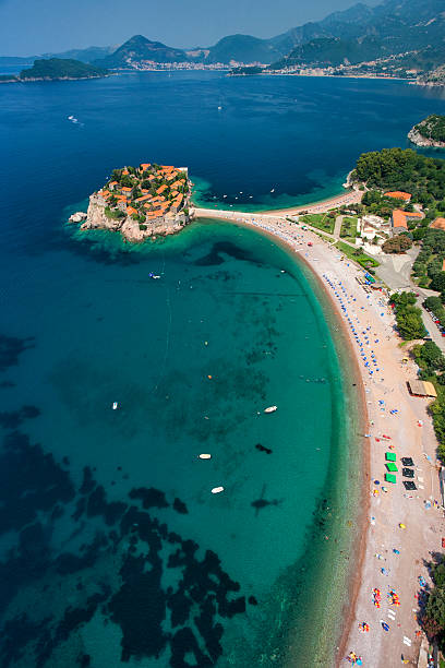
Aerial photo of Sveti Stefan (St. Stefan) island, an luxury resort famous for its traditional architecture, located on the coast of Adriatic Sea, near Budva city, Montenegro, Europe. Photo was taken from the helicopter.

Green Lustica peninsula with the Arza fort on the cape. Montenegro. High quality photo

Autumn On Old Mission Peninsula Vineyards Traverse City Michigan

Es Vedra island sunset view from the Eye of Es Vedra cave, Sant Josep de Sa Talaia, Ibiza, Balearic Islands, Spain
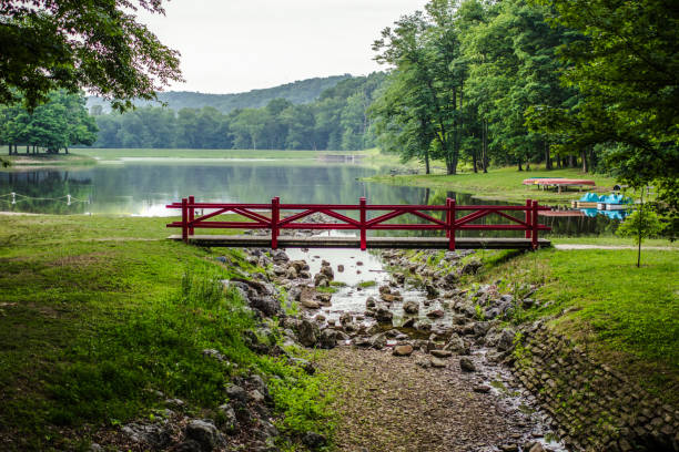
Picnic table on a small island surrounded by a green forest landscape reflecting in the water at Scioto Trail State Park in Chillicothe Ohio.

View of one of the best sights of Madeira Island. Cape Ponta de São Lourenço, Madeira Island, Portugal. High quality photo
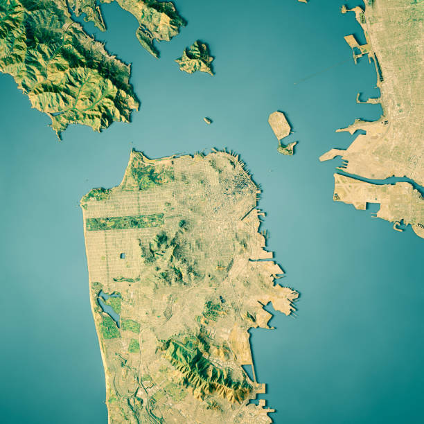
3D Render of a Topographic Map of the Area around San Francisco, California. All source data is in the public domain. Color texture: U.S. Geological Survey, US Topo https://viewer.nationalmap.gov/basic/?basemap=b1&category=ustopo&title=US%20Topo%20Download Relief texture: SRTM data courtesy of USGS. URL of source image: https://e4ftl01.cr.usgs.gov//MODV6_Dal_D/SRTM/SRTMGL1.003/2000.02.11/ Water texture: USGS The National Map: National Hydrography Dataset (NHD): https://nationalmap.gov/hydro.html
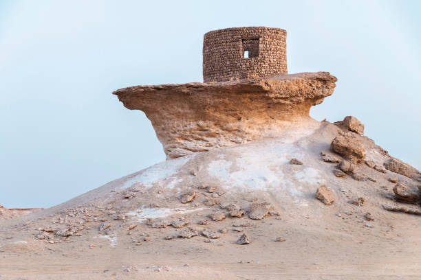
Zekreet fort: Qatar, evening time

Remote settlement on the dramatic ocean cliffs of the Snaefellsnes peninsula in eastern Iceland.ProPhoto RGB profile for maximum color fidelity and gamut.

"View of Papagayo Beach at sunset, Lanzarote."
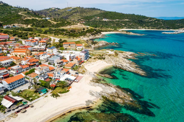
Aerial view of Sarti village on the Sithonia peninsula, in the Chalkidiki , Greece

Landscape view at Farmer field in Azuero Peninsula, in Panama

View at the beach and landscape at the Playita beach in Azuero Peninsula just 40 km from Pedasi just before famous Venao beach in Panama.
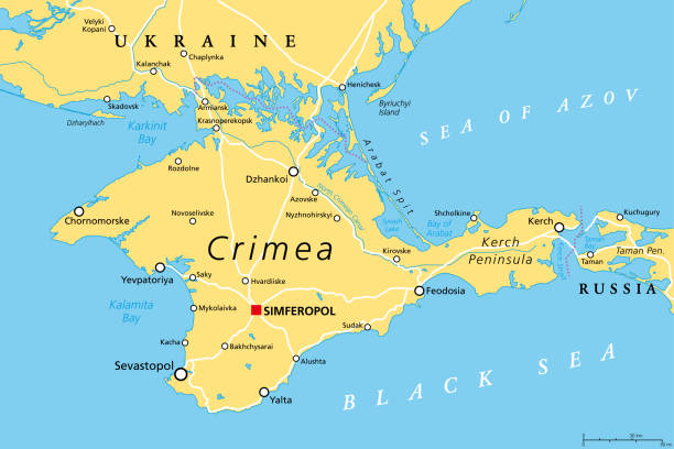
Crimea political map. Peninsula in Eastern Europe on the northern coast of the Black Sea, with disputed status. Controlled and governed by Russia, internationally recognized as part of Ukraine. Vector

Vacations in Poland -bicycles, a convenient means of transport for traveling around the Hel Peninsula in summer
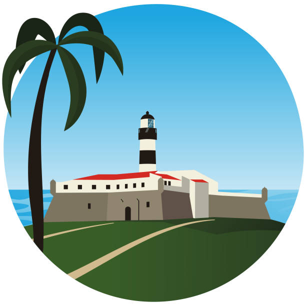
Salvador Bahia - Panoramic view of Barra lighthouse and Barra beach - Touristic attraction