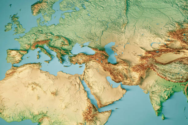
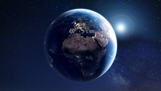
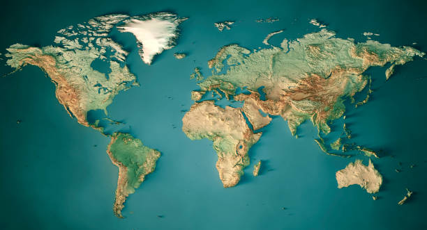
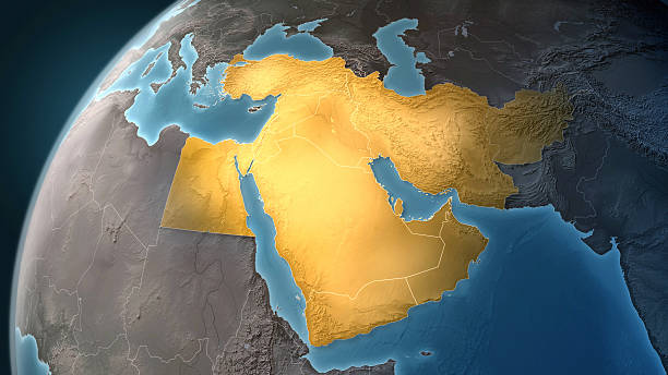
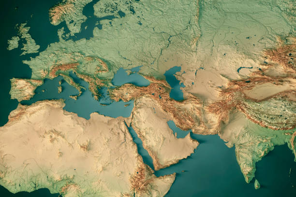
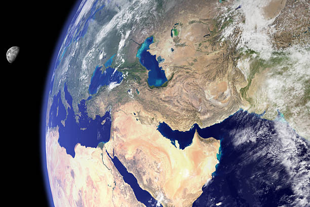
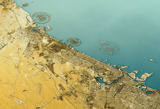
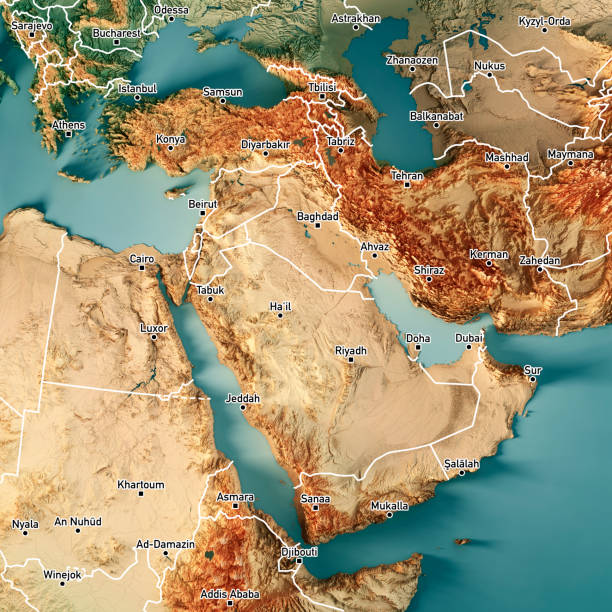
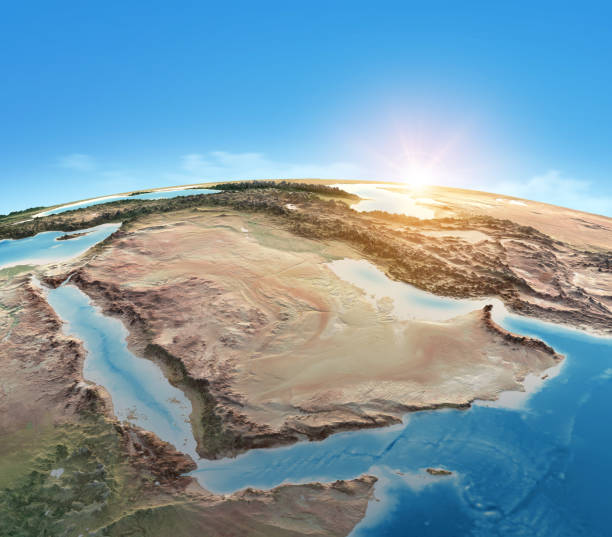
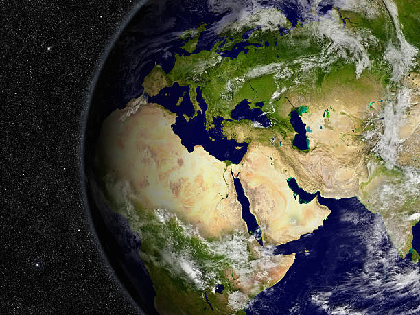
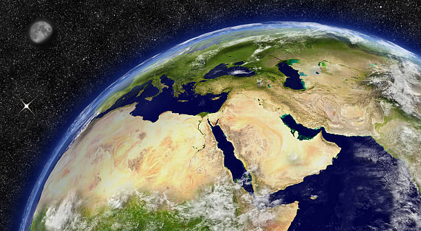
Middle East 3D Render of the Planet Earth with Clouds. Made with Natural Earth. URL of source data: http://www.naturalearthdata.com Relief texture GMTED2010 data courtesy of USGS. URL of source image: https://topotools.cr.usgs.gov/GMTED_viewer/gmted2010_global_grids.php Cloud data courtesy of NASA. URL of source image: https://visibleearth.nasa.gov/view.php?id=57747 The source data is in the public domain.
Satellite View Middle East Pictures, Images and Stock Photos
Browse 170+ satellite view middle east stock photos and images available, or start a new search to explore more stock photos and images.
3D Render of a Topographic Map of Europe, India and Middle East. All source data is in the public domain. Color and Water texture: Made with Natural Earth. http://www.naturalearthdata.com/downloads/10m-raster-data/10m-cross-blend-hypso/ http://www.naturalearthdata.com/downloads/110m-physical-vectors/ Relief texture: GMTED 2010 data courtesy of USGS. URL of source image: https://topotools.cr.usgs.gov/gmted_viewer/viewer.htm
3D Render of a Topographic Map of the World in Miller Projection. All source data is in the public domain. Color and Water texture: Made with Natural Earth. http://www.naturalearthdata.com/downloads/10m-raster-data/10m-cross-blend-hypso/ http://www.naturalearthdata.com/downloads/110m-physical-vectors/ Relief texture: GMTED 2010 data courtesy of USGS. URL of source image: https://topotools.cr.usgs.gov/gmted_viewer/viewer.htm
Map of Middle East on a Earth globe, looking west to Europe. Turkey, Syria, Lebanon, Israel, Jordan, Egypt, Saudi Arabia, Yemen, Oman, Qatar, United Arab Emirates, Kuwait, Iraq, Iran and Afghanistan are the main focus. Countries are highlighted in yellow, while seas are deep blue and land are brown gray. Europe and North Africa are also included in the frame, together with Mediterranean Sea and Persian Gulf. Physical and geographical features are visible. Geopolitics and diplomacy connected to history and geography. Map is blank, without country names. For illustration puroposes only, country grouping and current borders status may differ.
3D Render of a Topographic Map of Europe, India and Middle East. All source data is in the public domain. Color and Water texture: Made with Natural Earth. http://www.naturalearthdata.com/downloads/10m-raster-data/10m-cross-blend-hypso/ http://www.naturalearthdata.com/downloads/110m-physical-vectors/ Relief texture: GMTED 2010 data courtesy of USGS. URL of source image: https://topotools.cr.usgs.gov/gmted_viewer/viewer.htm
3D Render of a Topographic Map of Middle East. Version with Country Boundaries and Cities. All source data is in the public domain. Color texture: Made with Natural Earth. http://www.naturalearthdata.com/downloads/10m-raster-data/10m-cross-blend-hypso/ Relief texture: GMTED2010 data courtesy of USGS. URL of source image: https://topotools.cr.usgs.gov/gmted_viewer/viewer.htm Water texture: World Water Body Limits: Humanitarian Information Unit HIU, U.S. Department of State http://geonode.state.gov/layers/geonode%3AWorld_water_body_limits_polygons Boundaries: Humanitarian Information Unit HIU, U.S. Department of State (database: LSIB) http://geonode.state.gov/layers/geonode%3ALSIB_10
3D Render of a Topographic Map of the World in Miller Projection. All source data is in the public domain. Color and Water texture: Made with Natural Earth. http://www.naturalearthdata.com/downloads/10m-raster-data/10m-cross-blend-hypso/ http://www.naturalearthdata.com/downloads/110m-physical-vectors/ Relief texture: GMTED 2010 data courtesy of USGS. URL of source image: https://topotools.cr.usgs.gov/gmted_viewer/viewer.htm
Physical map of Planet Earth, focused on Saudi Arabia, Arabian Peninsula. Satellite view of Middle East, sun shining on the horizon. 3D illustration (Blender software), elements of this image furnished by NASA (https://eoimages.gsfc.nasa.gov/images/imagerecords/147000/147190/eo_base_2020_clean_3600x1800.png)
Map of Silk Road, a network of overland routes that connected China to Middle East and Europe through Central Asia. The road network was used in the past centuries by merchants trading goods and silk between distant countries and cross-continental regions. Marco Polo, an italian explorer, is believed to have travelled the route in the 13th century. Geopolitics, commerce and diplomacy connected to history and geography. Map is blank, without country names. Map is for illustration puroposes only, country grouping and current borders status may differ.
3D Render of a Topographic Map of the Middle East region including Jordan and Syria. Version with Country Boundaries and Cities. All source data is in the public domain. Color texture: Made with Natural Earth. http://www.naturalearthdata.com/downloads/10m-raster-data/10m-cross-blend-hypso/ Relief texture: NASADEM data courtesy of NASA JPL (2020). URL of source image: https://doi.org/10.5067/MEaSUREs/NASADEM/NASADEM_HGT.001 Water texture: SRTM Water Body SWDB: https://dds.cr.usgs.gov/srtm/version2_1/SWBD/ Boundaries Level 0: Humanitarian Information Unit HIU, U.S. Department of State (database: LSIB) http://geonode.state.gov/layers/geonode%3ALSIB7a_Gen
"3D render and image composing: Topographic Map of the Middle East region. Including borders, rivers and accurate longitude/latitude lines. High resolution available! High quality relief structure!Relief texture and satellite images courtesy of NASA. Further data source courtesy of CIA World Data Bank II database.Related images:"
3D Render of a Topographic Map of Middle East. All source data is in the public domain. Color texture: Made with Natural Earth. http://www.naturalearthdata.com/downloads/10m-raster-data/10m-cross-blend-hypso/ Relief texture: GMTED2010 data courtesy of USGS. URL of source image: https://topotools.cr.usgs.gov/gmted_viewer/viewer.htm Water texture: World Water Body Limits: Humanitarian Information Unit HIU, U.S. Department of State http://geonode.state.gov/layers/geonode%3AWorld_water_body_limits_polygons Boundaries: Humanitarian Information Unit HIU, U.S. Department of State (database: LSIB) http://geonode.state.gov/layers/geonode%3ALSIB_10
3D Render of a Topographic Map of the World in Miller Projection. All source data is in the public domain. Color and Water texture: Made with Natural Earth. http://www.naturalearthdata.com/downloads/10m-raster-data/10m-cross-blend-hypso/ http://www.naturalearthdata.com/downloads/110m-physical-vectors/ Relief texture: GMTED 2010 data courtesy of USGS. URL of source image: https://topotools.cr.usgs.gov/gmted_viewer/viewer.htm
Surface of the Planet Earth viewed from a satellite, focused on Middle East, sun rising on the horizon. Gulf region map. 3D illustration (Blender software) - Elements of this image furnished by NASA (https://eoimages.gsfc.nasa.gov/images/imagerecords/73000/73776/world.topo.bathy.200408.3x5400x2700.jpg).
3D Render of a Topographic Map of Europe, India and Middle East. All source data is in the public domain. Color and Water texture: Made with Natural Earth. http://www.naturalearthdata.com/downloads/10m-raster-data/10m-cross-blend-hypso/ http://www.naturalearthdata.com/downloads/110m-physical-vectors/ Relief texture: GMTED 2010 data courtesy of USGS. URL of source image: https://topotools.cr.usgs.gov/gmted_viewer/viewer.htm
3D Render of a Topographic Map of the Middle East region including Syria and Iraq. All source data is in the public domain. Color texture and Rivers: Made with Natural Earth. http://www.naturalearthdata.com/downloads/10m-raster-data/10m-cross-blend-hypso/ http://www.naturalearthdata.com/downloads/10m-physical-vectors/ Relief texture: SRTM data courtesy of USGS. URL of source image: https://e4ftl01.cr.usgs.gov//MODV6_Dal_D/SRTM/SRTMGL1.003/2000.02.11/ Water texture: HIU World Water Body Limits: http://geonode.state.gov/layers/?limit=100&offset=0&title__icontains=World%20Water%20Body%20Limits%20Detailed%202017Mar30
3D Render of a Topographic Map of the World in Miller Projection. Version with Country boundaries and city names. All source data is in the public domain. Color and Water texture: Made with Natural Earth. http://www.naturalearthdata.com/downloads/10m-raster-data/10m-cross-blend-hypso/ http://www.naturalearthdata.com/downloads/110m-physical-vectors/ Relief texture: GMTED 2010 data courtesy of USGS. URL of source image: https://topotools.cr.usgs.gov/gmted_viewer/viewer.htm
3D Render of a Topographic Map of Europe, India and Middle East. All source data is in the public domain. Color and Water texture: Made with Natural Earth. http://www.naturalearthdata.com/downloads/10m-raster-data/10m-cross-blend-hypso/ http://www.naturalearthdata.com/downloads/110m-physical-vectors/ Relief texture: GMTED 2010 data courtesy of USGS. URL of source image: https://topotools.cr.usgs.gov/gmted_viewer/viewer.htm
3D Render of a Topographic Map of Israel, Middle East. All source data is in the public domain. Color texture: Made with Natural Earth. http://www.naturalearthdata.com/downloads/10m-raster-data/10m-cross-blend-hypso/ Relief texture and Rivers: SRTM data courtesy of USGS. URL of source image: https://e4ftl01.cr.usgs.gov//MODV6_Dal_D/SRTM/SRTMGL1.003/2000.02.11/ Water texture: SRTM Water Body SWDB: https://dds.cr.usgs.gov/srtm/version2_1/SWBD/
3D Render of a Topographic Map of the Middle East region including Jordan and Syria. All source data is in the public domain. Color texture: Made with Natural Earth. http://www.naturalearthdata.com/downloads/10m-raster-data/10m-cross-blend-hypso/ Relief texture: NASADEM data courtesy of NASA JPL (2020). URL of source image: https://doi.org/10.5067/MEaSUREs/NASADEM/NASADEM_HGT.001 Water texture: SRTM Water Body SWDB: https://dds.cr.usgs.gov/srtm/version2_1/SWBD/ Boundaries Level 0: Humanitarian Information Unit HIU, U.S. Department of State (database: LSIB) http://geonode.state.gov/layers/geonode%3ALSIB7a_Gen
3D Render of a Topographic Map of the World in Eckert III Projection. All source data is in the public domain. Color and Water texture: Made with Natural Earth. http://www.naturalearthdata.com/downloads/10m-raster-data/10m-cross-blend-hypso/ http://www.naturalearthdata.com/downloads/110m-physical-vectors/ Relief texture: GMTED 2010 data courtesy of USGS. URL of source image: https://topotools.cr.usgs.gov/gmted_viewer/viewer.htm
3D Render of a Topographic Map of Israel, Middle East. All source data is in the public domain. Boundaries Level 0: Humanitarian Information Unit HIU, U.S. Department of State (database: LSIB) http://geonode.state.gov/layers/geonode%3ALSIB7a_Gen Relief texture and Rivers: SRTM data courtesy of USGS. URL of source image: https://e4ftl01.cr.usgs.gov//MODV6_Dal_D/SRTM/SRTMGL1.003/2000.02.11/ Water texture: SRTM Water Body SWDB: https://dds.cr.usgs.gov/srtm/version2_1/SWBD/
3D Render of a Topographic Map of Israel, Middle East. All source data is in the public domain. Relief texture and Rivers: SRTM data courtesy of USGS. URL of source image: https://e4ftl01.cr.usgs.gov//MODV6_Dal_D/SRTM/SRTMGL1.003/2000.02.11/ Water texture: SRTM Water Body SWDB: https://dds.cr.usgs.gov/srtm/version2_1/SWBD/
3D Render of a Topographic Map of the World in Eckert III Projection. All source data is in the public domain. Color and Water texture: Made with Natural Earth. http://www.naturalearthdata.com/downloads/10m-raster-data/10m-cross-blend-hypso/ http://www.naturalearthdata.com/downloads/110m-physical-vectors/ Relief texture: GMTED 2010 data courtesy of USGS. URL of source image: https://topotools.cr.usgs.gov/gmted_viewer/viewer.htm
3D Render of a Topographic Map of the Red Sea, North Africa, Middle East. All source data is in the public domain. Color texture and Rivers: Made with Natural Earth. http://www.naturalearthdata.com/downloads/10m-raster-data/10m-cross-blend-hypso/ http://www.naturalearthdata.com/downloads/10m-physical-vectors/ Relief texture: SRTM data courtesy of USGS. URL of source image: https://e4ftl01.cr.usgs.gov//MODV6_Dal_D/SRTM/SRTMGL1.003/2000.02.11/ Water texture: HIU World Water Body Limits: http://geonode.state.gov/layers/?limit=100&offset=0&title__icontains=World%20Water%20Body%20Limits%20Detailed%202017Mar30
3D Render of a Topographic Map of Israel, Middle East. All source data is in the public domain. Color texture: Made with Natural Earth. http://www.naturalearthdata.com/downloads/10m-raster-data/10m-cross-blend-hypso/ Boundaries Level 0: Humanitarian Information Unit HIU, U.S. Department of State (database: LSIB) http://geonode.state.gov/layers/geonode%3ALSIB7a_Gen Relief texture and Rivers: SRTM data courtesy of USGS. URL of source image: https://e4ftl01.cr.usgs.gov//MODV6_Dal_D/SRTM/SRTMGL1.003/2000.02.11/ Water texture: SRTM Water Body SWDB: https://dds.cr.usgs.gov/srtm/version2_1/SWBD/