Buildings in Manhattan, New York
Browse 520+ the bronx aerial stock photos and images available, or start a new search to explore more stock photos and images.

Aerial view of New York City from a helicopter on a sunny summer day.

Aerial Photograph of Manhattan and Queens, New York.

Arial view of NYC and Yankee Stadiumhttp://www.twodozendesign.info/i/1.png

Aerial view of the Bronx, a borough of New York City.

New York, United States - October 3, 2024: Aerial view of Yankee Stadium in New York City shot via helicopter from an altitude of about 1500 feet.

A commercial airline flies over the Bronx and Westchester County in New York shortly after taking off

Sunset above New York City, as seen from Washington Heights.

An aerial view of a busy city highway intersection with a variety of cars and buses in Bronx, New York

Aerial view of New York City from a helicopter on a sunny summer day.

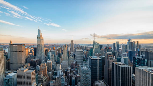
Above the skyscrapers of New York City at the end of the day.

An aerial view over the Pelham Bay Bridge on a sunny morning in the Bronx, New York

Sunset above New York City, as seen from Washington Heights.

View above New York City, as seen from Washington Heights.

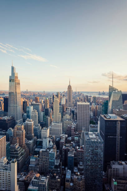
July 2022 - New York, USA - Manhattan buildings in the evening viewed from high up, New York

Aerial view of Manhattan College with train station

Nizhniy Novgorod River Bridge traffic

Above the skyscrapers of New York City at the end of the day.

New York City's Midtown, Upper East and West Side and Central Park in New York, NY, United States
June 2022 - New York, NY, USA - Buildings in Manhattan

June 2022 - New York, United States - Times Square intersection in New York City

View above New York City, as seen from Washington Heights.

Aerial isometric illustration of an urban neighborhood, with townhomes, row houses, apartment buildings, schools, businesses, streetcars, parks, traffic, and other details.

An aerial view over the Pelham Bay Railroad Bridge on a sunny morning in the Bronx, New York

July 2022 - New York, USA - Manhattan buildings in the evening viewed from high up, New York

An aerial view of racquetball and tennis courts in a park in Pelham Bay, Bronx, New York

Sunset above Bronx, Queens, Long Island, New York City, as seen from Washington Heights.

The Bronx map outline isolated on white background, New York City

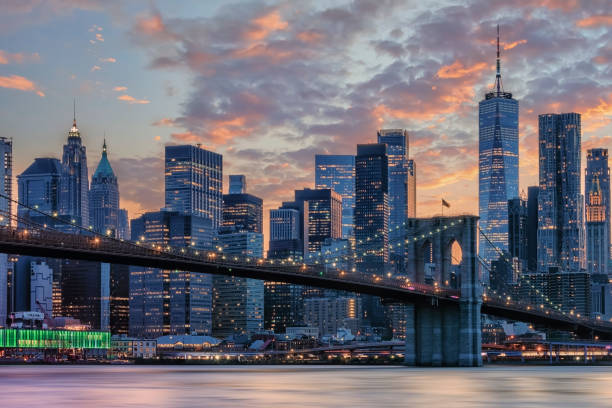
New York City viewed from the Manhattan bridge

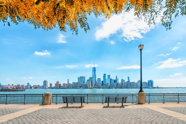
Aerial View of New York City and its Boroughs, Rivers, and Bridges

Bronx, United States – July 19, 2023: An aerial view of abandoned judging stand overlooking Orchard Beach Lagoon in the Bronx, New York

Aerial view on 145th Street Bridge between Manhattan and Bronx NYC, New York City, USA

Aerial view of Throgs Neck and Whitestone bridges.

3D Render of a Topographic Map of New York City, USA. All source data is in the public domain. Color and Water texture: Contains modified Copernicus Sentinel data courtesy of ESA. URL of source image: https://dataspace.copernicus.eu/explore-data/data-collections/sentinel-data/sentinel-2 Relief texture: SRTM data courtesy of NASA JPL (2020). URL of source image: https://lpdaac.usgs.gov/products/srtmgl1v003/

Aerial view of an American football field and running track at the Williamsbridge Oval in the Bronx, New York City, in the fall, with people playing football and running in the heart of the city.

Cityscape Panorama: Spuyten Duyvil Creek, Columbia University campus Baker Athletic Complex, Manhattan and Bronx, Marble Hill, Inwood, Spuyten Duyvil, Fordham Manor, Fordham Heights, Bronx, Manhattan,

George Washington Bridge and Manhattan aerial view - New York.

United States, New York Bronx travel landmarks, vector city tourism illustration

Aerial view of the Henry Hudson Bridge in the Bronx, New York

Bronx-Whitestone Bridge from above

3D Render of a Topographic Map of New York, Long Island. All source data is in the public domain. Color and Water texture: Contains modified Copernicus Sentinel data courtesy of ESA. URL of source image: https://dataspace.copernicus.eu/explore-data/data-collections/sentinel-data/sentinel-2 Relief texture: 3DEP data courtesy of USGS. URL of source image: https://apps.nationalmap.gov/downloader/#/

July 2022 - New York, USA - Manhattan buildings in the evening viewed from high up, New York

Aerial view of the Bronx, New York City, in the morning. High angle view of the Norwood neighborhood with apartment buildings and elevated subway tracks and a subway train leaving the station.