Tuscaloosa is a city in and the seat of Tuscaloosa County in west central Alabama
Browse 600+ tuscaloosa stock photos and images available, or search for tuscaloosa al or lake tuscaloosa to find more great stock photos and pictures.
Tuscaloosa is a city in and the seat of Tuscaloosa County in west central Alabama

The Federal Building and Courthouse in downtown Tuscaloosa, Alabama.
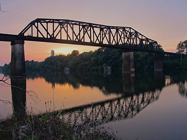
A classic train bridge spans the Black Warrior River at sunset.

High Angle View of University Boulevard in Tuscaloosa, Alabama on a Sunny Winter Day with a View of Denny Chimes and Woods Quad near Bryant-Denny Stadium

Tuscaloosa is a city in and the seat of Tuscaloosa County in west central Alabama

A map pin with a red flag pinpoints the city on a select area from a high quality map. The red flag creates highlighted copy space for text.

Walking and biking trail with wooden railings along the riverfront in Tuscaloosa, Alabama.
Tuscaloosa, AL - December 2020: Bryant-Denny Stadium on the campus of The University of Alabama on an overcast day.

Rusty railroad train bridge reflecting in river

Looking down river at large truss railroad train bridge in silhouette with sunset reflecting in water
![US capital cities on map series: Tuscaloosa, MS [url=/file_search.php?action=file&lightboxID=11838152#e650b4d][img]http://farm8.staticflickr.com/7189/6818724910_54c206caf8.jpg[/img][/url] tuscaloosa stock pictures, royalty-free photos & images](https://media.istockphoto.com/id/181852377/photo/us-capital-cities-on-map-series-tuscaloosa-ms.jpg?s=612x612&w=0&k=20&c=gMWLd8C8PMN0m1WSU1HDDwJpLouEp306lGbuZlSdu_g=)
[url=/file_search.php?action=file&lightboxID=11838152#e650b4d][img]http://farm8.staticflickr.com/7189/6818724910_54c206caf8.jpg[/img][/url]

Looking down river at old railroad train truss bridge reflecting in foggy water

Tuscaloosa, Alabama, USA - March 21, 2008: Aerial view of the Bryant-Denny Stadium located on The University of Alabama campus in Tuscaloosa, Alabama (USA). This image was taken about two years prior to the south end zone expansion.

Looking up at old rusty railroad train bridge crossing river with reflection
Tuscaloosa, Alabama, USA - February 9, 2011: Alabama Crimson Tide logo in brick pattern in sidewalk leading to entrance of the Paul W. Bryant Museum. Paul \'Bear\' Bryant was a famous football coach at the university.

A tug boat pushes empty cargo containers back to home port at the end of the day. Tuscaloosa, Alabama

"Tuscaloosa, Alabama, USA - October 27, 2012: Big Al mascot in the 2012 University of Alabama homecoming day parade in Tuscaloosa, Alabama. Close up taken near stadium on University Boulevard."

"Tuscaloosa, Alabama, USA - October 27, 2012: Large crowd waiting along University Boulevard for the 2012 University of Alabama homecoming day parade in Tuscaloosa. Taken near Bryant Denny Stadium."

A vertical shot of the Shelton State Community College yard with a stone watch sculpture with bells in Old Greensboro Rd, Tuscaloosa, USA

Football stadium with field ready to be lined.

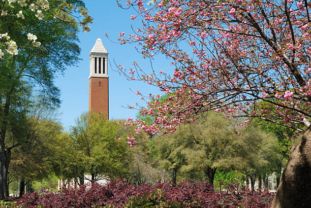
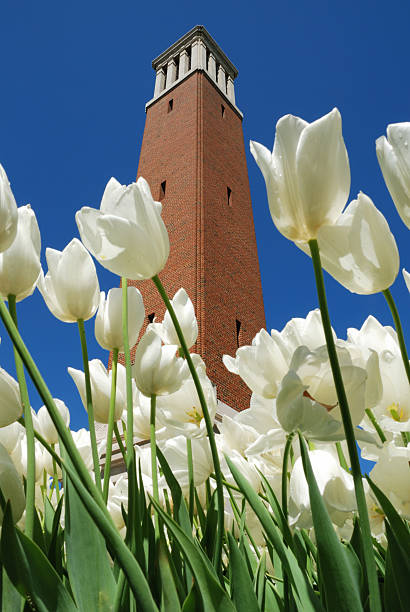
Tuscaloosa, Alabama, USA - April 16, 2008: Denny Chimes bell tower on the quad at The University of Alabama campus during the spring. Campus located in Tuscaloosa, Alabama.

Tuscaloosa, Alabama, USA - October 8, 2011: Big Al riding in back of four wheeler in the Homecoming Parade for The University of Alabama. Image taken on University Boulevard near the stadium on The University of Alabama campus in Tuscaloosa, Alabama.

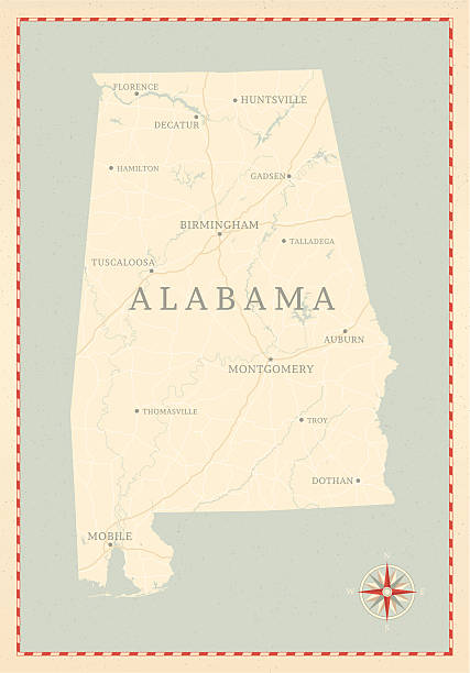
Alabama State on a 1880's map. Alabama is a state located in the southeastern region of the United States. It is bordered by Tennessee to the north, Georgia to the east, Florida and the Gulf of Mexico to the south, and Mississippi to the west. Alabama is the 30th-most extensive and the 23rd-most populous of the 50 United States. Selective focus and Canon EOS 5D Mark II with MP-E 65mm macro lens.
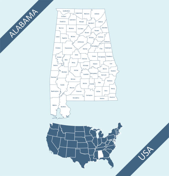
Downloadable and printable counties map of Alabama with its spatial location on USA map. The map is accurately prepared by a map expert with highly detailed borders which are ready to editing and recoloring.

"Tuscaloosa, Alabama, USA - October 27, 2012: Female brass player marching in The Million Dollar Band during the 2012 University of Alabama homecoming day parade in Tuscaloosa. Close up taken near stadium on University Boulevard."

Fall on university campus with copy space

A beautiful scenery of this large lake in the spring.

Tuscaloosa, USA - May 11, 2011: Sign for the University of Alabama entrance in Tuscaloosa, Alabama. Sign located on University Drive on the west side of campus with teaching, research, and service.
TUSCALOOSA, AL/USA - JUNE 6, 2018: Bryant-Denny Stadium on the campus of University of Alabama.
A vintage-style map of Alabama with freeways, highways and major cities. Shoreline, lakes and rivers are very detailed. Includes an EPS and JPG of the map without roads and cities. Texture, compass, cities, etc. are on separate layers for easy removal or changes.

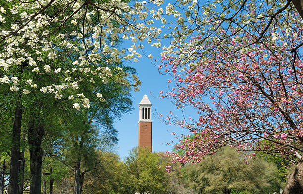
Tuscaloosa, Alabama, USA - April 16, 2008: Denny Chimes bell tower on the quad at The University of Alabama campus during the spring. Campus located in Tuscaloosa, Alabama.

Long version of football stadium tunnel with fence.

Tuscaloosa, Alabama, USA - November 12, 2008: Illuminated Denny Chimes bell tower on the The University of Alabama campus after a storm. Campus located in Tuscaloosa, Alabama.

"Tuscaloosa, Alabama, USA - October 27, 2012: Mother holding childs hand and looking down street for start of the 2012 University of Alabama homecoming day parade in Tuscaloosa. Close up taken near stadium on University Boulevard."

Tuscaloosa, Alabama, USA - February 8, 2011: Sign on southeast corner of Bryant Denny Stadium on The University of Alabama campus in Tuscaloosa, Alabama. Flowers in front of curved flower bed.
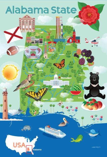
Vector Alabama State Travel Map https://maps.lib.utexas.edu/maps/united_states/fed_lands_2003/alabama_2003.pdf https://maps.lib.utexas.edu/maps/united_states/us_general_reference_map-2003.pdf

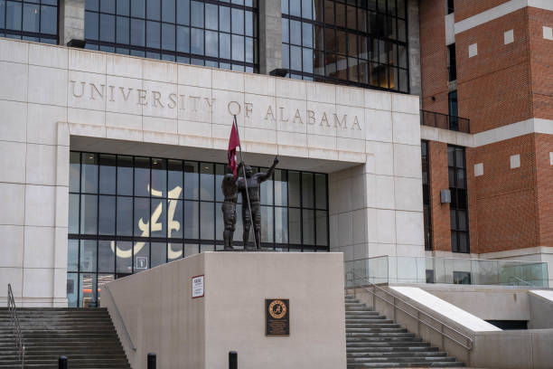
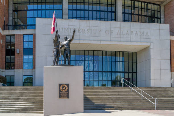
Tuscaloosa, USA - May 12, 2011: North end zone entrance to The University of Alabama football stadium in Tuscaloosa, Alabama. University logo and statue visible.

Tuscaloosa, Alabama, USA - March 31, 2010: Modern blue water tower for City of Tuscaloosa, with sign, located in south part of town.

Tuscaloosa AL City Vector Road Map Blue Text. All source data is in the public domain. U.S. Census Bureau Census Tiger. Used Layers: areawater, linearwater, roads.

Vector Illustration of a City Street Map of Tuscaloosa, Alabama, USA. Scale 1:60,000. All source data is in the public domain. U.S. Geological Survey, US Topo Used Layers: USGS The National Map: National Hydrography Dataset (NHD) USGS The National Map: National Transportation Dataset (NTD)