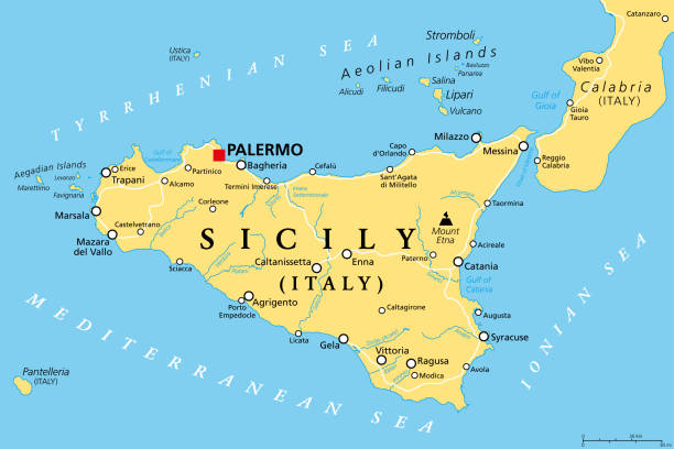
Sicily, autonomous region of Italy, political map, with capital Palermo, Aeolian and Aegadian Islands, volcano Etna, and important cities. Largest island in the Mediterranean Sea. Illustration. Vector
Browse 1,600+ sicily map stock illustrations and vector graphics available royalty-free, or search for palermo sicily to find more great stock images and vector art.
Sicily, autonomous region of Italy, political map, with capital Palermo, Aeolian and Aegadian Islands, volcano Etna, and important cities. Largest island in the Mediterranean Sea. Illustration. Vector

Highly detailed physical map of Sicily in vector format,with all the relief forms,regions and big cities.

Detailed vector road map of island sicily italy

Road vector map of the italian mediterranean island Sicily with flag

Stylized map of Sicily with traditional symbols of nature, cuisine and culture

Sicily vector map, divided into provinces
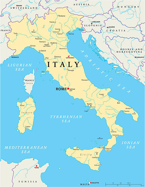
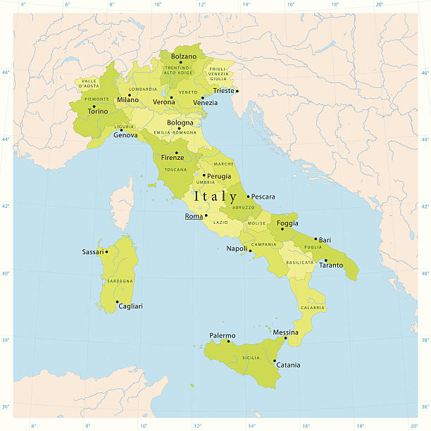
Political map of Italy with capital Rome, the Vatican and San Marino, with national borders, most important cities, rivers and lakes. Vector illustration with English labeling and scaling.

Sicily regions map with labels isolated on white background

Political map of Italy with national borders, cities and rivers

High Quality map of Sicily is a state of Italy, with borders of the districts

Detailed map of Sicily.

Highly detailed physical map of Italy in vector format,

Sicily, autonomous region of Italy, gray political map, with capital Palermo, Aeolian and Aegadian Islands, volcano Etna and important cities. Largest island in Mediterranean Sea. Illustration. Vector

Vector map and flag of sicily, Italy
Map of Sicily for your own design. Four maps with editable stroke included in the bundle: - One black map on a white background. - One blank map on a black background. - One white map with shadow on a blank background (for easy change background or texture). - One line map with only a thin black outline (in a line art style). The layers are named to facilitate your customization. Vector Illustration (EPS10, well layered and grouped). Easy to edit, manipulate, resize or colorize. Vector and Jpeg file of different sizes.

Meyers Konversations-Lexikon. Ein Nachschlagewerk des allgemeinen Wissens, 5th edition 17 volumes Bibliographisches Institut - Leipzig 1895-1897
Detailed vector map of Italy with regions.

Stylized map of Sicily with traditional symbols of nature, cuisine and culture

Map of Italy and Travel Icons.Italy Travel Seamless Pattern. Vector Illustration.

an old map of italy - 1863

Editable high quality illustration of the mediterranean island of Sicily simple flat style black line vector map isolated on white.

Palermo Italy City Map in Retro Style. Outline Map. Vector Illustration.

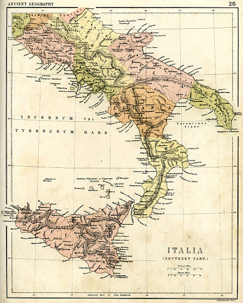
Vintage illustration of Antique map of Southern Italy in Ancient times, Italiae Antiquae pars meridionalis. Atlas of Ancient Geography. By Samuel Butler

Antique Italian map from Italy Handbook for Travellers by K. Baedeker, 1893.
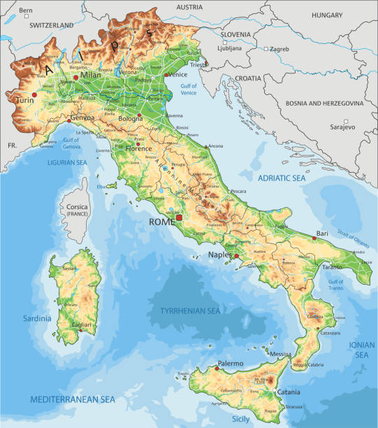
High detailed Italy physical map with labeling. Organized vector illustration on seprated layers.

Flag of Sicily in the form of a map of the island

Sicily vector Sicilian island map with cathedral architecture art culture and traditional Italian food illustration tourism. Set of icons etna volcano ceramic souvenir isolated on white background.
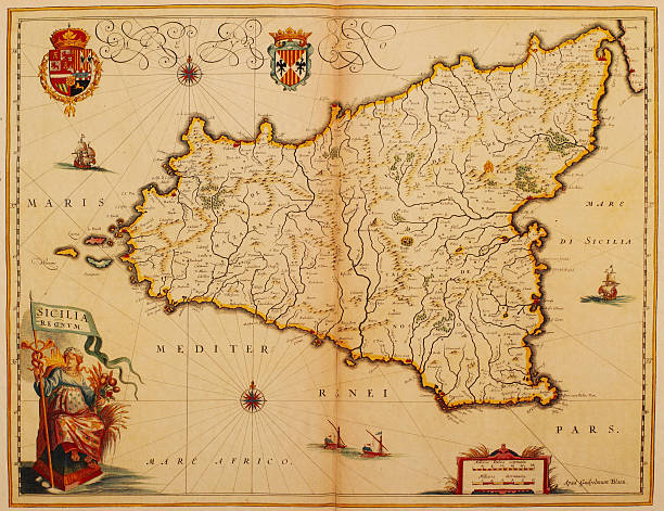
Antique map of the island of Sicily. Published by the Dutch cartographer Willem Blaeu in Atlas Novus (Amsterdam 1635). Photo by N. Staykov (2007)CLICK ON THE LINKS BELOW FOR HUNDREDS OF SIMILAR IMAGES:

Highly detailed physical map of Italy,in vector format,with all the relief forms,regions and big cities.

Map of Sicily in a trendy vintage style. Beautiful retro illustration with old textured paper (colors used: blue, green, beige and red). Vector Illustration (EPS10, well layered and grouped). Easy to edit, manipulate, resize or colorize. Vector and Jpeg file of different sizes.

Andres Allgemeiner Handatlas - Bielefeld und Leipzig 1896
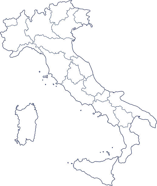
Silhouette contour border map of the Italy
Vintage map from 1861 of Southern Italia in ancient times

an old map of southern italy (inset showing malta) - 1855
Highly detailed vector map of Italy. File was created on September 5, 2011. The colors in the .eps-file are ready for print (CMYK). Included files: EPS (v8) and Hi-Res JPG.
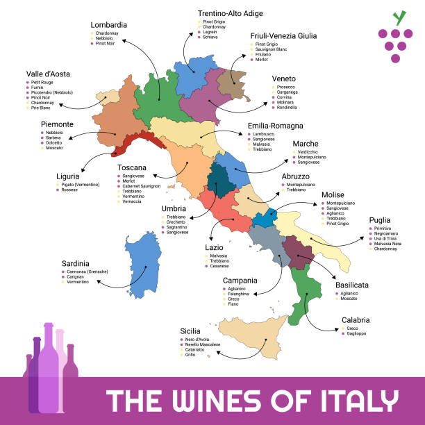
Vector illustration of the map of all the different kinds of wines in every region in Italy.

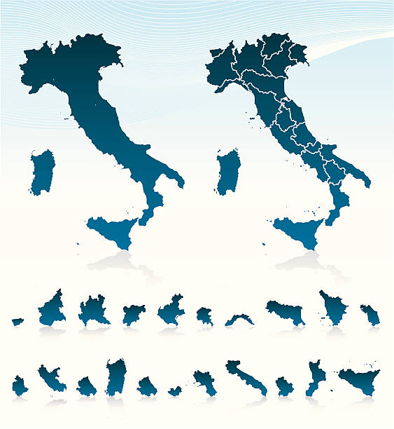
Italy political map of administrative divisions - regions. Solid blue blank vector map with white borders.

Sicily island map vector illustration, scribble sketch Sicily island

"Vintage map of Magna Graecia, showing the settlements of the ancient greeks in Italy. Magna GrA|cia is the name of the coastal areas of Southern Italy on the Tarentine Gulf that was extensively colonized by Greek settlers around the eighth century BC ."

Map of Italy for your own design. Three maps with editable stroke included in the bundle: - One black map on a white background. - One line map with only a thin black outline in a line art style (you can adjust the stroke weight as you want). - One map on a blank transparent background (for change background or texture). The layers are named to facilitate your customization. Vector Illustration (EPS file, well layered and grouped). Easy to edit, manipulate, resize or colorize. Vector and Jpeg file of different sizes.

Map of Italy in a trendy vintage style. Beautiful retro illustration with old textured paper and light rays in the background (colors used: blue, green, beige and black for the outline). Vector Illustration (EPS10, well layered and grouped). Easy to edit, manipulate, resize or colorize.

Sicily region location within Italy 3d map

Map of Sicily sketched and isolated on a white background. The map is purple with a black outline. Pink and blue are overlapped to create a modern visual effect, looking like anaglyph image. The combination of pink and blue in this illustration creates a predominantly purple map. Vector Illustration (EPS file, well layered and grouped). Easy to edit, manipulate, resize or colorize. Vector and Jpeg file of different sizes.

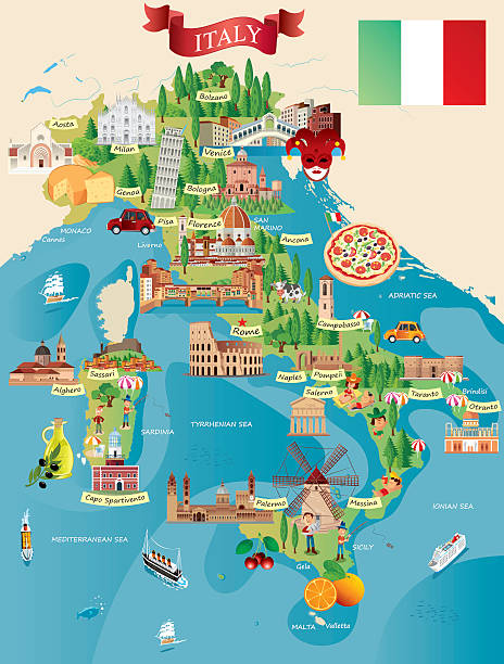
Stylized map of Italy with main attractions and landmarks. Vector illustration

Itali Travel map illustration with Italian landmarks.

Detailed negative navigation urban street roads map on dark gray background of the quarter Monte Po-Nesima/San Leone-Rapisardi district of the Italian regional capital city of Catania, Italy

Colorful Italy political map with clearly labeled, separated layers. Vector illustration.

Vector illustration of map of Italy with famous destinations and cities Rome, Venice, Florence, Milan