Highly detailed physical map of Andaman and Nicobar islands in vector format,with all the relief forms,regions and big cities.
Browse 260+ andaman stock illustrations and vector graphics available royalty-free, or search for andaman sea or andaman islands to find more great stock images and vector art.
Highly detailed physical map of Andaman and Nicobar islands in vector format,with all the relief forms,regions and big cities.
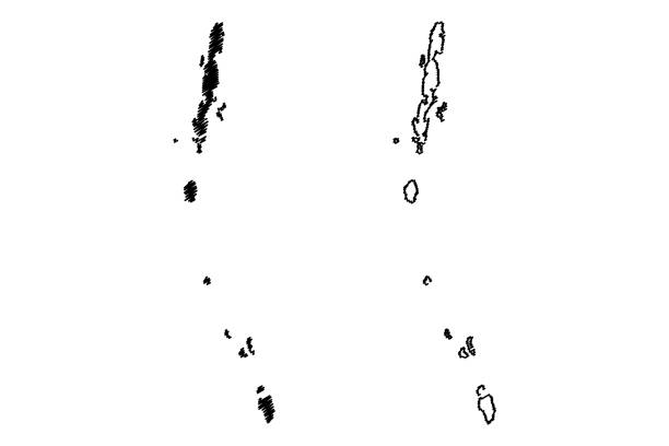
Andaman and Nicobar Islands (States and union territories of India, Federated states, Republic of India) map vector illustration, scribble sketch Andaman and Nicobar Islands map

Chhattisgarh, Andaman and Nicobar Islands, Dadra and Nagar Haveli and Daman and Diu Indian states vintage plates. Vector travel destination aged signs, India landmarks. Retro boards or banners set
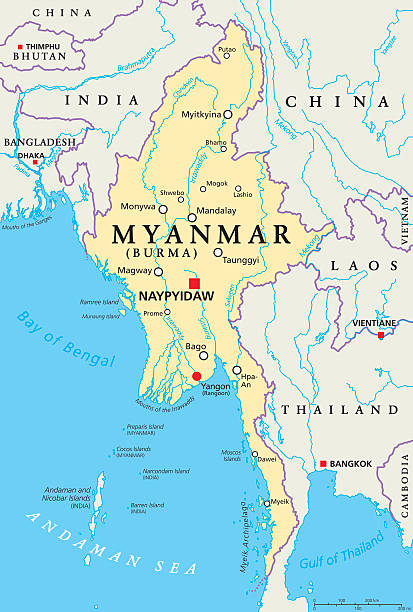
Myanmar political map with capital Naypyidaw, national borders, important cities, rivers and lakes. Also called Burma and old capital Rangoon, Yangon. English labeling. Illustration.
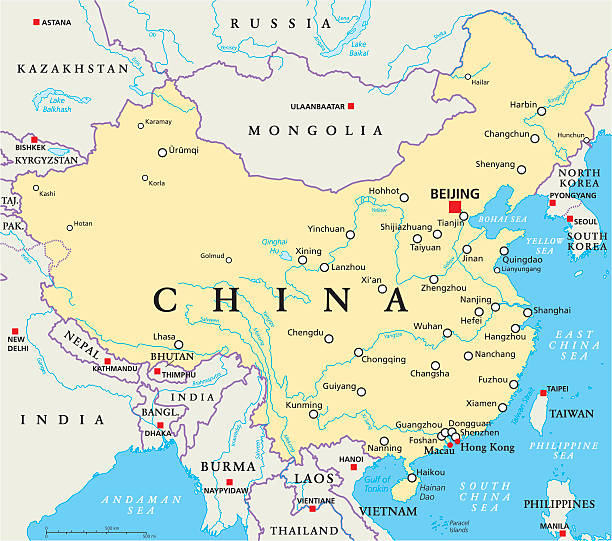
China political map with capital Beijing, national borders, important cities, rivers and lakes. English labeling and scaling. Illustration.

Thailand Political Map with capital Bangkok, national borders, most important cities, rivers and lakes. English labeling and scaling. Illustration.
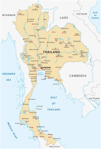
Thailand vector map

Indian Ocean political map. Countries and borders. World's third largest ocean division, bounded by Africa, Asia, Antarctica and Australia. Named after India. Illustration. English labeling. Vector.

Isolated colombian indigenous man Colombian culture Vector illustration

Strait of Malacca, political map. Important shipping lane and a main shipping channel between Malay Peninsula (Peninsular Malaysia) and Sumatra (Indonesia), connecting Andaman Sea and South China Sea.

Detailed phuket road and beach vector map.

india administrative and political zones vector map

Northern part of Mainland Southeast Asia, multi colored political map, with borders and capitals. Formerly known as Indochina, with the countries Thailand, Vietnam, Myanmar, Laos, and Cambodia.
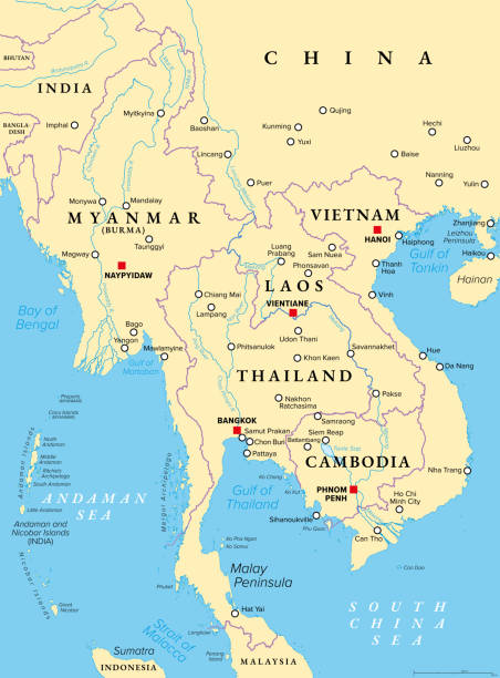
Mainland Southeast Asia, northern part of formerly known Indochina, political map. The countries Thailand, Vietnam, Myanmar, Laos, and Cambodia, with borders, their capitals and largest and cities.

Thailand administrative and political vector map
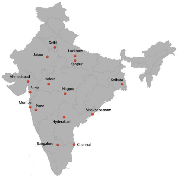
detailed map of the India with cities

Strait of Malacca, gray political map. Important shipping lane and a main shipping channel between Malay Peninsula (Peninsular Malaysia) and Sumatra (Indonesia) connecting Andaman and South China Sea.

Northern part of Mainland Southeast Asia, transport political map. Countries Thailand, Vietnam, Myanmar, Laos, and Cambodia, with the most important waterways on rivers, and with the largest cities.
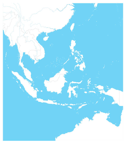
Southeast Asia Outline Map. Vector illustration.

Physical map of Phuket with road and highway network

Top view of a girl in a swimsuit on a swimming circle in a swimming pool or the sea with a copyspace for banner, poster or article

Bay of Bengal, political map. Northeastern part of the Indian Ocean and largest bay of the world, positioned between the Indian subcontinent and Indochinese peninsula, located below the Bengal region.

landscape of cave on the beach

Vintage illustration of Port Blair, capital city of the Andaman and Nicobar Islands, a union territory of India in the Bay of Bengal, 1870s

Phuket, largest Island of Thailand, political map with surrounding area. Popular tourist region with plenty of islands, south of Malay Peninsula, in the Andaman Sea and north of the Strait of Malacca.

Southern of thailand, Phi Phi Island, Krabi, vector

Girl in a swimming circle at sea with copyspace on blue background, top view, flat lay. Minimal composition

Penang, a state of Malaysia in Southeast Asia, gray political map. Located on the coast of Peninsular Malaysia along Strait of Malacca in the Andaman Sea, with capital George Town on Penang Island.

Political map of India with national borders, cities and rivers

Southeast Asia Map Detailed Vintage Colors.All elements are separated in editable layers clearly labeled.

Thailand country detailed editable map with regions cities and towns, roads and railways, geographic sites. Vector EPS-10 file

The different depths of the sea and the ocean around the world

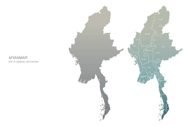
Republic of the Union of Myanmar vector map
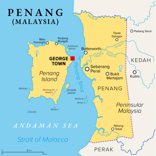
Penang, a state of Malaysia in Southeast Asia, political map. Located on the coast of Peninsular Malaysia along the Strait of Malacca in the Andaman Sea, with capital George Town on Penang Island.

Highly detailed physical map of Indochina in vector
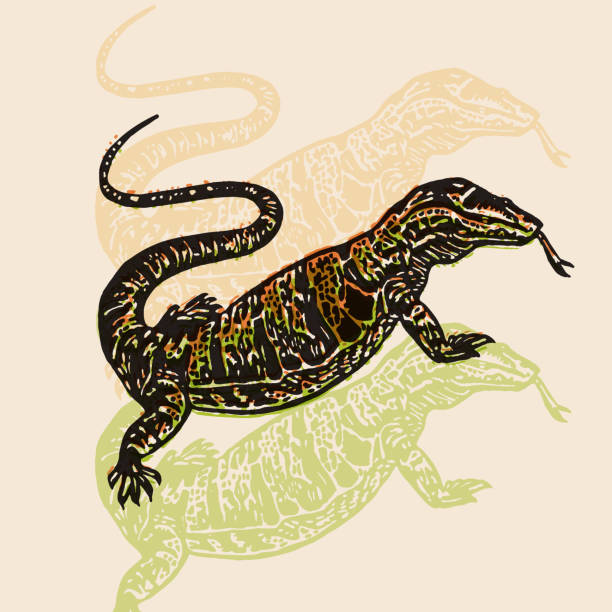
Desert Varan sign. Desert Varan. Vector engraved Illustration. Linocut Varan Isolated on beige background

Illustration of Thailand's Island at sunset

Beautiful exotic nature.
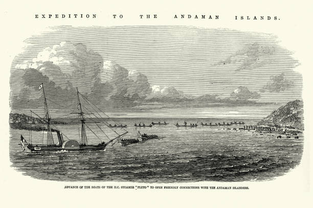
Vintage illustration H.C. Steamer Pluto to open friendly connections with the Andaman Islanders, Expedition to the Andaman Islands, 1858, Victorian exploration 19th Century

india administrative and political zones vector map

Desert Varan sign. Desert Varan. Vector engraved Illustration. Linocut Varan Isolated on old paper