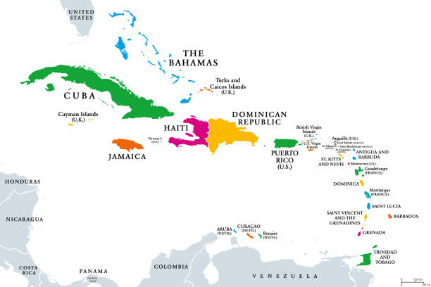
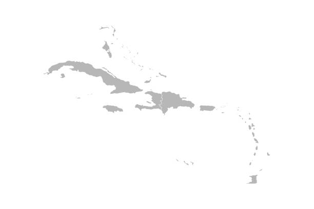
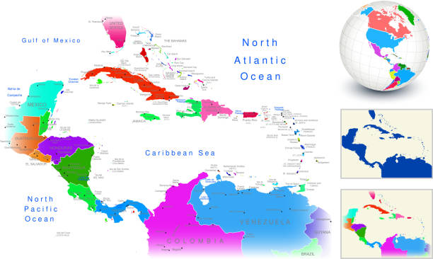
The Caribbean, colored political map. Subregion of the Americas in the Caribbean Sea with its islands and English names. The Greater Antilles and the Lesser Antilles. Isolated illustration over white.
Browse 105,400+ carribean stock illustrations and vector graphics available royalty-free, or search for carribean beach or carribean food to find more great stock images and vector art.
The Caribbean, colored political map. Subregion of the Americas in the Caribbean Sea with its islands and English names. The Greater Antilles and the Lesser Antilles. Isolated illustration over white.

June is Caribbean American Heritage Month geometric shape pattern background template.
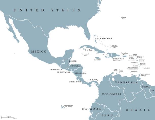
Middle America political map with borders and English labeling. Countries of southern North America, the nations of Central America and the Caribbean. Gray illustration on white background. Vector.
Caribbean island map vector graphics design. Gray background. Perfect for business concepts, backgrounds, backdrop, banner, poster, sticker, label and wallpapers.
Abstract boho stripe seamless pattern. Geometric reputable motif in fun bright tropical summer color. For fabric, background, wrapping paper, wallpaper, decor. Stock vector illustration.
High detailed Map of Central America with national borders, countries and navigational icons
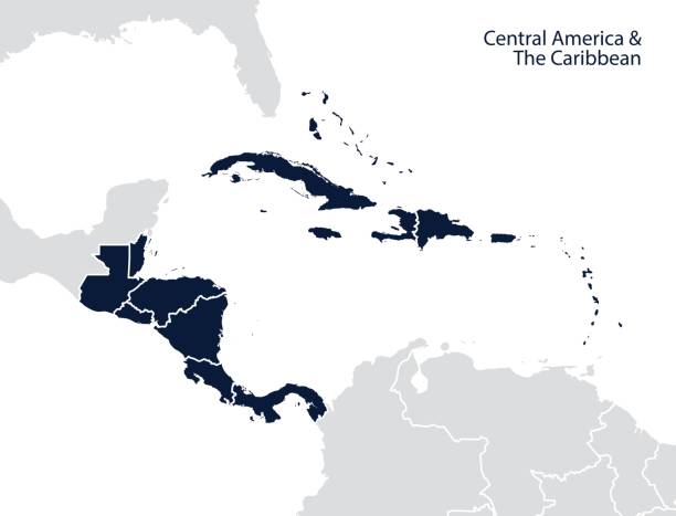
Central America and the Caribbean map. Vector

Caribbean Travel poster tropical resort vintage. Beach coast, palms, ocean, sutf. Paradise resort, retro style illustration vector postcard
National Caribbean Heritage Month. Vector banner, poster for social networks and media. Concept with palm leaves on blue background. Horizontal composition with text National Caribbean Heritage Month.
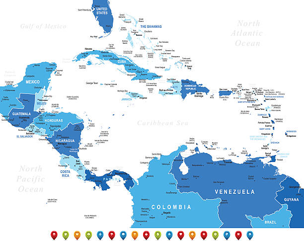
Latin America map, North America, Caribbean, Central America, South America.

Map of Central America with names of countries, capitals and cities. Vector illustration
Empty Blue Map of Central America

Lesser Antilles political map. The Caribbees with Haiti, the Dominican Republic and Puerto Rico in the Caribbean Sea. With capitals and national borders. English labeling. Illustration. Vector.

Hispanic heritage month background. Vector web banner, poster, card for social media, networks. Greeting national Hispanic heritage month, tropical flowers on background with blue, yellow color
Lesser Antilles political map. Caribbees with Haiti, Dominican Republic and Puerto Rico in the Caribbean Sea. Gray illustration with English labeling on white background. Vector.Illustration. Vector.

Jungle background with tropical palm leaves. Exotic plants template for your design, banner, poster, fashion, interior. Vector illustration.

Caribbean American Heritage month - celebration in USA. Bright colorful summer banner template design with palm leaves foliage silhouette
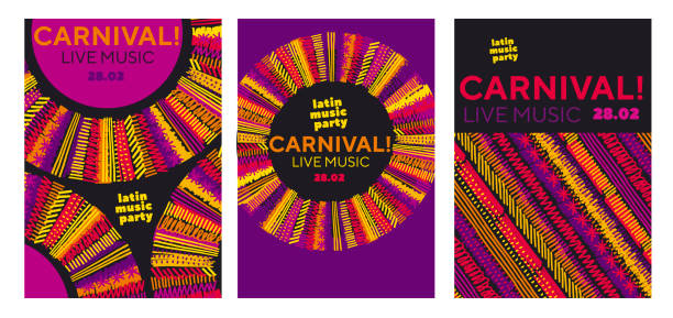
Abstract latin music carnival poster. Tropical color sketch-style striped pattern for party poster, invitation, cover. Stock vector illustration.
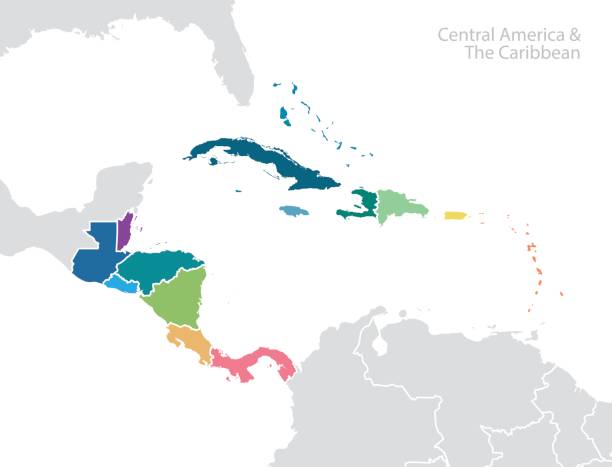
Central America and the Caribbean map. Vector

Central America - high detailed political map Central American and Caribbean region with country, ocean and sea names labeling.

Hand drawn illustration of guitar - cuban tres, hat and maracas. TRopical vibe vacation concept. T-shirt design.
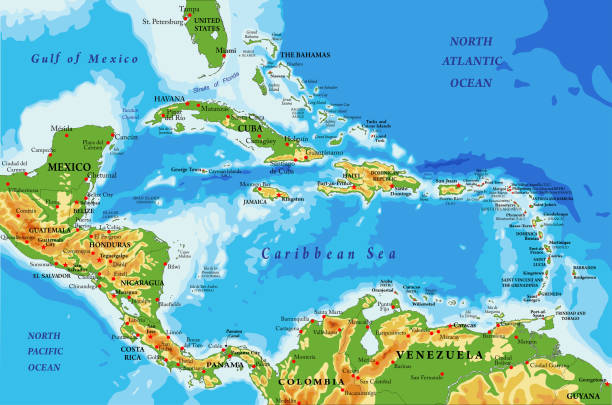
Highly detailed physical map of Central America and Caribbean Islands,in vector format,with all the relief forms,regions and big cities.
Greater Antilles political map. Vector illustration

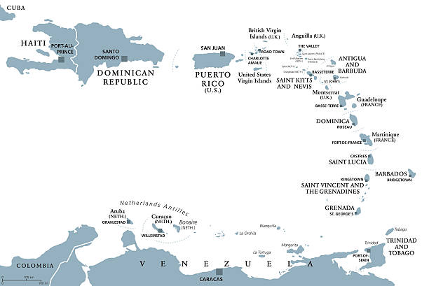
Eastern Caribbean islands, political map. Puerto Rico, Virgin Islands, Leeward and Windward Islands, and part of the Leeward Antilles north the coast of Venezuela, all located in the Caribbean Sea.

classic reggae color music background. Jamaica seamless pattern poster vector illustration
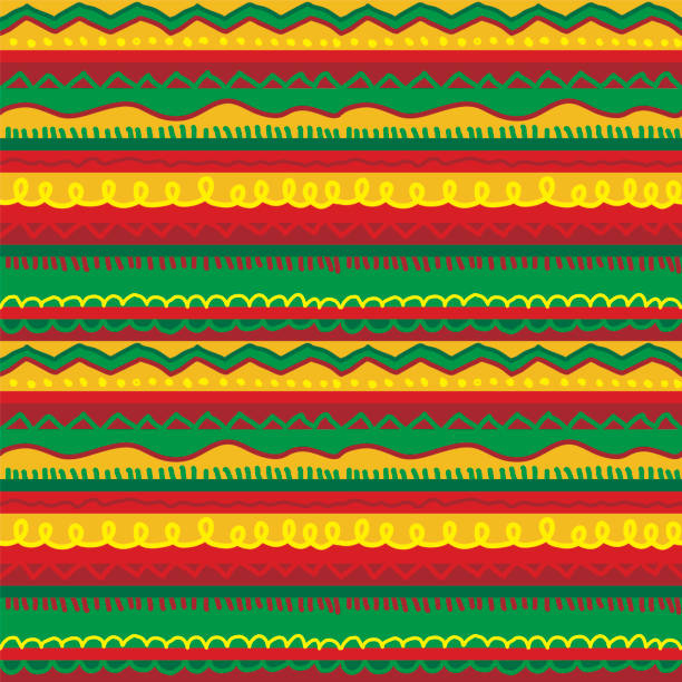
Folk hand drawn stripes rug seamless pattern in reggae music colors. Yellow, red and green Jamaica summer color tribal repeatable motif for surface design, textile, background, wrap, packing.
Groovy Summer Icons in Boho Style. Vector Abstract Square Tropical Illustrations in Freehand. Geometric Bird, Sun, Sea Wave, Palm, Flower, Pineapple and Turtle for Logo, Patterns, Print, Stickers

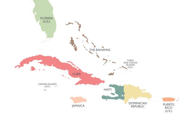
Greater Antilles in the Caribbean, multicolored political map. Grouping of larger islands in the Caribbean Sea, including Cuba, Hispaniola, Puerto Rico, Jamaica, Navassa Island and the Cayman Islands.
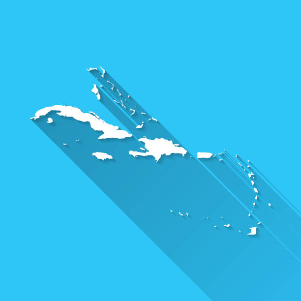
White map of Caribbean isolated on a blue background with a long shadow effect and in a flat design style. Vector Illustration (EPS10, well layered and grouped). Easy to edit, manipulate, resize or colorize.

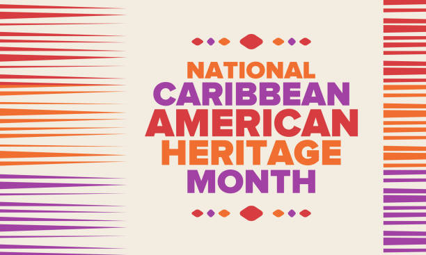
June is National Caribbean American Heritage Month. Holiday concept. Template for background, banner, card, poster with text inscription. Vector EPS10 illustration

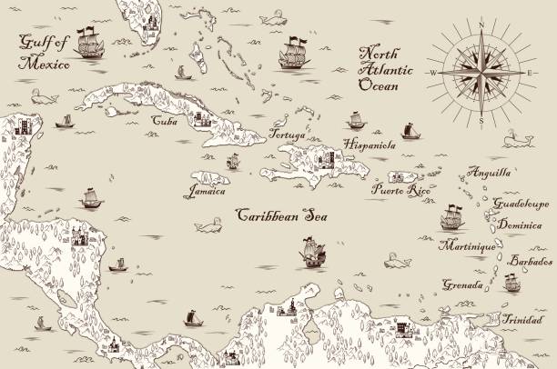
Old vintage map of caribbean sea. Vector worn parchment with ships, islands and land, wind rose and cardinal points. Fantasy world, vintage grunge paper, pirate map with travel locations and monsters
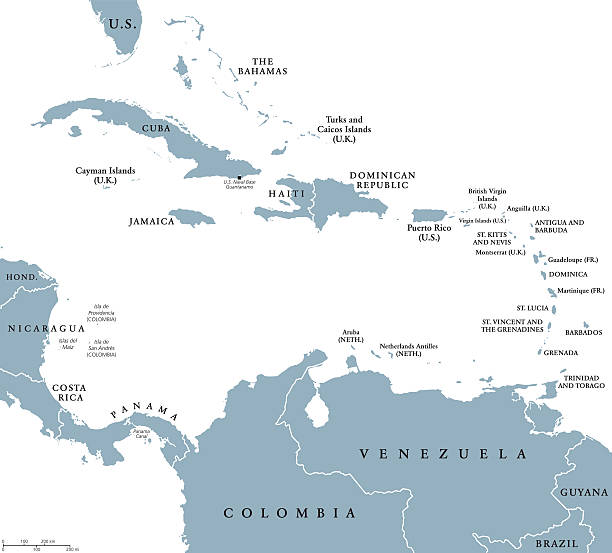
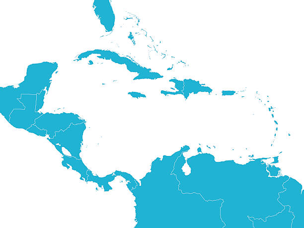
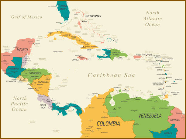
The Caribbean countries political map with national borders. The Caribbean Sea with Greater, Lesser and Leeward Antilles, with West Indies and parts of Central and South America. English labeling.
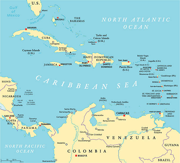
Caribbean political map with capitals, national borders, important cities, rivers and lakes. English labeling and scaling. Illustration.
World Geography Cewntral America

June is Caribbean American Heritage Month palm tree background template.

POLITICAL MAP OF CENTRAL AMERICA
Vector background with Puerto-Rican Caribbean culture traditional symbols and items. Bright colors Central American funny seamless pattern
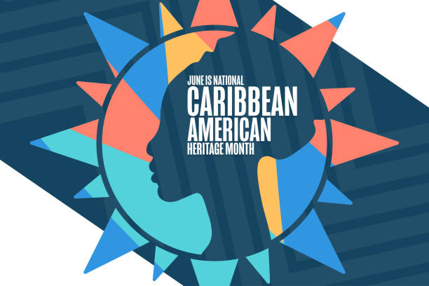
June is National Caribbean American Heritage Month. Holiday concept. Template for background, banner, card, poster with text inscription. Vector EPS10 illustration
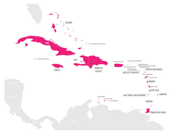
Political map of Carribean. Pink highlighted states and dependent territories. Simple flat vector illustration.
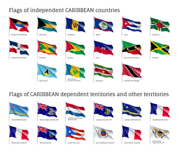
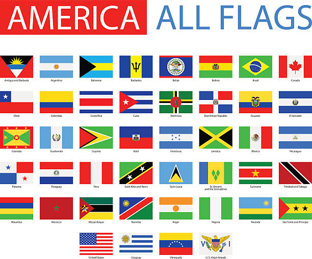
Wavy flags of independent Caribbean countries and dependent territories. Officially recognized flag of state on flagpole. Realistic national and political identity. Patriotic vector illustration.
Central America and The Caribbean Map with Geographical Borders
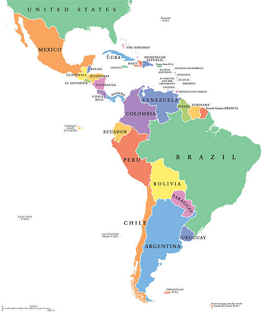
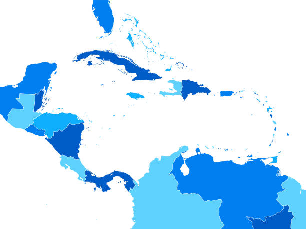
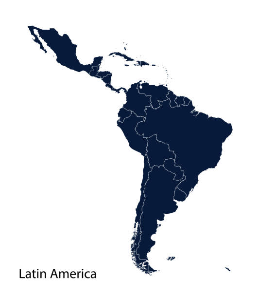
Latin America single states political map. Countries in different colors, with national borders and English country names. From Mexico to the southern tip of South America, including the Caribbean.

Colorful Summer banners, tropical backgrounds set with palms, sea, clouds, sky, beach. Beautiful Summer Time cards, posters, flyers, party invitations. Summertime, template collection.
bright vector seamless pattern in tribal style

Floral postcard design with guzmania and hibiscus flowers, monstera and royal palm leaves. Exotic hawaiian background. Vector illustration.
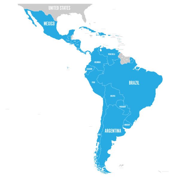
Political map of Latin America. Latin american states blue highlighted in the map of South America, Central America and Caribbean. Vector illustration.
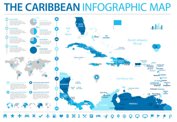
The Caribbean Map - Detailed Info Graphic Vector Illustration
A set of jamaican themed icons. See below for more travel images and other city and country icon sets. If you can't see a set you require, message me I take requests!