seaport from above
Browse 690+ dock top view stock illustrations and vector graphics available royalty-free, or search for boat dock top view or lake dock top view to find more great stock images and vector art.
seaport from above

Illustration of an island in the middle of the ocean. Cargo port in flat style. Top view.
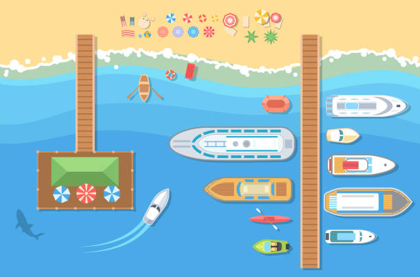
Beach top view - modern vector colorful illustration. A landscape with different types of boats, launch, pier, shark, recreation zone with umbrellas and beds

Top view of logistics with cargo train and cargo ship at the shipping port.Warehouse loading hub.Semi trucks for loading or unloading goods,factory, industry and transportation,vector illustration.

Dockyard harbor terminal aerial top view with cargo ship and ocean boats vector illustration. Sea terminal port with cargo ship

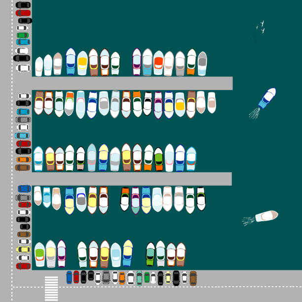
Container ship, yachts, boats, sea transport in the port. Highway top view.

Yachts, boats, sea transport in the port. The helicopter flies over the ocean. Summer, sea, sand, umbrellas, palms.

Wooden piers with boats. Container ship, yachts, boats, sea transport in the port. The helicopter flies over the ocean.

Ship and sea boats in dock. Top view illustrations ship and boat, water transportation vector

Marine top view vector set of sea and beach items and objects.

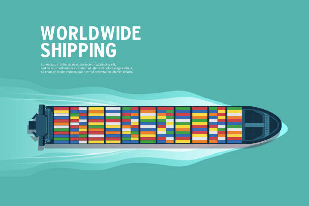
Container ship. Aerial top view. Cargo to harbor. Vector illustration flat design

Transport and logistics service concept. Sea freight service. International transport industry. Vector illustration.

Container ship, cargo ship, yacht, boat and harbor, industry shipping transport, crane and dock.

Container ship, yachts, boats, sea transport in the port. Highway top view.

The five main types of cargo transportation in Brazil. Air, rail, waterway, pipeline and road. logistics of the map of brazil

Fisherman on old wooden pier fishing in pond, top view. Man in hat sitting with fishing rod on shore of lake or river with water plants to catch carp fish or goldfish cartoon vector illustration

Top view sea ship vector illustration. Aerial view of ocean transport. Marine vessel with containers. Carriage and maritime transportation. Worldwide cargo shipments. Sea freight. Logistics banner.

seaport from above at night

Detailed line art of port Hamburg with the Elbphilharmonie. The illustration captures the waterfront, bridges, and industrial buildings along the Elbe River in a black and white sketch style.

Marine Shipping. Cargo port, Seagulls flying, containers. Top view. Ship, sea, shipping transport industry, crane. Editable vector illustration
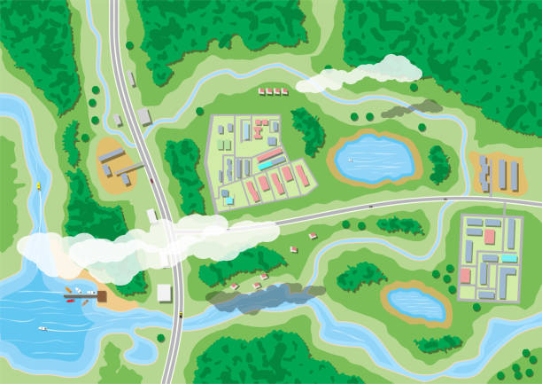
Suburban map with houses with car, boats, trees, road, river, forest, lake and clouds. Village aerial view. Vector illustration in flat style

Set of wooden moorings. View from above. Vector illustration in a flat style.

Sea wooden pier for boats and yachts. Top view design for flyers and brochures, postcards, banners, posters, broadsheets. Vector illustration.
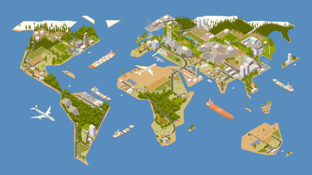
A stylized map of the world illustrated in rich detail includes oceans, forests, and mountains — along with modern supply chains depicted by roadways, railways, and shipping routes. These are utilized by cars, trucks, trains, and container ships, while airplanes, shipping ports, an oil pipeline and an oil tanker ship can also be seen. To supply these trade routes: farms, cattle fields, factories, oil fields, renewable energy sources, and a mining quarry are shown. Villages, towns, and cities dot the map as destinations for this commercial activity. An original stylized map created by the illustrator is presented in isometric view, while the art board uses a 16 x 9 ratio. Major landforms are presented in full color on a blue background.

Boat at the pier on the lake, top view.Summer concept background

Aerial isometric illustration of a beachfront town including beach, boardwalk, amusement park, playground, pier, ocean, jetties, hotels, swimming pools, homes, and other details.

Top view of a pier on the seashore with white yacht and sandy beach. Tropical paradise. Travel and be free. Vector illustration flat design style.

Isometric port city with docked ship being loaded with containers

Ship top view. Seaside cargo boats dockyard terminal vector map above ship illustrations. Sea view top to port with ship, harbor marine

House by the sea or near a lake.

Top view of cargo port with cargo ship full of standard shipping containers .Semi trucks for loading or unloading goods.factory and industry, vector illustration.

Sea port, loading of cargo on Board. Marine shipping. Delivery of the goods. Color containers on the dock with a lifting crane. Seagulls flying on water. Editable vector illustration top view

Vintage engraving of View of Boston from Bunker's Hill, 19th Century

Cargo Ship Illustration on green background

Architectural plan of rebuilding and development of a port harbour. Drawing of new city port.

Northern part of Mainland Southeast Asia, transport political map. Countries Thailand, Vietnam, Myanmar, Laos, and Cambodia, with the most important waterways on rivers, and with the largest cities.
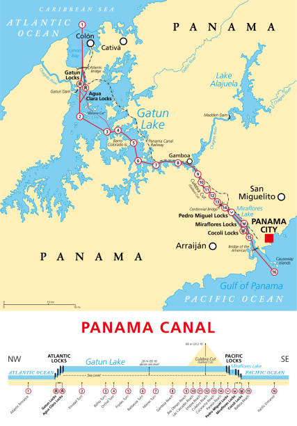
Panama Canal, political map and schematic diagram, illustrating the sequence of locks and passages. An artificial waterway, connecting the Atlantic Ocean with the Pacific Ocean, and expanded in 2016.

ilustration of London city structure.near Waterloo Bridge and London Eye.Map data from© OpenStreetMap contributors.

Northwest Passage, NWP, political map. Sea lane between Atlantic and Pacific Ocean through the Arctic Ocean, along the coast of North America via waterways through the Arctic Archipelago of Canada.

This vector illustration shows a traditional Vietnamese junk boat with vibrant red sails gliding over calm waters, showcasing maritime beauty

Fisherman and boy fishing in water of lake. Elderly grandfather and grandson sitting on old wooden pier to catch fish together, fun summer family adventure in nature cartoon vector illustration

Aerial isometric illustration of a cargo port complete with container ships, cranes, a tug boat, shipping ports, and stacks of cargo containers.

Set of container loaders, gantry and level luffing cranes. Vector illustration isolated on white background

Location pin in hand. Suburban map with houses with car, boats, trees, road, river, forest, lake and clouds. Village aerial view. Map and cartography. Vector illustration in flat style

Red Colored Industrial Ship Illustration. Isometric Container Ship. Vector Transport Icon.

Sum symbol made from Container ships. Zero sum. Economic concept. Vector Illustration