
Doodle vector map of Delaware state of USA. With legends of state and capital
Browse 580+ dover map stock illustrations and vector graphics available royalty-free, or start a new search to explore more great stock images and vector art.
Doodle vector map of Delaware state of USA. With legends of state and capital

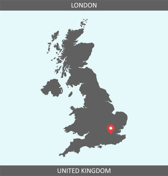
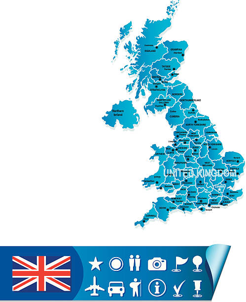
Map of Great Britain (UK) with its capital location, London, for web page, application, and educational purposes. The map is accurately prepared by a map expert.
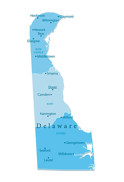
Detailed vector map of the US State of Delaware with administrative divisions. The colors in the .eps-file are ready for print (CMYK). Included files are EPS (v10) and Hi-Res JPG.
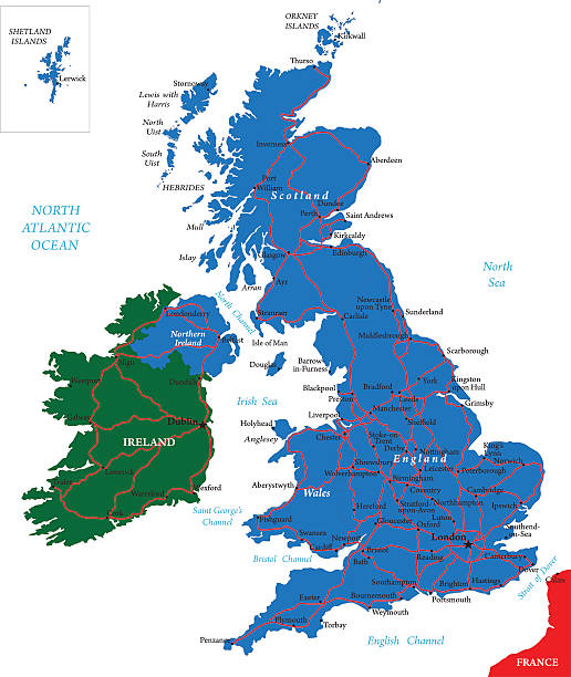
Highly detailed map of United Kingdom.
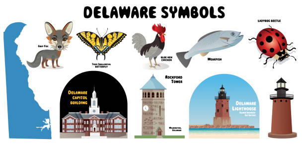
Vector Delaware Symbols I have used http://legacy.lib.utexas.edu/maps/united_states/fed_lands_2003/delaware_2003.pdf http://legacy.lib.utexas.edu/maps/united_states/fed_lands_2003/maryland_2003.pdf address as the reference to draw the basic map outlines with Illustrator CS5 software, other themes were created by myself.
Printable outline vector map of United Kingdom (Great Britain) for educational purposes. The map is accurately prepared by a map expert.
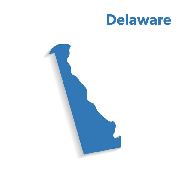
Delaware map shape, united states of america. Flat concept icon symbol vector illustration .

Map of Delaware in a trendy vintage style. Beautiful retro illustration with old textured paper and light rays in the background (colors used: blue, green, beige and black for the outline). Vector Illustration (EPS10, well layered and grouped). Easy to edit, manipulate, resize or colorize.
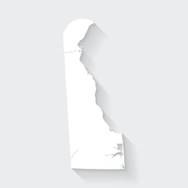
White map of Delaware isolated on a gray background with a long shadow effect and in a flat design style. Vector Illustration (EPS10, well layered and grouped). Easy to edit, manipulate, resize or colorize.

Delaware State map outline isolated on white background

Educational map of Great Britain. UK cities. Isolated on white. Poster, banner, brochure template. Vector illustration.
Isolated U.S.A State With Capital City. The map is on a transparent background (there is no white shape behind it)

Vintage map showing the Cinque Ports in Kent, England, Uk. Vintage etching circa 19th century.

Accurate outline vector map in gray background prepared by a map expert.

colorful geometric Delaware map- vector illustration

vector illustration of Delaware - US State map

Delaware State I have used http://legacy.lib.utexas.edu/maps/united_states/fed_lands_2003/delaware_2003.pdf http://legacy.lib.utexas.edu/maps/united_states/fed_lands_2003/maryland_2003.pdf address as the reference to draw the basic map outlines with Illustrator CS5 software, other themes were created by myself.
http://s017.radikal.ru/i410/1110/e5/b7d44df3f1f1.jpg

Vector Cartoon Map of Delawarehttps://maps.lib.utexas.edu/maps/united_states/fed_lands_2003/delaware_2003.pdfhttps://maps.lib.utexas.edu/maps/world_maps/world_physical_2015.pdf

Highly detailed printable map of North Dakota state county of United States of America for web banner, mobile, smartphone, iPhone, iPad applications and educational use. The map is accurately prepared by a map expert.
This abstract dotted UK map is accurately prepared using the overlaid vector map of the UK with highly detailed information. The map is prepared by a GIS and remote sensing specialist.

Delaware state USA map glowing silhouette outline made of stars lines dots triangles, low polygonal shapes. Communication, internet technologies concept. Wireframe futuristic vector illustration

Vector Delaware Breakwater East End Light
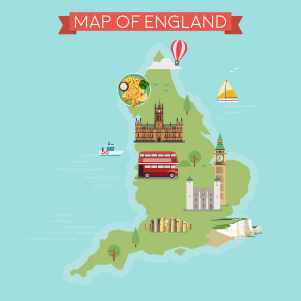
Map of England. Flat style illustration.

The map of Delaware with text and textless

Delaware US State Vector Road Map Grey. All source data is in the public domain. U.S. Census Bureau Census Tiger. Used Layers: areawater, linearwater, urban areas, roads.

E-government. United States vector maps. Microchip Series

Accurate outline vector map in gray background prepared by a map expert.

vector illustration of Delaware - US State map

Map of Delaware in a trendy vintage style. Beautiful retro illustration with old textured paper and a black long shadow (colors used: blue, green, beige and black). Vector Illustration (EPS10, well layered and grouped). Easy to edit, manipulate, resize or colorize.

Map of Delaware with a big set of infographic elements. This large selection of modern elements includes charts, pie charts, diagrams, demographic graph, people graph, datas, time lines, flowcharts, icons... (Colors used: red, green, turquoise blue, black). Vector Illustration (EPS10, well layered and grouped). Easy to edit, manipulate, resize or colorize. Please do not hesitate to contact me if you have any questions, or need to customise the illustration. http://www.istockphoto.com/portfolio/bgblue

Map of Delaware with a realistic paper cut effect isolated on white background (colors used: golden white, beige, sepia). Vector Illustration (EPS10, well layered and grouped). Easy to edit, manipulate, resize or colorize.

Map of Delaware isolated on realistic grunge canvas texture.

Highly detailed gray map of Delaware, US state. Administrative Delawarean map with territory borders and counties names labeled realistic vector illustration

An accurate outline vector map prepared by a map expert.

Map of Delaware for your own design. With space for your text and your background. Four maps included in the bundle: - One black map on a white background. - One blank map on a black background. - One white map with shadow on a blank background (for easy change background or texture). - One blank map with only a thin black outline (in a line art style). The layers are named to facilitate your customization. Vector Illustration (EPS10, well layered and grouped). Easy to edit, manipulate, resize or colorize. Please do not hesitate to contact me if you have any questions, or need to customise the illustration. http://www.istockphoto.com/portfolio/bgblue

Delaware (United States of America) - map of coffee bean, Delaware map made of coffee beans,

England outline map isolated on white background

Isolated U.S.A State With Capital City

White blank vector map of the Federal State of Delaware, USA with black borders of its counties

Highly detailed downloadable map of North Dakota state of United States of America for web banner, mobile, smartphone, iPhone, iPad applications and educational use. The map is accurately prepared by a map expert.

vector illustration of Delaware map

Virginia Map with Dogwood and Cardinal Birdshttps://maps.lib.utexas.edu/maps/united_states/united_states_wall_2002.jpg

Coronavirus pandemic reported on the map of Delaware. Spread of COVID-19 represented with red circles on a black background, like a radar screen. Conceptual image: coronavirus detected, quarantined area, spread of the disease, coronavirus outbreak on the territory, virus alert, danger zone, confined space, closing of borders, area under control, stop coronavirus, defeat the virus. Vector Illustration (EPS10, well layered and grouped). Easy to edit, manipulate, resize or colorize.

The map is accurately prepared by a map expert.

Map of Delaware in a realistic neon sign style. The map is created with a pink glowing neon light on a dark brick wall. Modern and trendy illustration with beautiful bright colors. Vector Illustration (EPS10, well layered and grouped). Easy to edit, manipulate, resize or colorize.

Map of Delaware made with round blue dots on a blank background. Original mosaic illustration. Vector Illustration (EPS10, well layered and grouped). Easy to edit, manipulate, resize or colorize. Please do not hesitate to contact me if you have any questions, or need to customise the illustration. http://www.istockphoto.com/portfolio/bgblue

Map of Delaware for your own design. With space for your text and your background. Four maps included in the bundle: - One black map. - One blank map with only a thin black outline (in a line art style). - One mosaic map. - One white map with a thin black outline. The 4 maps are isolated on a blank background (for easy change background or texture).The layers are named to facilitate your customization. Vector Illustration (EPS10, well layered and grouped). Easy to edit, manipulate, resize or colorize.

Vector Cartoon Map of Delawarehttps://maps.lib.utexas.edu/maps/united_states/fed_lands_2003/delaware_2003.pdfhttps://maps.lib.utexas.edu/maps/world_maps/world_physical_2015.pdf

The maps are accurately prepared by a GIS and remote sensing expert.


