Schematic map of the Eurotunnel (Channel Tunnel). Vector.
Browse 580+ dover map stock illustrations and vector graphics available royalty-free, or start a new search to explore more great stock images and vector art.
Schematic map of the Eurotunnel (Channel Tunnel). Vector.
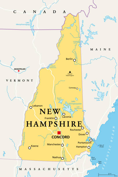
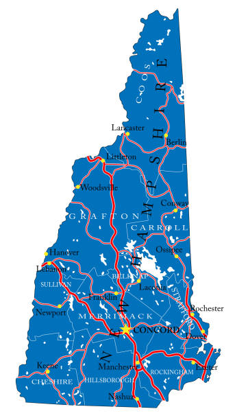
New Hampshire, NH, political map, with capital Concord. State in the New England region of the United States of America. The Granite State. The White Mountain State. Illustration over white. Vector.

Vector Illustration of a City Street Map of Dover, Kent, UK. Included files are EPS (v10) and Hi-Res JPG. Data courtesy from Ordnance Survey: VectorMap District https://www.ordnancesurvey.co.uk/business-and-government/products/vectormap-district.html OS OpenData is free to use under the Open Government Licence (OGL). Contains OS data © Crown copyright and database right 2017. http://www.nationalarchives.gov.uk/doc/open-government-licence/version/3/
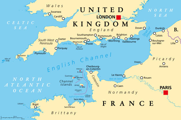
English Channel political map. Also British Channel. Arm of Atlantic Ocean separates Southern England from northern France and link to North Sea by Strait of Dover. Busiest shipping area in the world.

Vintage illustration of Victorian plans for a channel tunnel between England and France, 1850s, 19th Century
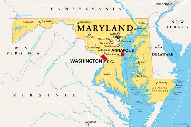
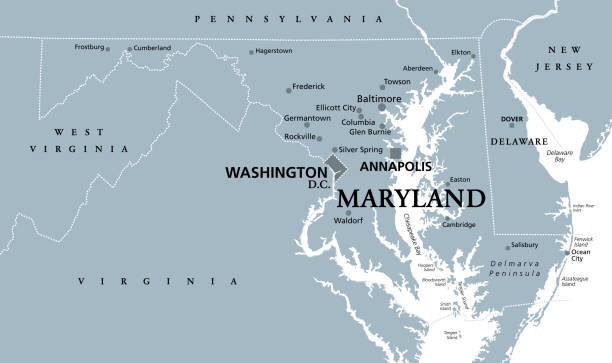
Maryland, MD, political map. State in the Mid-Atlantic region of the United States of America. Capital Annapolis. Old Line State. Free State. Little America. America in Miniature. Illustration. Vector

Mid-Atlantic region of the United States, political map. Located in the overlap between Northeastern and Southeastern states, including Delaware, D.C., Maryland, New Jersey, New York and Pennsylvania.

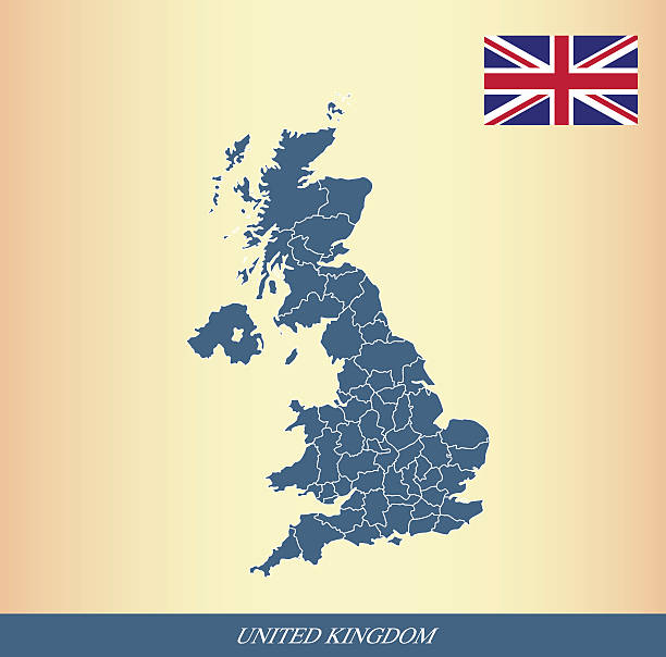
Political map of United Kingdom with capital London, national borders, most important cities, rivers and lakes. Vector illustration with English labeling and scaling.
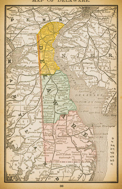
19th century map of Delaware. Published in New Dollar Atlas of the United States and Dominion of Canada. (Rand McNally & Co's, Chicago, 1884).
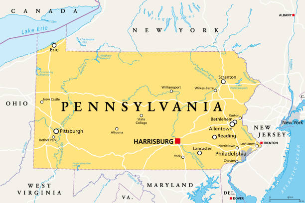
Pennsylvania, PA, political map. Officially the Commonwealth of Pennsylvania. State in the northeastern United States of America. Capital Harrisburg. Keystone State. Quaker State. Illustration. Vector
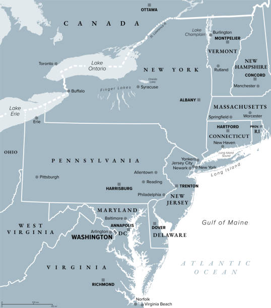
Mid-Atlantic region of the United States, gray political map. The overlap between the Northeastern and Southeastern states, including Delaware, D.C., Maryland, New Jersey, New York and Pennsylvania.
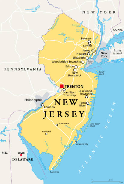
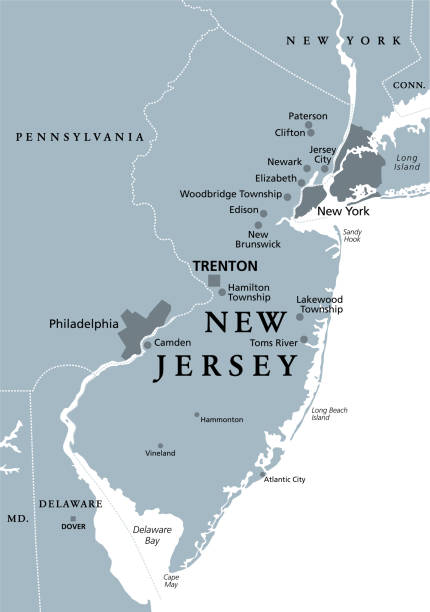
New Jersey, NJ, political map with capital Trenton. State in the Mid-Atlantic region of northeastern United States of America. The Garden State. Most densely populated US state. Illustration. Vector.
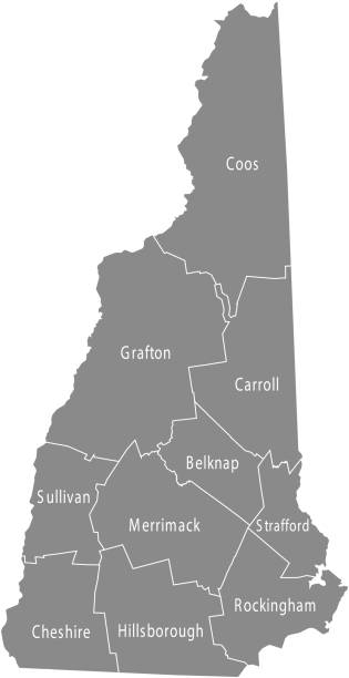
Detailed map of New Hampshire state,in vector format,with county borders,roads and major cities.
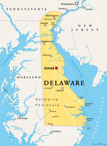
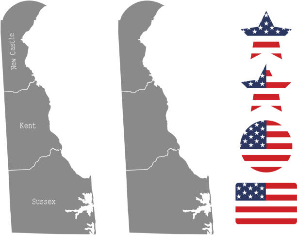
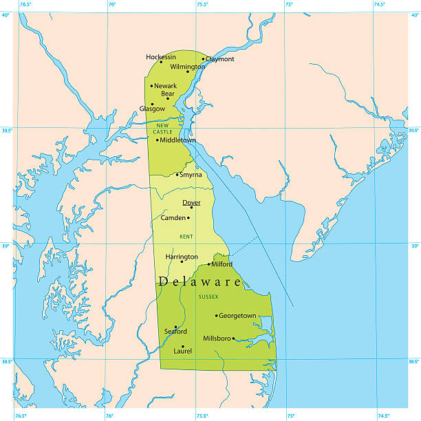
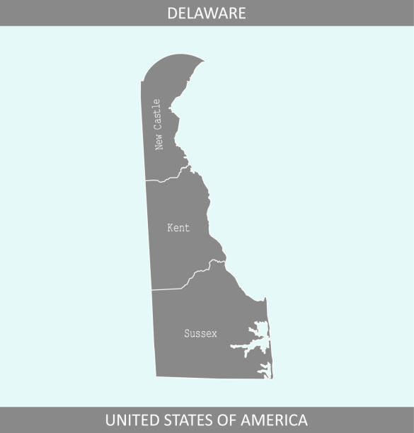
Delaware, DE, political map. State in the Mid-Atlantic region of the United States of America. Capital Dover. The First State, The Small Wonder, Blue Hen State, The Diamond State. Illustration. Vector.
Maryland, MD, gray political map. State in Mid-Atlantic region of United States of America. Capital Annapolis. Old Line State. Free State. Little America. America in Miniature. Illustration. Vector.
New Jersey, NJ, gray political map with capital Trenton. State in the Mid-Atlantic region of the Northeastern United States of America. The Garden State. Illustration on white background. Vector.

NH Strafford Vector Map Green. All source data is in the public domain. U.S. Census Bureau Census Tiger. Used Layers: areawater, linearwater, cousub, pointlm.
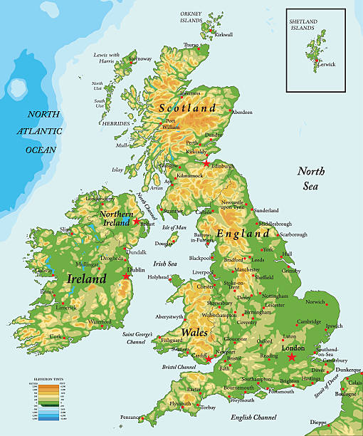
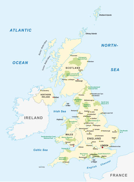
Highly detailed physical map of United Kingdom
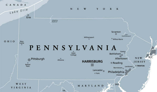
Pennsylvania, PA, gray political map. The Commonwealth of Pennsylvania, a state in the Northeastern United States of America with capital Harrisburg. Keystone State. Quaker State. Illustration. Vector

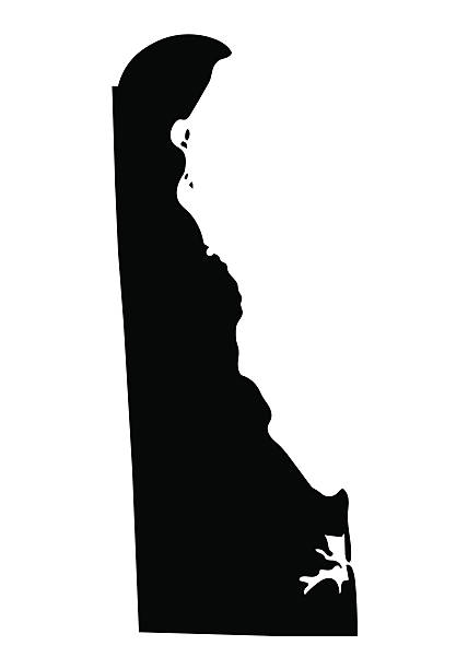
Delaware, state of USA - solid black silhouette map of country area. Simple flat vector illustration.

Vector Illustration of a City Street Map of Dover, New Hampshire, USA. Scale 1:60,000. All source data is in the public domain. U.S. Geological Survey, US Topo Used Layers: USGS The National Map: National Hydrography Dataset (NHD) USGS The National Map: National Transportation Dataset (NTD)

vector illustration of Delaware map

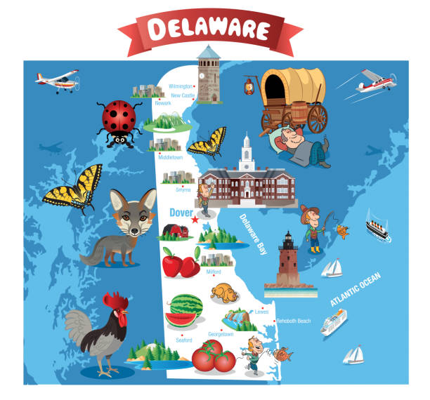
Illustrated map of the state of Delaware in United States with cities and landmarks. Editable vector illustration

Map of Great Britain, United Kingdom with famous landmarks.

Cartoon Map of DelawareI have used http://legacy.lib.utexas.edu/maps/united_states/fed_lands_2003/delaware_2003.pdfhttp://legacy.lib.utexas.edu/maps/united_states/fed_lands_2003/maryland_2003.pdfaddress as the reference to draw the basic map outlines with Illustrator CS5 software, other themes were created by myself.

Delaware road vector map
The maps are accurately prepared by a GIS and remote sensing expert.
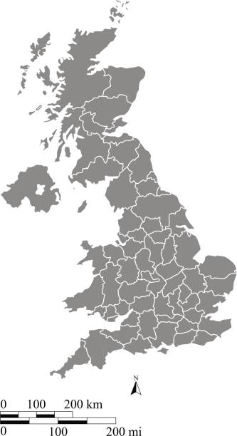
A gray background of United Kingdom map vector outline illustration with miles and kilometer scales and states or counties borders. This vector map of UK has been accurately made by a graphic designer who has a postgraduate degree in GIS and remote sensing. You can use this map to show your study site of a project.
This abstract dotted map of United Kingdom is accurately prepared using the overlaid vector map of the UK with highly detailed information.
Detailed vector map of the US State of Delaware with administrative divisions. The colors in the .eps-file are ready for print (CMYK). Included files are EPS (v10) and Hi-Res JPG (4924 x 4924 px).

vector illustration of Delaware map
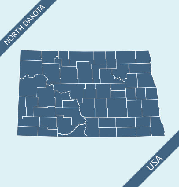
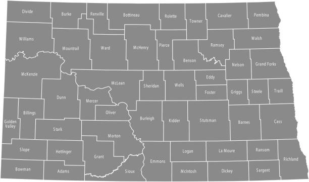
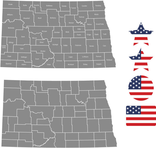
Highly detailed printable map of North Dakota state counties of United States of America for web banner, mobile, smartphone, iPhone, iPad applications and educational use. The map is accurately prepared by a map expert.

Vector map of the Channel Tunnel which connects Great Britain with mainland Europe
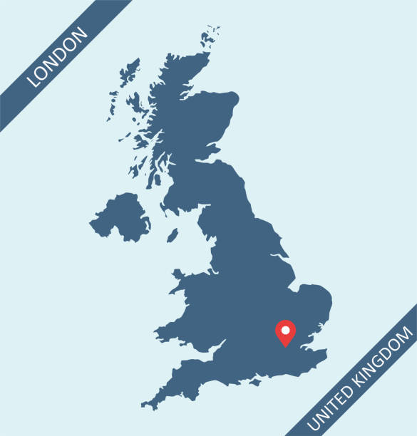
United Kingdom map with its capital location, London, for web page, application, and educational purposes. The map is accurately prepared by a map expert.
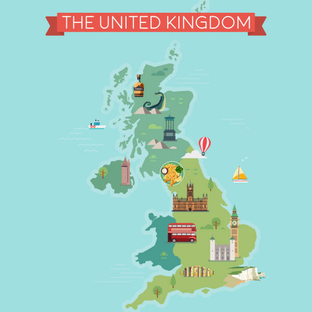
Map of Great Britain, United Kingdom with famous landmarks.

English Channel, gray political map. British Channel, arm of Atlantic Ocean, separates Southern England from northern France, link to North Sea by Strait of Dover. Busiest shipping area in the world.
Map of Delaware with design elements, isolated on white background.
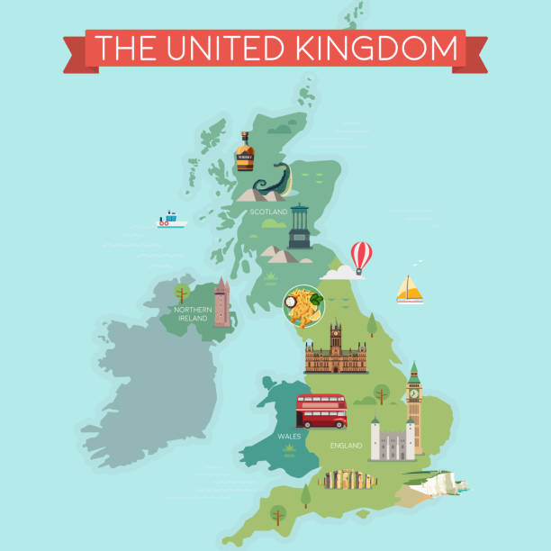
Map of Great Britain, United Kingdom with famous landmarks.
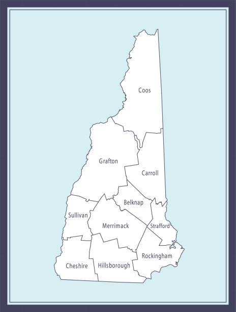
Printable counties map of New Hampshire state of United States of America. The map is accurately prepared by a map expert.
united kingdom national park vector map
Cartoon Map of Delaware I have used http://legacy.lib.utexas.edu/maps/united_states/fed_lands_2003/delaware_2003.pdf http://legacy.lib.utexas.edu/maps/united_states/fed_lands_2003/maryland_2003.pdf address as the reference to draw the basic map outlines with Illustrator CS5 software, other themes were created by myself.
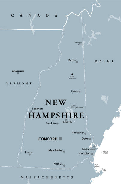
New Hampshire, NH, gray political map, with capital Concord. State in the New England region of United States of America. The Granite State. The White Mountain State. Illustration over white. Vector.
United Kingdom flag outline vector and UK map vector outline with states or provinces borders in a creative design
The map is accurately prepared by a map expert.

Detailed map of Delaware state,in vector format,with county borders,roads and major cities.

Delaware state detailed editable map with with cities and towns, geographic sites, roads, railways, interstates and U.S. highways. Vector EPS-10 file, trending color scheme

Official current vector great seal of the Federal State of Delaware, USA