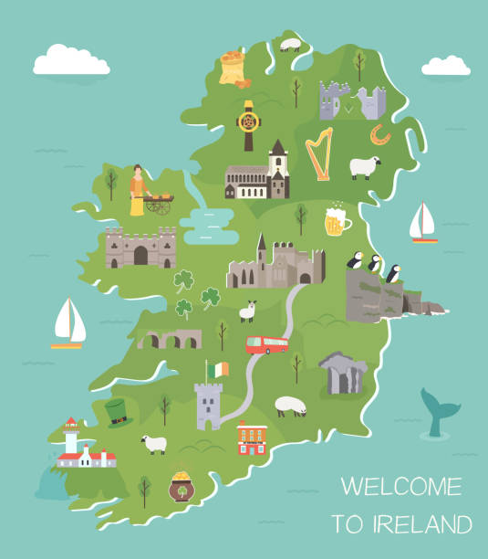
Flat vector illustration with stylized travel map of Ireland. The landmarks and main cities like Dublin and Belfast. Text Welcome to Ireland
Browse 1,000+ dublin ireland map stock illustrations and vector graphics available royalty-free, or start a new search to explore more great stock images and vector art.
Flat vector illustration with stylized travel map of Ireland. The landmarks and main cities like Dublin and Belfast. Text Welcome to Ireland
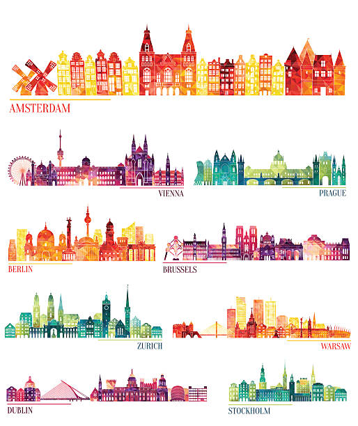
Skyline detailed silhouette set (Amsterdam, Vienna, Prague, Berlin, Brussels, Zurich, Warsaw, Dublin, Stockholm ). Vector illustration

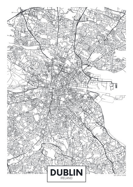
Poster Style Topographic / Road map of Dublin, Ireland Original map data is open data via © OpenStreetMap contributors. All maps are layered and easy to edit. Roads are editable stroke.

Dublin Ireland Map in Retro Style. Vector Illustration. Outline Map.

Highly detailed physical map of Ireland, in vector format,with all the relief forms,regions and big cities.
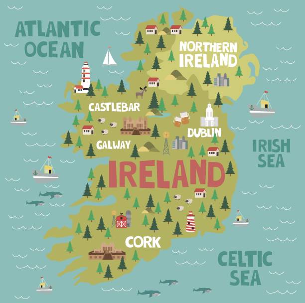
Illustrated map of Ireland with nature and landmarks. Editable vector illustration

Antique map of Dublin
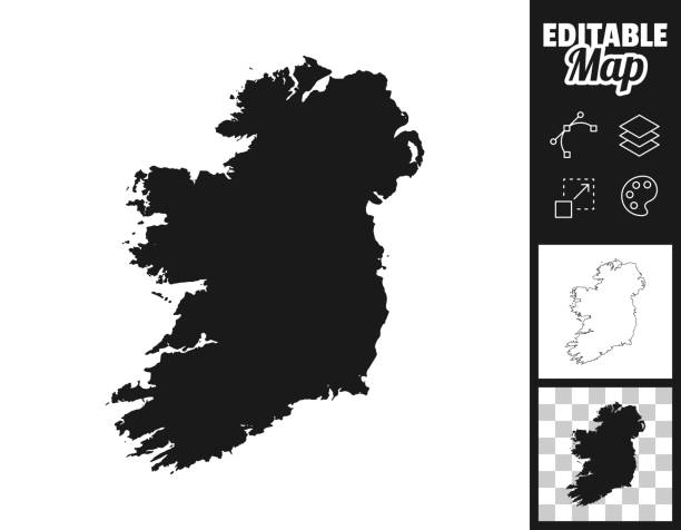
Map of Ireland for your own design. Three maps with editable stroke included in the bundle: - One black map on a white background. - One line map with only a thin black outline in a line art style (you can adjust the stroke weight as you want). - One map on a blank transparent background (for change background or texture). The layers are named to facilitate your customization. Vector Illustration (EPS file, well layered and grouped). Easy to edit, manipulate, resize or colorize. Vector and Jpeg file of different sizes.

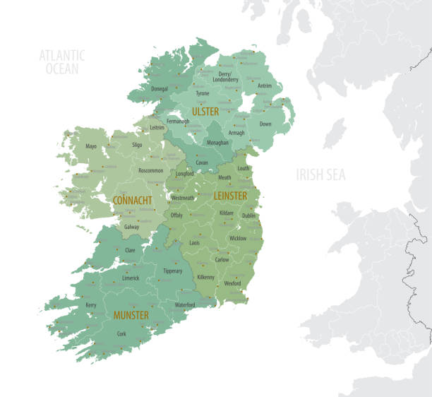
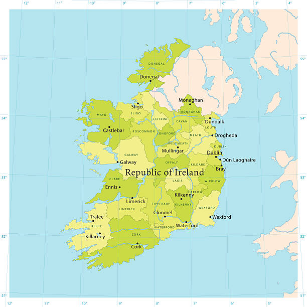
Ireland Political Map with capital Dublin, national borders, most important cities, rivers and lakes. English labeling and scaling. Illustration.
Irish map with symbols of Ireland, destinations and landmarks

Ireland map glowing silhouette outline made of stars lines dots triangles, low polygonal shapes. Communication, internet technologies concept. Wireframe futuristic design. Vector illustration

An illustrated map of Dublin featuring its most important tourist attractions, such as Christ Church, Dublin Castle, government buildings, Merrion Square, and Saint Stephen's Green, along with the famous and traditional brewery, Temple Bar region, Phoenix Park, the stadium, the chimneys on the docks, the River Liffey, and its bridges.

Ireland and United Kingdom political map with capitals Dublin and London and with national borders. Gray illustration of British Isles with English labeling and scaling on white background.

City of Dublin, Ireland - Baile Átha Clíath, Éire

Dublin Ireland City Map in Retro Style in Golden Color. Outline Map. Vector Illustration.

Detailed map of Ireland.

Ireland - Highly detailed editable political map with labeling. Organized vector illustration on seprated layers.

Ireland Sketch Doodles. Hand Drawn Irish Elements Set with flag and map of Ireland, Celtic Cross, Castle, Shamrock, Celtic Harp, Mill and Sheep, Whiskey Bottles and Irish Beer, Vector Illustration.

Hand drawn map of Central Europe with selected capitals and landmarks, vintage web banner

Detailed map of Ireland with navigation icons.

Irish map with symbols of Ireland, destinations and landmarks

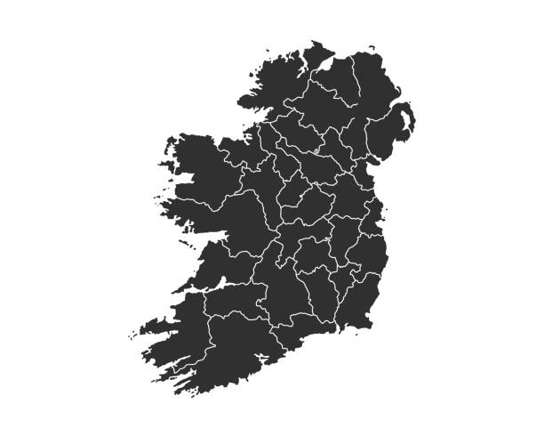
"Detailed vector map of Ireland with administrative divisions. File was created on November 5, 2012. The colors in the .eps-file are ready for print (CMYK). Included files: EPS (v8) and Hi-Res JPG (4776aa aaa 5600 px)."

White map of Ireland isolated on a gray background with a long shadow effect and in a flat design style. Vector Illustration (EPS10, well layered and grouped). Easy to edit, manipulate, resize or colorize.

Poster Style Topographic / Road map of Dublin, Ireland Original map data is open data via © OpenStreetMap contributors. All maps are layered and easy to edit. Roads are editable stroke.
Highly detailed vector map of the Republic of Ireland. File was created on June 24, 2011. The colors in the .eps-file are ready for print (CMYK). Included files: EPS (v8) and Hi-Res JPG.

Very Rare, Beautifully Illustrated Antique Engraving of Map of the City of Map of the City of Dublin, Ireland Victorian Engraving, 1840. Source: Original edition from my own archives. Copyright has expired on this artwork. Digitally restored.
vector illustration of United Kingdom map

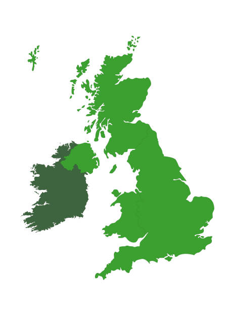
Ireland and Northern Ireland political map with capitals Dublin and Belfast, borders, important cities, rivers and lakes. Island in the North Atlantic Ocean. English labeling. Illustration. Vector.

High Detailed Ireland Blue Map with Navigation Icons

An illustrated map of Dublin featuring its most important tourist attractions, such as Christ Church, Dublin Castle, government buildings, Merrion Square, and Saint Stephen's Green, along with the famous and traditional brewery, Temple Bar region, Phoenix Park, the two major stadiums, the chimneys on the docks, the River Liffey, and its bridges. It is a simplified version of another map.

Ireland map geometric mesh polygonal light. Business wireframe mesh spheres from flying debris blue structure style. Vector illustration EPS10

Map of Ireland draw with the stippling technique. Beautiful and trendy illustration created only with dots and isolated on a blank background. White map with dotted black outline and dark shadow. White background with a stippled circular gradient. (colors used: black and white). Vector Illustration (EPS10, well layered and grouped). Easy to edit, manipulate, resize or colorize. Vector and Jpeg file of different sizes.
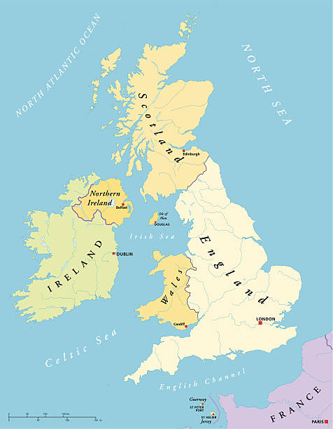
British Isles with capitals, national borders, rivers and lakes. Illustration with English labeling and scaling.

United Kingdom countries and Ireland political map. England, Scotland, Wales, Northern Ireland, Guernsey, Jersey, Isle of Man and their capitals in different colors. Illustration on white background.

Vector map of ireland with the rail route network

http://dikobraz.org/map_2.jpg

Vintage map showing the city of Dublin, Ireland. Vintage etching circa 19th century.

Map of Ireland - Vector illustration
Vector poster detailed city map Dublin detailed plan of the city, rivers and streets

Map of Ireland, https://maps.lib.utexas.edu/maps/europe/ireland.jpg

White map of Ireland isolated on a trendy color, a blue green background and with a dropshadow. Vector Illustration (EPS10, well layered and grouped). Easy to edit, manipulate, resize or colorize.

Very Rare, Beautifully Illustrated Antique Engraving of Map of the City of Map of the City of Dublin, Ireland Victorian Engraving, 1840. Source: Original edition from my own archives. Copyright has expired on this artwork. Digitally restored.

High detailed Ireland physical map with labeling. Organized vector illustration on seprated layers.
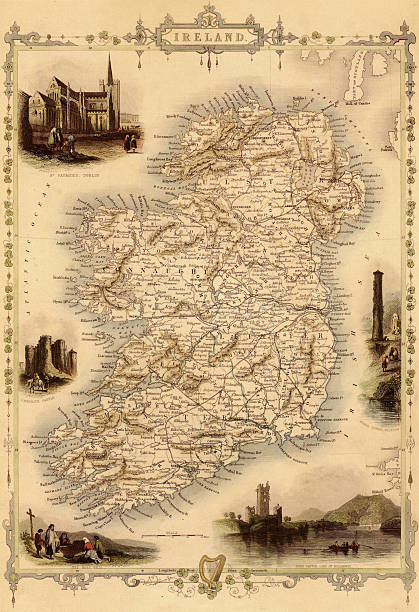
Antique map of Ireland. Published by the J.Tallis and Sons, London and New York, 1851. Photo by N. Staykov (2008)Click on thumbnails below for more UK and Ireland maps:

Topographic / Road map of Dublin, Ireland Original map data is open data via © OpenStreetMap contributors. All maps are layered and easy to edit. Roads are editable stroke.

Topographic / Road map of Dublin, Ireland Original map data is open data via © OpenStreetMap contributors. All maps are layered and easy to edit. Roads are editable stroke.
© 2025 iStockphoto LP. The iStock design is a trademark of iStockphoto LP. Browse millions of high-quality stock photos, illustrations, and videos.
Do Not Sell or Share