
Illustrations
Evansville Indiana stock illustrations
Browse 120+ evansville indiana stock illustrations and vector graphics available royalty-free, or search for evansville indiana map to find more great stock images and vector art.
Most popular


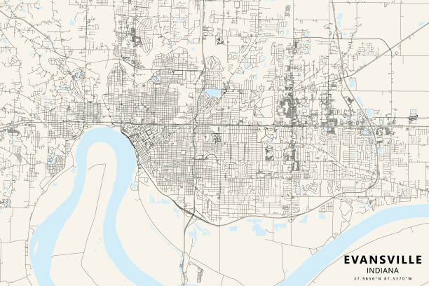
Topographic / Road map of Evansville, Indiana, USA. Map data is public domain via census.gov. All maps are layered and easy to edit. Roads are editable stroke.

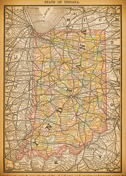
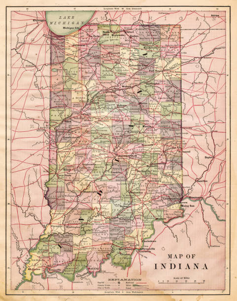
19th century map of Indiana. Published in New Dollar Atlas of the United States and Dominion of Canada. (Rand McNally & Co's, Chicago, 1884).
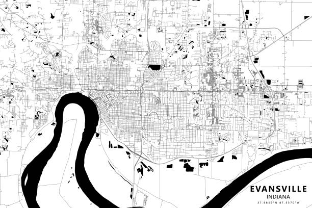
Topographic / Road map of Evansville, Indiana, USA. Map data is public domain via census.gov. All maps are layered and easy to edit. Roads are editable stroke.
Indiana Educational Series The Complete Geography - Indianapolis 1889

Harper's School Geography, New York, Harper's and Brothers, 1881.

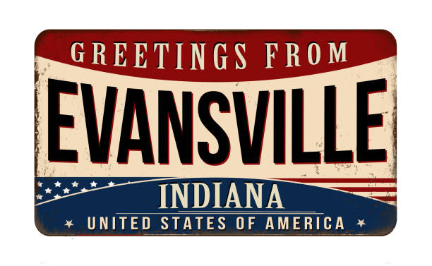
Greetings from Evansville vintage rusty metal sign on a white background, vector illustration

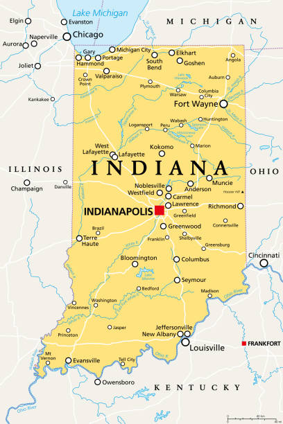
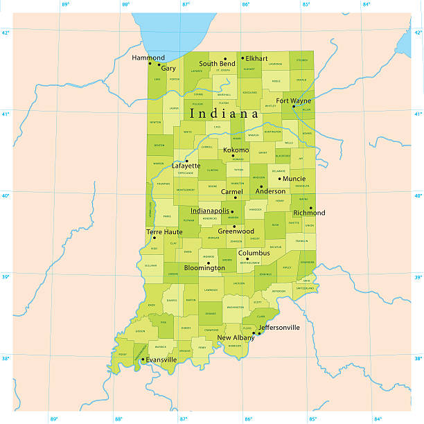
Indiana, IN, political map, with the capital Indianapolis, and most important cities, rivers and lakes. State in the Midwestern region of the United States of America, nicknamed The Hoosier State.
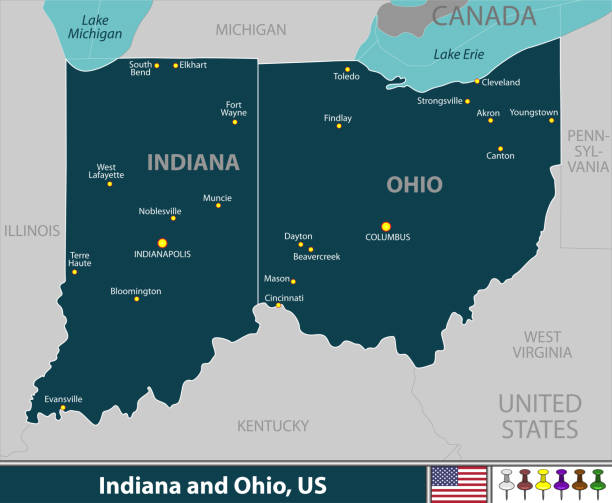
Vector of Indiana and Ohio states of United States with large cities


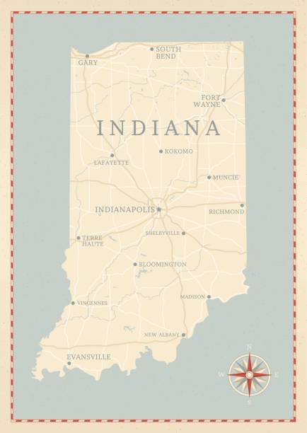
A vintage-style map of Indiana with freeways, highways and major cities. Shoreline, lakes and rivers are very detailed. Includes an EPS and JPG of the map without roads and cities. Texture, compass, cities, etc. are on separate layers for easy removal or changes.
Indiana US State Vector Road Map Grey. All source data is in the public domain. Roads, Water, Regions, Urban Areas: Made with Natural Earth. https://www.naturalearthdata.com/downloads/10m-physical-vectors/ https://www.naturalearthdata.com/downloads/10m-cultural-vectors/

Love Evansville Picture. Map of United States with Heart as City Point. Vector Illustration
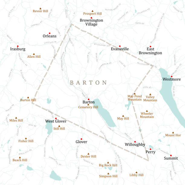
VT Orleans Barton Vector Road Map. All source data is in the public domain. U.S. Census Bureau Census Tiger. Used Layers: areawater, linearwater, roads, rails, cousub, pointlm, uac10.
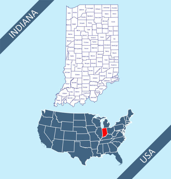
Detailed vector map of Indiana with administrative divisions. File was created on February 15, 2013. The colors in the .eps-file are ready for print (CMYK). Included files: EPS (v8) and Hi-Res JPG (3953 × 5600 px).
United States, Indianapolis city isolated skyline vector illustration, travel landmark
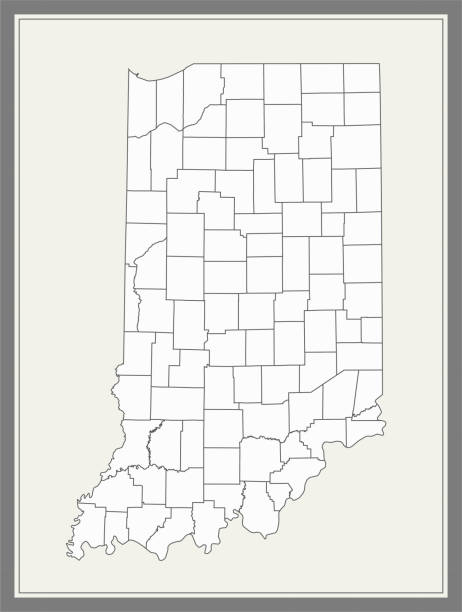
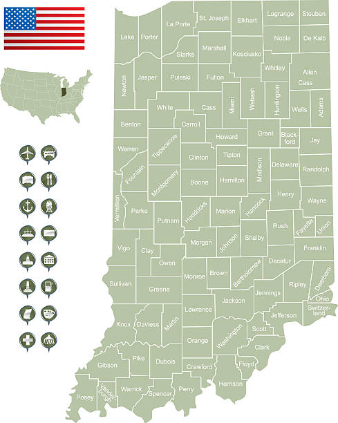
Printable counties map of Indiana state of United States of America. The map is accurately prepared by a map expert.
Highly detailed map of United States of America with highlighted state of Indiana for web banner, mobile, smartphone, iPhone, iPad applications and educational use. The map is accurately prepared by a map expert.

A flag of Indiana with a grunge texture
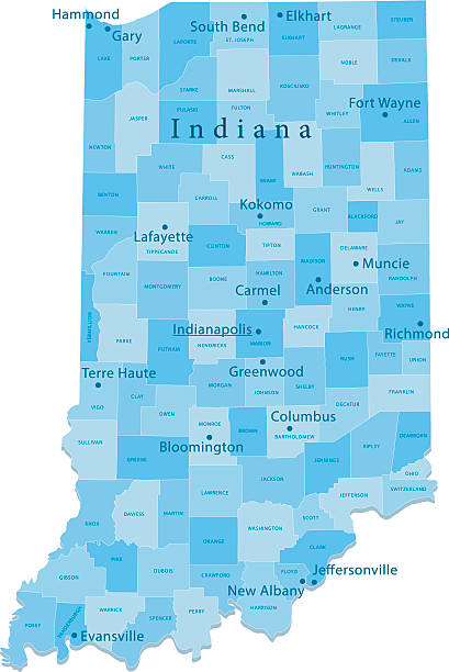
Highly detailed labeled map of Indiana counties state of United States of America for book cover, brochure and web banner designs, iPhone, iPad, tablet, smart phone, mobile app and educational use.
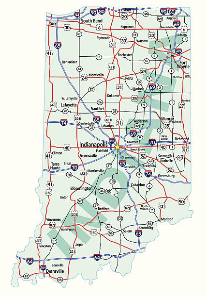
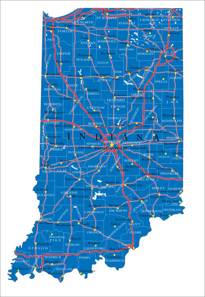
Indiana state road map with Interstates, U.S. Highways and state roads. All elements on separate layers for easy editing. Map created January 2, 2010.
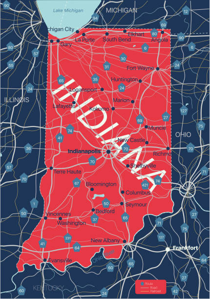
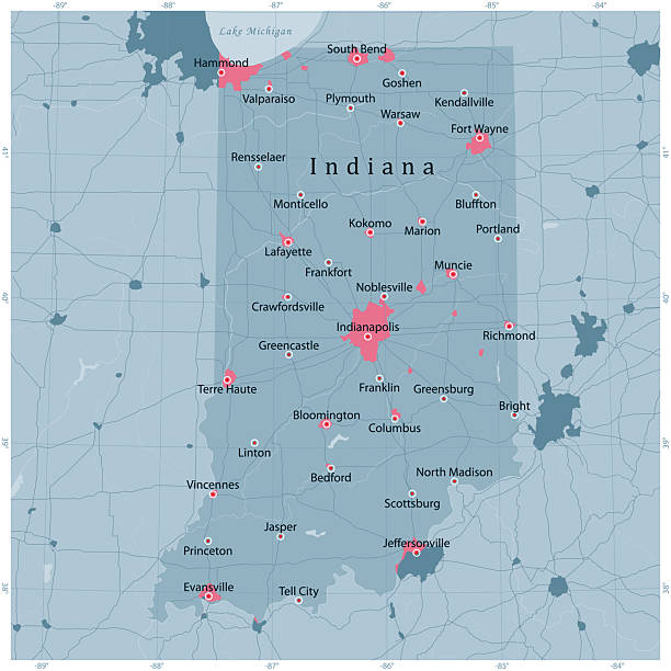
Indiana state detailed editable map with with cities and towns, geographic sites, roads, railways, interstates and U.S. highways. Vector EPS-10 file, trending color scheme
Detailed map of Indiana state,in vector format,with county borders,roads and major cities.
Downloadable outline vector map of Indiana state of United States of America.
Set of icons. Cities of the USA flags. Vector.

Great Lakes Forest Map and Cardinal Birds https://maps.lib.utexas.edu/maps/united_states/united_states_wall_2002.jpg
Highly detailed vector map of Indiana, United States. File was created on January 16, 2013. The colors in the .eps-file are ready for print (CMYK). Included files: EPS (v8) and Hi-Res JPG (5600 × 5600 px).
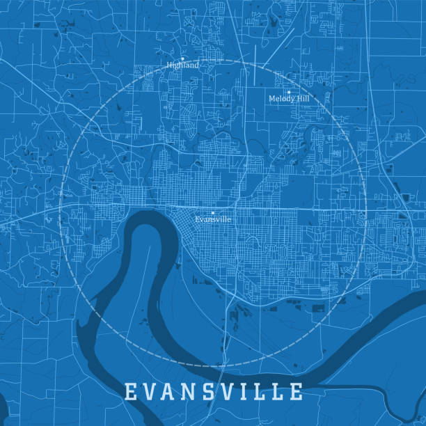
Evansville IN City Vector Road Map Blue Text. All source data is in the public domain. U.S. Census Bureau Census Tiger. Used Layers: areawater, linearwater, roads.


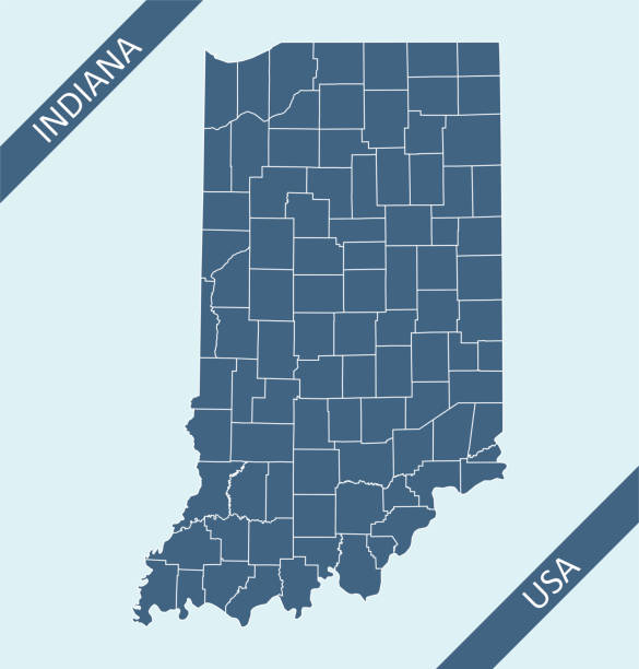
Highly detailed county map of Indiana state of United States of America for web banner, mobile, smartphone, iPhone, iPad applications and educational use. The map is accurately prepared by a map expert.

Highly detailed map of Indiana state of United States of America for web banner, mobile, smartphone, iPhone, iPad applications and educational use. The map is accurately prepared by a map expert.
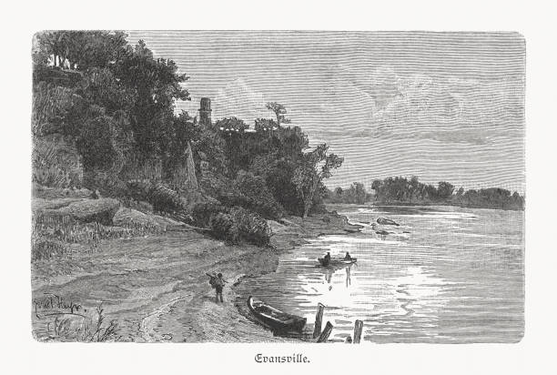
The Ohio River near Evansville, Indiana, USA. Wood engraving after a photograph, published in 1897.
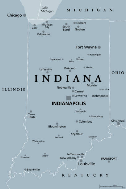
Indiana, IN, gray political map with the capital Indianapolis, and most important cities, rivers and lakes. State in the Midwestern region of the United States of America, nicknamed The Hoosier State.
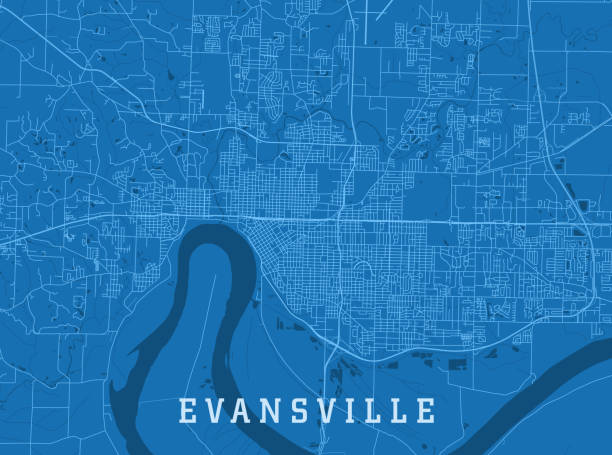
Evansville IN City Vector Road Map Blue Horizontal. All source data is in the public domain. U.S. Census Bureau Census Tiger. Used Layers: areawater, linearwater, roads.


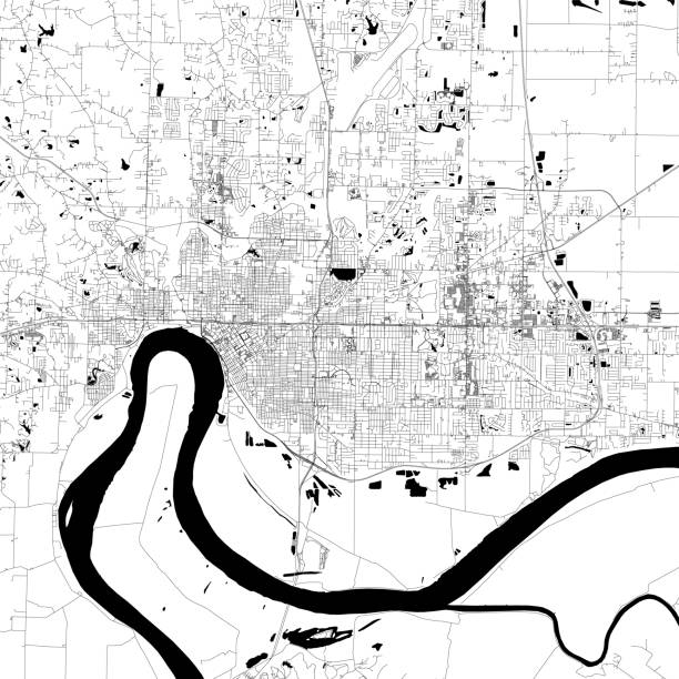
Topographic / Road map of Evansville, Indiana, USA. Map data is public domain via census.gov. All maps are layered and easy to edit. Roads are editable stroke.
Vector Illustration of a Road Map of Indiana State, USA. All source data is in the public domain. U.S. Geological Survey, US Topo Used Layers: USGS The National Map: National Hydrography Dataset (NHD) USGS The National Map: National Transportation Dataset (NTD)

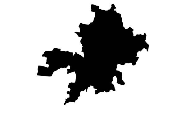
black silhouette map of Fort Wayne city in Indiana on white background
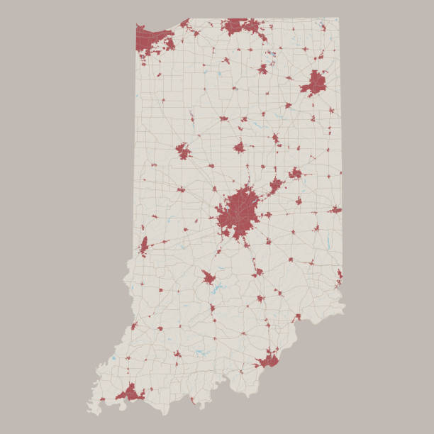
Detailed map of Indiana with icons of organizations providing services, government organizations and structures.
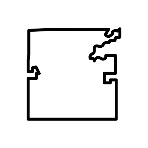
Icon for indianapolis, map, us, usa, america, country, contour, border, evansville, american, mosaic, region, indiana


Icon for indianapolis, map, us, usa, america, country, contour, border, evansville, american, mosaic, region, indiana


Maps of Vanderburgh County - Indiana, on blue and red backgrounds. Four map versions included in the bundle: - One map on a blank blue background. - One map on a blue background with the word "Democrat". - One map on a blank red background. - One map on a red background with the word "Republican". Vector Illustration (EPS file, well layered and grouped). Easy to edit, manipulate, resize or colorize. Vector and Jpeg file of different sizes.
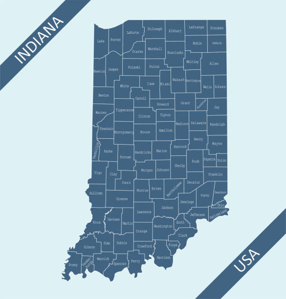
Highly detailed map of Indiana counties state of United States of America for web banner, mobile, smartphone, iPhone, iPad applications and educational use. The map is accurately prepared by a map expert.
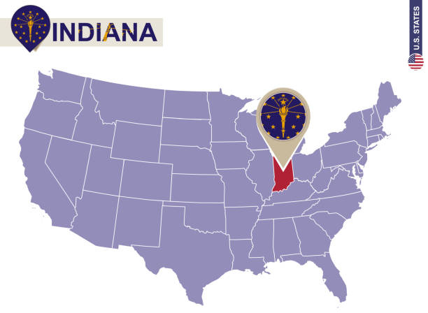
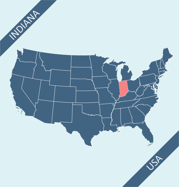
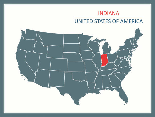
Indiana State on USA Map. Indiana flag and map. US States.
Next