Goa (States and union territories of India, Federated states, Republic of India) map vector illustration, scribble sketch Goa state map
Browse 360+ goa map stock illustrations and vector graphics available royalty-free, or start a new search to explore more great stock images and vector art.
Goa (States and union territories of India, Federated states, Republic of India) map vector illustration, scribble sketch Goa state map

High Quality map of Goa is a state of India

Goa administrative and political vector map
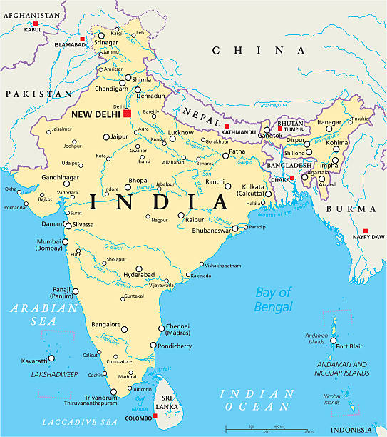
India political map with capital New Delhi, national borders, important cities, rivers and lakes. English labeling and scaling. Illustration.

goa vector map, india

White map of Goa isolated on a gray background with a long shadow effect and in a flat design style. Vector Illustration (EPS10, well layered and grouped). Easy to edit, manipulate, resize or colorize.

Goa districts map. Indian State. Gray background. Business Concepts and Backgrounds.

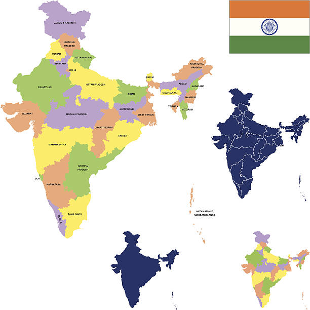
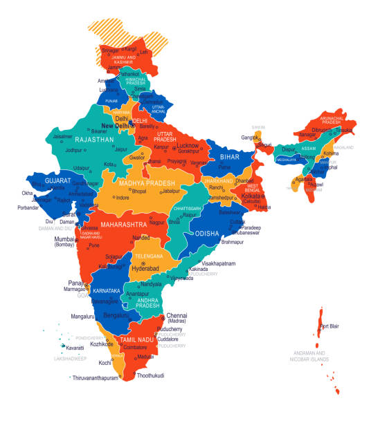
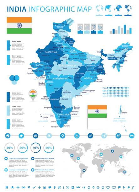
Political detailed map of India with all states and country boundary

India map - highly detailed vector illustration

Goa, India - high detailed physical map. Vector map. Dem map. Vector template for website, design, cover, infographics. Vector illustration.

Political detailed map of India with all states and country boundary

Goa vector road map

3d map of Goa is a state of India

Goa (States and union territories of India, Federated states, Republic of India) map vector illustration, scribble sketch Goa state map

Map of Goa in a trendy vintage style. Beautiful retro illustration with old textured paper (colors used: blue, green, beige and red). Vector Illustration (EPS10, well layered and grouped). Easy to edit, manipulate, resize or colorize. Vector and Jpeg file of different sizes.

Vintage map of India fron 1837

Map of Goa isolated on a blank background and with his name on a red ribbon. Vector Illustration (EPS10, well layered and grouped). Easy to edit, manipulate, resize or colorize. Vector and Jpeg file of different sizes.

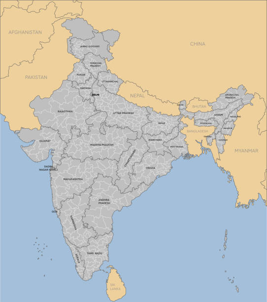
Vector isolated illustration of simplified administrative map of India. Borders and names of the states (regions). Grey silhouettes. White outline.

Goa state map highlighted on indian map. Light gray background. Perfect for business concepts, backdrop, backgrounds, label, sticker, chart etc.

3D map of Goa isolated on a blank and gray background, with a dropshadow. Vector Illustration (EPS10, well layered and grouped). Easy to edit, manipulate, resize or colorize. Vector and Jpeg file of different sizes.
Detailed map of India with states for your design , products and print.

Traditional symbols in the form of a map of India on white

High Quality map of Goa is a state of India, With main cities location

Goa’s Liberation Day vector, illustration. 19 December. Goa state 3d map.

India map and flag - highly detailed vector illustration

Detailed vector India country outline border map isolated on background. State, region, area, province, territory, department for your report, infographic, backdrop, business concept

Map of Goa drawn in chalk on a green chalkboard with chalk traces. Vector Illustration (EPS10, well layered and grouped). Easy to edit, manipulate, resize or colorize.

White map of Goa isolated on a blue background with a long shadow effect and in a flat design style. Vector Illustration (EPS10, well layered and grouped). Easy to edit, manipulate, resize or colorize.

Vector Maphttp://legacy.lib.utexas.edu/maps/world_maps/world_physical_2015.pdf
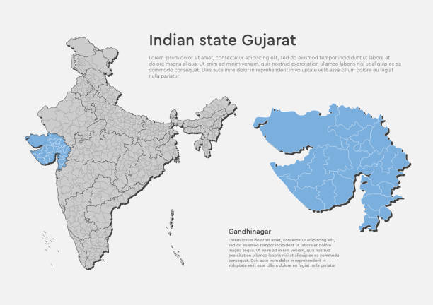
Detailed vector India country outline border map isolated on background. Gujarat state, region, area, province, territory, department for your report, infographic, backdrop, business concept.
Vector India Travel
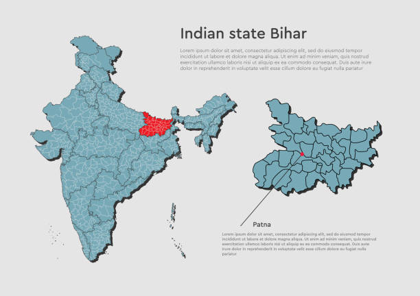
Detailed vector India country outline border map isolated on background. Bihar state, region, area, province, territory, department for your report, infographic, backdrop, business concept.
India map - highly detailed vector illustration

Vector Indian Travel Map https://maps.lib.utexas.edu/maps/middle_east_and_asia/india_physio-2001.jpg

Map of India - highly detailed vector illustration
Detailed vector India country outline border map isolated on background. Divided on state, region, area, province, territory, department for your report, infographic, backdrop, business concept.

Map of India. Floating blue plexus geometric background. Creative abstract vector illustration. High tech, communications and travel. Effect of motion luminous particles and points. Polygonal graphic forms.

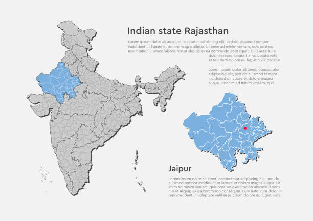
Andhra Pradesh administrative and political vector map, India
India map and flag - highly detailed vector illustration
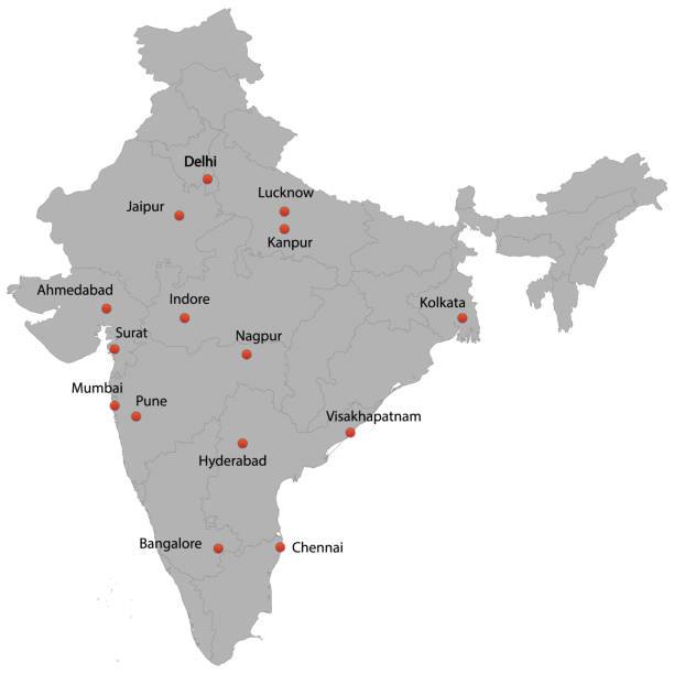
detailed map of the India with cities
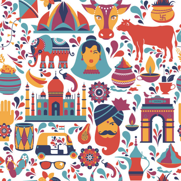
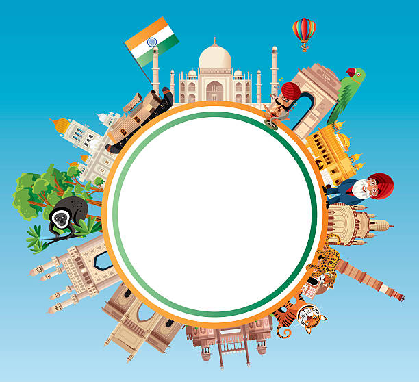
Traditional symbols of India seamless pattern on white.

Traditional symbols in the form of a map of India on blue
India map graphic, travel geography icon, indian region GOA, vector illustration .

Detailed vector India country outline border map isolated on background. Punjab state, region, area, province, territory, department for your report, infographic, backdrop, business concept.

Traditional symbols of India seamless pattern on white.

Inspirational handwritten brush lettering Curry. Vector calligraphy illustration isolated on white background. Typography for banners, badges, postcard, t-shirt, prints, posters.
Detailed vector India country outline border map isolated on background. Sikkim state, region, area, province, territory, department for your report, infographic, backdrop, business concept.