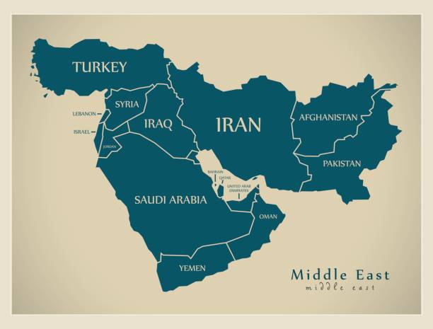
Map of Iran showing surrounding countries and bodies of water.
Browse 19,300+ gulf map stock illustrations and vector graphics available royalty-free, or search for arabian gulf map or florida gulf map to find more great stock images and vector art.
Map of Iran showing surrounding countries and bodies of water.

New york city, 5 boroughs vector map

Vector maps of Saudi Arabia with variable specification and icons

Strait of Hormuz, sand-colored political map. Waterway between the Persian Gulf and the Gulf of Oman. Strategically important choke point with Iran to the north and UAE and Oman to the south. Vector
Country line of Asia, Asian map illustration, vector isolated on white background, outline style

City map of Cádiz, Spain.Wood engraving, published in 1897.

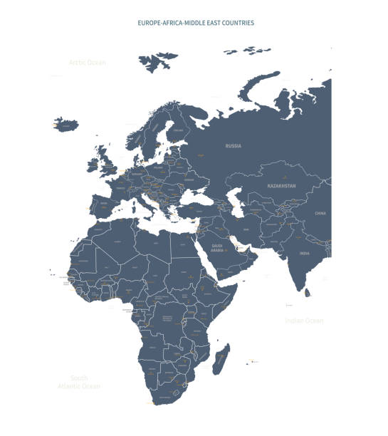
All round World Flags with country names (part1)
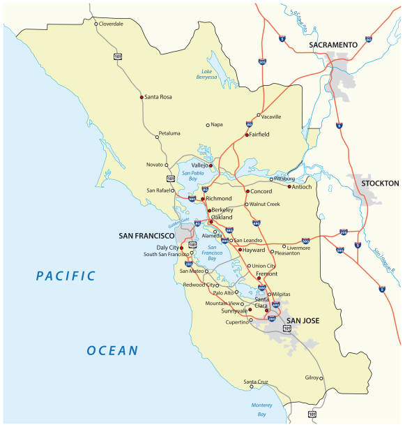
San Francisco Bay Area vector map

Detailed waving flag map of Oman. Vector map with masked flag.

Shipping lanes of the Strait of Hormuz, political map. Sea passage from Persian Gulf to Gulf of Oman into the open ocean. Strategically important choke points for shipping oil and natural gas. Vector

Persian Gulf Map - Vintage Detailed Vector Illustration

Persian Gulf Map - Detailed Vector Illustration
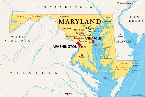
Maryland, MD, political map. State in the Mid-Atlantic region of the United States of America. Capital Annapolis. Old Line State. Free State. Little America. America in Miniature. Illustration. Vector

A map showcasing the geopolitical tension zones in the Middle East, with Israel, Gaza Strip, and West Bank in focus alongside neighboring countries.

Map of Asia with details and the name of each country. Vector illustration in HD very easy to make edits.
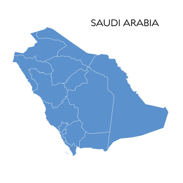
Vector illustration of the map of Saudi Arabia
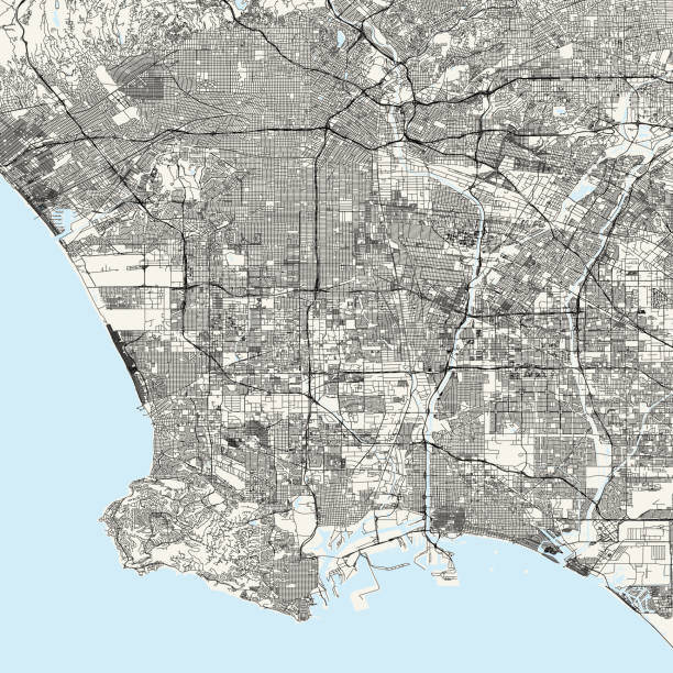
Topographic / Road map of Los Angeles, CA. Original map data is public domain sourced from www.census.gov/
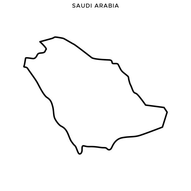
Saudi Arabia Outline Map Vector Stock Illustration Design Template. Editable Stroke. Vector eps 10.
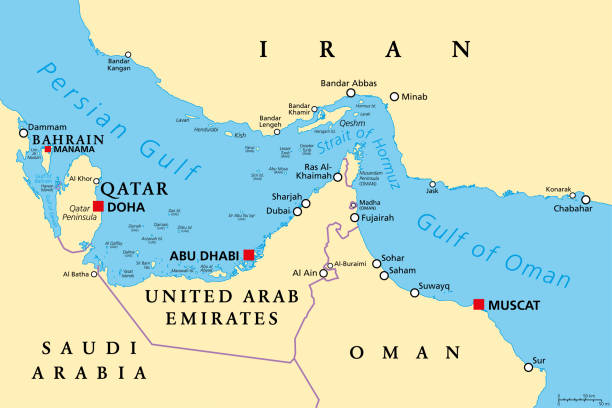
Strait of Hormuz, political map. Waterway between Persian Gulf and Gulf of Oman, a strategically extremely important choke point, with Iran to the north and UAE and Oman exclave Musandam to the south.
Middle America political map with capitals and borders. Mid-latitudes of the Americas region. Mexico, Central America, the Caribbean and northern South America. Illustration. English labeling. Vector.

Topographic / Road map of Oakland, California CA. USA United States of America. Original map data is open data via © OpenStreetMap contributors. All maps are layered and easy to edit. Roads are editable stroke.

Southeast Region, South of the United States, gray political map. Geographic and cultural region, also referred to as the Southern United States, American South, Southland, Dixieland, or simply Dixie.
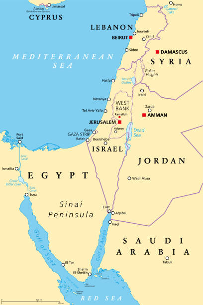
Israel and the Sinai Peninsula, political map. The Southern Levant, an arid geographical and historical region, encompassing Israel, Palestine, Jordan, Lebanon, southern Syria and the Sinai Peninsula.
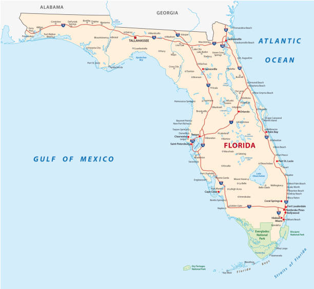
florida road vector map with national parks
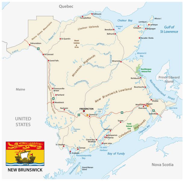
Road vector map with flag of the canada atlantic province new brunswick
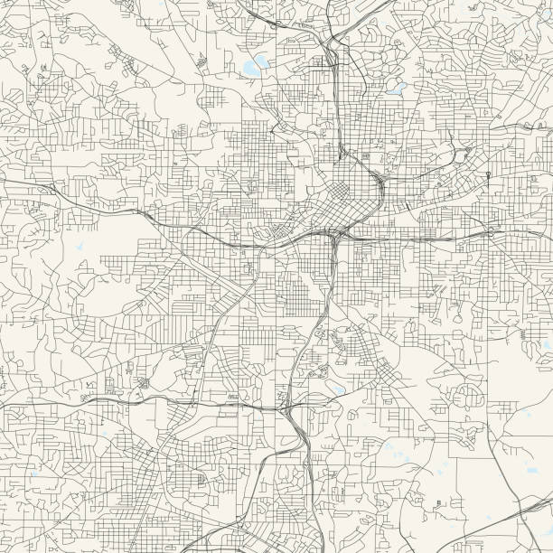
Topographic / Road map of Atlanta GA. Original map data is public domain sourced from www.census.gov/
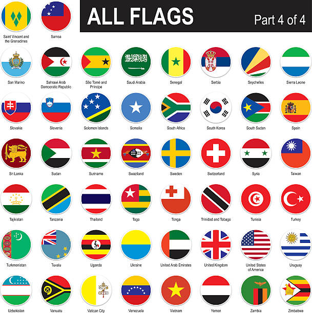
All round World Flags with country names (part4)

Outline of U.S. state Florida divided into counties. State in the Southeastern region of United States, subdivided into 67 counties. Map with county boundaries and names. Black and white illustration.
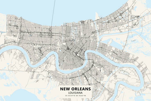
Poster Style topographic / Road map of New Orleans, Louisiana . USA United States of America. Original map data is open data via © OpenStreetMap contributors. All maps are layered and easy to edit. Roads are editable stroke.

3D map of United Arab Emirates isolated on a blank and gray background, with a dropshadow. Vector Illustration (EPS10, well layered and grouped). Easy to edit, manipulate, resize or colorize.
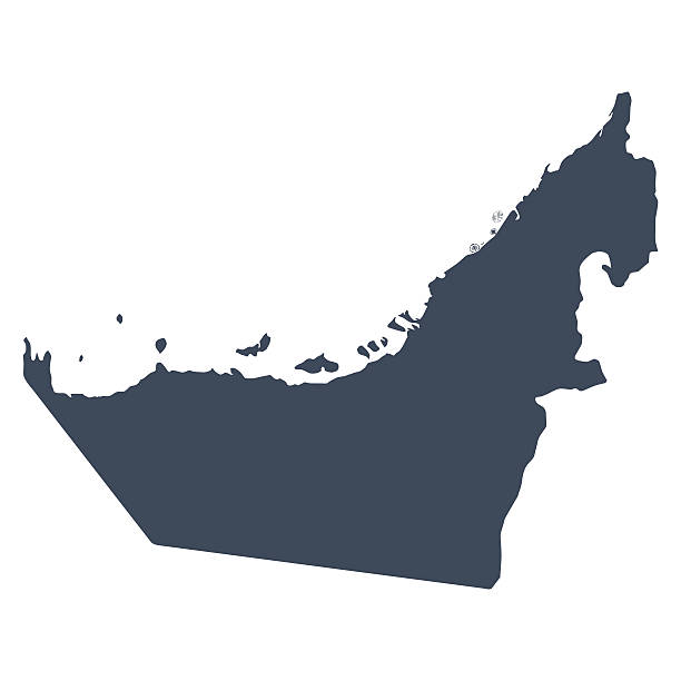
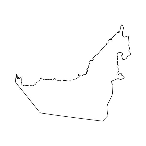
A graphic illustrated vector image showing the outline of the country UAE. The outline of the country is filled with a dark navy blue colour and is on a plain white background. The border of the country is a detailed path.

States of Mexico, political map. The United Mexican States, a country in the southern portion of North America. Federal republic composed of autonomous entities, of 31 states with capital Mexico City.
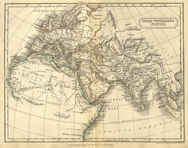
Vintage illustration of Antique map of Orbis veteribus notus, The Old World. Atlas of Ancient Geography. By Samuel Butler

vector map of the five US states on the Gulf of Mexico

vector road map of the US American State of California.

Gulf of Venice, gray political map. A bay of water in the northern Adriatic Sea, limited by the Po delta and Venetian Lagoon in Italy, and the Istrian Peninsula in Croatia, also bordered by Slovenia.
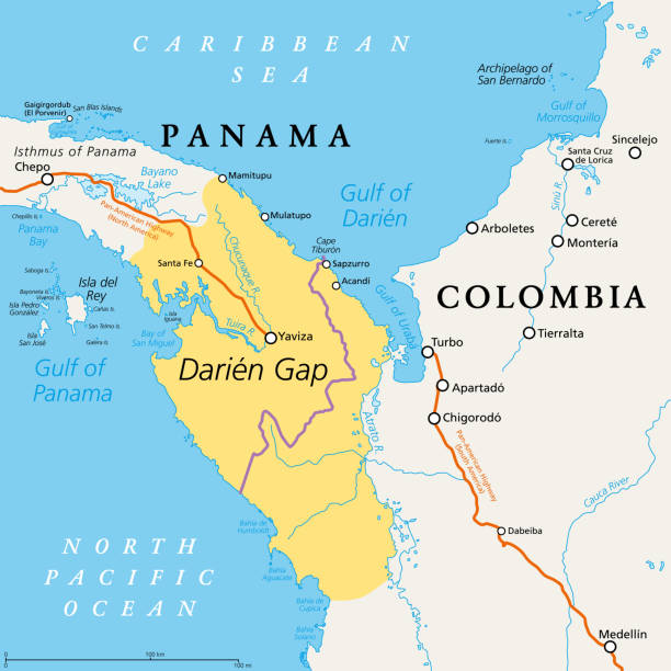
Darien Gap, political map. Geographical region in the Isthmus of Panama, connecting North and South America with Central America. The gap is in the Pan-American Highway of which a part were not built.
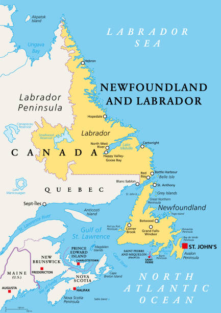
Newfoundland and Labrador, political map. Province of Canada, in the Atlantic region, with capital St. Johns. Island of Newfoundland and continental region of Labrador between Quebec and the Atlantic.
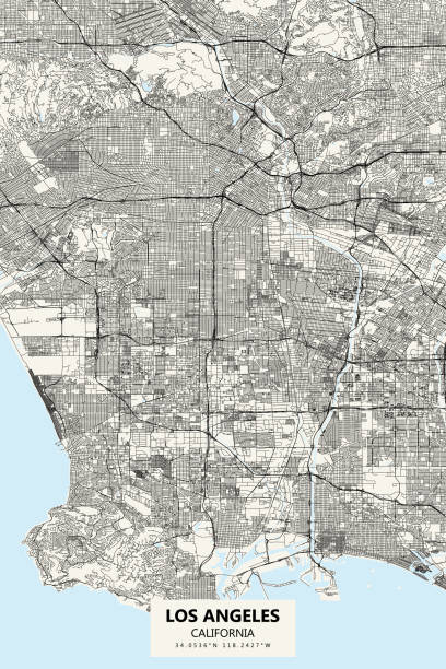
Topographic / Road map of Los Angeles, CA - Poster Style. Original map data is public domain sourced from www.census.gov/
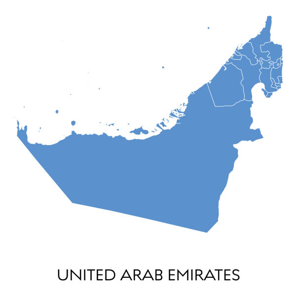
Vector illustration of the map of United Arab Emirates

Abstract image Oman map from point blue and glowing stars on a dark background. vector illustration.