All counties have separate and accurate borders that can be selected and easily edited.
Browse 150+ knoxville tn illustrations stock illustrations and vector graphics available royalty-free, or start a new search to explore more great stock images and vector art.
All counties have separate and accurate borders that can be selected and easily edited.

Knoxville TN City Vector Road Map Blue Text. All source data is in the public domain. U.S. Census Bureau Census Tiger. Used Layers: areawater, linearwater, roads.
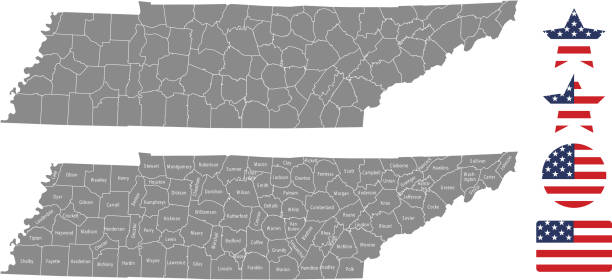
The maps are accurately prepared by a GIS and remote sensing expert.
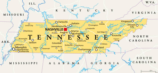
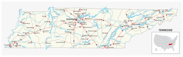
Tennessee, TN, political map, with capital Nashville, largest cities, lakes and rivers. State of Tennessee. Landlocked state in Southeastern region of the United States, nicknamed The Volunteer State.

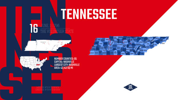
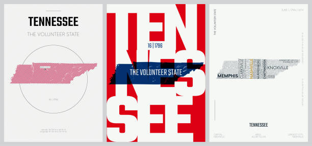
Tennessee. Vector silhouette state. Tennessee map with text script. Tennessee shape state map for poster, t-shirt, tee, souvenir. Vector outline Isolated illustratuon on a white background.

Stamp or label with text Knoxville, Tennessee written inside, vector illustration

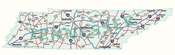
A vintage-style map of Tennessee with freeways, highways and major cities. Shoreline, lakes and rivers are very detailed. Includes an EPS and JPG of the map without roads and cities. Texture, compass, cities, etc. are on separate layers for easy removal or changes.
The map is accurately prepared by a map expert.

Vector Illustration of a City Street Map of Knoxville, Tennessee, USA. Scale 1:60,000.All source data is in the public domain.U.S. Geological Survey, US TopoUsed Layers:USGS The National Map: National Hydrography Dataset (NHD)USGS The National Map: National Transportation Dataset (NTD)

Poster Style Topographic / Road map of Knoxville, TN. Map data is public domain via census.gov. All maps are layered and easy to edit. Roads are editable stroke.

Cartoon silhouette of the city of Knoxville, USA.

TN Knox County Vector Map Green. All source data is in the public domain. U.S. Census Bureau Census Tiger. Used Layers: areawater, linearwater, cousub, pointlm.

Vector illustrator Graphic Slogan Design , For Labels, Posters, And Printed For T-shirts And For Other Uses

Poster Style Topographic / Road map of Knoxville, TN. Map data is public domain via census.gov. All maps are layered and easy to edit. Roads are editable stroke.

Hand painted water color drawing, isolated clipart elements for design decoration.

vector graphic illustration of the outline of the state of Tennessee with the word home on white background

Tennesy state detailed editable map with cities and towns, geographic sites, roads, railways, interstates and U.S. highways. Vector EPS-10 file, trending color scheme

Tennessee, TN, gray political map, with capital Nashville, and with large, important cities. State of Tennessee, located in the Southeastern region of the United States. Nicknamed The Volunteer State.

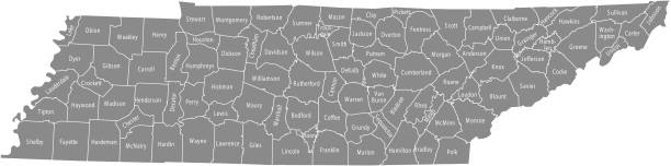
Tennessee, TN - detailed political map of US state. Administrative map divided into counties. Thin blank black outline map. Vector illustration

Tennessee - flat collection of US states flags. Flags of twelve flat icons of various shapes. Set of vector illustrations
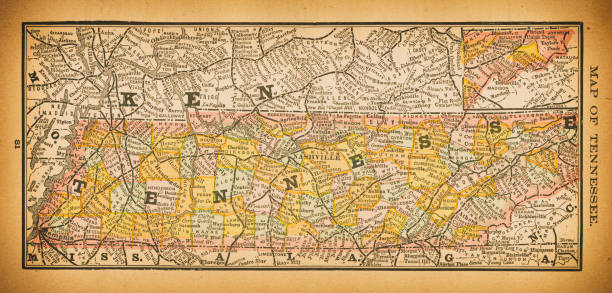
19th century map of Tennessee. Published in New Dollar Atlas of the United States and Dominion of Canada. (Rand McNally & Co's, Chicago, 1884).

Topographic / Road map of Knoxville, TN. Map data is public domain via census.gov. All maps are layered and easy to edit. Roads are editable stroke.

Map of Knox County - Tennessee for your own design. Three maps with editable stroke included in the bundle: - One black map on a white background. - One line map with only a thin black outline in a line art style (you can adjust the stroke weight as you want). - One map on a blank transparent background (for change background or texture). The layers are named to facilitate your customization. Vector Illustration (EPS file, well layered and grouped). Easy to edit, manipulate, resize or colorize. Vector and Jpeg file of different sizes.

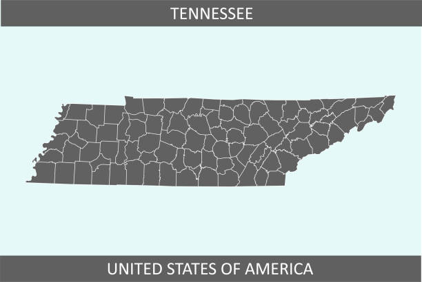
Highly detailed downloadable and printable map of Tennessee state of United States of America for web banner, mobile, smartphone, iPhone, iPad applications and educational use. The map is accurately prepared by a map expert.

Vintage engraving of Northrop leading the attack at Knoxville during American civil war

Tennessee Nashville Stamp with National Flag and Postmark