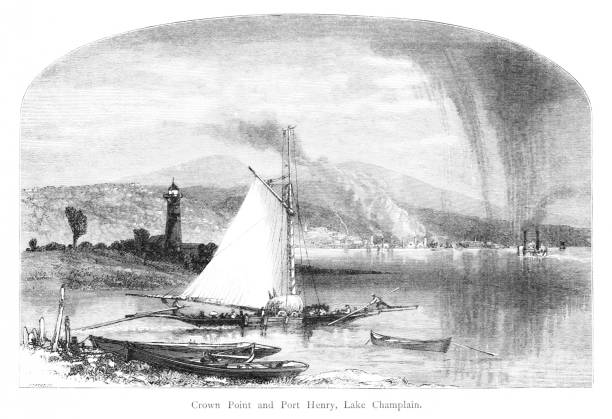
You're looking at a beautifully detailed engraved illustration from the 'Picturesque America' series. Published by D. Appleton and Company of New York in 1872 and 1874 and edited by the romantic poet and journalist William Cullen Bryant. The "Picturesque America; or, The Land We Live In. A Delineation by Pen and Pencil of the Mountains, Rivers, Lakes, Forests, Water-falls, Shores, Cañons, Valleys, Cities, and Other Picturesque Features of Our Country. With Illustrations on Steel and Wood, by Eminent American Artists" series was published and delivered as a subscription; semi-monthly parts were sent out to subscribers. Once complete, the subscription would be bound into volumes. The stately, bound two volume set was proudly displayed in parlors of subscriber homes as a show of status. Engravers included Robert Hinshelwood (1812-1885), Edward Paxman Brandard (1819-1898), Samuel Valentine Hunt (1803-1893), William Wellstood (1819-1900), William Chapin (1802-1888), Henry Bryan Hall (1808-1884).