Series of stylized travel stamps of the state of Utah
Browse 20+ lake powell stock illustrations and vector graphics available royalty-free, or search for lake powell arizona or lake powell utah to find more great stock images and vector art.
Series of stylized travel stamps of the state of Utah

Famous rainbow bridge of Lake Powell
Utah, UT, political map, with the capital Salt Lake City. State in the Mountain West subregion of the Western United States of America, nicknamed Beehive State, The Mormon State, and Deseret. Vector.

Stylized Arizona travel Graphics

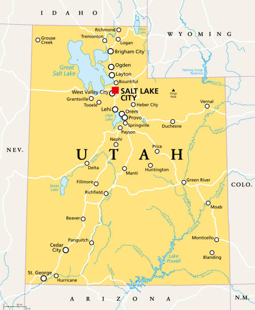
Detailed vector map of the US State of Utah with administrative divisions. The colors in the .eps-file are ready for print (CMYK). Included files are EPS (v10) and Hi-Res JPG (4924 x 4924 px).
"Vector illustration of map fo Arizona with major roads, rivers and lakes."

"Antique illustration of Glen Canyon in the U.S. states of Utah and Arizona. Engraving published in Picturesque America (D. Appleton & Co., New York, 1872).MORE VINTAGE AMERICAN ILLUSTRATIONS HERE:"

Vector illustration. Hand-drawn map of US state Utah in sketchy style, atop an aged, textured lined paper background.

Kanab Canyon, Utah, USA. Pencil and pen, engraving published 1874. This edition edited by William Cullen Bryant is in my private collection. Copyright is in public domain.

U.S. states - map of Arizona. Hand made. Rivers and lakes are shown. Please look at my other images of cartographic series - they are all very detailed and carefully drawn by hand WITH RIVERS AND LAKES.

U.S. states - map of Arizona. Hand made. Rivers and lakes are shown. Please look at my other images of cartographic series - they are all very detailed and carefully drawn by hand WITH RIVERS AND LAKES.

Map of the US State of Utah in a soft blue color, including lakes, vector map illustration

Antique illustration of Glen Canyon in the U.S. states of Utah and Arizona. Engraving published in Picturesque America (D. Appleton & Co., New York, 1872).MORE VINTAGE AMERICAN ILLUSTRATIONS HERE:

Illustration of The gorge Inferno by Gaston Vuillier

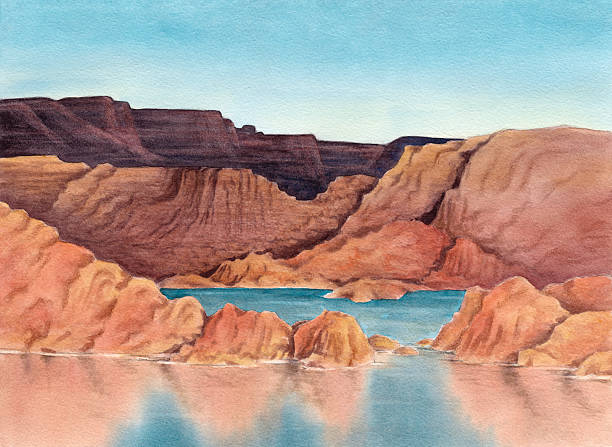
Illustration of low water levels in western reservoir as a result of climate change

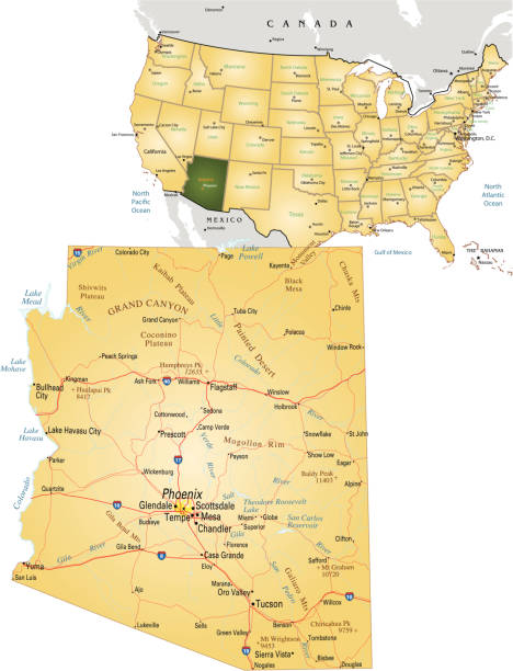
Detailed vector map of the US State of Arizona with administrative divisions. The colors in the .eps-file are ready for print (CMYK). Included files are EPS (v10) and Hi-Res JPG (4924 x 4924 px).
© 2025 iStockphoto LP. The iStock design is a trademark of iStockphoto LP. Browse millions of high-quality stock photos, illustrations, and videos.
Do Not Sell or Share