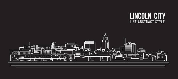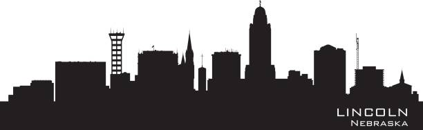
Lincoln Nebraska city skyline vector silhouette illustration
Browse 610+ lincoln nebraska stock illustrations and vector graphics available royalty-free, or search for lincoln nebraska neighborhood or lincoln nebraska skyline to find more great stock images and vector art.
Lincoln Nebraska city skyline vector silhouette illustration
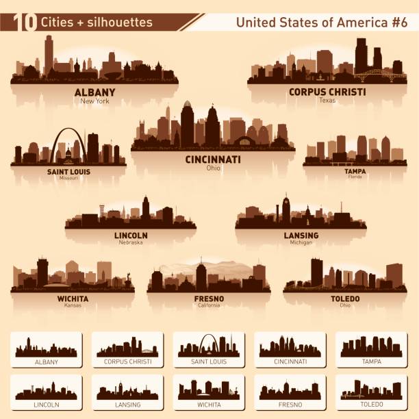
City skyline set. USA. Vector silhouette background illustration.

Lincoln Nebraska city skyline vector silhouette illustration

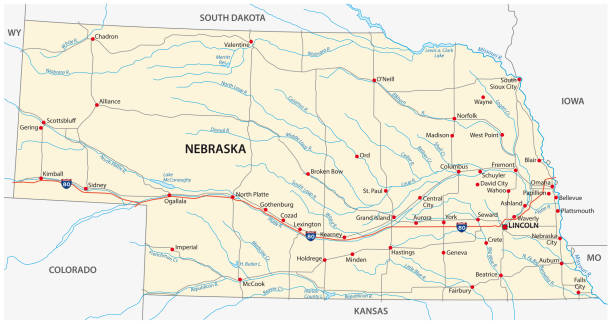
Lincoln NE City Vector Road Map Blue Text. All source data is in the public domain. U.S. Census Bureau Census Tiger. Used Layers: areawater, linearwater, roads.

Flag of the city of Lincoln, Nebraska, USA, original colors and proportions. Illustration.

happy president day, president abraham lincoln vector illustration design

Map of Lincoln city, Nebraska. Urban black and white poster. Road map image with metropolitan city area view.

Vector Nebraska State Capitol

Lincoln Nebraska City Skyline Silhouette with Black Buildings Isolated on White. Vector Illustration. Business Travel and Tourism Concept with Historic Architecture. Lincoln USA Cityscape with Landmarks.

Lincoln Nebraska City Skyline with Color Buildings. Vector Illustration. Business Travel and Tourism Concept with Historic Architecture. Lincoln USA Cityscape with Landmarks.

Lincoln Nebraska City Skyline Silhouette with Golden Buildings Isolated on White. Vector Illustration. Business Travel and Tourism Concept with Historic Architecture. Lincoln USA Cityscape with Landmarks.

Lincoln Nebraska city skyline vector silhouette illustration

A vintage-style map of Nebraska with freeways, highways and major cities. Shoreline, lakes and rivers are very detailed. Includes an EPS and JPG of the map without roads and cities. Texture, compass, cities, etc. are on separate layers for easy removal or changes.

Outline Lincoln Nebraska City Skyline with Blue Buildings. Vector Illustration. Business Travel and Tourism Concept with Historic Architecture. Lincoln USA Cityscape with Landmarks.
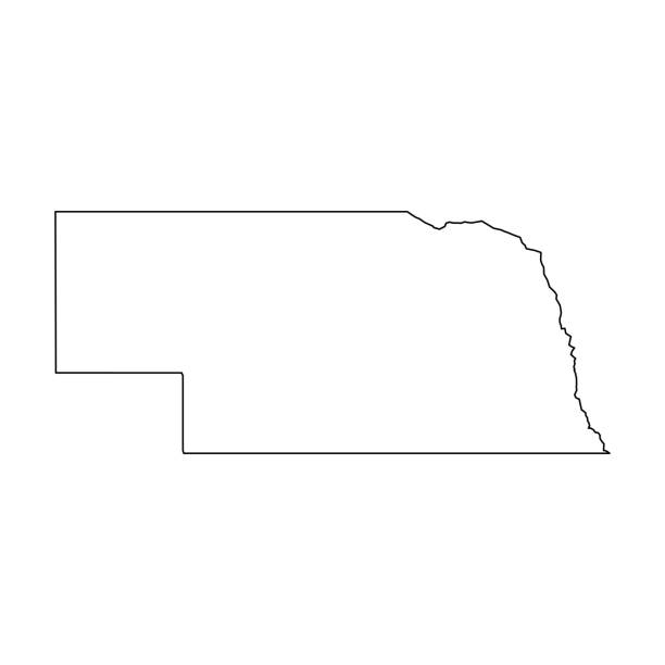
Nebraska, state of USA - solid black outline map of country area. Simple flat vector illustration.

Lincoln Nebraska City Skyline with Color Buildings, Blue Sky and Reflections. Vector Illustration. Business Travel and Tourism Concept with Historic Architecture. Lincoln USA Cityscape with Landmarks.

Outline Lincoln Nebraska City Skyline with Blue Buildings and Reflections. Vector Illustration. Business Travel and Tourism Concept with Historic Architecture. Lincoln USA Cityscape with Landmarks.

Lincoln Nebraska City Skyline in Paper Cut Style with Snowflakes, Moon and Neon Garland. Vector Illustration. Christmas and New Year Concept. Santa Claus on Sleigh. Lincoln USA Cityscape Landmarks.

vector illustration of Nebraska map

Lincoln Nebraska city skyline vector silhouette illustration
Nebraska map shape, united states of america. Flat concept icon symbol vector illustration .
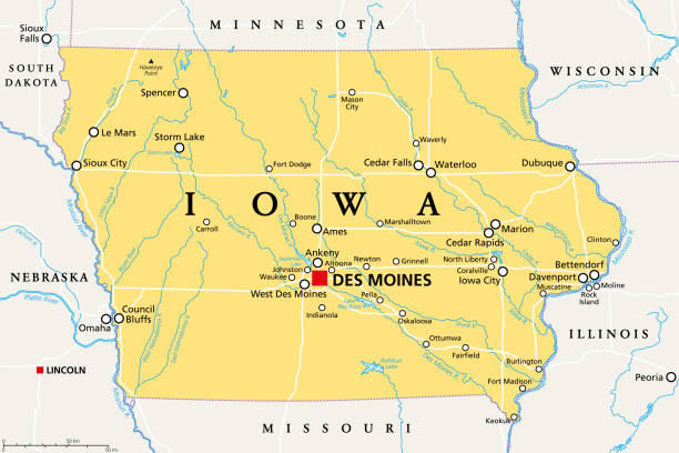
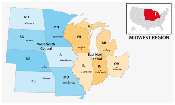
Iowa, IA, political map, with the capital Des Moines and most important cities, rivers and lakes. State in the Midwestern region of the United States of America, nicknamed The Hawkeye State. Vector.
The map is accurately prepared by a map expert.

Map of Nebraska in a realistic neon sign style. The map is created with a pink glowing neon light on a dark brick wall. Modern and trendy illustration with beautiful bright colors. Vector Illustration (EPS10, well layered and grouped). Easy to edit, manipulate, resize or colorize.

Lincoln Nebraska City Skyline with Color Buildings and reflections Isolated on White. Vector Illustration. Tourism Concept with Historic Architecture. Lincoln USA Cityscape with Landmarks.

Lincoln Nebraska city skyline vector silhouette illustration

Lincoln Nebraska city skyline vector silhouette illustration

Vector Illustration of a City Street Map of Lincoln, Nebraska, USA. Scale 1:60,000. All source data is in the public domain. U.S. Geological Survey, US Topo Used Layers: USGS The National Map: National Hydrography Dataset (NHD) USGS The National Map: National Transportation Dataset (NTD)

Illustrated map of the state of New Hampshire in United States with cities and landmarks. Editable vector illustration

Map of Nebraska in a trendy vintage style. Beautiful retro illustration with old textured paper and a black long shadow (colors used: blue, green, beige and black). Vector Illustration (EPS10, well layered and grouped). Easy to edit, manipulate, resize or colorize.

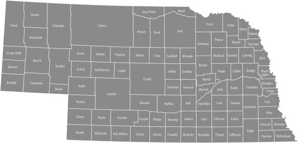
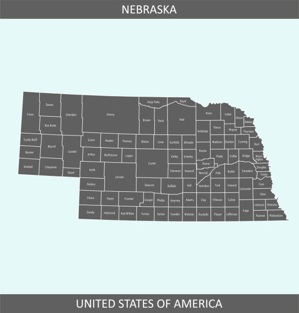
Highly-detailed Nebraska county map. Each county shape is in a separate labeled layer. All layers have been alphabetized for easy manipulation, recoloring or other use. (see image below -- note: labels only available in AICS2 and AI10 files)
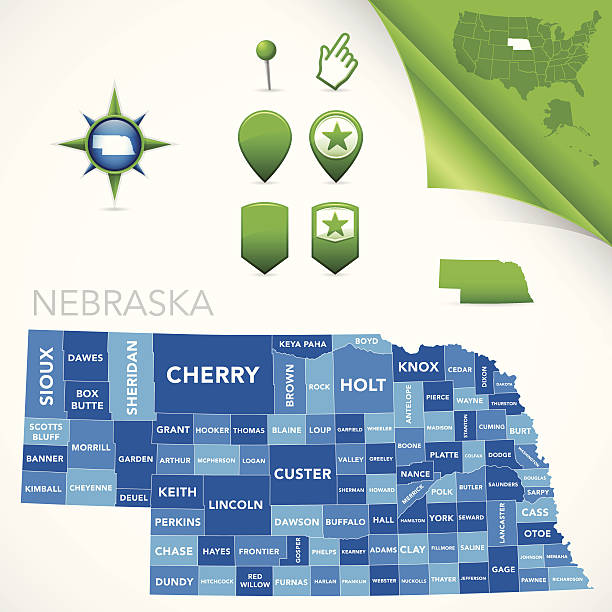
Highly-detailed Nebraska county map. Each county is in it's own separate labeled layer. County names are in a separate layer and can be easily adjusted or removed as well. All layers have been alphabetized for easy manipulation, recoloring or other use.
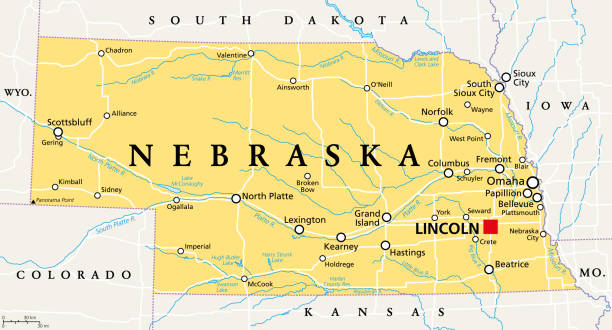
Nebraska, NE, political map with the capital Lincoln and the largest city Omaha. Triply landlocked State in the Midwestern subregion of the United States of America, nicknamed Cornhusker State. Vector
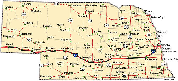
Highway map of the state of Nebraska with Interstates and US Routes. It also has lines for state and county routes (but not labeled) and many cities on it as well. All cities are the County Seats and the Capitol (and some others).
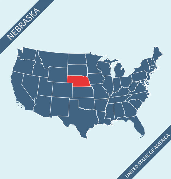
Highly detailed map of United States of America with highlighted state of Nebraska for web banner, mobile, smartphone, iPhone, iPad applications and educational use. The map is accurately prepared by a map expert.

black outline of Nebraska map- vector illustration
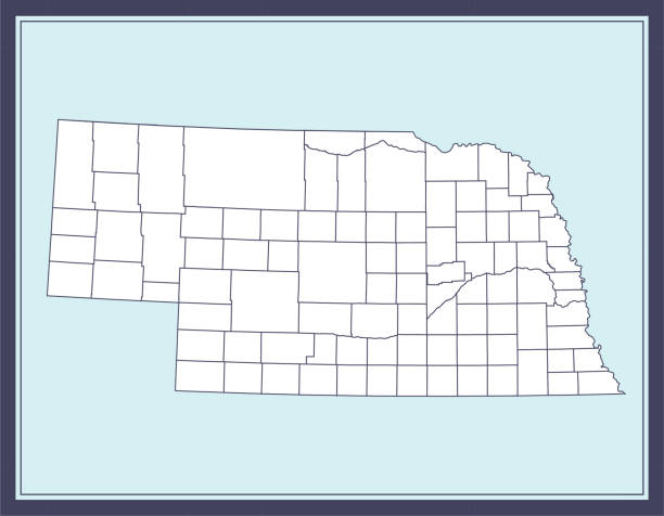
Printable counties map of Nebraska state of United States of America. The map is accurately prepared by a map expert.

Map of Nebraska created with a mesh of thin bright blue lines and glowing dots, isolated on a dark blue background. Conceptual illustration of networks (communication, social, internet, ...). Vector Illustration (EPS10, well layered and grouped). Easy to edit, manipulate, resize or colorize.

Map of Nebraska cut out on a blank white paper with a blue background. Modern and trendy paper cutout effect. Vector Illustration (EPS file, well layered and grouped). Easy to edit, manipulate, resize or colorize. Vector and Jpeg file of different sizes.

Lincoln Nebraska City Skyline with Color Buildings, Blue Sky and Reflections. Vector Illustration. Business Travel and Tourism Concept with Historic Architecture. Lincoln USA Cityscape with Landmarks.

happy presidents day usa flags abraham lincoln fireworks vector illustration
Nebraska map shape, united states of america. Flat concept icon symbol vector illustration .

vector illustration of Nebraska maps