A rocket flying into space. Starting or starting an important project. The startup. Procurement for presentation
Browse 140+ outer banks stock illustrations and vector graphics available royalty-free, or search for outer banks north carolina or the outer banks to find more great stock images and vector art.
A rocket flying into space. Starting or starting an important project. The startup. Procurement for presentation

North Carolina flag long banner digital vector illustration
Gazebo icon in black style isolated on white background. Park symbol vector illustration.

A rocket flying into space. Starting or starting an important project. The startup. Procurement for presentation
North Carolina circle flag logo icon digital vector illustration

A rocket flying into space. Starting or starting an important project. The startup. Procurement for presentation

High-quality vector illustration of North Carolina featuring a modern flat design with blue circle patterns on a clean white background. Perfect for educational materials, school projects, infographics, presentations, travel guides, and creative or commercial projects. Scalable vector suitable for digital or print use, classroom resources, maps for teaching, or home/office decor highlighting North Carolina’s geography, coastline, and location in the United States.

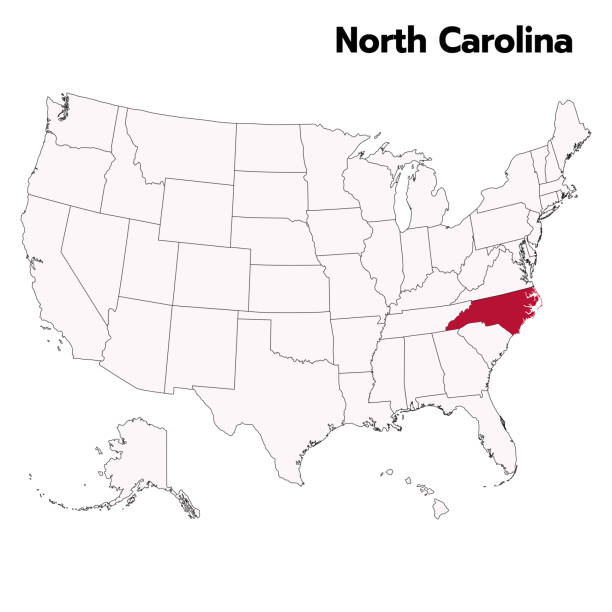
High-quality vector illustration of a US state map featuring a black solid fill and outline on a white background. Fully editable and isolated for use in design projects, presentations, infographics, and educational materials. Perfect for graphic designers, educators, content creators, and marketers who need a clean, professional, and versatile map for visual storytelling, classroom activities, or digital projects. Compatible with all major vector software, this template allows easy customization of size, color, and layout to fit your creative needs.

Engraving from 1877 that shows the amphibious assault on the Island of Roanoke on February 1862 in the North Carolina Sounds. Image is a high resolution scan and is available at 600dpi. Now in public domain. Photo by M. Poe

North Carolina flag long banner digital vector illustration
Gazebo icon in cartoon style isolated on white background. Park symbol vector illustration.

Maps of Currituck County - North Carolina, on blue and red backgrounds. Four map versions included in the bundle: - One map on a blank blue background. - One map on a blue background with the word "Democrat". - One map on a blank red background. - One map on a red background with the word "Republican". Vector Illustration (EPS file, well layered and grouped). Easy to edit, manipulate, resize or colorize. Vector and Jpeg file of different sizes.

North Carolina (USA State) Flag Waving Vector Illustration on White Background. Flag of the United States of America.

Isolated flag of North Carolina us state vector illustration. Fluttering America North Carolina flag. North Carolina United States flagpole flag.

Flag of North Carolina. North Carolina wavy flag digital vector illustration. Fluttering flag.

Isolated national flag of North Carolina. Love flag of North Carolina. North Carolina state heart-shaped flag vector illustration.

A vecror image of a flower. Saved as EPS8, xar(CorelXara Xtreme) @ jpg
Gazebo icon in outline style isolated on white background. Park symbol vector illustration.

A vecror image of a flower. Saved as EPS8, xar(CorelXara Xtreme) @ jpg
Vector flat isolate gray corolla icon. Eps10

A vecror image of a flower. Saved as EPS8, xar(CorelXara Xtreme) @ jpg

Map of Currituck County - North Carolina for your own design. Three maps with editable stroke included in the bundle: - One black map on a white background. - One line map with only a thin black outline in a line art style (you can adjust the stroke weight as you want). - One map on a blank transparent background (for change background or texture). The layers are named to facilitate your customization. Vector Illustration (EPS file, well layered and grouped). Easy to edit, manipulate, resize or colorize. Vector and Jpeg file of different sizes.

North Carolina flag. North Carolina circle flag. Flag of the state of North Carolina. State flag. Standard color. Circle icon flag. Computer illustration. Digital illustration. Vector illustration.

Map of Currituck County - North Carolina, on two blue and red rubber stamps. Two versions included in the bundle: - One blue stamp with the map in the middle and the word "Democrat" around. - One red stamp with the map in the middle and the word "Republican" around. And also two blue and red banners with the name of the county. Vector Illustration (EPS file, well layered and grouped). Easy to edit, manipulate, resize or colorize. Vector and Jpeg file of different sizes.
Flag of North Carolina. North Carolina flag computer digital vector illustration icon design. Flagpole flag icon.

Highly detailed downloadable map of North Carolina counties state of United States of America for web banner, mobile, smartphone, iPhone, iPad applications and educational use. The map is accurately prepared by a map expert.

Flag of North Carolina. North Carolina wavy flag digital vector illustration. Fluttering flag.

Map of Currituck County - North Carolina, with a realistic paper cut effect isolated on white background. Trendy paper cutout effect. Vector Illustration (EPS file, well layered and grouped). Easy to edit, manipulate, resize or colorize. Vector and Jpeg file of different sizes.

North Carolina flag official colors and proportion digital vector illustration. Pleated flag.

Flag of North Carolina. North Carolina stateflag vector illustration icon design in the hand-drawn style. Fluttering flagpole flag.
Flag of North Carolina. North Carolina flag circle icon vector illustration design

North Carolina, NC - detailed political map of US state. Administrative map divided into counties. Thin blank black outline map. Vector illustration

North Carolina, NC - detailed political map of US state. Administrative map divided into counties. Thin black outline map with county name labels. Vector illustration

Map of Currituck County - North Carolina, with a large group of people. The faces are blue and red and represent patriots. The color blue for the Democratic Party and the color red for the Republican Party. Conceptual creative map, can symbolize the unity, cooperation, teamwork, patriotism... Vector Illustration (EPS file, well layered and grouped). Easy to edit, manipulate, resize or colorize. Vector and Jpeg file of different sizes.

North Carolina flag, the vertical flag of North Carolina. Hanging flag.

Flag of North Carolina. North Carolina flag official colors tilted icon digital vector illustration design.

Flag of North Carolina. North Carolina flag computer digital vector illustration icon design. Fluttering flagpole flag. Waving Flag.

Map of Currituck County - North Carolina, for your own design. Four maps with editable stroke included in the bundle: - One black map on a white background. - One blank map on a black background. - One white map with shadow on a blank background (for easy change background or texture). - One line map with only a thin black outline (in a line art style). The layers are named to facilitate your customization. Vector Illustration (EPS file, well layered and grouped). Easy to edit, manipulate, resize or colorize. Vector and Jpeg file of different sizes.
Vector flat isolate outline corolla icon. Eps10

Map of Currituck County - North Carolina, isolated on a blank background and with his name on a red ribbon. Vector Illustration (EPS file, well layered and grouped). Easy to edit, manipulate, resize or colorize. Vector and Jpeg file of different sizes.

Flag of North Carolina. North Carolina vertical flag icon digital vector illustration.

Map of Currituck County - North Carolina, on a blue and red colored background. The blue color represents the Democratic Party and the red color represents the Republican Party. White stars are placed above and below the map. Vector Illustration (EPS file, well layered and grouped). Easy to edit, manipulate, resize or colorize. Vector and Jpeg file of different sizes.

3D Map of Currituck County - North Carolina, isolated on a blank and gray background, with a dropshadow. Vector Illustration (EPS file, well layered and grouped). Easy to edit, manipulate, resize or colorize. Vector and Jpeg file of different sizes.

North Carolina flag official colors and proportion digital vector illustration. Pleated flag.
Flag of North Carolina state. North Carolina circle flag logo 3d icon digital vector illustration.

Flag of North Carolina. Black loop edge. North Carolina circle flag logo icon computer vector illustration design.

North Carolina flag long banner digital vector illustration.
Flag of North Carolina. North Carolina circle flag logo icon computer vector illustration design. Transparent checkerboard background.

Map of Currituck County - North Carolina folded with design elements. Blue map with grid lines, isolated on a blank background. Included in the illustration: Map pins, pushpins, marbles, stars, speech bubbles, people, and a map of the United States. Vector Illustration (EPS file, well layered and grouped). Easy to edit, manipulate, resize or colorize. Vector and Jpeg file of different sizes.