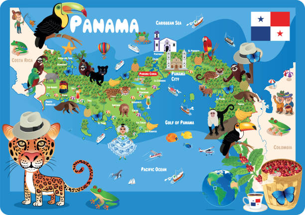
Political map of Panama with capital, national borders, most important cities, rivers and lakes. Vector illustration with English labeling and scaling.
Browse 100+ panama canal map stock illustrations and vector graphics available royalty-free, or search for panama map or mountain range to find more great stock images and vector art.
Political map of Panama with capital, national borders, most important cities, rivers and lakes. Vector illustration with English labeling and scaling.
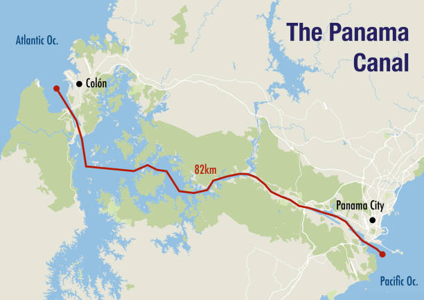
Map of the Panama canal, illustrating the route from the Pacific to the Atlantic ocean
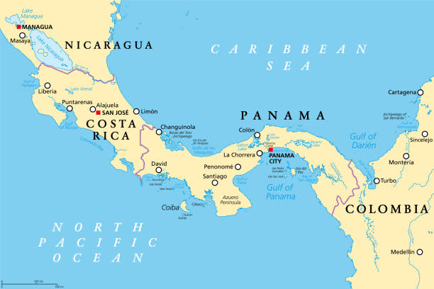
Costa Rica and Panama, political map, with the Isthmus of Panama and the Darien Gap. Narrow strip of land and region between the Caribbean Sea and the Pacific Ocean, linking North and South America.

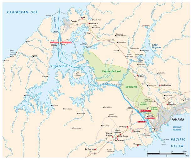
Political map of Panama Canal - with cross-section, cities, rivers and lakes. Vector illustration with english labeling, description and scale.

grey vector map of Panama
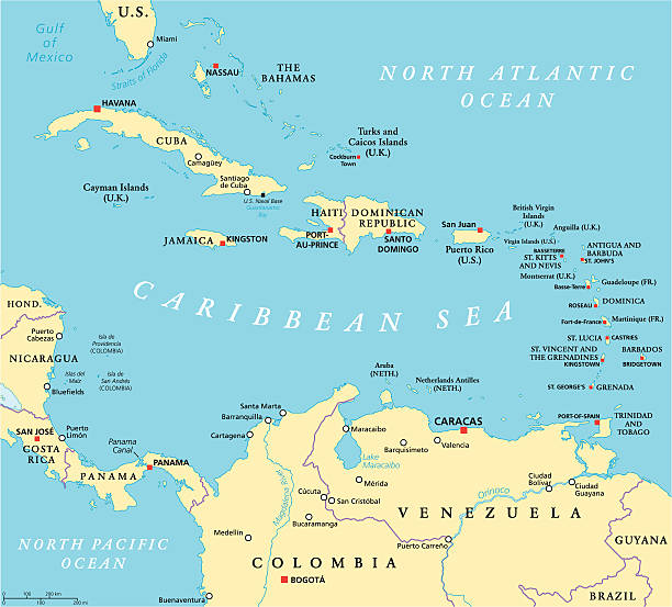
Caribbean political map with capitals, national borders, important cities, rivers and lakes. English labeling and scaling. Illustration.

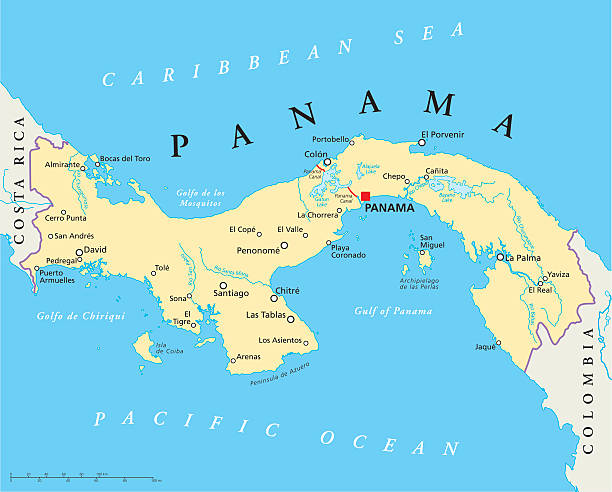
Panama Canal, political map. Artificial waterway in Panama, connecting the Atlantic Ocean (Caribbean Sea) with Pacific Ocean, cutting across the Isthmus of Panama, reducing the travel time for ships.
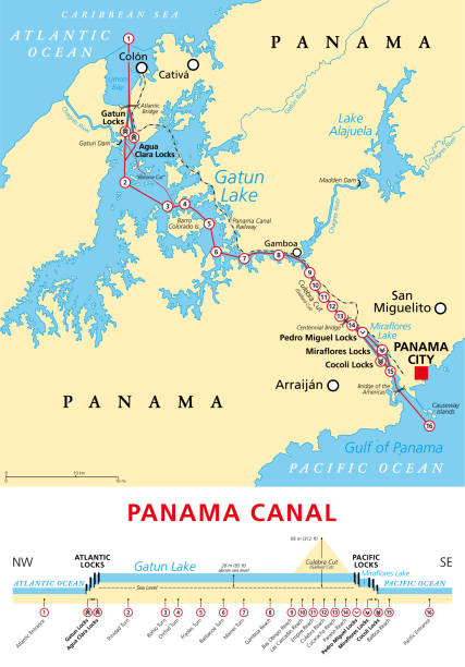
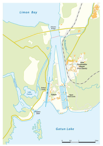
Panama Canal, political map and schematic diagram, illustrating the sequence of locks and passages. An artificial waterway, connecting the Atlantic Ocean with the Pacific Ocean, and expanded in 2016.
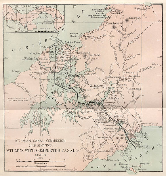
Panama Canal map was produced by the US Government, Isthmian Canal Commission. This map was drawn prior to 1913, the canal opened in 1914.

Vector Map of the Panama Canal Route from the Atlantic to the Pacific Ocean

Map of the historical projects of the Panama Canal (unfinished construction) and the Nicaragua Canal (in planning). Lithograph, published in 1897.

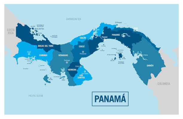
Vector Map of Panama with Major Cities and Neighboring Countries

Panama political map with capital Panama City, national borders, neighbor countries and the Panama Canal. Republic in North and Central America. Gray illustration, English labeling, over white. Vector

Highly detailed physical map of the Panama Canal region,in vector format,with all the relief forms and big cities.

South America and Central America map on transparent background. Vector illustration in HD very easy to make edits.

Panama Canal, gray political map. Artificial waterway in Panama, connecting Atlantic Ocean (Caribbean Sea) with Pacific Ocean, cutting across the Isthmus of Panama, reducing the travel time for ships.

Vintage engraving of a Map of the Panama Railroad, 19th Century. The Panama Canal Railway (Spanish: Ferrocarril de Panamá) is a railway line linking the Atlantic Ocean to the Pacific Ocean in Central America.

Ancient map of the Panama Canal Project. Lithograph, published in 1880.
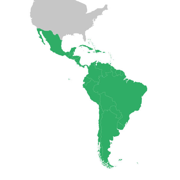
Map of South America and Central America. Vector illustration in HD very easy to make edits.
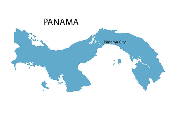
blue vector map of Panama with indication of Panama City
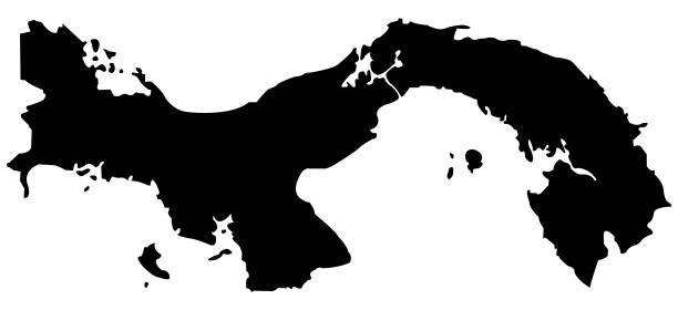
vector illustration of Panama map

Highly detailed physical map of Panama,in vector format,with all the relief forms,regions and big cities.

Very Rare, Beautifully Illustrated Antique Victorian Engraved Colored Map of South America Political Map Antique Victorian Engraved Colored Map, 1899. Source: Original edition from my own archives. Copyright has expired on this artwork. Digitally restored.

Panama Maphttps://maps.lib.utexas.edu/maps/americas/central_america_ref_2013.pdfhttps://maps.lib.utexas.edu/maps/americas/panama_relief.jpg

Panama Maphttps://maps.lib.utexas.edu/maps/americas/central_america_ref_2013.pdfhttps://maps.lib.utexas.edu/maps/americas/panama_relief.jpg

Vintage engraving of a Map, Plan of the Panama Canal, 19th Century. An artificial 82 km (51 mi) waterway in Panama that connects the Atlantic Ocean with the Pacific Ocean. The canal cuts across the Isthmus of Panama and is a conduit for maritime trade.

Engraving from 1873 of Panama and the Darien.

Panama Maphttps://maps.lib.utexas.edu/maps/americas/central_america_ref_2013.pdfhttps://maps.lib.utexas.edu/maps/americas/panama_relief.jpg
Vector Panamap http://legacy.lib.utexas.edu/maps/world_maps/world_physical_2015.pdf

Vector Panama Travelhttp://legacy.lib.utexas.edu/maps/world_maps/world_physical_2015.pdf

Panama Canal map from out-of-copyright 1898 book "Blackie's Modern Cyclopedia of Universal Information".

America set. World Countries vector maps series. Spiral fingerprint series.

Vector Find the Shadow of Panama Symbols http://legacy.lib.utexas.edu/maps/world_maps/world_physical_2015.pdf
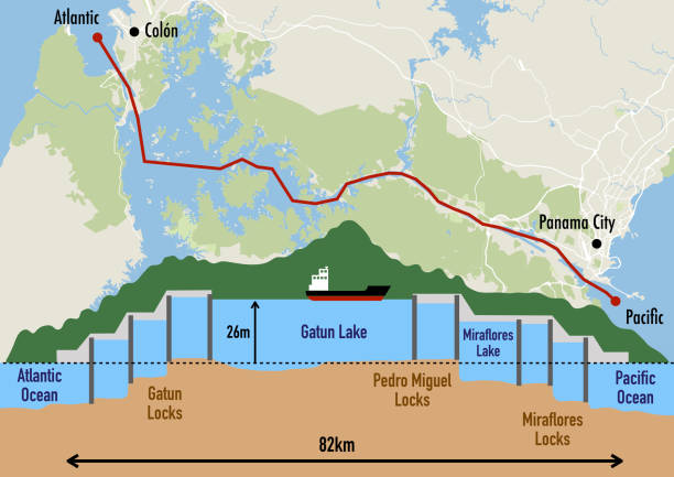
Schematic of the Panama canal structure and map illustrating the sequence of locks and passages

Map of South America and Central America.Vector illustration in HD very easy to make edits.

Costa Rica and Panama, gray political map, with the Isthmus of Panama and the Darien Gap. Narrow strip of land and region between the Caribbean Sea and Pacific Ocean, linking North and South America.

Panama Travel Map https://maps.lib.utexas.edu/maps/americas/central_america_ref_2013.pdf https://maps.lib.utexas.edu/maps/americas/panama_relief.jpg

Vector Panama Travel Symbols

Vector Map http://legacy.lib.utexas.edu/maps/world_maps/world_physical_2015.pdf

Panama Travel Maphttps://maps.lib.utexas.edu/maps/americas/central_america_ref_2013.pdfhttps://maps.lib.utexas.edu/maps/americas/panama_relief.jpg

Vector Panama Travel http://legacy.lib.utexas.edu/maps/world_maps/world_physical_2015.pdf

Map of South America and Central America.Vector illustration in HD very easy to make edits.

Map of South America and Central America.Vector illustration in HD very easy to make edits.