
Illustrations
210 Illustrations
View south yorkshire map videos
Browse 210+ south yorkshire map stock illustrations and vector graphics available royalty-free, or start a new search to explore more great stock images and vector art.


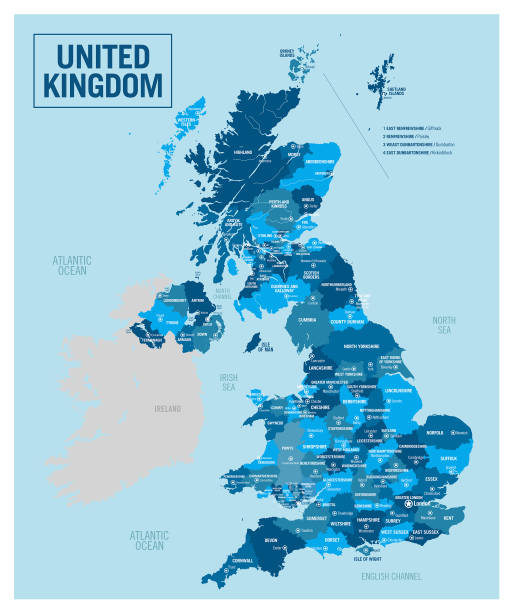


Map of United Kingdom - Vector illustration
Highly detailed vector map of England. Source data courtesy of NGDC and NASA. Source database: World Data Bank II. The source data is in the public domain. Data updated and improved. File was created on July 27, 2011. The colors in the .eps-file are ready for print (CMYK). Included files: EPS (v8) and Hi-Res JPG.


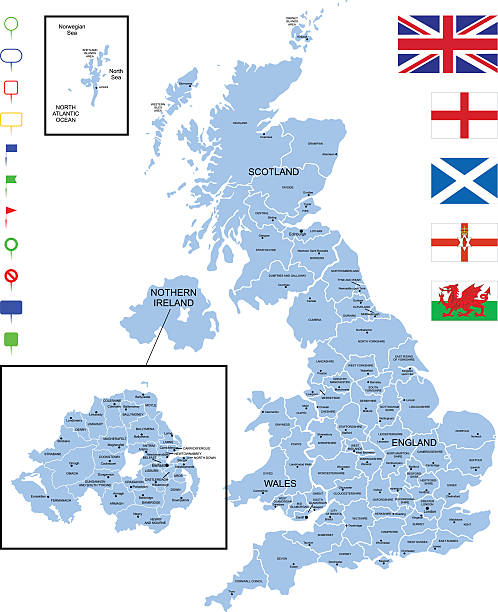
Detailed map of United Kingdom with pointers.

Map of United Kingdom - Infographic Vector illustration

Map of United Kingdom - Vintage Vector illustration

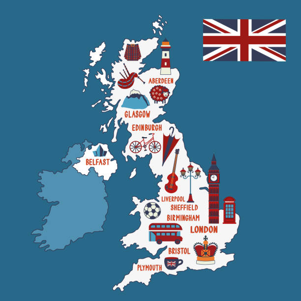
Vector illustrated map of Great Britain. Travel concept. Country landmarks, attractions and nation symbols on the map.

South Yorkshire county, administrative map isolated on white background , England
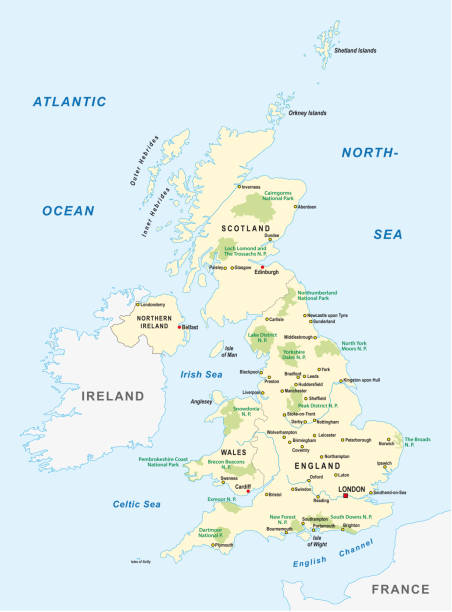
united kingdom national park vector map

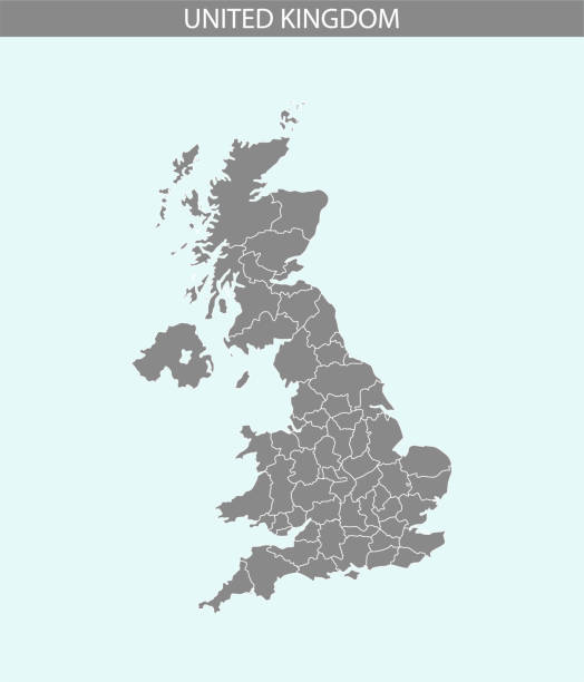


Detailed map of United Kingdom.

Colored sticker of Hand drawn doodle Great Britain map. England city names lettering and cartoon landmarks, tourist attractions cliparts. US travel, trip comic infographic poster, banner concept design.


Colored Hand drawn doodle Great Britain map. England city names lettering and cartoon landmarks, tourist attractions cliparts. US travel, trip comic infographic poster, banner concept design.

Map of United Kingdom - Vintage Vector illustration

Map of United Kingdom - Vector illustration

Map of United Kingdom - Infographic Vector illustration

Lorain OH City Vector Road Map Blue Horizontal. All source data is in the public domain. U.S. Census Bureau Census Tiger. Used Layers: areawater, linearwater, roads.

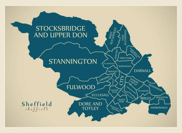
High Quality map of Sheffield is a city in United Kingdom, with borders of districts

Map of United Kingdom - Infographic Vector illustration


Map of United Kingdom - Vector illustration

Detailed map of United Kingdom with navigation icons.

Map of United Kingdom - Vector illustration


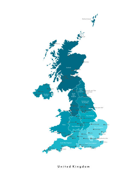
Vector map of United Kingdom with named counties and cities

Map of United Kingdom - Vector illustration

Map of United Kingdom - Infographic Vector illustration

Map of United Kingdom - Vector illustration

MA Berkshire Sheffield Vector Road Map. All source data is in the public domain. U.S. Census Bureau Census Tiger. Used Layers: areawater, linearwater, roads, rails, cousub, pointlm, uac10.

Sheffield Great Britain (United Kingdom) City Map in Retro Style. Outline Map. Vector Illustration.


Vector United Kingdom Oil Platform Map https://maps.lib.utexas.edu/maps/europe/united_kingdom_pol87.jpg

PA Warren County Vector Map Green. All source data is in the public domain. U.S. Census Bureau Census Tiger. Used Layers: areawater, linearwater, cousub, pointlm.

South Yorkshire (United Kingdom, England, Metropolitan county) map vector illustration, scribble sketch South Yorkshire map

Sheffield Great Britain City Map in Black and White Color in Retro Style. Outline Map. Vector Illustration.


South Yorkshire county, administrative map with labels, England

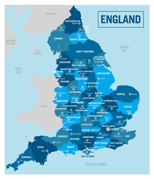
Detailed map of England with navigation icons.
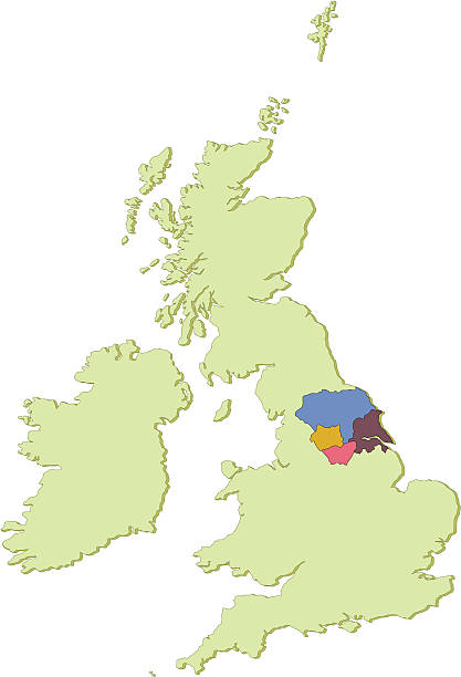
A map of the United Kingdom, showing the 4 counties that make up the Yorkshire region.

Map of United Kingdom - Vintage Vector illustration

Map of United Kingdom - Vector illustration

Detailed map of United Kingdom with navigation icons.

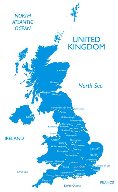
UNITED KINGDOM MAP with big cities, UK MAP with borders on grey background.
Outline detailed map with city names


Vector United Kingdom Travel Map https://maps.lib.utexas.edu/maps/europe/united_kingdom_pol87.jpg
of4Next