asian countries vector map.
Browse 1,000+ vietnam on world map stock illustrations and vector graphics available royalty-free, or start a new search to explore more great stock images and vector art.

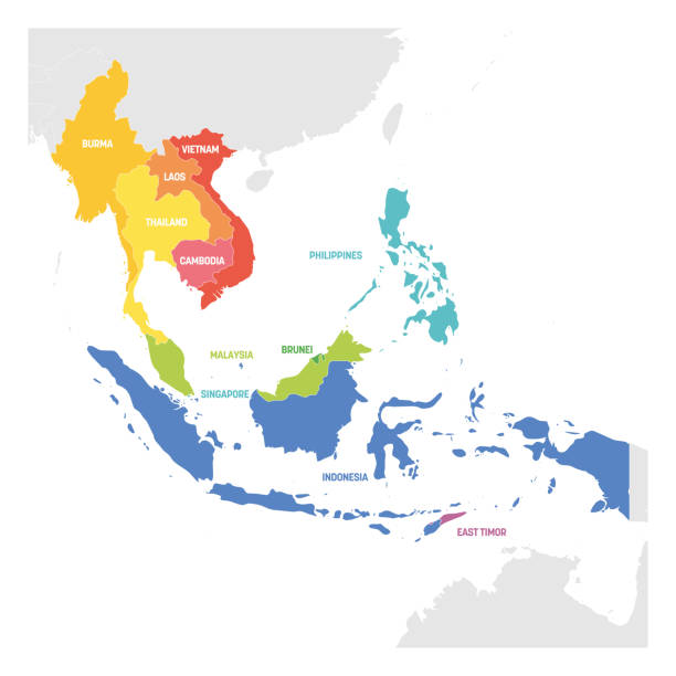
ASEAN member states, infographic and map. Association of Southeast Asian Nations, a regional intergovernmental organization with 10 member countries, shown with green color. Illustration. Vector.
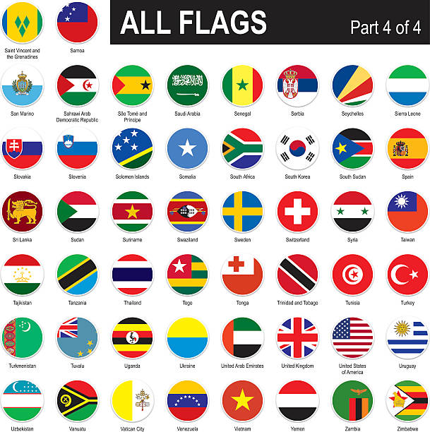
All round World Flags with country names (part4)
Vietnam country in the world map vector isolated on background. Flat Earth template for pattern, report, infographics, banner, backdrop. World map templates, patterns.
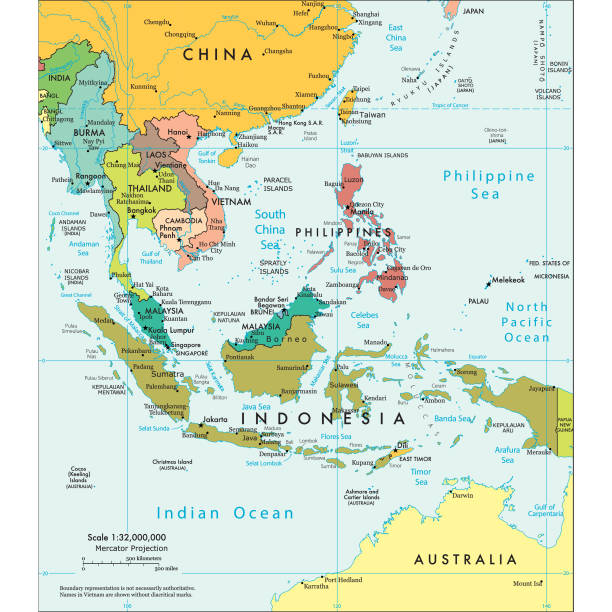
Vector illustration of the political map of South East Asia Reference map was created by the US Central Intelligence Agency and is available as a public domain map at the University of Texas Libraries website. https://www.cia.gov/library/publications/resources/the-world-factbook/graphics/ref_maps/political/pdf/southeast_asia.pdf

Vietnam map silhouette with flag isolated on white background. Flat style

Southeast Asia countries, political map. Geographical region of Asia, bordered by East and South Asia, by the Bay of Bengal, Oceania, the Pacific Ocean, and bordered by Australia and the Indian Ocean.

Northern part of Mainland Southeast Asia, multi colored political map, with borders and capitals. Formerly known as Indochina, with the countries Thailand, Vietnam, Myanmar, Laos, and Cambodia.
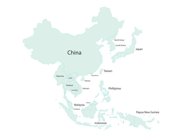
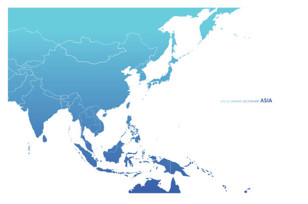
Vector illustration of a map of Asia and all its countries with their names. Cut out design element on a white background.

Realistic Waving Vector Flags Set. All Flags (part 4 of 4) Isolated on White Background

Circle Geometry East Asia map. All elements are separated in editable countries. Vector illustration EPS10.

Vietnam highlighted blue on world map vector illustration. Business concept graphics design. Gray background.

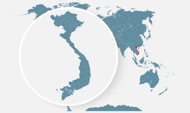
Asia centered world map with magnified glass on Vietnam. Focus on map of Vietnam on Pacific-centric World Map. Vector illustration.
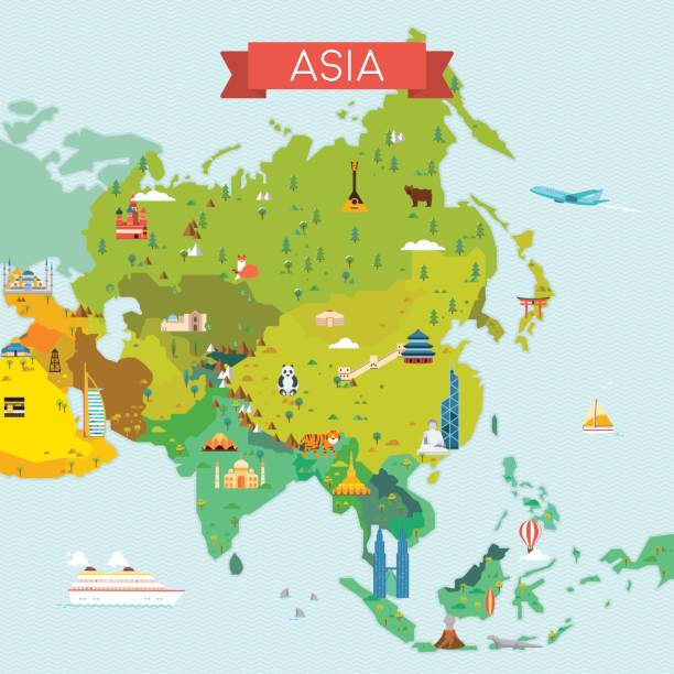
Travel and tourism background. Vector flat illustration

modern style blue world earth globe asia japan

Hexagon shape South east Asia and nearby countries map. Vector illustration

Map of Comprehensive and Progressive Agreement for Trans-Pacific Partnership, CPTPP or TPP11. Pink highlighted member states. Vector illustration.

Vietnam is magnified over a World Map, illustration with airplane, passport, boarding pass, compass and eyeglasses. Vector illustration.

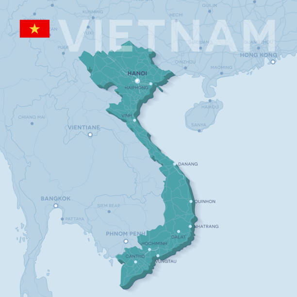
Vietnam - Detailed Map with Regions and Cities. Set of Flags, Globe, Country Outline, Country Location on World Map.

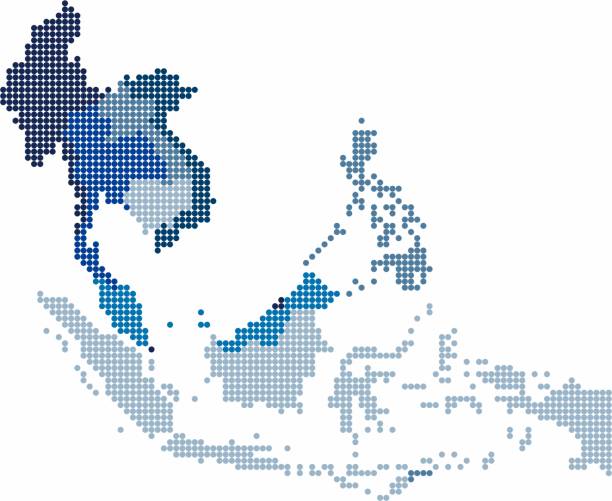
map of southeast asia countries with dotted style

ASEAN member states, political map. Association of Southeast Asian Nations, a regional intergovernmental organization with 10 member countries, shown in the map in green color. Illustration. Vector.

Indochina detailed editable map with countries cities and towns. Vector EPS-10 file
3d verctor map of cities and roads in Asia. Countries and their neighbors.

High detailed vector globe with Eurasia and Oceania. Vector illustration.
Circle shape South east Asia and nearby countries map. Vector illustration.

The flag of the country in the form of borders

Southeast Asia Region. Map of countries in southeastern Asia. Vector illustration.
Asia Map with national borders and navigation icons Map was found: http://legacy.lib.utexas.edu/maps/middle_east_and_asia/txu-oclc-247232986-asia_pol_2008.jpg Created with Adobe Illustrator with splines 24-12-2019

Waving Realistic Vector Flag Set. Asia Flags Isolated on White Background

Circle dot South east Asia and nearby countries map. Vector illustration

Political map of western, southern and eastern Asia in grey. Modern style simple flat vector illustration.
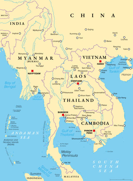
Mainland Southeast Asia, northern part of formerly known Indochina, political map. The countries Thailand, Vietnam, Myanmar, Laos, and Cambodia, with borders, their capitals and largest and cities.

Highly detailed Vietnam map with borders isolated on background. Flat style
Southeast Asia Region. Colorful map of countries in southeastern Asia. Vector illustration.

ASEAN countries highlighted with green color on world map vector illustration.

Northern part of Mainland Southeast Asia, transport political map. Countries Thailand, Vietnam, Myanmar, Laos, and Cambodia, with the most important waterways on rivers, and with the largest cities.