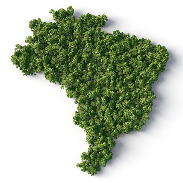
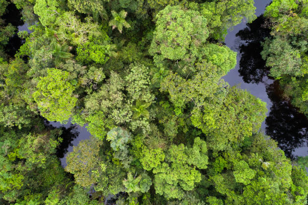
Ecology concept: Brazil shaped forest viewed from above. Computer generated, and lit with global radiosity. Subtle grain texture added.
Browse 500+ amazon forest map stock photos and images available, or start a new search to explore more stock photos and images.
Ecology concept: Brazil shaped forest viewed from above. Computer generated, and lit with global radiosity. Subtle grain texture added.
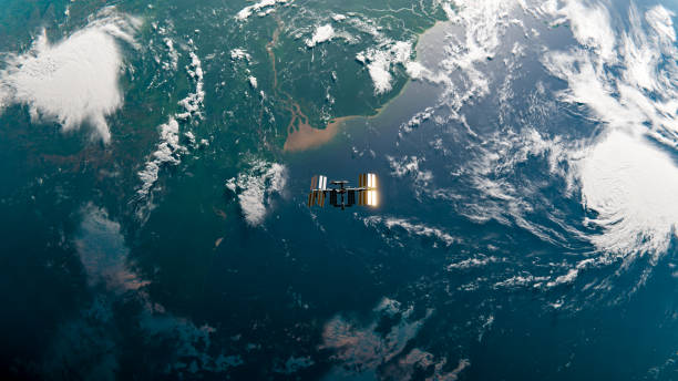
ISS orbiting over the end of the Amazon River. Top down view.Planet map and ISS model from NASA: https://eoimages.gsfc.nasa.gov/images/imagerecords/74000/74192/world.200411.3x21600x21600.D2.pnghttps://solarsystem.nasa.gov/resources/2378/international-space-station-3d-model/Tools and software used: Blender 2.8

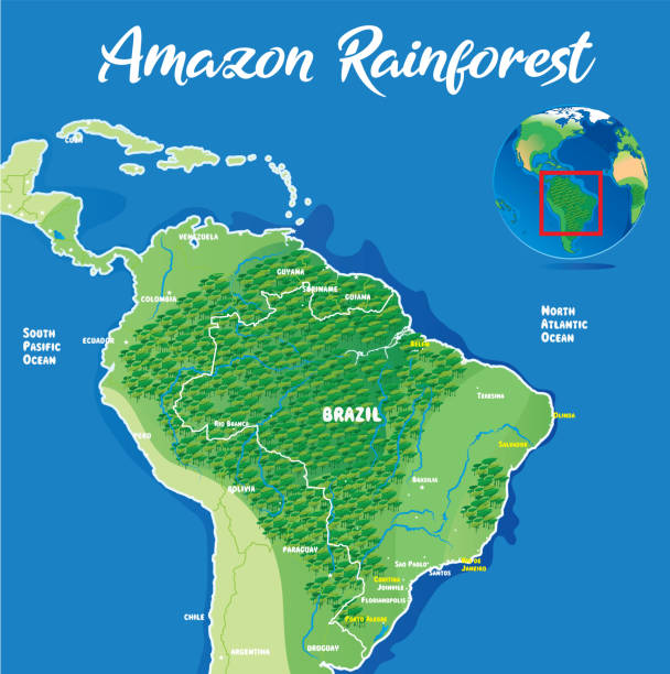
3D Render of a Topographic Map of the Amazon Rainforest.All source data is in the public domain.Color texture: Made with Natural Earth. http://www.naturalearthdata.com/downloads/10m-raster-data/10m-cross-blend-hypso/Relief texture and rivers: GMTED 2010 data courtesy of USGS. URL of source image:https://topotools.cr.usgs.gov/gmted_viewer/viewer.htmWater texture: SRTM Water Body SWDB:https://dds.cr.usgs.gov/srtm/version2_1/SWBD/
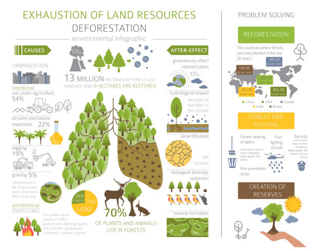
Global environmental problems. Exhaustion of land resources infographic. Deforestation. Vector illustration
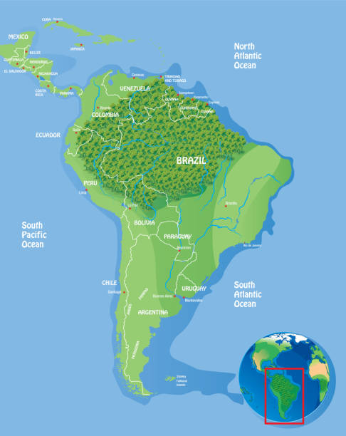
Vector Amazon Rainforest http://legacy.lib.utexas.edu/maps/world_maps/world_physical_2015.pdf

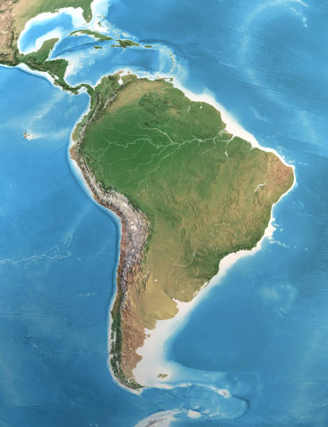
3D Render of a Topographic Map of the Amazon Rainforest.All source data is in the public domain.Color texture: Made with Natural Earth. http://www.naturalearthdata.com/downloads/10m-raster-data/10m-cross-blend-hypso/Relief texture and rivers: GMTED 2010 data courtesy of USGS. URL of source image:https://topotools.cr.usgs.gov/gmted_viewer/viewer.htmWater texture: SRTM Water Body SWDB:https://dds.cr.usgs.gov/srtm/version2_1/SWBD/
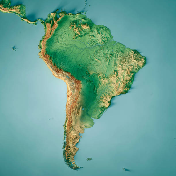
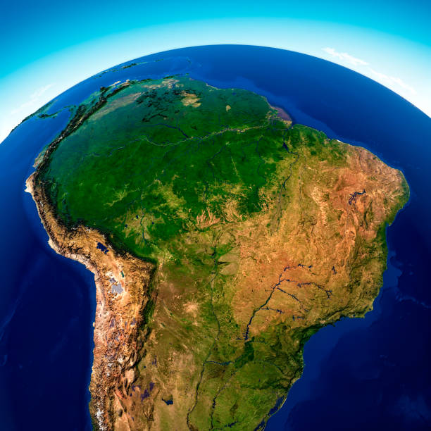
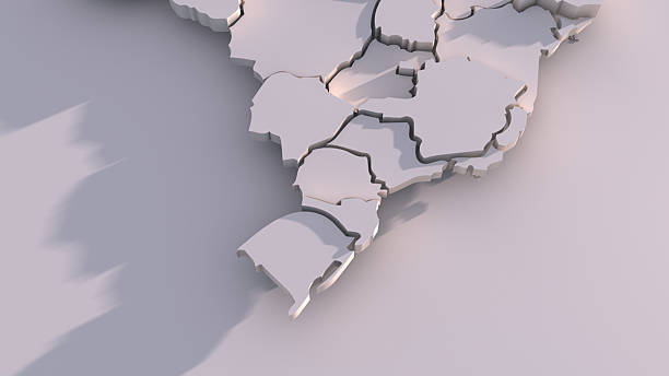
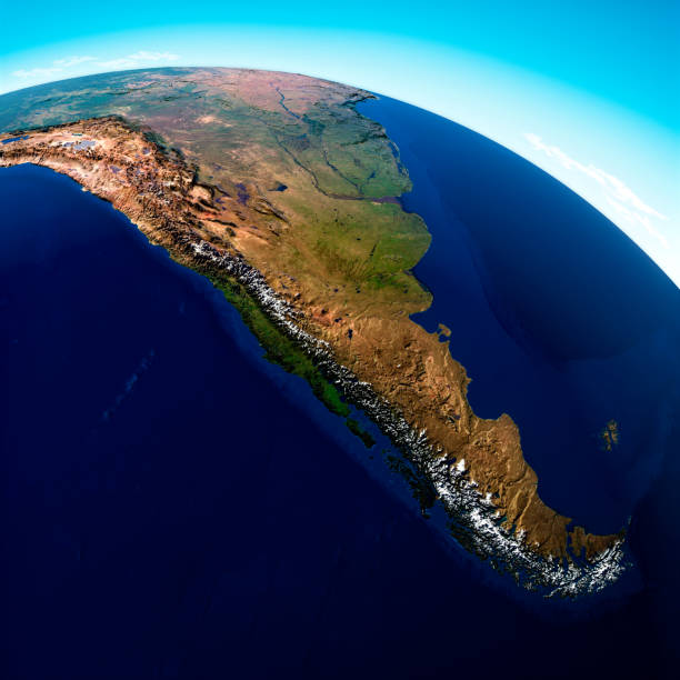
3D Render of a Topographic Map of South America. All source data is in the public domain.Color texture: Made with Natural Earth.http://www.naturalearthdata.com/downloads/10m-raster-data/10m-cross-blend-hypso/Relief texture: GMTED 2010 data courtesy of USGS. URL of source image:https://topotools.cr.usgs.gov/gmted_viewer/viewer.htmWater texture: SRTM Water Body SWDB: https://dds.cr.usgs.gov/srtm/version2_1/SWBD/

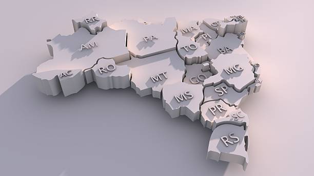
3D Render of a Topographic Map of Brazil. Version with Country Boundaries.All source data is in the public domain.Color texture: Made with Natural Earth. http://www.naturalearthdata.com/downloads/10m-raster-data/10m-cross-blend-hypso/Relief texture: NASADEM data courtesy of NASA JPL (2020). URL of source image: https://doi.org/10.5067/MEaSUREs/NASADEM/NASADEM_HGT.001Water texture: SRTM Water Body SWDB:https://dds.cr.usgs.gov/srtm/version2_1/SWBD/Boundaries Level 0: Humanitarian Information Unit HIU, U.S. Department of State (database: LSIB)http://geonode.state.gov/layers/geonode%3ALSIB7a_Gen

3D Render of a Topographic Map of Pará, Brazil.All source data is in the public domain.Color texture: Made with Natural Earth.http://www.naturalearthdata.com/downloads/10m-raster-data/10m-cross-blend-hypso/Relief texture: SRTM data courtesy of NASA JPL (2020). URL of source image:https://lpdaac.usgs.gov/products/srtmgl1v003/Water texture: SRTM Water Body SWDB: https://dds.cr.usgs.gov/srtm/version2_1/SWBD/
Satellite view of the Amazon rainforest, map, states of South America, reliefs and plains, physical map. Forest deforestation. 3d renderElement of this images are furnished by Nasahttps://visibleearth.nasa.gov/images/73801/september-blue-marble-next-generation-w-topography-and-bathymetry/73812l

Biomes in Brazil, map of 6 ecosystems with natural vegetation. Amazonia (rainforest), Caatinga (scrub), Cerrado (savanna), Mata Atlantica (Atlantic Forest), Pampa (grassland), and Pantanal (wetland).

Surface of the Planet Earth viewed from a satellite, focused on South America and Amazon rainforest, sun rising on the horizon. Physical map of Amazonia. 3D illustration (Blender software) - Elements of this image furnished by NASA (https://eoimages.gsfc.nasa.gov/images/imagerecords/73000/73776/world.topo.bathy.200408.3x5400x2700.jpg).

Vector Amazon Rain Forest Animals Maphttps://maps.lib.utexas.edu/maps/americas/south_america_ref_2010.pdf

3D Render of a Topographic Map of Brazil. All source data is in the public domain.Color texture: Made with Natural Earth. http://www.naturalearthdata.com/downloads/10m-raster-data/10m-cross-blend-hypso/Relief texture: NASADEM data courtesy of NASA JPL (2020). URL of source image: https://doi.org/10.5067/MEaSUREs/NASADEM/NASADEM_HGT.001Water texture: SRTM Water Body SWDB:https://dds.cr.usgs.gov/srtm/version2_1/SWBD/Boundaries Level 0: Humanitarian Information Unit HIU, U.S. Department of State (database: LSIB)http://geonode.state.gov/layers/geonode%3ALSIB7a_Gen

Brazil country 3D Map Top View. Brasil map with green trees isolated on white background.

COP30 - United Nations Climate Change Conference Brasil, Amazonia.

Sun shining over a high detailed view of Planet Earth, focused on South America, Amazon rainforest and Brazil. 3D illustration (Blender software), elements of this image furnished by NASA (https://eoimages.gsfc.nasa.gov/images/imagerecords/73000/73776/world.topo.bathy.200408.3x5400x2700.jpg)

Surface of the Planet Earth viewed from a satellite, focused on South America, Andes cordillera and Amazon rainforest. Physical map of Amazonia. 3D illustration (Blender software) - Elements of this image furnished by NASA (https://eoimages.gsfc.nasa.gov/images/imagerecords/73000/73776/world.topo.bathy.200408.3x5400x2700.jpg).
Physical map of South and Central America, with high resolution details. Satellite view of Planet Earth. 3D illustration (Blender software), elements of this image furnished by NASA (https://eoimages.gsfc.nasa.gov/images/imagerecords/147000/147190/eo_base_2020_clean_3600x1800.png)

Vector Amazon Rainforest http://legacy.lib.utexas.edu/maps/world_maps/world_physical_2015.pdf

3D Render of a Satellite Landscape View of Pará, Brazil.All source data is in the public domain.Color and Water texture: Contains modified Copernicus Sentinel data (2021) courtesy of ESA.URL of source image: https://dataspace.copernicus.eu/explore-data/data-collections/sentinel-data/sentinel-2Relief texture: SRTM data courtesy of NASA JPL (2020). URL of source image:https://lpdaac.usgs.gov/products/srtmgl1v003/
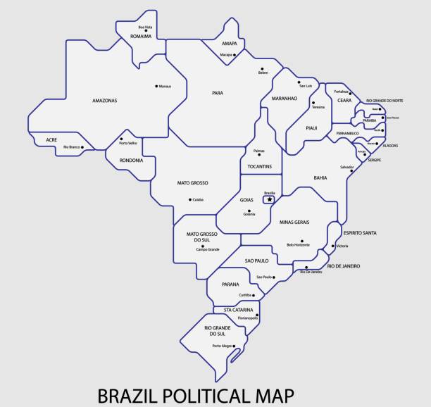
Brazil political map divide by state colorful outline simplicity style. Vector illustration.

"Ecology concept: France shaped forest viewed from above. Computer generated, and lit with global radiosity. Subtle grain texture added."

3D relief map of the Amazon River. 3D illustration of a top view of the Amazon River, Brazil.

3D Render of a Topographic Map of Pará, Brazil.All source data is in the public domain.Color texture: Made with Natural Earth.http://www.naturalearthdata.com/downloads/10m-raster-data/10m-cross-blend-hypso/Relief texture: SRTM data courtesy of NASA JPL (2020). URL of source image:https://lpdaac.usgs.gov/products/srtmgl1v003/Water texture: SRTM Water Body SWDB: https://dds.cr.usgs.gov/srtm/version2_1/SWBD/
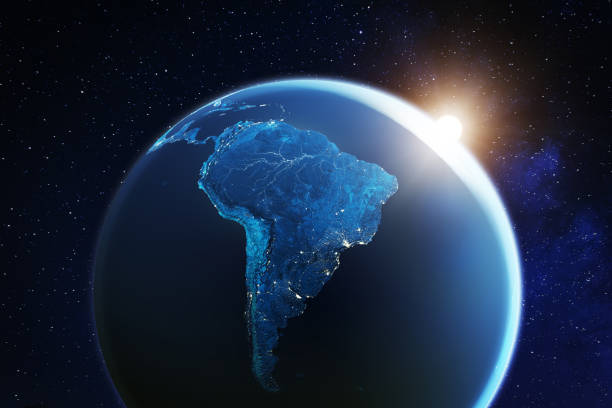
South America viewed from space with sunrise on planet Earth and stars, overview of Amazon river and forest, night lights from cities in Brazil, Argentina, Chile, Peru, map elements from NASA, 8k (https://eoimages.gsfc.nasa.gov/images/imagerecords/57000/57752/land_shallow_topo_2048.jpg)

Animation of a map from Brazil showing the state of São Paulo and Rio de Janeiro.
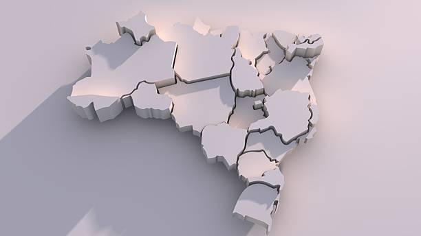
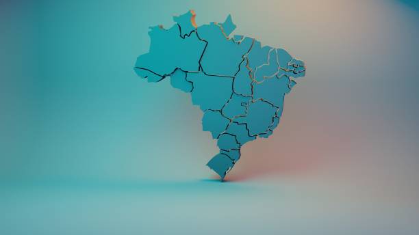
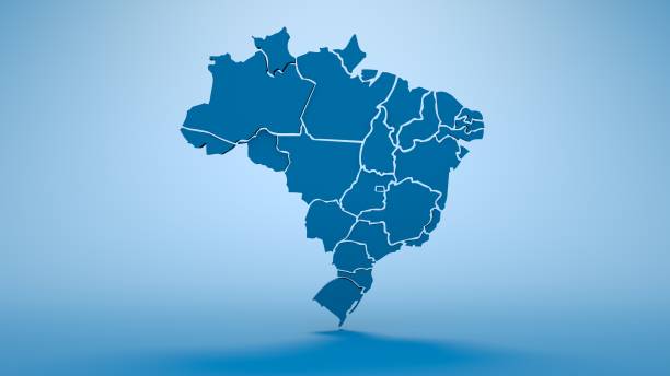
3D map of Federative Republic of Brazil with visible regions.
brazil map icon isolated on white background. Vector illustration. Eps 10.

Brazil country political map with isolated provinces, regions, states, departments and cities, easy to ungroup. Detailed vector illustration.

An indigenous female in traditional clothing holding the earth with two hands

COP30 - United Nations Climate Change Conference Brasil, Amazonia.
Vector Amazon Rainforesthttp://legacy.lib.utexas.edu/maps/world_maps/world_physical_2015.pdf
3D map of Federative Republic of Brazil with visible regions.

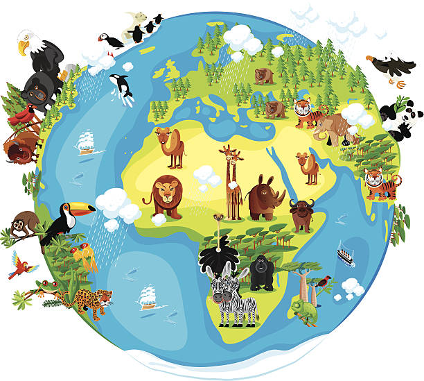
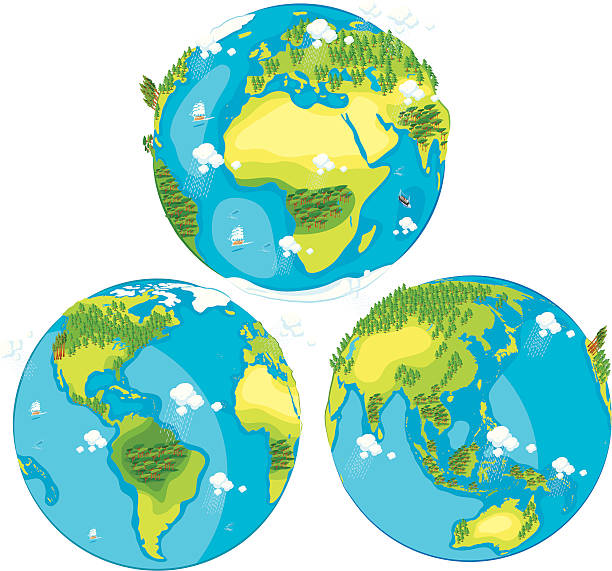
A 3D map showing all the continents.
3D map of Federative Republic of Brazil with visible regions.

south america seen from space 3D rendering

Amazonas State, outline map isolated on white background, Brazil

Brazil political map divide by state colorful outline simplicity style. Vector illustration.

Map of South America from early 18th century engraving.Please see more antic maps: Europe, America, Africa, Asia:
This image is a vector illustration and can be scaled to any size without loss of resolution.
Globe map of South America, geographical map, physics. Cartography, atlas. Map with reliefs and mountains. Argentina, Chile. Satellite view. Element of this images are furnished by Nasahttps://visibleearth.nasa.gov/images/73801/september-blue-marble-next-generation-w-topography-and-bathymetry/73812l

3D map of Federative Republic of Brazil with visible regions.