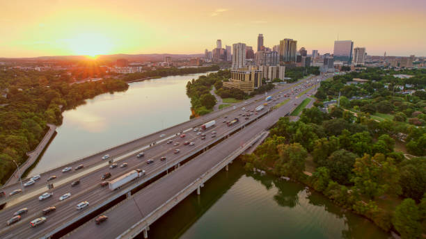
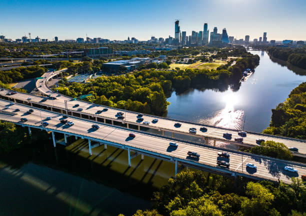
Aerial view of bridge over Colorado river in Austin, Texas, USA.
Browse 940+ austin texas traffic stock photos and images available, or start a new search to explore more stock photos and images.
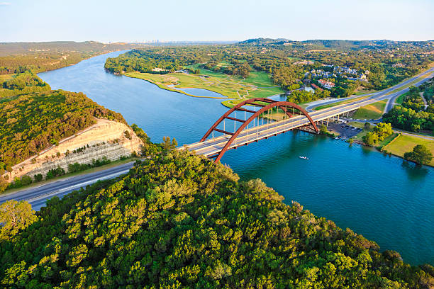
Aerial view of bridge over Colorado river in Austin, Texas, USA.

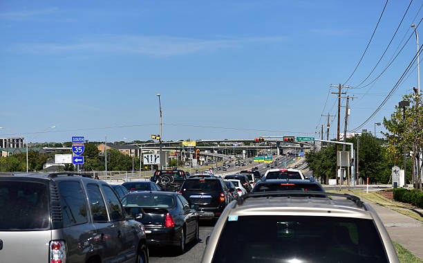
Austin, TX, USA - April 11, 2016: Heavy rush hour traffic on the highway near Austin City. Texas, United States

Highways overpass transportation aerial drone view above interchange cross overs in Austin Texas
Straight down Above Tall Towers rising over Austin Texas at Blue Hour sunset with Urban City lights illuminated the City Streets and intersections
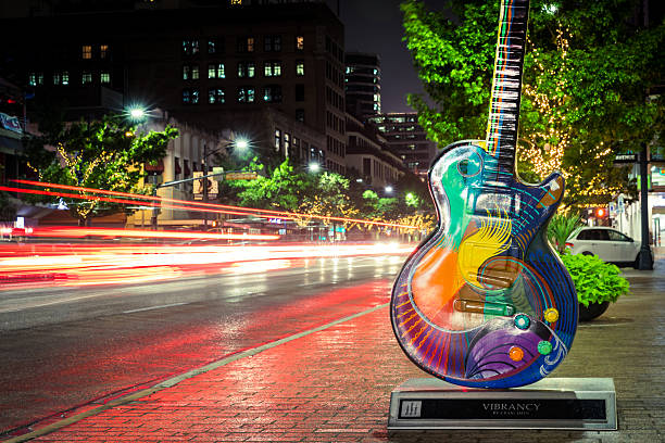
Austin, USA - November 5, 2016: Vibrancy by Craig Hein is one of the Guitar town Austin art project Guitars on Congress Avenue in Austin, Texas.
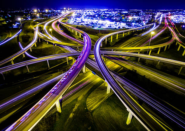
Aerial Ambulance Rushing Interstate Highway Interchange Night TimeLapse of Headlights and brake lights driving down the highway. The Crossover from 183 and Mopac Expressway. A long night shot in Austin Texas. Illuminated City lights. The Vast Expansive Never ending Fossil Fuel Using Energy Huge of A Civilization
Aerial view looking down above Cross Over and Interchange Urban Sprawl

Aerial Pennybacker Bridge 360 Bridge From the Air as the leaves change colors and fall and the seasons change in central Texas. Fall turns to winter and Austin , Texas glows with bright colors of Fall and green and the Texas hill country looks amazing. This aerial breathtaking image of the Pennybacker Bridge built in 1984 and completes the Austin Vibe of West Texas Hill Country

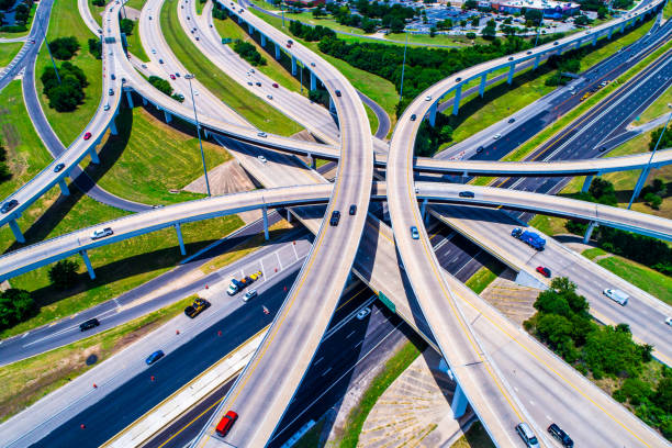
The connection between two major urban freeways just outside of downtown Austin, Texas from an altitude of about 1000 feet.
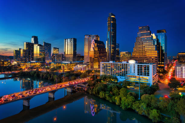
Downtown Austin skyline, elevated view, at dusk with the sunset reflections on the building facade, and the Lady Bird Lake / Town Lake / Colorado River with heavy traffic on the bridges in the foreground.

Night shot at Pennybacker or 360 Bridge on Highway with cars racing by. A long exposure allowed this amazing photo to take up all the cars driving by. right in the middle of the Bridge.

Golden Hour Austin Construction Traffic Urban City center. The lone star state capital city with the frost bank tower , condos , office buildings and multiple cranes that construct and expand Austin every day. The Golden evening sunset makes the city skyline or cityscape to reflect Golden yellow colors of the downtown city center. Cesar Chavez Street starts to get traffic.

360 bridge or Pennybacker bridge before dawn Austin Texas cityscape Texas hill country landscape. Long time lapse long exposures

Aerial view of an Austin freeway ramp and intersection located just outside of downtown Austin, Texas shot from an altitude of about 1000 feet.

Spaghetti highway overpass intersection and shopping center in Austin Texas.

Austin, TX—January 9, 2019; streaks of light from cars in motion on Congress Ave in downtown pass in front of the State and Paramount Theaters with their neon signs lining the road.
Aerial drone views of the busy traffic on the Mopac bridge , Austin Texas USA and Mopac Bridge crossing the gorgeous Colorado River

Aerial drone views above huge highway interchange in Austin texas USA

The view up Congress Ave towards the beautiful Texas State Capitol Building in Austin, Texas. This capitol building is unique within in that the use of "sunset-red granite" from nearby Burnet County in it's construction gives this building a distinctive hue unique among all U.S. capitol buildings.

Panoramic aerial view from helicopter of 360 bridge on Colorado River near Austin Texas, looking west at sunset.

Austin, Texas, USA - November 15, 2021: People and cars move along the modern buildings of Congress Avenue in the downtown core of Austin Texas USA. Austin is the state capital of Texas and with a strong economic focus on government and education, since the 1990s, the city has become a center for technology and business.
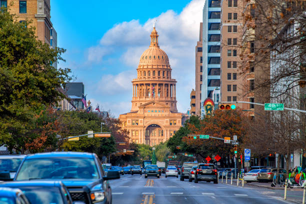
The Texas State Capitol Building shot from Congress Street on a warm January afternoon.
Austin Texas USA - perfect late summer September Sunset - Austin Texas Aerial drone view above City Panoramic Panorama Afternoon Sun on City Skyline Cityscape 2018 with the Tallest Tower in the City completed and no cranes

A dynamic view of the Austin, Texas skyline as seen from Interstate 35. The bustling highway is flanked by lush greenery on one side and a cluster of modern skyscrapers under construction on the other, showcasing the city's rapid development. The sky exhibits a soft, overcast glow, adding a serene backdrop to the urban scene. Perfect for social media posts or stock image searches related to urban landscapes, city life, or travel in Texas.

Austin downtown skyline view and view down Congress Avenue with the Texas State Capitol building in view.

Aerial photo taken over Interstate Highway 35 featuring Lady Bird Lake and the Austin, Texas skyline during sunset.

Cedar Park Texas Highway Interchange above huge long roadways and Toll Roads aerial drone view on a bright sunny day in Central Texas
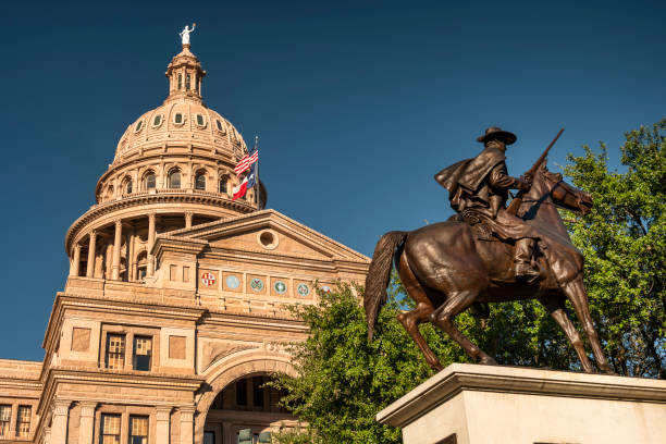
Architectural detail of the Texas State Capitol building in downtown Austin USA

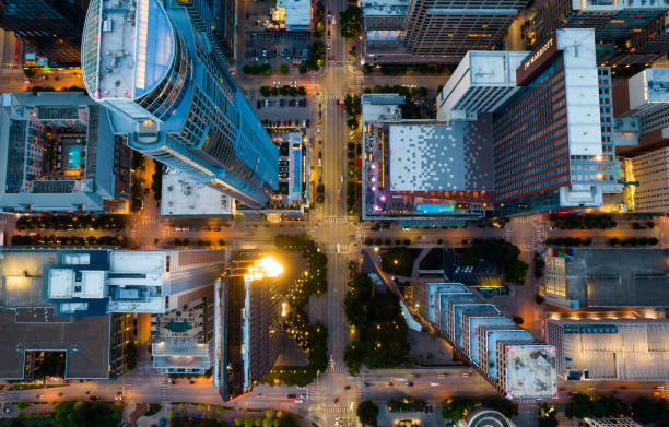
Straight down aerial drone views Intersections and Urban Shopping Center , Austin Texas USA Travel Destination Hotels , Shopping , and Modern Living Straight down Drone angle

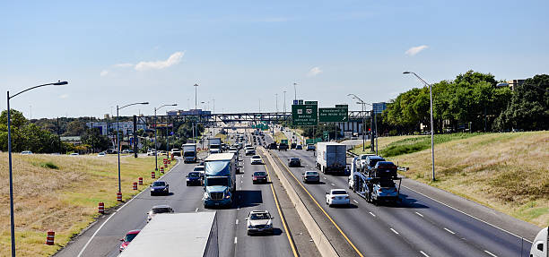
Traffic Congestion Motion Driving Aerial Intersection Highway in Austin , Texas near Round Rock. As the Mopac Expressway builds during traffic the sun starts to set during Golden hour and cars are blurred during motion. Some at a Red Light and some ready to get home from work.

Tilt Shift Austin Texas Aerial Interstate blurred surrounding with busy interstate 35 running right down the center of Texas and the Texas State Capitol building and Skyline background

Transportation Highway Morning Sunrise Golden Hour Leander , Texas

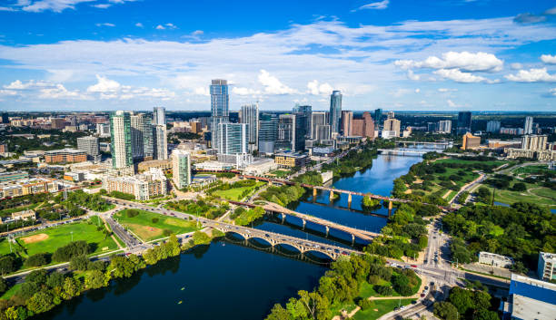
Panoramic aerial view of downtown Austin, Texas and surrounding communities from about 1500 feet in altitude during a helicopter photo flight.

Aerial Austin Texas 2016 Interstate i35 Sunny Day Capital City. Amazing dramatic sunny shot high over the Central Texas capital city of Austin , TX. The Entire skyline with the texas state capital building and high skyscrapers and busy traffic on i35

Panoramic aerial view from helicopter of 360 bridge on Colorado River near Austin Texas, looking east. Austin city skyline visible in far distance.
Aerial view from helicopter of 360 bridge on Colorado River near Austin Texas.

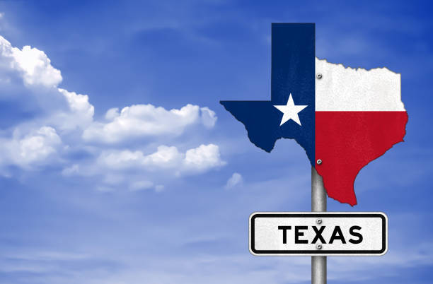
Vector illustration of the Austin (Texas) City Limits green road sign

Pennybacker Bridge or 360 Bridge September 2015 USA Capital of Texas. The Amazing View of the Colorado river overlook with the large Capital of Texas highway Bridge that connects the West side of Austin North and South Area's

Aerial view of vehicles passing through downtown Austin at sunset, Texas, USA.

Austin, Texas, USA - November 15, 2021: Historic buildings along Congress Avenue in the capital of Texas Austin USA

Aerial Over Austin Texas Summer Urban Traffic on Interstate 35 central texas massive highway problem with the Austin Skyline Cityscape in the background on a sunny afternoon

Downtown view from East Austin. Texas, USA

The beautiful and growing Austin skyline shot via helicopter from a distance at an altitude of about 1500 feet

This is a long exposure shot taken in the middle of Capital 360 Highway at night. The exposure was long enough to capture the streaming headlights and taillights from the cars and combine them into beautiful streams of light. You can also see the stars in the sky as well as streaming clouds. Taken with Canon 70D & 10-18mm f/4.5 lens.

Bridges crossing the Colorado River into downtown Austin, Texas shot aerially from an altitude of about 1200 feet on a clear late summer morning.

Austin Downtown Skyline in sunny day in Austin, Texas, USA