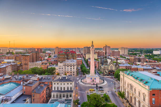
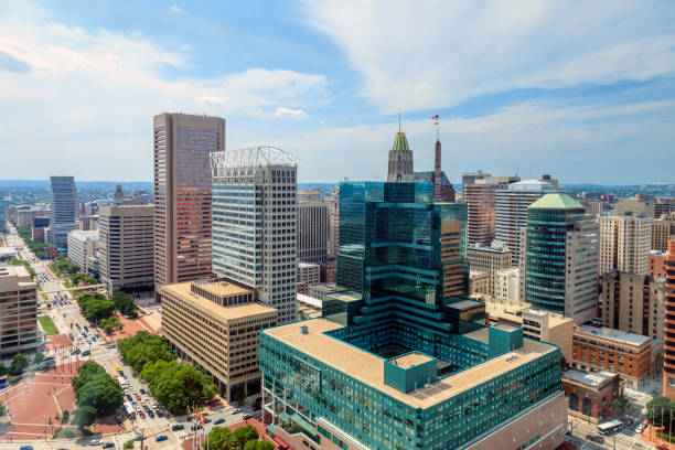
Baltimore, Maryland, USA cityscape at Mt. Vernon and the Washington Monument.
Browse 770+ baltimore aerial stock photos and images available, or start a new search to explore more stock photos and images.
Baltimore, Maryland, USA cityscape at Mt. Vernon and the Washington Monument.
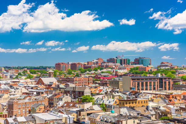
Baltimore, Maryland, USA cityscape overlooking little italy and neighborhoods.
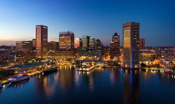
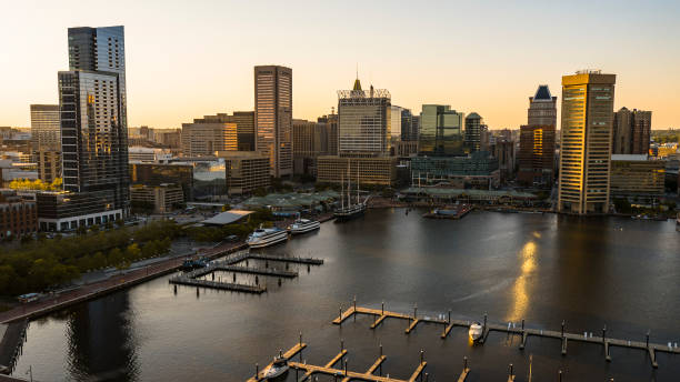
Downtown Baltimore skyline aerial at dusk, with Inner Harbor in the foreground.
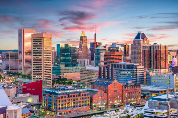
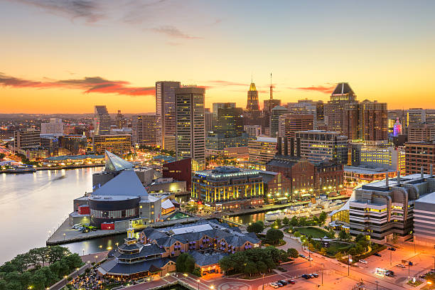
The Baltimore cityscape skyline at sunset
Row houses churches parks and businesses exhist in the expansive city of Baltimore

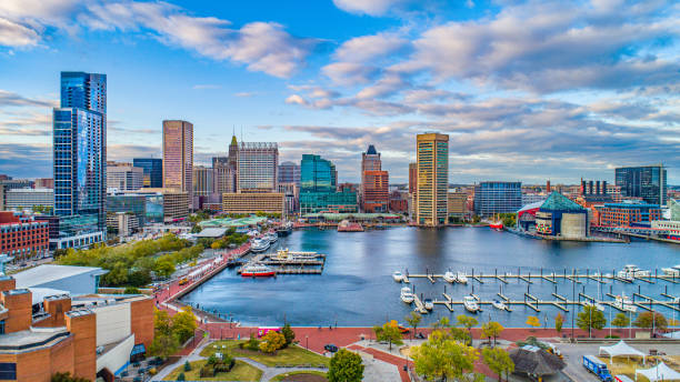
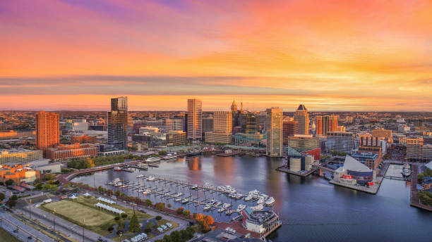
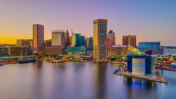
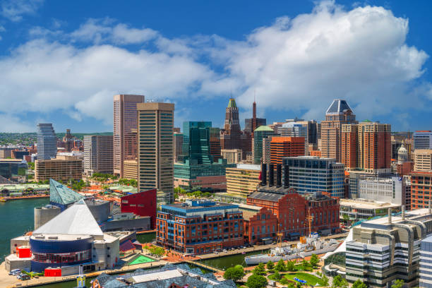
Downtown cityscape and marina on the Inner Harbor of Baltimore Maryland flowing out to the Patapsco River and Chesapeake Bay

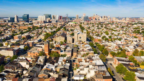
Aerial shot of Baltimore, Maryland, looking over residential streets in Greektown towards the Downtown skyline.
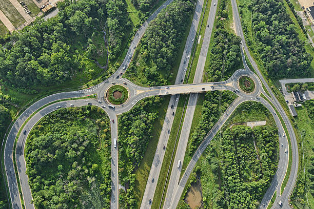
aerial view of roadway in suburban baltimore maryland
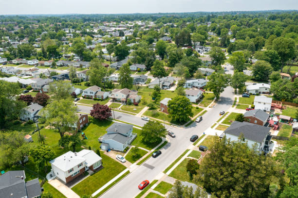
Aerial View of Single-family homes in Pikesville, suburbs of Baltimore, Maryland.
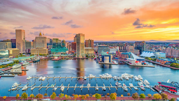
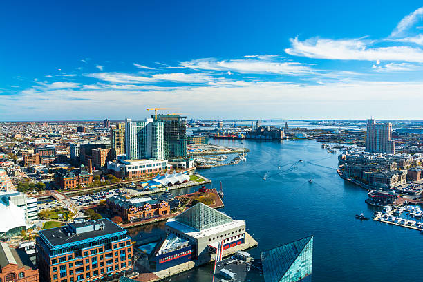
Baltimore, Maryland, USA Skyline on the Inner Harbor in the afternoon.
Aerial of Baltimore City with the Patapsco River and waterfront buildings. Harbor East and Fells Point neighborhoods is shown on the left and the Tide Point neighborhood is shown on the right.
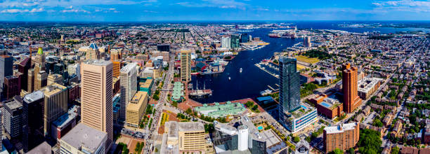
Aerial view of the Baltimore Skyline near the famous Baltimore Inner Harbor
Baltimore, Maryland, USA Skyline over the Inner Harbor at dusk.

Baltimore, Maryland - Sept. 26, 2019: Overhead view of Pratt Street in downtown Baltimore, Maryland near the popular Inner Harbor

A scenic aerial view of the John Hopkins Homewood area of Baltimore in Maryland.

Aerial establishing shot of Baltimore, Maryland on an overcast day in Fall.

View of Baltimore, Maryland aerial drone view during sunset

Aerial photo of downtown Baltimore, Maryland and the Baltimore Harbor.
Baltimore, Maryland, USA downtown cityscape at dusk.

Contrast of residential and industrial area on President Street in Baltimore, MD. Downtown skyline shown in the distance
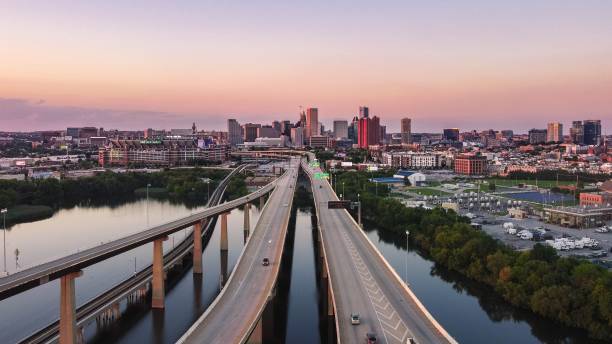
An aerial view of overlapping highways and roads over the water in downtown Baltimore, Maryland, USA
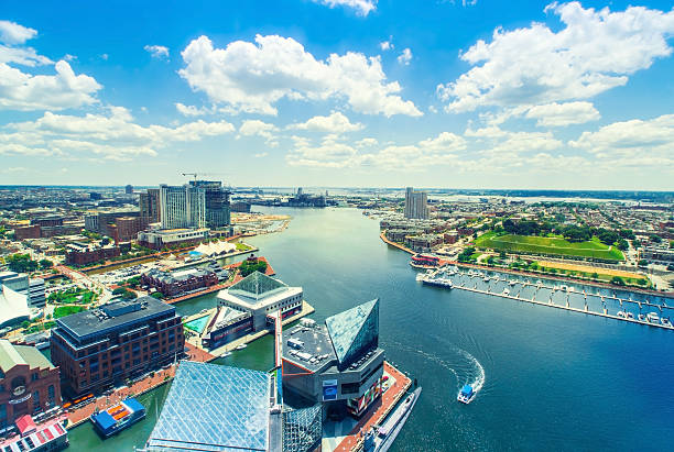
Aerial view of the Inner Harbor of Baltimore, Maryland on a clear summer day
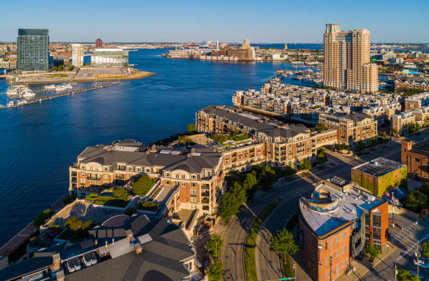
The aerial view on Harbor View residential district and marina at Patapasco River in Baltimore, Maryland, USA, at sunset.

Key bridge seen from an aerial view. A bright blue sky with white puffy clouds are seen above.

Annapolis Maryland from above plane view plan view

Downtown cityscape and marina on the Inner Harbor of Baltimore Maryland flowing out to the Patapsco River and Chesapeake Bay

Baltimore, Maryland, USA cityscape at Mt. Vernon and the Washington Monument.
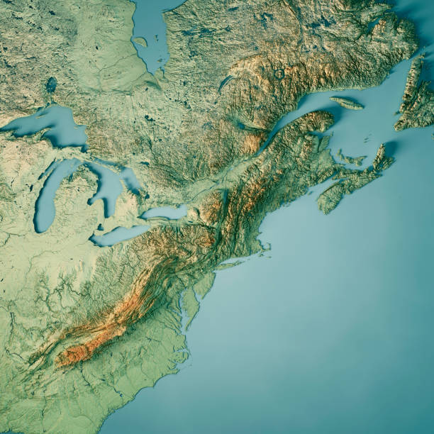
3D Render of a Topographic Map of North East USA and parts of Ontario and Quebec, and Nova Scotia to the right. All source data is in the public domain. Color texture: Made with Natural Earth. http://www.naturalearthdata.com/downloads/10m-raster-data/10m-cross-blend-hypso/ Relief texture: GMTED2010 data courtesy of USGS. URL of source image: https://topotools.cr.usgs.gov/gmted_viewer/viewer.htm Water texture: World Water Body Limits: Humanitarian Information Unit HIU, U.S. Department of State http://geonode.state.gov/layers/geonode%3AWorld_water_body_limits_polygons Boundaries: Humanitarian Information Unit HIU, U.S. Department of State (database: LSIB) http://geonode.state.gov/layers/geonode%3ALSIB_10

An aerial view of Baltimore Maryland and the Inner Harbour.

Downtown Baltiimore city skyline cityscape of Maryland in USA

Drone shot of Baltimore, Maryland, looking straight down on streets and rooftops in Greektown.

Aerial shot of residential streets in the Canton neighborhood of Baltimore, Maryland.

The buildings are illuminated in the downtown urban core of Baltimore Maryland
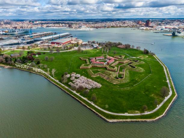
Fort McHenry, Baltimore, MD, USA - April 9, 2022: The image is an aerial photo taken of Fort McHenry during a flag ceremony. The image is taken from a drone above the water.
The aerial view on Downtown Baltimore, Maryland, USA, at sunset.

The aerial view on Inner Harbor district and marina at Patapasco River in Baltimore, Maryland, USA, at sunset.

An aerial view of overlapping highways and roads over the water in downtown Baltimore, Maryland, USA

Baltimore, Maryland, USA cityscape at Mt. Vernon and the Washington Monument.

Baltimore, Maryland, USA Skyline over the Inner Harbor at dusk.

Drone view over typical North American houses, quintessence of family home in suburban areas. Perfect for showcasing family home lifestyle where Americans cherish family values American suburban life
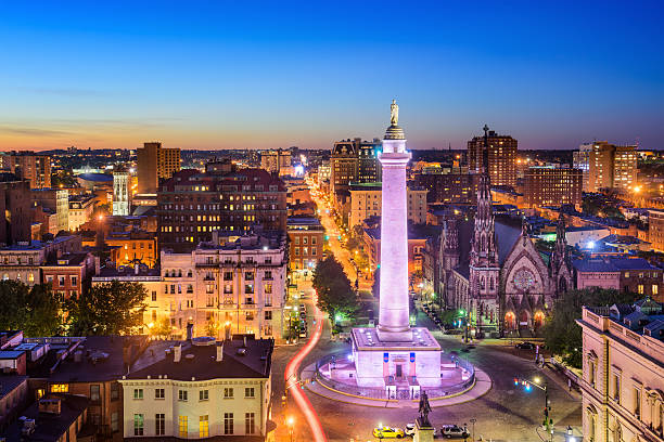
Baltimore, Maryland, USA cityscape at Mt. Vernon and the Washington Monument.

Aerial shot of Baltimore, Maryland, looking over residential streets in Greektown towards the Downtown skyline.

Baltimore, Maryland, USA Skyline over the Inner Harbor at dusk.

Aerial shot of the Port of Baltimore at sunset, flying over a container terminal towards a freeway interchange that cuts across piles of coal and salt on the dock. Beyond that is the Inner Harbor and the City of Baltimore.

Topographic / Road map of Baltimore, MD, USA. Original map data is open data via © OpenStreetMap contributors. All maps are layered and easy to edit. Roads have editable stroke.

Big city awakening in dawn panoramic view. Baltimore, Maryland waterfront and Downtown district meet morning sunlight

Baltimore, Maryland, USA downtown cityscape at dusk.
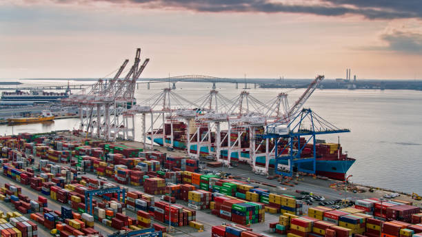
Aerial shot of the Port of Baltimore at sunset, looking across and intermodal container yard towards a ship being loaded by cranes. In the distance, the Key Bridge stretches across the river.