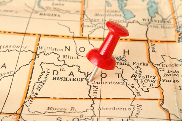
Pushpin pointing Bismarck city, North Dakota state capital, over more than fifty years old map
Browse 490+ bismarck on a map stock photos and images available, or start a new search to explore more stock photos and images.
Pushpin pointing Bismarck city, North Dakota state capital, over more than fifty years old map

Bismarck ND City Vector Road Map Blue Text. All source data is in the public domain. U.S. Census Bureau Census Tiger. Used Layers: areawater, linearwater, roads.

Photo of pinned Bismarck on a map of USA. May be used as illustration for traveling theme.

North Dakota, ND, political map, with capital Bismarck. State in the upper Midwest subregion of the United States of America, nicknamed Peace Garden State, Roughrider State and Heaven on Earth. Vector
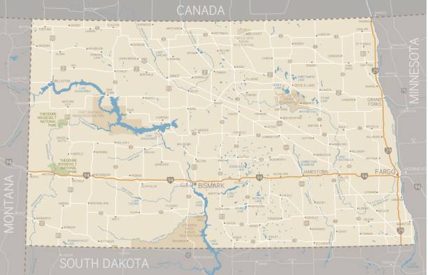
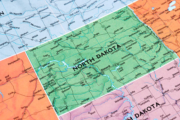
A detailed map of the state of North Dakota, including surrounding states. Includes major highways, cities, rivers and lakes. Elements are grouped and separate for easy changes. Includes an extra-large JPG so you can crop in to the area you need.

North Dakota, state of USA - solid black outline map of country area. Simple flat vector illustration.
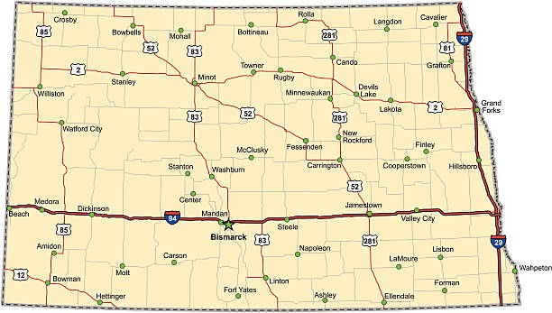
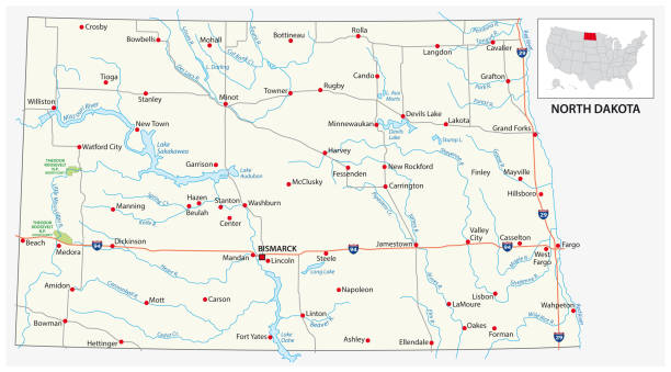
Highway map of the state of North Dakota with Interstates and US Routes. It also has lines for state and county routes (but not labeled) and many cities on it as well. All cities are the County Seats and the Capitol (and some others).
The maps are accurately prepared by a GIS and remote sensing expert.
Map of North Dakota State. Selective focus.

vector illustration of North Dakota map
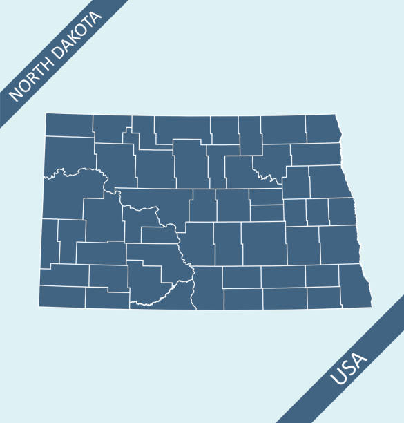
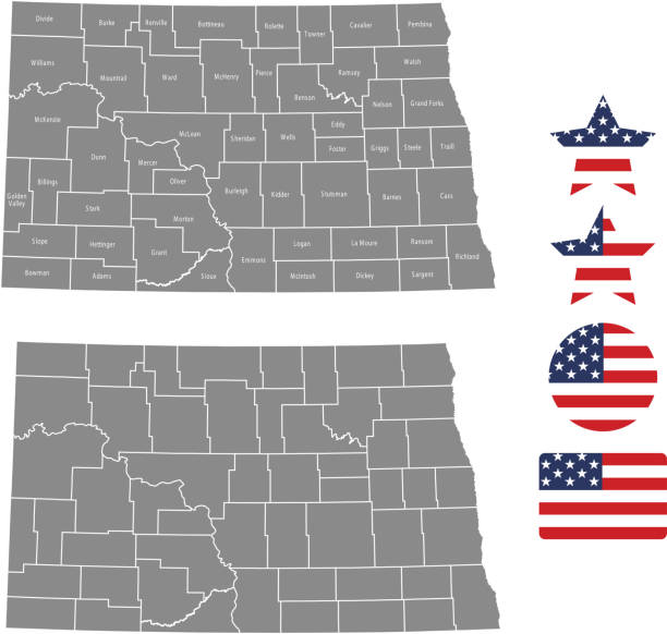
Highly detailed printable map of North Dakota state counties of United States of America for web banner, mobile, smartphone, iPhone, iPad applications and educational use. The map is accurately prepared by a map expert.

All elements were drawn in a vector graphics editor and design program. Elements and layers are well organized, separable, detachable and easy to use and edit. Map data is in the public domain, available from the United States Census Bureau via census.gov

Map of North Dakota for your own design. With space for your text and your background. Four maps included in the bundle: - One black map. - One blank map with only a thin black outline (in a line art style). - One mosaic map. - One white map with a thin black outline. The 4 maps are isolated on a blank background (for easy change background or texture).The layers are named to facilitate your customization. Vector Illustration (EPS10, well layered and grouped). Easy to edit, manipulate, resize or colorize.

Photo of pinned Bismarck on a map of USA. May be used as illustration for travelling theme.

Detailed vector map of the US State of North Dakota with administrative divisions. The colors in the .eps-file are ready for print (CMYK). Included files are EPS (v10) and Hi-Res JPG.

Detailed map of North Dakota state,in vector format,with county borders,roads and major cities.

Road map of North Dakota US American federal state. Editable highly detailed transportation map of North Dakota with highways and interstate roads, rivers and cities vector illustration
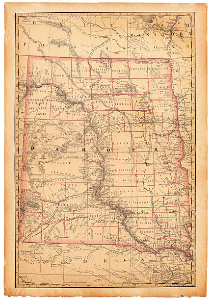
An old map of the state of Dakota scanned from an 1881 original. Photo by N. Staykov (2007) CLICK ON THE LINKS BELOW FOR HUNDREDS OF SIMILAR IMAGES:

North Dakota (United States of America, USA, U.S., US) - map is designed cannabis leaf green and black, State of North Dakota map made of marijuana (marihuana,THC) foliage,

Vector emblem of US federal state of North Dakota

Studying Geography - Photograph of North Dakota on retro globe.

Highly detailed printable map of North Dakota state county of United States of America for web banner, mobile, smartphone, iPhone, iPad applications and educational use. The map is accurately prepared by a map expert.
North Dakota map shape, united states of america. Flat concept icon symbol vector illustration .

Vector Cartoon Map of North Dakota

All elements were drawn in a vector graphics editor and design program. Elements and layers are well organized, separable, detachable and easy to use and edit. Map data is in the public domain, available from the United States Census Bureau via census.gov

Vector outline map of North Dakota state of the United States

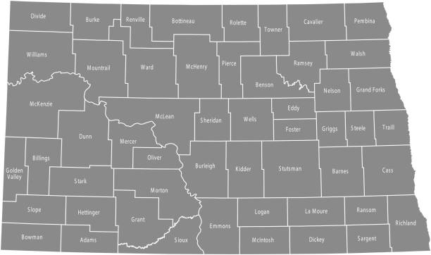
North Dakota, ND, gray political map, with capital Bismarck. State in the upper Midwest subregion of United States of America nicknamed Peace Garden State, Roughrider State and Heaven on Earth. Vector

North dakota road vector map with flag.
North Dakota map shape, united states of america. Flat concept icon symbol vector illustration .

North Dakota state map outline and borders

vector illustration of North Dakota maps

vector illustration of North Dakota map

3D map of North Dakota isolated on a blank and gray background, with a dropshadow. Vector Illustration (EPS10, well layered and grouped). Easy to edit, manipulate, resize or colorize.

White map of North Dakota isolated on a gray background with a long shadow effect and in a flat design style. Vector Illustration (EPS10, well layered and grouped). Easy to edit, manipulate, resize or colorize.

Map of North Dakota isolated on a blank background with a black outline and shadow. Vector Illustration (EPS file, well layered and grouped). Easy to edit, manipulate, resize or colorize. Vector and Jpeg file of different sizes.
Vector illustration of a dark green marijuana leaf on a white silhouette of North Dakota on a green background.

Highly detailed downloadable map of North Dakota state of United States of America for web banner, mobile, smartphone, iPhone, iPad applications and educational use. The map is accurately prepared by a map expert.

The map is accurately prepared by a map expert.

North Dakota line art map - red, blue and white on black background

http://dikobraz.org/map.jpg
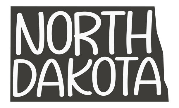
North Dakota. Vector silhouette state. North Dakota map with text script. North Dakota shape state map for poster, t-shirt, tee, souvenir. Vector outline Isolated illustratuon on a white background.

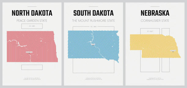
The Dakotas, political map. Collective term for the U.S. states of North Dakota and South Dakota, in the Upper Midwest and North Central. Used to describe the Dakota Territory and collective heritage.

Vector Illustration of a City Street Map of Bismarck, North Dakota, USA. Scale 1:60,000. All source data is in the public domain. U.S. Geological Survey, US Topo Used Layers: USGS The National Map: National Hydrography Dataset (NHD) USGS The National Map: National Transportation Dataset (NTD)