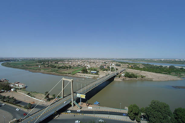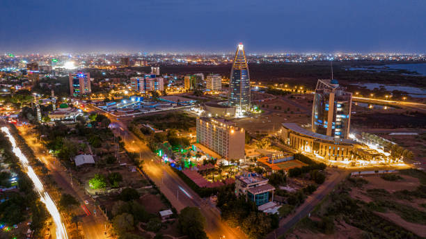
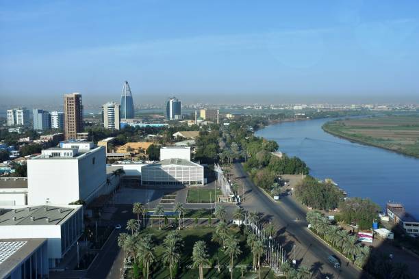
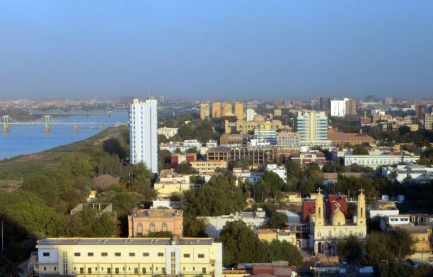
Aerial photo of the Sudanese capital Khartoum on the evening of July 25, 2023
Browse 2,800+ capital of sudan stock photos and images available, or start a new search to explore more stock photos and images.
Aerial photo of the Sudanese capital Khartoum on the evening of July 25, 2023

Aerial photo of the area of the headquarters in the Sudanese capital Khartoum

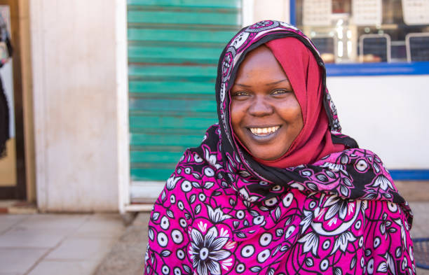
Sudanese business man in traditional outfit using mobile phone in office.
The house of the residents in Khartoum with a beautiful and towering mosque tower, with the crowds of the residents
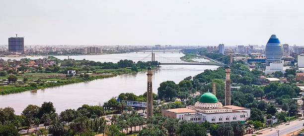
View of the blue nile and some famous places at Khartoum city - Sudan
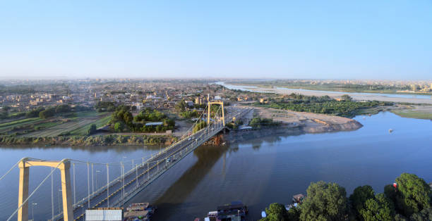
Khartoum, Sudan: Tuti Island, where the White Nile and Blue Nile merge to form the main Nile - Tuti bridge on Arbab Al Qaed Avenue - Khartoum North / Khartoum Bahri in the background

Africa Map - Vintage Detailed Vector Illustration

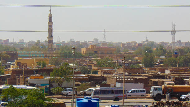
Sudan, Khartoum - 18 Feb 2017: The view of the old town of Khartoum, Sudan
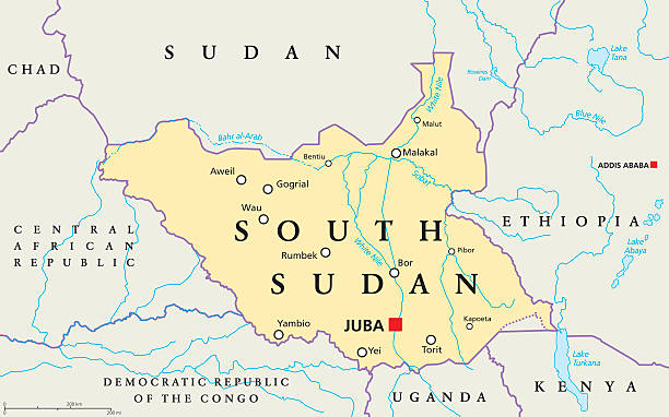
South Sudan political map with capital Juba, national borders, important cities, rivers and lakes. Illustration with English labeling and scaling.
Rock City, Juba, South Sudan.

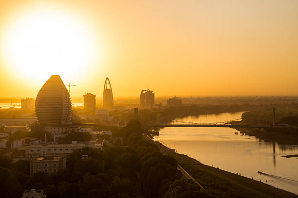
Khartoum, Sudan: skyline of the Sudanese capital - general view of the downtown area, waterfront along the Blue Nile river, Presidential palace, Presidency of the Council of Ministers (cabinet / government), Ministry of Internal Affairs, Ministry of Finance, Ministry of Foreign Affairs, Judiciary, Coptic Church, Ewa Hotel, Grand Holiday Villa Hotel, Al Mek Nimir Bridge, Blue Nile Bridge, Armed Forces Bridge...
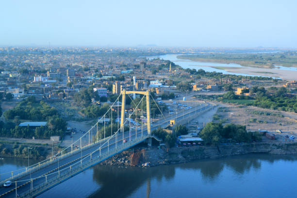
Khartoum, Sudan: Tuti Island, where the White Nile and Blue Nile merge to form the main Nile - Tuti bridge, suspension bridge on Arbab Al Qaed Avenue - Khartoum North / Khartoum Bahri in the background
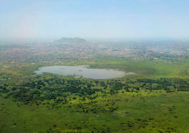
Juba, South Sudan: Africa's newest capital seen from the air - lake and mountain - White Nile in the background
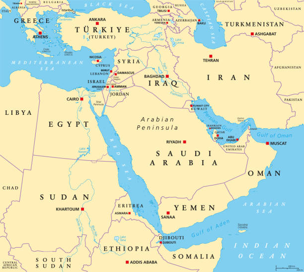
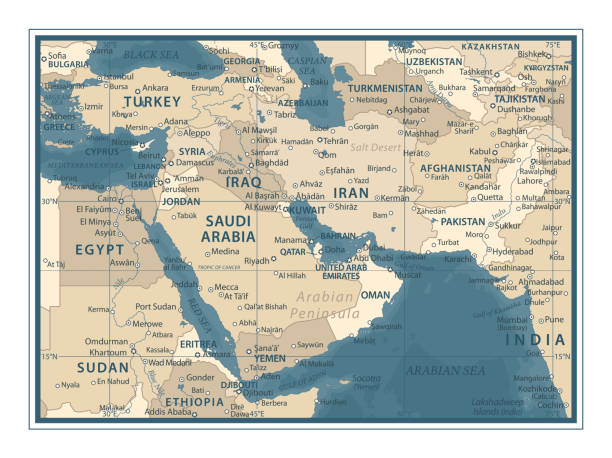
The Middle East, political map with capitals and international borders. Geopolitical region encompassing the Arabian Peninsula, the Levant, Turkey, Egypt, Iran and Iraq. Formerly called Near East.

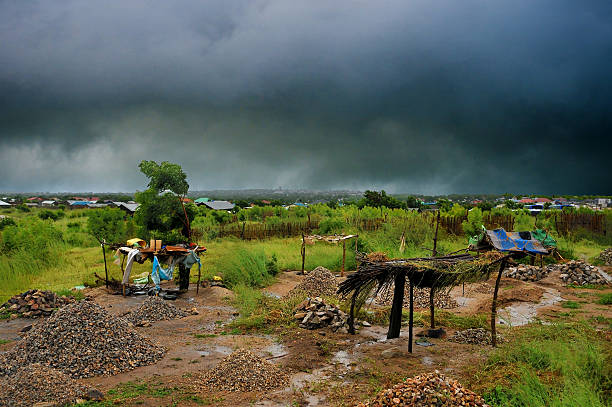
Juba, South Sudan - February 28th, 2012: Unidentified people have breakfast in front of their huts in displaced persons camp, Juba, South Sudan, February 28, 2012.
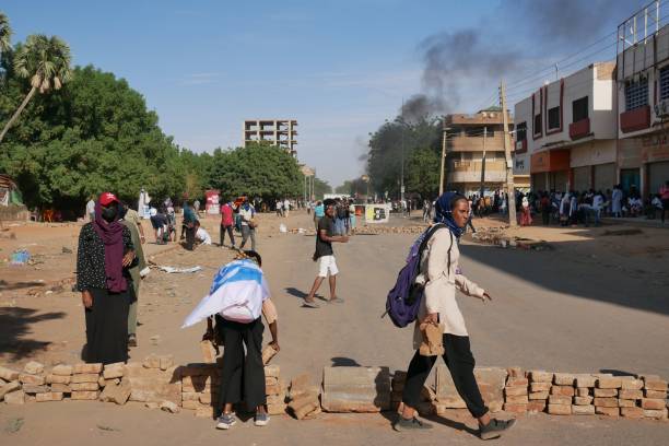
Khartoum, Sudan – 10.27.2022: Young Sudanese protestors barricade the streets on the one year anniversary of military coup

An aerial photo showing the Sunnah of flames in the market of the Al-Arab neighborhood in the city of Omdurman on June 2, 2023

Khartoum, Sudan, ca. February 8., 2019: Street scene in downtown Khartoum, capital of Sudan

Khartoum, Sudan - 18 Feb 2017: Corinthia Hotel Khartoum, Sudan
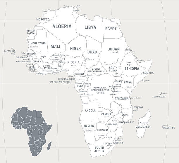
Map of Africa with labeled countries and capital cities. All elements grouped in their own layers, labeled and alphabetized for easy editing. (See screenshot.) EPS 10 file. Transparency effects used longitude and latitude lines.

Detailed map of Sudan with surroundings, provinces, capital and flag.
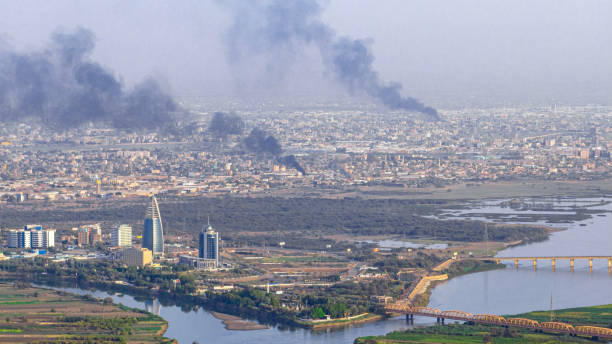
Aerial picture shows smoke plumes rising from several places in Khartoum and Omdurman due to clashes between the Sudanese army and the Rapid Support Forces

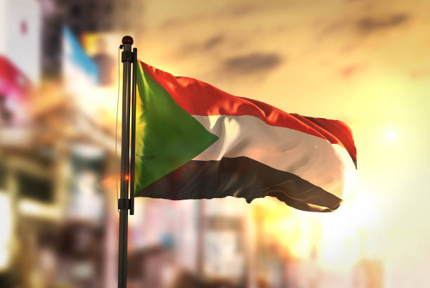
Flag of Sudan in front of a clear blue sky
Aerial view of the Nile and Tuti island in Khartoum

Pyramids of Meroe in the Sahara desert
Gold pound coin cartoon style isolated. Shiny gold pound sign for designers and illustrators. Gold piece in the form of a vector illustration

Juba, South Sudan - February 29th, 2012: Unidentified shoe shiners wait for their clients at a market of Juba, South Sudan on February 29, 2012.
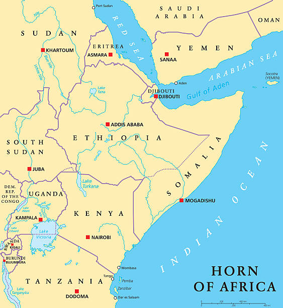
Horn of Africa peninsula political map with capitals, national borders, important cities, rivers and lakes. In ancient times called Land of the Berbers. English labeling and scaling. Illustration.

Black and white Sudan map in trendy vintage style, isolated on a dusty white background. A grunge texture is used to have a retro and worn effect. His name is written on the bottom of the image. Vector Illustration (EPS10, well layered and grouped). Easy to edit, manipulate, resize or colorize.
Empty Dark Gray Map of Middle East Asia - illustration
Khartoum, Sudan, 18th December 2015: woman selling tea at the streets of Khartoum
Khartoum, Sudan: skyline of the Sudanese capital - downtown area, waterfront along the Blue Nile river, government buildings, presidential palace, churches...
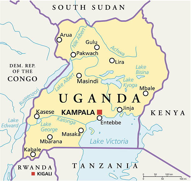
Political map of Uganda with capital Kampala, with national borders, most important cities, rivers and lakes. Illustration with English labeling and scaling.

Sudanese Pounds - banknotes issued by the Central Bank of Sudan - currency of Sudan - The pound is divided in 100 piasters, it is pegged to the United States dollar - ISO 4217.
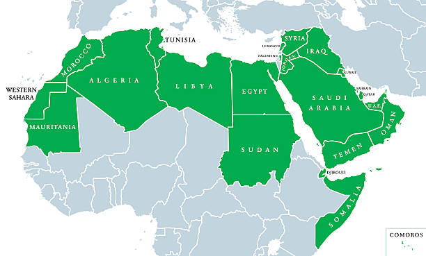
Arab World political map, also called Arab nation, consists of twenty-two arabic-speaking countries of the Arab League. All nations in green color, plus Western Sahara and Palestine. English labeling.
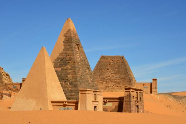
Meroe, Begarawiyah, Kush, Sudan: Nubian pyramids of Meroe, tombs of the Kushite kingdoms - Archaeological Sites of the Island of Meroe - UNESCO World Heritage Site - dated c. 800 BCE – c. 350 CE - pyramids N32, N19 (King Tarekeniwal) partly hidden by sand dunes with N20 in the background, part of the North Necropolis
Gulf of Aden area, political map. Deepwater gulf between Yemen, Djibouti, the Guardafui Channel, Socotra and Somalia, connecting the Arabian Sea through the Bab-el-Mandeb strait with the Red Sea.

Juba, South Sudan - 06 27 2023: a busy street in the South Sudan capital of Juba

Boda boda are bicycle & motorcycle taxis commonly found in East Africa. These Boda Boda are waiting for customers
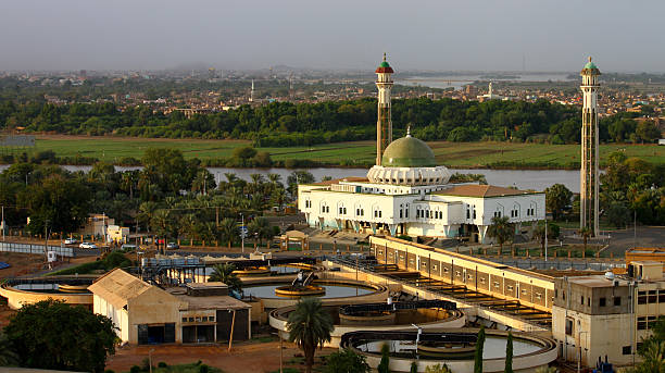
Al-Mogran Mosque at al-Mogran, Khartoum, Sudan.

Trading between China and african countries, tourism, economy and investment

kenya road and national park vector map
Juba, South Sudan - February 28th, 2012: Unidentified women argue at Konyo Konyo Market, Juba, South Sudan, February 28, 2012.

An aerial photo dated June 21, 2023 showing the rising smoke columns in the sky of Khartoum city
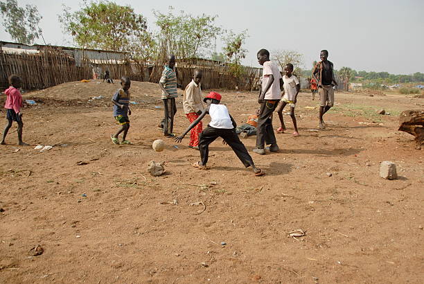
Juba, South Sudan - FEBRUARY 26, 2012: Unidentified kids play football on a street of Juba on February 26, 2012 in Juba, South Sudan.

Meroe, Begarawiyah, Kush, Sudan: Nubian pyramids of Meroe, ruins of King Arqamani tomb in the center - South cemetery aka East Necropolis, tombs of the Kushite kingdoms, dating ca. 300 BC to about 350 AD - Archaeological Sites of the Island of Meroe - UNESCO World Heritage Site - dated c. 800 BCE – c. 350 CE - S5 pyramid was largely destroyed in the 19th century by tomb raiders
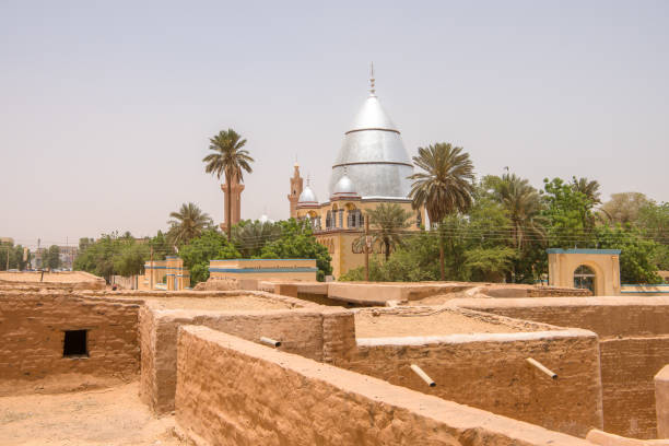
Sudan Khartoum old town city ancient village in capital city of Sudan Khartoum near Omdurman.
Middle East Map - Vintage Detailed Vector Illustration

Meroë, Begarawiyah, Kush, Sudan: Nubian pyramids of Meroe, tombs of the Kushite kingdoms - South Necropolis and North Necropolis (foreground and background respectively) - located 200 kilometers northeast of Khartoum near the village of Bagrawiya, spread over small hills. In total there are more than 900 pyramids and tombs. The pyramids, mostly built of stone, are significantly smaller than the Egyptian pyramids with a height of less than 30 meters and served as burial places for the kings, queens and high officials of the historical empire of Kush in Nubia. Construction ranges from around 300 BC to about AD 300. The first pyramid at Meroe that can be attributed to King Ergamenes, who died about 280 BC.

Khartoum, Sudan: colorful woven plate with geometrical pattern - Omdurman Market
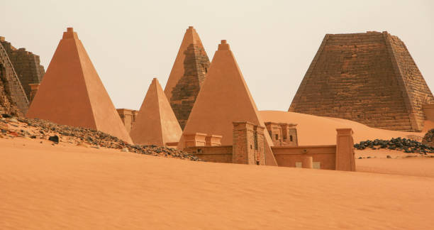
The abandoned pyramids of Meroe, an ancient city on the east bank of the River Nile, in northern Sudan. Meroe was the capital of the Kingdom of Kush for several centuries. The pyramids are funerary elements of the necropolis for the Nubian kings and queens, also known as the Black Pharaohs. It is a UNESCO world heritage site. There are more pyramids in Sudan than in Egypt. The Nubian Desert is in the eastern region of the Sahara Desert, between the Nile and the Red Sea.