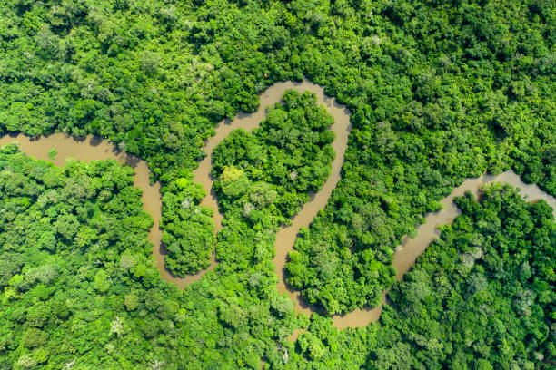
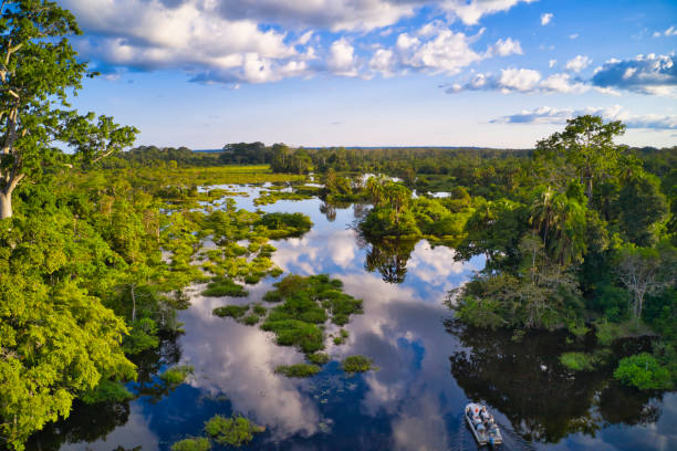
Aerial view of an meandering jungle river in the rainforest of the Congo Basin. Odzala National Park, Republic of Congo.
Browse 100+ congo basin aerial stock photos and images available, or start a new search to explore more stock photos and images.
Aerial view of an meandering jungle river in the rainforest of the Congo Basin. Odzala National Park, Republic of Congo.
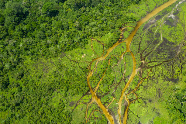
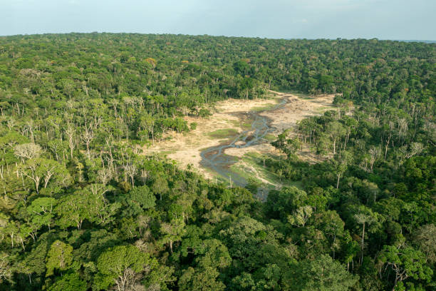
Aerial view of a Bai (saline, mineral lick) in the rainforest of the Congo Basin. This rich mineral clearing is located in the middle of the rainforest where forest elephants, buffalos and gorillas gather in large numbers to reap the benefits of the mineral salts. Odzala National Park, Republic of Congo.
Aerial view of the congo basin,where a meandering river winds through tropical rainforest. republic account,west africa
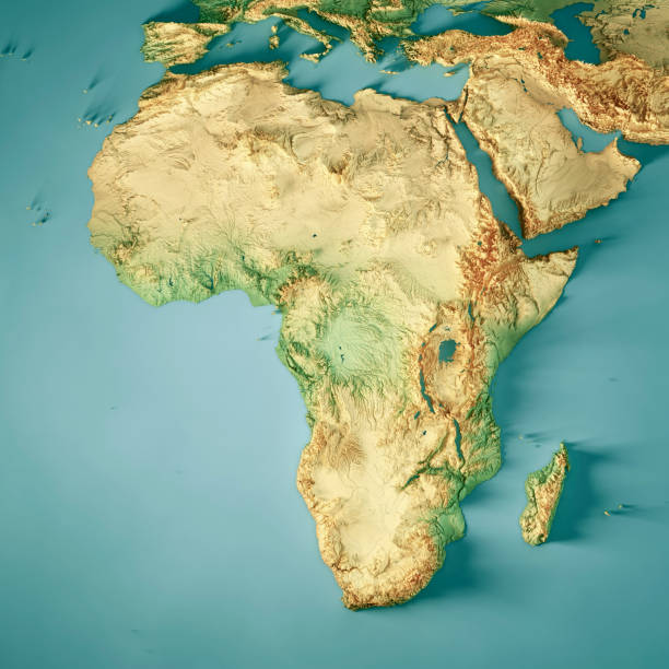
3D Render of a Topographic Map of Africa. All source data is in the public domain. Color texture: Made with Natural Earth. http://www.naturalearthdata.com/downloads/10m-raster-data/10m-cross-blend-hypso/ Relief texture: GMTED2010 data courtesy of USGS. URL of source image: https://topotools.cr.usgs.gov/gmted_viewer/viewer.htm Water texture: HIU World Water Body Limits: http://geonode.state.gov/layers/?limit=100&offset=0&title__icontains=World%20Water%20Body%20Limits%20Detailed%202017Mar30

Aerial view of a Bai (saline, mineral lick) in the rainforest of the Congo Basin. This rich mineral clearing is located in the middle of the rainforest where forest elephants, buffalos and gorillas gather in large numbers to reap the benefits of the mineral salts. Odzala National Park, Republic of Congo.
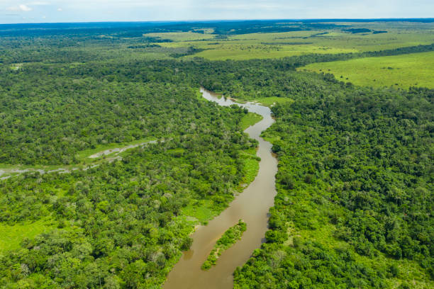
Aerial view of an meandering jungle river in the rainforest of the Congo Basin. Odzala National Park, Republic of Congo.

Aerial view of a jungle river flowing out of a Bai (saline, mineral lick) in the rainforest of the Congo Basin. This rich mineral clearing is located in the middle of the rainforest where forest elephants, buffalos and gorillas gather in large numbers to reap the benefits of the mineral salts. Odzala National Park, Republic of Congo.
Dzanga Bai, the famous clearing and salt lick in the area of dzanga-sangha. On the clearing small forest elephants (Loxodonta cyclotis) and also forest buffalos (Syncerus nanus) could be seen. The Dzanga Bai is also regulary visited from rare Bongo antelopes (Tragelaphus eurycerus). A bai - the term comes from the language of various indigenous groups - is a natural rainforest opening/clearing. Location: Dzanga-Sangha Special Reserve (in the border triangle of CAR, Cameroon and Republic of Congom Congo Basin, Central African Republic, Africa.

Aerial view of a green rainforest foliage, Congo Basin. Odzala National Park, Republic of Congo.

Aerial view of a Bai (saline, mineral lick) in the rainforest of the Congo Basin. This rich mineral clearing is located in the middle of the rainforest where forest elephants, buffalos and gorillas gather in large numbers to reap the benefits of the mineral salts. Odzala National Park, Republic of Congo.

Aerial view of a Bai (saline, mineral lick) in the rainforest of the Congo Basin. This rich mineral clearing is located in the middle of the rainforest where forest elephants, buffalos and gorillas gather in large numbers to reap the benefits of the mineral salts. Odzala National Park, Republic of Congo.

Aerial View of the Congo river just above the famous Livingstone Falls at the lower Congo River - the falls are the last navigable point before the Livingstone rapids make the river impassable for a long stretch upriver. The falls are named for the explorer David Livingstone and are providing a difference in altitude of 270 meters over a distance of 350 km. Congo river is the deepest river of the world and the largest river in Africa.

Aerial view of a green rainforest foliage, Congo Basin. Odzala National Park, Republic of Congo.

Aerial view of the Matadi suspension bridge in the town of Matadi. This bridge is the only bridge over the Congo River from the river mouth up to more than 3800 km. The bridge was built in 1983 by Japanese companies and has a span of 520 m. Matadi is the chief sea port of the Democratic Republic of the Congo and the capital of the Kongo Central province. Matadi serves as a major import and export point for the whole nation. Chief exports are coffee and timber. The town was founded in 1879 by Sir Henry Morton Stanley.

Rare wildlife shot of a herd of African Forest Buffalos (Syncerus caffer nanus) in Lango Bai (saline, mineral lick) in the rainforest of the Congo Basin. This rich mineral clearing is located in the middle of the rainforest where forest elephants gather in large numbers to reap the benefits of the mineral salts. Odzala National Park, Republic of Congo.

Aerial view of a green rainforest foliage, Congo Basin. Odzala National Park, Republic of Congo.

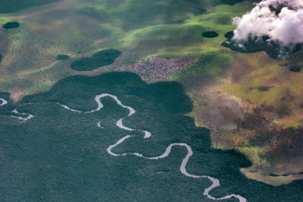
Aerial view of a jungle river in the rainforest of the Congo Basin. Odzala National Park, Republic of Congo.

Aerial View of the Congo river just above the famous Livingstone Falls at the lower Congo River - the falls are the last navigable point before the Livingstone rapids make the river impassable for a long stretch upriver. The falls are named for the explorer David Livingstone and are providing a difference in altitude of 270 meters over a distance of 350 km. Congo river is the deepest river of the world and the largest river in Africa.

Aerial view of a Bai (saline, mineral lick) in the rainforest of the Congo Basin. This rich mineral clearing is located in the middle of the rainforest where forest elephants, buffalos and gorillas gather in large numbers to reap the benefits of the mineral salts. Odzala National Park, Republic of Congo.
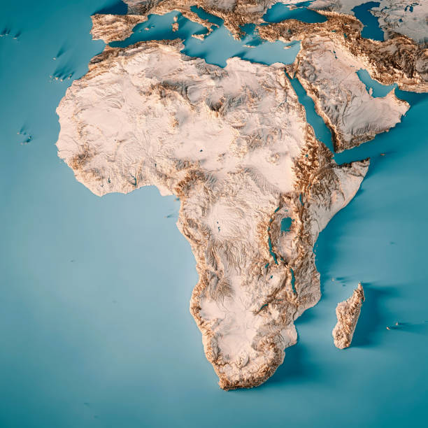
3D Render of a Topographic Map of Africa. All source data is in the public domain. Color texture: Made with Natural Earth. http://www.naturalearthdata.com/downloads/10m-raster-data/10m-cross-blend-hypso/ Relief texture: GMTED2010 data courtesy of USGS. URL of source image: https://topotools.cr.usgs.gov/gmted_viewer/viewer.htm Water texture: HIU World Water Body Limits: http://geonode.state.gov/layers/?limit=100&offset=0&title__icontains=World%20Water%20Body%20Limits%20Detailed%202017Mar30

Aerial view of a tourist motor boat on a jungle river in the rainforest of the Congo Basin. Odzala National Park, Republic of Congo.

Aerial view of an meandering jungle river in the rainforest of the Congo Basin, the river forms the shape of a heart. Odzala National Park, Republic of Congo.

Odzala National Park, Republic of Congo - May 19, 2019: Aerial view of a tourist motor boat on a jungle river in the rainforest of the Congo Basin. Odzala National Park, Republic of Congo.
The sea port of Matadi at the Congo River. Matadi is the chief sea port of the Democratic Republic of the Congo, it is the last navigable point before rapids make the river impassable for a long stretch upriver. Matadi is also the capital of the Kongo Central province, it was founded in 1879 by Sir Henry Morton Stanley.

Aerial view of an meandering jungle river in the rainforest of the Congo Basin. Odzala National Park, Republic of Congo.

Odzala National Park, Republic of Congo - May 19, 2019: Aerial view of a tourist motor boat on a jungle river in the rainforest of the Congo Basin. Odzala National Park, Republic of Congo.
Aerial view of a tourist motor boat on a jungle river in the rainforest of the Congo Basin. Odzala National Park, Republic of Congo.

Aerial view of an meandering jungle river in the rainforest of the Congo Basin. Odzala National Park, Republic of Congo.

Aerial view of a Bai (saline, mineral lick) in the rainforest of the Congo Basin. This rich mineral clearing is located in the middle of the rainforest where forest elephants, buffalos and gorillas gather in large numbers to reap the benefits of the mineral salts. Odzala National Park, Republic of Congo.
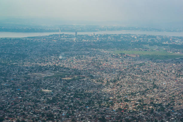
Aerial view of Kinshasa, capital of the Democratic Republic of Congo. In the background Congo River is visible and on the other side of the river the city of Brazzaville, capital of the Republic of Congo is visible.

Aerial view of an meandering jungle river in the rainforest of the Congo Basin. Odzala National Park, Republic of Congo.

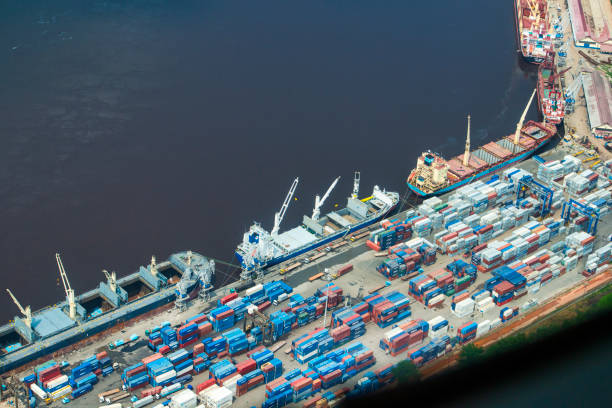
Huge logs of tropical timber from the Congo rainforest being loaded onto cargo ships at the port of Matadi at the Congo River. Matadi is the chief sea port of the Democratic Republic of the Congo, it is the last navigable point before rapids make the river impassable for a long stretch upriver. Matadi is also the capital of the Kongo Central province, it was founded in 1879 by Sir Henry Morton Stanley.

Congo River in the Tshopo Province

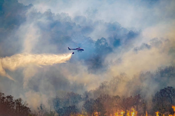
Firefighting helicopter dropping water on forest fireHelicopter dumping water on forest fire

Helicopter dropping water on forest fireHelicopter dumping water on forest fire

Aerial view of an meandering jungle river in the rainforest of the Congo Basin. Odzala National Park, Republic of Congo.

Aerial view of a jungle river in the rainforest of the Congo Basin. Odzala National Park, Republic of Congo.

Aerial view of a jungle river flowing out of a Bai (saline, mineral lick) in the rainforest of the Congo Basin. This rich mineral clearing is located in the middle of the rainforest where forest elephants, buffalos and gorillas gather in large numbers to reap the benefits of the mineral salts. Odzala National Park, Republic of Congo.

Aerial view of a Bai (saline, mineral lick) in the rainforest of the Congo Basin. This rich mineral clearing is located in the middle of the rainforest where forest elephants, buffalos and gorillas gather in large numbers to reap the benefits of the mineral salts. Odzala National Park, Republic of Congo.

Congo river in the Tshopo province

Helicopter dumping water on forest fireHelicopter dropping water on forest fire

Aerial view of an meandering jungle river in the rainforest of the Congo Basin. Odzala National Park, Republic of Congo.

Aerial view of a Bai (saline, mineral lick) in the rainforest of the Congo Basin. This rich mineral clearing is located in the middle of the rainforest where forest elephants, buffalos and gorillas gather in large numbers to reap the benefits of the mineral salts. Odzala National Park, Republic of Congo.

Dzanga Bai, the famous clearing and salt lick in the area of dzanga-sangha. On the clearing small forest elephants (Loxodonta cyclotis) and also forest buffalos (Syncerus nanus) could be seen. The Dzanga Bai is also regulary visited from rare Bongo antelopes (Tragelaphus eurycerus).A bai - the term comes from the language of various indigenous groups - is a natural rainforest opening/clearing.Location: Dzanga-Sangha Special Reserve (in the border triangle of CAR, Cameroon and Republic of Congom Congo Basin, Central African Republic, Africa.
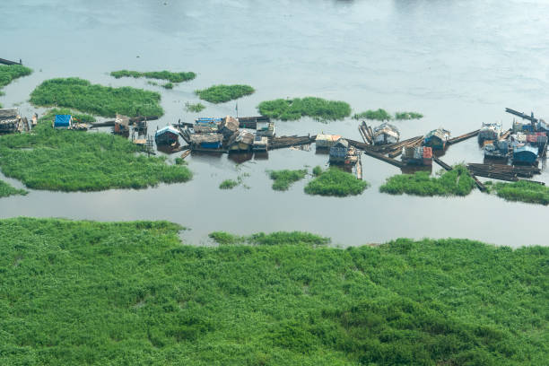
Kinshasa, Democratic Republic of Congo - December 13, 2014: Aerial view of a floating village on the Congo River in an outlying district of Kinshasa, the capital of DR Congo.

Aerial view of an meandering jungle river in the rainforest of the Congo Basin. Odzala National Park, Republic of Congo.

Aerial shot of active Nyiragongo volcano surrounded by rainforest with mountain gorillas. Small huts for tourists at the crater rim

Aerial view of a jungle river flowing out of a Bai (saline, mineral lick) in the rainforest of the Congo Basin. This rich mineral clearing is located in the middle of the rainforest where forest elephants, buffalos and gorillas gather in large numbers to reap the benefits of the mineral salts. Odzala National Park, Republic of Congo.

Rare wildlife shot of a herd of African Forest Buffalos (Syncerus caffer nanus) in Lango Bai (saline, mineral lick) in the rainforest of the Congo Basin. This rich mineral clearing is located in the middle of the rainforest where forest elephants gather in large numbers to reap the benefits of the mineral salts. Odzala National Park, Republic of Congo.